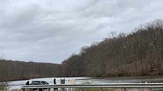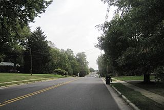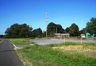
Fair Haven is a borough situated in the Jersey Shore region within Monmouth County, in the U.S. state of New Jersey, in the New York metropolitan area. Fair Haven is located on the Rumson peninsula along the Navesink River and is bordered by Red Bank and Little Silver to the west. As of the 2020 United States census, the borough's population was 6,269, its highest decennial count ever and an increase of 148 (+2.4%) from the 2010 census count of 6,121, which in turn reflected an increase of 184 (+3.1%) from the 5,937 counted in the 2000 census.

Millstone Township is a township in western Monmouth County, in the U.S. state of New Jersey. The township is located within the Raritan Valley region and is a part of the New York metropolitan area. As of the 2020 United States census, the township's population was 10,376, a decrease of 190 (−1.8%) from the 2010 census count of 10,566, which in turn reflected an increase of 1,596 (+17.8%) from the 8,970 counted in the 2000 census.

West Freehold is an unincorporated community and census-designated place (CDP) within Freehold Township, in Monmouth County, New Jersey, United States. As of the 2010 United States Census, the CDP's population was 13,613. Due to the community's close proximity to the Battle of Monmouth, West Freehold is home to several important historical structures, which have been preserved in the 'West Freehold Village Historic District'. The historically preserved Monmouth Battlefield, along with the historic villages of Clarksburg, Englishtown, Smithburg and Tennent are a short distance away.

Clarksburg is an unincorporated community located within Millstone Township in Monmouth County, in the U.S. state of New Jersey. The area is served as United States Postal Service ZIP code 08510.

Rocky Brook is a tributary of the Millstone River in Monmouth and Mercer counties, New Jersey, in the United States.

County Route 571 is a county highway in the U.S. state of New Jersey. The highway extends 43.9 miles (70.7 km) from Route 37 in Toms River to Route 27 in Princeton. Though it is designated a north–south county route by the New Jersey Department of Transportation, it is signed both as north–south and east–west inconsistently.

Adelphia is an unincorporated community located in northern Howell Township, Monmouth County, in the U.S. state of New Jersey. The area is served as United States Postal Service ZIP code 07710. The community borders Freehold Township, and residents who reside in Adelphia use a Freehold mailing address.
Port-au-peck is an unincorporated community located within Oceanport in Monmouth County, in the U.S. state of New Jersey. The name Port-Au-Peck comes from the Lenape name Pootapeck. The land was "sold" to English interests in 1670; however, it is unclear how fair this land transfer was or if the local residents were aware they were giving away their hunting and fishing rights in the transfer.

New Monmouth is an unincorporated community located within Middletown Township in Monmouth County, in the U.S. state of New Jersey. The area is served as United States Postal Service ZIP Code 07748.

Perrineville is an unincorporated community located within Millstone Township in Monmouth County, in the U.S. state of New Jersey. The area is served as United States Postal Service ZIP Code 08535.

Hornerstown is an unincorporated community located within Upper Freehold Township in Monmouth County, in the U.S. state of New Jersey. Hornerstown is located near Cream Ridge and uses the 08514 ZIP code.

Prospertown is an unincorporated community located within the New Jersey townships of Jackson and Plumsted in Ocean County and Upper Freehold in Monmouth County. The community is home to Prospertown Lake and is adjacent to Six Flags Great Adventure, both located on County Route 537. The center of the community is located at the intersection of CR 537, Hawkin Road, and Emleys Hill Road. Most of the area consists of pine forests but there are some homes along the roads in the area.

Emleys Hill is an unincorporated community located within Upper Freehold Township in Monmouth County, in the U.S. state of New Jersey. The settlement is located at the intersection of Emleys Hill Road and Burlington Path Road.

Charleston Springs is an unincorporated community located within Millstone Township in Monmouth County, in the U.S. state of New Jersey. Stage Coach Road, also designated County Route 524, is the main road that runs through the settlement, with Ely Harmony Road as the intersecting road defining the locality. The Manalapan Brook runs to the west of the center of Charleston Springs and CR 537 runs to the south of the area. The Monmouth County-owned Charleston Springs Golf Course is located one mile (1.6 km) northeast of the center of Charleston Springs on CR 527.

Cooleys Corner is an unincorporated community located within Upper Freehold Township in Monmouth County, in the U.S. state of New Jersey. The site of the settlement is within the Assunpink Wildlife Management Area, a New Jersey Department of Environmental Protection Division of Fish and Wildlife-operated preserved area in Monmouth and Mercer counties along the Assunpink Creek. Before the creation of the Assunpink Lake in the 1970s, the area consisted of farmland located at the intersection of Clarksburg Road and Imlaystown-Hightstown Road. Some farmland is still present in the area but is now mostly used by hunters. The main boat ramp to Assunpink Lake is located along the former Imlaystown-Hightstown Road.

Ely is an unincorporated community located within Millstone Township in Monmouth County, in the U.S. state of New Jersey. The settlement is named for the Ely family that owned property in the area and operated the Charleston Springs hotel. Today, the settlement is located along Stage Coach Road, County Route 524, in the eastern portion of the township. Most of the area consists of large single-family homes though some farmland and the township-owned Brandywine Soccer Complex are located in the near the settlement.

Fairfield is an unincorporated community located within Howell Township in Monmouth County, in the U.S. state of New Jersey. The community is centered on the intersection of County Route 524 (CR 524) and Ketchum Road, where the Colonial Era Our House Tavern is located. The area includes several small businesses, township offices and schools. There are also small farms and residential developments in the area. Fairfield was a stop on the Freehold and Jamesburg Agricultural Railroad.

Freewood Acres is an unincorporated community located within Howell Township in Monmouth County, in the U.S. state of New Jersey. The area is made up of mostly single-story homes arranged along a street grid in the northern reaches of the Pine Barrens. U.S. Route 9 runs through the center of the community just north of its interchange with Interstate 195. The Land O'Pines Elementary School and Manasquan Reservoir County Park exist to the east of the community. It became the center of the Kalmyk American community in the latter part of the 20th century.

Sharon is an unincorporated community located within Upper Freehold Township in Monmouth County, in the U.S. state of New Jersey. Located at the intersection of Herbert Road and Sharon Station Road, the settlement is the site of a former stop on the Pemberton and Hightstown Railroad. Except for a few single-family homes in the area, most of the area is farmland. The railroad has since been abandoned and is being converted to the Union Transportation Trail, a rail trail. Sharon is the current northern terminus of the trail.


