Colts Neck Township is a township in Monmouth County, in the U.S. state of New Jersey. It is located in the New York Metropolitan Area. As of the 2020 United States census, the township's population was 9,957, a decrease of 185 (−1.8%) from the 2010 census count of 10,142, which in turn reflected a decline of 2,189 (−17.8%) from the 12,331 counted in the 2000 census.

Englishtown is a rapidly growing borough in western Monmouth County, in the U.S. state of New Jersey. The community is located within the Raritan Valley region. As of the 2020 United States census, the borough's population was 2,346, its highest decennial count ever and an increase of 499 (+27.0%) from the 2010 census count of 1,847, which in turn reflected reflected an increase of 83 (+4.7%) from the 1,764 counted in the 2000 census.

Farmingdale is a borough in Monmouth County, in the U.S. state of New Jersey. As of the 2020 United States census, the borough's population was 1,504, an increase of 175 (+13.2%) from the 2010 census count of 1,329, which in turn reflected a decline of 258 (−16.3%) from the 1,587 counted in the 2000 census.

Freehold is a borough and the county seat of Monmouth County, in the U.S. state of New Jersey. Known for its Victorian era homes and extensive colonial history, the borough is located in the Raritan Valley region within the New York Metropolitan Area, located about 33 miles (53 km) from Manhattan and 17 miles (27 km) from Staten Island. The borough has grown to become a commuter town of New York City. As of the 2020 United States census, the borough's population was 12,538, its highest decennial count ever and an increase of 486 (+4.0%) from the 12,052 recorded at the 2010 census, which in turn had reflected an increase of 1,076 (+9.8%) from the 10,976 counted at the 2000 census.

Freehold Township is a township in western Monmouth County, in the U.S. state of New Jersey. Located in Central New Jersey and crisscrossed by several major highways, the township is known for being the regional commercial hub for Monmouth County and as a suburban bedroom community of New York City, located within the Raritan Valley region of the much larger New York Metropolitan Area. The township is located roughly 38 miles (61 km) away from Manhattan and about 20 miles (32 km) away from Staten Island. As of the 2020 United States census, the township's population was 35,369, a decrease of 815 (−2.3%) from the 36,184 recorded at the 2010 census, which in turn had reflected an increase of 4,647 (+14.7%) from the 31,537 counted at the 2000 census.
Howell Township is a township in Monmouth County, in the U.S. state of New Jersey. The township is the largest municipality in the county by total area, comprised of about 61.21 square miles (158.5 km2). It is located in the New York metropolitan area and has been a steadily growing bedroom community of New York City. As of the 2020 United States census, the township's population was 53,537, its highest decennial count ever and an increase of 2,462 (+4.8%) from the 2010 census count of 51,075, which in turn reflected an increase of 2,172 (+4.4%) from the 48,903 counted in the 2000 census.
Manalapan Township is a township in western Monmouth County, in the U.S. state of New Jersey. The township is centrally located within the Raritan Valley region and is a part of the New York Metropolitan Area. As of the 2020 United States census, the township's population was 40,905, its highest decennial count ever and an increase of 2,033 (+5.2%) from the 2010 census count of 38,872, which in turn reflected an increase of 5,449 (+16.3%) from the 33,423 counted in the 2000 census.
Millstone Township is a township in western Monmouth County, in the U.S. state of New Jersey. The Township is located within the Raritan Valley region and is a part of the New York metropolitan area. As of the 2020 United States census, the township's population was 10,376, a decrease of 190 (−1.8%) from the 2010 census count of 10,566, which in turn reflected an increase of 1,596 (+17.8%) from the 8,970 counted in the 2000 census.

West Freehold is an unincorporated community and census-designated place (CDP) within Freehold Township, in Monmouth County, New Jersey, United States. As of the 2010 United States Census, the CDP's population was 13,613. Due to the community's close proximity to the Battle of Monmouth, West Freehold is home to several important historical structures, which have been preserved in the 'West Freehold Village Historic District'. The historically preserved Monmouth Battlefield, along with the historic villages of Clarksburg, Englishtown, Smithburg and Tennent are a short distance away.

Clarksburg is an unincorporated community located within Millstone Township in Monmouth County, in the U.S. state of New Jersey. The area is served as United States Postal Service ZIP code 08510.

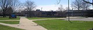
Manalapan High School is a comprehensive four-year public high school located in Manalapan Township, in Monmouth County, in the U.S. state of New Jersey, operating as part of the Freehold Regional High School District. The school serves students in ninth through twelfth grades from all of Englishtown and portions of Manalapan. The Freehold Regional High School District also serves students from Colts Neck Township, Farmingdale, Freehold Borough, Freehold Township, Howell Township, and Marlboro Township. The school has been accredited by the Middle States Association of Colleges and Schools Commission on Elementary and Secondary Schools since 1975.
The Freehold Regional High School District is a public regional school district established in 1953, that serves students in ninth through twelfth grades from eight communities in western Monmouth County, New Jersey, United States. The district, with six high schools, is the largest regional high school district in the state, as measured by enrollment. The district serves students from Colts Neck Township, Englishtown, Farmingdale, Freehold Borough, Freehold Township, Howell Township, Manalapan Township and Marlboro Township.
The Manalapan-Englishtown Regional School District is a regional public school district serving students in pre-kindergarten through eighth grade from the suburban communities of Englishtown and Manalapan Township in Monmouth County, New Jersey, United States.
Freehold Township High School is a four-year comprehensive public high school located in Freehold Township, in Monmouth County, in the U.S. state of New Jersey, and is part of the Freehold Regional High School District. The school serves students from portions of Freehold Township, and from parts of both Howell Township and Manalapan Township. The school has been accredited by the Middle States Association of Colleges and Schools Commission on Elementary and Secondary Schools since 1976.

Marlboro High School is a four-year comprehensive public high school located in Marlboro Township, in Monmouth County, in the U.S. state of New Jersey, serving students in ninth through twelfth grades as one of the six secondary schools of the Freehold Regional High School District (FRHSD). The school serves students from portions of Marlboro Township. Marlboro High School hosts the Business Administration Magnet Program (BAMP), a selective magnet program offered within FRHSD, so there are students attending Marlboro High School from across the county. Students that are a part of the BAMP take advanced classes that are more in-depth than regular classes. The school has been accredited by the Middle States Association of Colleges and Schools Commission on Elementary and Secondary Schools since 1974.
The Freehold Borough Schools are a community public school district that serves students in pre-kindergarten through eighth grade from Freehold Borough in Monmouth County, New Jersey, United States.
The Marlboro Township School District is a community public school district that serves students in pre-kindergarten through eighth grade in Marlboro Township in Monmouth County, in the U.S. state of New Jersey.
The Colts Neck School District is a comprehensive community public school district serving students in pre-kindergarten through eighth grade in Colts Neck Township in Monmouth County, New Jersey, United States.
The Howell Township Public Schools is a community public school district that serves students in pre-kindergarten through eighth grade from Howell Township, in Monmouth County, New Jersey, United States.
The Farmingdale School District is a community public school district that serves students in pre-kindergarten through eighth grade from Farmingdale in Monmouth County, New Jersey, United States.


