Morganville, New Jersey

Last updated

Morganville, New Jersey
Morganville, NJ.jpg
Along northbound Route 79
Monmouth County New Jersey Incorporated and Unincorporated areas Morganville Highlighted.svg
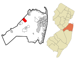
Location of Morganville in Monmouth County highlighted in red (left). Inset map: Location of Monmouth County in New Jersey highlighted in orange (right).
Location map of Monmouth County, New Jersey.svg
Red pog.svg
Morganville
Location in Monmouth County
USA New Jersey relief location map.svg
Red pog.svg
Morganville
Location in New Jersey
Usa edcp relief location map.png
Red pog.svg
Morganville
Location in the United States
Coordinates: 40°22′31″N74°13′58″W / 40.375327°N 74.23281°W / 40.375327; -74.23281
Country Flag of the United States.svg  United States
State Flag of New Jersey.svg  New Jersey
County Monmouth
Township Marlboro
Area
[1]
  Total5.42 sq mi (14.04 km2)
  Land5.42 sq mi (14.02 km2)
  Water0.01 sq mi (0.01 km2)  0.11%
Elevation
[2]
190 ft (58 m)
Population
 (2020) [3]
  Total6,203
  Density1,145.5/sq mi (442.3/km2)
Time zone UTC−05:00 (Eastern (EST))
  Summer (DST) UTC−04:00 (Eastern (EDT))
ZIP Code
07751 [4]
Area code(s) 732/848
FIPS code 34-48030 [5] [6] [7]
GNIS feature ID02389505 [5] [8]

Morganville is an unincorporated community and census-designated place (CDP) within Marlboro Township, in Monmouth County, New Jersey. [9] [10] [11] As of the 2010 United States Census, the CDP's population was 5,040. [12]

Contents

Morganville has its own post office, with a ZIP Code of 07751. [4]

Geography

A neighborhood in Morganville Morganville, NJ residential area.jpg
A neighborhood in Morganville

According to the United States Census Bureau, Morganville had a total area of 5.429 square miles (14.061 km2), including 5.423 square miles (14.045 km2) of land and 0.006 square miles (0.016 km2) of water (0.11%). [5] [13]

Demographics

Historical population
CensusPop.Note
1990 9,841
2000 11,25514.4%
2010 5,040−55.2%
2020 6,20323.1%
Population sources:
1990-2010 [9] 2000 [14]
2010 [12] 2020 [3]

2010 census

The 2010 United States census counted 5,040 people, 1,526 households, and 1,370 families in the CDP. The population density was 929.4 per square mile (358.8/km2). There were 1,583 housing units at an average density of 291.9 per square mile (112.7/km2). The racial makeup was 75.12% (3,786) White, 3.27% (165) Black or African American, 0.14% (7) Native American, 18.53% (934) Asian, 0.00% (0) Pacific Islander, 1.07% (54) from other races, and 1.87% (94) from two or more races. Hispanic or Latino of any race were 5.00% (252) of the population. [12]

Of the 1,526 households, 52.4% had children under the age of 18; 80.9% were married couples living together; 5.6% had a female householder with no husband present and 10.2% were non-families. Of all households, 8.1% were made up of individuals and 4.1% had someone living alone who was 65 years of age or older. The average household size was 3.29 and the average family size was 3.49. [12]

30.7% of the population were under the age of 18, 6.5% from 18 to 24, 21.8% from 25 to 44, 32.6% from 45 to 64, and 8.4% who were 65 years of age or older. The median age was 40.7 years. For every 100 females, the population had 100.9 males. For every 100 females ages 18 and older there were 98.8 males. [12]

Based on data from the Census Bureau's 2010-2014 American Community Survey, the median income for a household in the CDP was $119,215, and the median income for a family was $126,213. Males had a median income of $126,208 versus $62,326 for females. The per capita income for the CDP was $50,942. About 0.9% of families and 0.7% of the population were below the poverty line, including 0.8% of those under age 18 and none of those age 65 or over. [15]

2000 census

As of the 2000 United States Census [6] there were 11,255 people, 3,642 households, and 3,270 families living in the CDP. The population density was 1,892.0 inhabitants per square mile (730.5/km2). There were 3,723 housing units at an average density of 625.8 per square mile (241.6/km2). The racial makeup of the CDP was 87.27% White, 1.71% African American, 0.01% Native American, 9.76% Asian, 0.04% Pacific Islander, 0.50% from other races, and 0.71% from two or more races. Hispanic or Latino of any race were 2.94% of the population. [14]

There were 3,642 households, out of which 45.0% had children under the age of 18 living with them, 82.1% were married couples living together, 6.2% had a female householder with no husband present, and 10.2% were non-families. 8.9% of all households were made up of individuals, and 4.2% had someone living alone who was 65 years of age or older. The average household size was 3.09 and the average family size was 3.29. [14]

In the CDP the population was spread out, with 27.9% under the age of 18, 5.9% from 18 to 24, 26.0% from 25 to 44, 32.2% from 45 to 64, and 8.1% who were 65 years of age or older. The median age was 40 years. For every 100 females, there were 95.3 males. For every 100 females age 18 and over, there were 91.4 males. [14]

The median income for a household in the CDP was $99,035, and the median income for a family was $107,081. Males had a median income of $75,067 versus $41,861 for females. The per capita income for the CDP was $39,802. About 1.3% of families and 1.7% of the population were below the poverty line, including 1.1% of those under age 18 and 0.8% of those age 65 or over. [14]

Transportation

New Jersey Transit offers bus service to the Port Authority Bus Terminal in Midtown Manhattan on route 139.

Education

As Morganville is located in Marlboro Township, students in public school are served by the Marlboro Township Public School District. Children in Morganville attend Robertsville Elementary School, Frank Defino Elementary School, and Asher Holmes Elementary School. [16]

Wineries

Notable people

People who were born in, residents of, or otherwise closely associated with Morganville include:

Related Research Articles

<span class="mw-page-title-main">Ramblewood, New Jersey</span> Populated place in Burlington County, New Jersey, US

Ramblewood is an unincorporated community and census-designated place (CDP) located within Mount Laurel Township in Burlington County, in the U.S. state of New Jersey. As of the 2010 United States Census, the CDP's population was 5,907.

<span class="mw-page-title-main">Echelon, New Jersey</span> Populated place in Camden County, New Jersey, US

Echelon is an unincorporated community and census-designated place (CDP) located within Voorhees Township in Camden County, in the U.S. state of New Jersey. As of the 2010 United States Census, the CDP's population was 10,743.

<span class="mw-page-title-main">Concordia, New Jersey</span> Populated place in Middlesex County, New Jersey, US

Concordia is an unincorporated community and census-designated place (CDP) located within Monroe Township, in Middlesex County, in the U.S. state of New Jersey. The CDP is oriented around the age restricted gated community of Concordia. As of the 2010 United States Census, the CDP's population was 3,092.

<span class="mw-page-title-main">Cranbury (CDP), New Jersey</span> Populated place in Middlesex County, New Jersey, US

Cranbury is an unincorporated community and census-designated place (CDP) located within Cranbury Township, in Middlesex County, in the U.S. state of New Jersey. As of the 2010 United States Census, the CDP's population was 2,181. Despite the similarity in the name of Cranbury Township and the CDP, the two are not one and the same, as had been the case for most paired Township / CDP combinations prior to the 2010 Census, in which the CDP was coextensive with a township of the same name.

<span class="mw-page-title-main">Madison Park, New Jersey</span> Populated place in Middlesex County, New Jersey, US

Madison Park is an unincorporated community and census-designated place (CDP) located within Old Bridge Township, in Middlesex County, in the U.S. state of New Jersey. As of the 2010 United States Census, the CDP's population was 7,144. The name "Madison Park" reflects Old Bridge's original name of "Madison Township" which it had when it was formed on March 2, 1869 from portions of South Amboy Township, until November 5, 1975, when voters approved a referendum changing the township's name to Old Bridge Township.

<span class="mw-page-title-main">Old Bridge (CDP), New Jersey</span> Census-designated place in New Jersey, United States

Old Bridge is a census-designated place (CDP) located in Old Bridge Township, in Middlesex County, in the U.S. state of New Jersey. As of the 2010 United States Census, the CDP's population was 23,753. Despite the similarity in the name of the CDP and the township, the two are not one and the same, as had been the case for most paired Township / CDP combinations prior to the 2010 Census, in which the CDP was coextensive with a township of the same name.

<span class="mw-page-title-main">Plainsboro Center, New Jersey</span> Populated place in Middlesex County, New Jersey, US

Plainsboro Center is an unincorporated community and census-designated place (CDP) located within Plainsboro Township, situated in southern Middlesex County, within the U.S. state of New Jersey. As of the 2020 United States census, the CDP's population was 2,760, its highest decennial count ever and an increase of 48 (+1.8%) from the 2,712 recorded at the 2010 census, which in turn had reflected an increase of 503 (+22.8%) from the 2,209 counted at the 2000 census.

<span class="mw-page-title-main">Society Hill, Middlesex County, New Jersey</span> Populated place in Middlesex County, New Jersey, US

Society Hill is an unincorporated community and census-designated place (CDP) located within Piscataway Township, in Middlesex County, in the U.S. state of New Jersey. As of the 2010 United States Census, the CDP's population was 3,829.

<span class="mw-page-title-main">Woodbridge (CDP), New Jersey</span> Populated place in Middlesex County, New Jersey, US

Woodbridge is an unincorporated community and census-designated place (CDP) within Woodbridge Township, in Middlesex County, in the U.S. state of New Jersey. As of the 2010 United States Census, the CDP's population was 19,265. Despite the similarity in the name of the CDP and the township, the two are not coextensive; the CDP occupies 15.7% of the township's 24.51 square miles (63.5 km2).

<span class="mw-page-title-main">West Freehold, New Jersey</span> Census-designated place in New Jersey, United States

West Freehold is an unincorporated community and census-designated place (CDP) within Freehold Township, in Monmouth County, New Jersey, United States. As of the 2010 United States Census, the CDP's population was 13,613. Due to the community's close proximity to the Battle of Monmouth, West Freehold is home to several important historical structures, which have been preserved in the 'West Freehold Village Historic District'. The historically preserved Monmouth Battlefield, along with the historic villages of Clarksburg, Englishtown, Smithburg and Tennent are a short distance away.

<span class="mw-page-title-main">Allenwood, New Jersey</span> Populated place in Monmouth County, New Jersey, US

Allenwood is an unincorporated community and census-designated place (CDP) located within Wall Township, in Monmouth County, in the U.S. state of New Jersey. As of the 2010 United States Census, the CDP's population was 925.

<span class="mw-page-title-main">Cedar Glen West, New Jersey</span> Populated place in Ocean County, New Jersey, US

Cedar Glen West is an unincorporated community and census-designated place (CDP) located within Manchester Township, in Ocean County, in the U.S. state of New Jersey. As of the 2010 United States Census, the CDP's population was 1,267.

<span class="mw-page-title-main">Leisure Knoll, New Jersey</span> Populated place in Ocean County, New Jersey, US

Leisure Knoll is an unincorporated community and census-designated place (CDP) located within Manchester Township, in Ocean County, in the U.S. state of New Jersey. As of the 2010 United States Census, the CDP's population was 2,490.

<span class="mw-page-title-main">Toms River (CDP), New Jersey</span> Populated place in Ocean County, New Jersey, US

Toms River is an unincorporated community and census-designated place (CDP) located within and constituting the mainland portion of Toms River Township, in Ocean County, in the U.S. state of New Jersey. As of the 2020 United States census, the CDP's population was 92,830, its highest decennial count ever and an increase of 4,039 (+4.5%) from the 88,791 recorded at the 2010 census, which in turn reflected an increase of 2,464 (+2.9%) from the 86,327 counted in the 2000 census. The Toms River CDP is the county seat of Ocean County. The area is named for Toms River, whose estuary flows through the community and empties into Barnegat Bay.

<span class="mw-page-title-main">Waretown, New Jersey</span> Populated place in Ocean County, New Jersey, US

Waretown is an unincorporated community and census-designated place (CDP) located within Ocean Township, in Ocean County, in the U.S. state of New Jersey. As of the 2010 United States Census, the CDP's population was 1,569. Waretown is home to Albert Music Hall.

<span class="mw-page-title-main">Crandon Lakes, New Jersey</span> Populated place in Sussex County, New Jersey, US

Crandon Lakes is an unincorporated community and census-designated place (CDP) split between Hampton Township and Stillwater Township, in Sussex County, in the U.S. state of New Jersey. As of the 2010 United States Census, the CDP's population was 1,178, of which 682 were in Hampton Township and 496 in Stillwater Township.

<span class="mw-page-title-main">Ramtown, New Jersey</span> Populated place in Monmouth County, New Jersey, US

Ramtown is a census-designated place and unincorporated community located within Howell Township, in Monmouth County, in the U.S. state of New Jersey. As of the 2010 United States Census, the CDP's population was 6,242.

<span class="mw-page-title-main">Pennsville (CDP), New Jersey</span> Populated place in Salem County, New Jersey, US

Pennsville is an unincorporated community and census-designated place (CDP) located within Pennsville Township, in Salem County, in the U.S. state of New Jersey. As of the 2010 United States Census, the CDP's population was 11,888.

<span class="mw-page-title-main">Robertsville, New Jersey</span> Populated place in Monmouth County, New Jersey, US

Robertsville is a census-designated place and unincorporated community located within Marlboro Township, in Monmouth County, in the U.S. state of New Jersey. At the 2010 census, the CDP's population was 11,297.

<span class="mw-page-title-main">Clearbrook, New Jersey</span> Populated place in Middlesex County, New Jersey, US

Clearbrook is a gated community and census-designated place (CDP) located in Monroe Township, Middlesex County, in the U.S. state of New Jersey. It is in the western part of the township, bordered to the north by Encore at Monroe and to the east by Concordia and The Ponds. It is 3.5 miles (5.6 km) southwest of Jamesburg and 5 miles (8 km) northeast of Hightstown.

References

  1. "ArcGIS REST Services Directory". United States Census Bureau. Retrieved October 11, 2022.
  2. U.S. Geological Survey Geographic Names Information System: Morganville Census Designated Place, Geographic Names Information System. Accessed August 8, 2012.
  3. 1 2 QuickFacts Morganville CDP, New Jersey, United States Census Bureau. Accessed June 25, 2023.
  4. 1 2 Look Up a ZIP Code for Morganville, NJ, United States Postal Service. Accessed August 8, 2012.
  5. 1 2 3 Gazetteer of New Jersey Places, United States Census Bureau. Accessed July 21, 2016.
  6. 1 2 U.S. Census website, United States Census Bureau. Accessed September 4, 2014.
  7. Geographic Codes Lookup for New Jersey, Missouri Census Data Center. Accessed June 9, 2023.
  8. US Board on Geographic Names, United States Geological Survey. Accessed September 4, 2014.
  9. 1 2 New Jersey: 2010 - Population and Housing Unit Counts - 2010 Census of Population and Housing (CPH-2-32), United States Census Bureau, August 2012. Accessed December 16, 2012.
  10. GCT-PH1 - Population, Housing Units, Area, and Density: 2010 - County -- County Subdivision and Place from the 2010 Census Summary File 1 for Monmouth County, New Jersey Archived 2020-02-12 at archive.today , United States Census Bureau. Accessed December 16, 2012.
  11. Locality Search, State of New Jersey. Accessed April 19, 2015.
  12. 1 2 3 4 5 DP-1 - Profile of General Population and Housing Characteristics: 2010 Demographic Profile Data for Morganville CDP, New Jersey, United States Census Bureau. Accessed August 8, 2012.
  13. US Gazetteer files: 2010, 2000, and 1990, United States Census Bureau. Accessed September 4, 2014.
  14. 1 2 3 4 5 DP-1 - Profile of General Demographic Characteristics: 2000 from the Census 2000 Summary File 1 (SF 1) 100-Percent Data for Morganville CDP, New Jersey Archived 2020-02-12 at archive.today , United States Census Bureau. Accessed August 8, 2012.
  15. DP03 Selected Economic Characteristics from the 2010-2014 American Community Survey 5-Year Estimates for Morganville CDP, New Jersey Archived 2020-02-13 at archive.today , United States Census Bureau. Accessed July 6, 2016.
  16. Home Page, Marlboro Township Public School District. Accessed September 2, 2022.
  17. Falkenstein, Michelle. "From Maplewood To Sundance", The New York Times , January 30, 2005. Accessed August 10, 2012. "In 1988, Daniel Johnston, a songwriter, gave a legendary concert in Pier Platters, an independent Hoboken record store. He had a mental breakdown during the concert and ran amok for two weeks, said Jeff Feuerzeig, who grew up in Hazlet and Morganville and attended Trenton State College."
  18. Staff. "Elmer H. Geran, 78, In Congress 1923-25", The New York Times , January 14, 1954. Accessed September 10, 2015. "Elmer H. Geran, former Congressman, assemblyman and United States attorney, died last night at his home, Glen Geran Farm, Marlboro Township."
  19. Geran, Elmer Hendrickson, (1875 - 1954), Biographical Directory of the United States Congress . Accessed January 8, 2018. "died in Marlboro Township, Morganville, N.J., January 12, 1954"
  20. Wanko, Lauren. "Pleasant Valley Lavender Offers the Plants in New Jersey", NJTV, July 10, 2015.Accessed January 8, 2018. "Nearly 5,000 lavender plants are sprawled across 10 acres at Pleasant Valley Lavender. Morganville resident Ellen Karcher started growing it in 2005."
  21. Akash Modi, USA Gymnastics. Accessed August 11, 2019. "Birthplace: Edison, NJ USA Hometown: Morganville, NJ USA Name of High School: High Technology High School High School Graduation Year: 2013"