Allenhurst is a borough located on the Jersey Shore, in Monmouth County, in the U.S. state of New Jersey. The settlement was named after resident Abner Allen and was incorporated as a borough by an act of the New Jersey Legislature on April 26, 1897, from portions of Ocean Township. As of the 2020 United States census, the borough's population was 472, a decrease of 24 (−4.8%) from the 2010 census count of 496, which in turn reflected a decline of 222 (−30.9%) from the 718 counted in the 2000 census.

Brielle is a borough located in southern Monmouth County, in the U.S. state of New Jersey, along the Manasquan River. As of the 2020 United States census, the borough's population was 4,982, its highest decennial count ever and an increase of 208 (+4.4%) from the 2010 census count of 4,774, which in turn reflected a decline of 119 (−2.4%) from the 4,893 counted in the 2000 census.
Millstone Township is a township in western Monmouth County, in the U.S. state of New Jersey. The township is located within the Raritan Valley region and is a part of the New York metropolitan area. As of the 2020 United States census, the township's population was 10,376, a decrease of 190 (−1.8%) from the 2010 census count of 10,566, which in turn reflected an increase of 1,596 (+17.8%) from the 8,970 counted in the 2000 census.

Upper Freehold Township is a township in Monmouth County, in the U.S. state of New Jersey. As of the 2020 United States census, the township's population was 7,273, an increase of 371 (+5.4%) from the 2010 census count of 6,902, which in turn reflected an increase of 2,620 (+61.2%) from the 4,282 counted in the 2000 census.

Deal is a borough situated on the Jersey Shore within Monmouth County, in the U.S. state of New Jersey. The community was settled by Europeans in the mid-1660s and named after an English carpenter from Deal, Kent. As of the 2020 United States census, the borough's population was 900, an increase of 150 (+20.0%) from the 2010 census count of 750, which in turn had reflected a decline of 320 (−29.9%) from the 1,070 counted in the 2000 census.

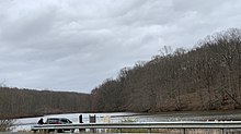
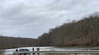
Clarksburg is an unincorporated community located within Millstone Township in Monmouth County, in the U.S. state of New Jersey. The area is served as United States Postal Service ZIP code 08510.
Newport is an unincorporated community and census-designated place (CDP) located within Downe Township in Cumberland County, in the U.S. state of New Jersey. The area is served as United States Postal Service ZIP Code 08345.

Ledgewood is an unincorporated community and census-designated place (CDP) located within Roxbury Township in Morris County, in the U.S. state of New Jersey. It was historically known as Drakesville after Abraham Drake, originally from Piscataway, New Jersey, who operated a mill and tavern here in the mid 1700s. The community was located on the Morris Canal.

Hibernia is an unincorporated community and census-designated place (CDP) located along County Route 513 in Rockaway Township of Morris County, in the U.S. state of New Jersey. The area is served as United States Postal Service ZIP Code 07842. The community takes its name from Hibernia, the classical name for Ireland.

Adelphia is an unincorporated community located in northern Howell Township, Monmouth County, in the U.S. state of New Jersey. The area is served as United States Postal Service ZIP code 07710. The community borders Freehold Township, and residents who reside in Adelphia use a Freehold mailing address.
Hewitt is an unincorporated community and census-designated place (CDP) located within West Milford Township in Passaic County, in the U.S. state of New Jersey. The area is served as United States Postal Service ZIP Code 07421. It is named for Abram Hewitt.

Cliffwood is an unincorporated community located within Aberdeen Township in Monmouth County, New Jersey, United States. The area is served as United States Postal Service ZIP code 07721.
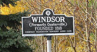
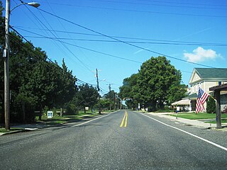
Windsor is a small historic unincorporated community and census-designated place (CDP) located within Robbinsville Township in Mercer County, in the U.S. state of New Jersey. The area is served as United States Postal Service ZIP Code 08561. As of the 2020 United States census, the CDP's population was 330, an increase of 104 (+46.0%) above the 226 counted at the 2010 census. The community, covering 570 acres (230 ha), was added to the National Register of Historic Places in 1992.
Landing is an unincorporated community and census-designated place (CDP) located within Roxbury Township, in Morris County, in the U.S. state of New Jersey. The community is located on the south shore of Lake Hopatcong near Hopatcong State Park. The area is served as United States Postal Service ZIP Code 07850.

Gillette is an unincorporated community and census-designated place (CDP) located within Long Hill Township in Morris County, in the U.S. state of New Jersey. The area is served as United States Postal Service ZIP Code 07933.

New Monmouth is an unincorporated community located within Middletown Township in Monmouth County, in the U.S. state of New Jersey. The area is served as United States Postal Service ZIP Code 07748.

Crosswicks is an unincorporated community and census-designated place (CDP) located along the Crosswicks Creek in the northern part of Chesterfield Township in Burlington County in the U.S. state of New Jersey. The area is served as United States Postal Service ZIP Code 08515.

Holmeson is an unincorporated community located within Millstone Township in Monmouth County, in the U.S. state of New Jersey. As it is located along County Route 537 through which the Monmouth–Ocean county line runs down the center, portions of the community are also located in Jackson Township. Owing to its location near Interstate 195 and Six Flags Great Adventure, the community is mostly made up of gas stations, restaurants, and small businesses though the Jackson Premium Outlets occupies land just south of the community.

West Allenhurst is an unincorporated community located within Ocean Township in Monmouth County, New Jersey, United States. The area is served as United States Postal Service ZIP code 07711. As of the 2000 United States Census, the population for ZIP Code Tabulation Area 07711 was 1,934. West Allenhurst is bordered by Allenhurst to the east, Deal to the northeast, and Interlaken to the south. Major arterial roads in the community are the east-west Corlies Avenue and the north-south Monmouth Road.
Allaire is an unincorporated community located within Wall Township in Monmouth County, in the U.S. state of New Jersey. As of the 2010 United States Census, the ZIP Code Tabulation Area for ZIP Code 07727 had a population of 7,050.