
Route 33 is a state highway in the central part of the US state of New Jersey. The highway extends 42.0 miles (67.6 km), from an interchange with US 1 in Trenton, Mercer County, east to an intersection of Main Street (Route 71) in Neptune, Monmouth County. Route 33 is a major route through Central New Jersey, as it runs from the greater state capital area in the Delaware Valley Region, through a mixture of farmland, housing, and commercial developments in the lower Raritan Valley Region, en route to the greater Asbury Park area on the Jersey Shore. The route traverses through historic towns such as Hightstown, Monroe Township, Manalapan, Freehold, and Tinton Falls. There are several intersections on Route 33 with future developments.

Route 37 is a state highway located in Ocean County, New Jersey, United States. The route runs 13.4 mi (21.57 km) from a traffic circle with Route 70 in Lakehurst east to an interchange with Route 35 in Seaside Heights. A two– to six–lane divided highway its entire length, Route 37 serves as the major east–west route through the Toms River area as well as a main route to the Barnegat Peninsula, crossing the Barnegat Bay on the Thomas A. Mathis and J. Stanley Tunney Bridges. The route through Toms River is lined with many businesses and named Little League World Champions Boulevard in honor of Toms River East Little League's victory in the 1998 Little League World Series. Route 37 intersects many major roads in the Toms River area, including CR 527, the Garden State Parkway/US 9, Route 166, CR 549, and CR 571. The route experiences congestion from both development in the area and from traffic bound for the barrier islands in the summer.

East Windsor is a township in Mercer County, in the U.S. state of New Jersey. Located at the cross-roads between the Delaware Valley region to the southwest and the Raritan Valley region to the northeast, the township is an outer-ring suburb of New York City in the New York Metropolitan area, as defined by the United States Census Bureau, but directly borders the Philadelphia metropolitan area and is part of the Federal Communications Commission's Philadelphia Designated Market Area. Since East Windsor is situated at the confluence of several major highways that serve both the major cities of New York City and Philadelphia, and even the local commercial hubs of nearby Freehold, Princeton, and the state capital of Trenton, the community has been a longtime residential, commercial, and industrial hub in the heart of Central New Jersey.
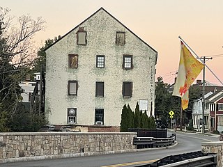
Allentown is a borough located in western Monmouth County, in the U.S. state of New Jersey, bordering adjacent Mercer County. As of the 2020 United States census, the borough's population was 1,734, a decrease of 94 (−5.1%) from the 2010 census count of 1,828, which in turn reflected a decline of 54 (−2.9%) from the 1,882 counted in the 2000 census. The borough is nestled within central New Jersey, and is roughly equidistant between New York City and Philadelphia.

Upper Freehold Township is a township in Monmouth County, in the U.S. state of New Jersey. As of the 2020 United States census, the township's population was 7,273, an increase of 371 (+5.4%) from the 2010 census count of 6,902, which in turn reflected an increase of 2,620 (+61.2%) from the 4,282 counted in the 2000 census.

Route 64 is a 0.32-mile-long (0.51 km) state highway in the U.S. state of New Jersey. It is a state-maintained bridge over Amtrak's Northeast Corridor line in West Windsor. Route 64 begins at an intersection with County Route 526 and County Route 571 in West Windsor. It heads along the bridge to an intersection with County Route 615, where Route 64 ends. County Routes 526 and 571, which are concurrent with Route 64, continues to Hightstown.

U.S. Route 130 is a U.S. Highway that is a spur route of U.S. Route 30, located completely within the state of New Jersey. It is signed with north and south cardinal directions, following a general northeast–southwest diagonal path, with north corresponding to the general eastward direction and vice versa. The route runs 83.4 mi (134.22 km) from I-295 and US 40 at Deepwater in Pennsville Township, Salem County, where the road continues south as Route 49, north to US 1 in North Brunswick, Middlesex County, where Route 171 continues north into New Brunswick. The route briefly runs concurrent with U.S. Route 30 near Camden, about one-third of the way to New Brunswick. The road runs within a close distance of I-295 south of Bordentown and a few miles from the New Jersey Turnpike for its entire length, serving as a major four- to six-lane divided local road for most of its length. US 130 passes through many towns including Penns Grove, Bridgeport, Westville, Camden, Pennsauken, Burlington, Bordentown, Hightstown, and North Brunswick.
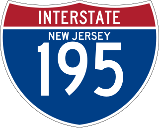
Interstate 195 (I-195) is an auxiliary route of the Interstate Highway System located in the US state of New Jersey. Its western end is at I-295 and Route 29 just south of Trenton in Hamilton, Mercer County, while its eastern end is at the Garden State Parkway, Route 138, and Route 34 in Wall Township, Monmouth County. I-195 is 34.1 miles (54.9 km) in length. The route is mostly a four-lane highway that mainly runs through agrarian and wooded areas in Central Jersey. It has an interchange with the New Jersey Turnpike (I-95) in Robbinsville and serves as a main access road to New Jersey's state capital of Trenton, the Horse Park of New Jersey, the Six Flags amusement park, and the Jersey Shore. I-195 is occasionally referred to as the Central Jersey Expressway. On April 6, 1988, President Ronald Reagan signed H.R. 4263 naming I-195 in New Jersey the James J. Howard Interstate Highway, in honor of the late James J. Howard.

Route 92 was a 6.7-mile (10.8 km) proposed branch of the New Jersey Turnpike that would have run from west to east, beginning at U.S. Route 1 just north of Ridge Road in South Brunswick Township, east along Route 32, to Exit 8A in Monroe Township. Route 92 was also assigned in the 1953 renumbering and by the late 1950s it was named the Princeton–Hightstown Bypass, a freeway planned to connect the Somerset Freeway in Montgomery Township, with Route 33 in East Windsor Township. In 1987, the planned Route 92 was truncated to only run east from U.S. Route 1 near Kingston. New plans were announced in 1994, this time running to US 1 near Princeton. After public hearings found opposition was still strong, the planned route was truncated to a much shorter bypass of Hightstown only and numbered Route 133. Construction on the road, the first project awarded under New Jersey's modified Design-build program, began on September 20, 1996 and was opened November 30, 1999.

County Route 571 is a county highway in the U.S. state of New Jersey. The highway extends 43.9 miles (70.7 km) from Route 37 in Toms River to Nassau Street in Princeton. Though it is designated a north–south county route by the New Jersey Department of Transportation, it is signed both as north–south and east–west inconsistently.

County Route 539 is a county highway in the U.S. state of New Jersey. The highway extends 54.32 miles (87.42 km) from Main Street in Tuckerton to CR 535 in Cranbury Township. Much of the two-lane route passes through isolated areas of the Pine Barrens and the eastern end of the Fort Dix entity of Joint Base McGuire–Dix–Lakehurst. In these stretches, the route has a speed limit of 55 miles per hour (89 km/h), one of the few two-lane roads in the state to carry a 55 mph limit. CR 539 passes through three boroughs: Tuckerton, Allentown, and Hightstown. Other than those boroughs, the route travels mainly through rural townships.

County Route 526 is a county highway in the U.S. state of New Jersey. The highway extends 35.56 miles (57.23 km) from Princeton–Hightstown Road in West Windsor Township to Lanes Mill Road in Lakewood Township.

County Route 524 is a county highway in the U.S. state of New Jersey. The highway extends 39.90 miles (64.21 km) from the White Horse Circle in Hamilton Township to Route 71 in Spring Lake Heights.

County Route 522 is a county highway in the U.S. state of New Jersey. The highway extends 21 miles (34 km) from Route 27 in South Brunswick Township to Main Street in Freehold Borough.
The Union Transportation Trail is a 9-mile (14 km) rail trail situated in western Monmouth County, New Jersey. It extends from Hornerstown, New Jersey, to the Assunpink Wildlife Management Area.

Hornerstown is an unincorporated community located within Upper Freehold Township in Monmouth County, in the U.S. state of New Jersey. Hornerstown is located near Cream Ridge and uses the 08514 ZIP code.

Ashby Creek is a tributary of Doctors Creek in Upper Freehold Township, Monmouth County, New Jersey, in the United States. It runs for 4.2 miles (6.8 km) from the area near Wrightsville and empties into Doctors Creek southeast of Allentown.

Cooleys Corner is an unincorporated community located within Upper Freehold Township in Monmouth County, in the U.S. state of New Jersey. The site of the settlement is within the Assunpink Wildlife Management Area, a New Jersey Department of Environmental Protection Division of Fish and Wildlife-operated preserved area in Monmouth and Mercer counties along the Assunpink Creek. Before the creation of the Assunpink Lake in the 1970s, the area consisted of farmland located at the intersection of Clarksburg Road and Imlaystown-Hightstown Road. Some farmland is still present in the area but is now mostly used by hunters. The main boat ramp to Assunpink Lake is located along the former Imlaystown-Hightstown Road.

Sharon is an unincorporated community located within Upper Freehold Township in Monmouth County, in the U.S. state of New Jersey. Located at the intersection of Herbert Road and Sharon Station Road, the settlement is the site of a former stop on the Pemberton and Hightstown Railroad. Except for a few single-family homes in the area, most of the area is farmland. The railroad has since been abandoned and is being converted to the Union Transportation Trail, a rail trail. Sharon is the current northern terminus of the trail.


