
Route 38 is a state highway in the southern part of the U.S. state of New Jersey serving the Philadelphia metropolitan area. It extends 19.19 mi (30.88 km) from the Airport Circle, where it intersects U.S. Route 30 and US 130, in Pennsauken Township, Camden County, east to an intersection with US 206 and CR 530 in Southampton Township, Burlington County. The entire route is closely parallel to CR 537 located to the north, being only one block away at places. The route is a multilane divided highway for most of its length and passes through commercial development, residential development, and some farmland.

Route 37 is a state highway located in Ocean County, New Jersey, United States. The route runs 13.4 mi (21.57 km) from a traffic circle with Route 70 in Lakehurst east to an interchange with Route 35 in Seaside Heights. A two– to six–lane divided highway its entire length, Route 37 serves as the major east–west route through the Toms River area as well as a main route to the Barnegat Peninsula, crossing the Barnegat Bay on the Thomas A. Mathis and J. Stanley Tunney Bridges. The route through Toms River is lined with many businesses and named Little League World Champions Boulevard in honor of Toms River East Little League's victory in the 1998 Little League World Series. Route 37 intersects many major roads in the Toms River area, including CR 527, the Garden State Parkway/US 9, Route 166, CR 549, and CR 571. The route experiences congestion from both development in the area and from traffic bound for the barrier islands in the summer.

Colts Neck Township is a township in Monmouth County, in the U.S. state of New Jersey. It is located in the New York Metropolitan Area. As of the 2020 United States census, the township's population was 9,957, a decrease of 185 (−1.8%) from the 2010 census count of 10,142, which in turn reflected a decline of 2,189 (−17.8%) from the 12,331 counted in the 2000 census.

Englishtown is a rapidly growing borough in western Monmouth County, in the U.S. state of New Jersey. The community is located within the Raritan Valley region. As of the 2020 United States census, the borough's population was 2,346, its highest decennial count ever and an increase of 499 (+27.0%) from the 2010 census count of 1,847, which in turn reflected an increase of 83 (+4.7%) from the 1,764 counted in the 2000 census.

Farmingdale is a borough in Monmouth County, in the U.S. state of New Jersey. As of the 2020 United States census, the borough's population was 1,504, an increase of 175 (+13.2%) from the 2010 census count of 1,329, which in turn reflected a decline of 258 (−16.3%) from the 1,587 counted in the 2000 census.

Freehold is a borough in and the county seat of Monmouth County, in the U.S. state of New Jersey. Known for its Victorian era homes and extensive colonial history, the borough is located in the Raritan Valley region within the New York Metropolitan Area, located about 33 miles (53 km) from Manhattan and 17 miles (27 km) from Staten Island. The borough has grown to become a commuter town of New York City. As of the 2020 United States census, the borough's population was 12,538, its highest decennial count ever and an increase of 486 (+4.0%) from the 12,052 recorded at the 2010 census, which in turn reflected an increase of 1,076 (+9.8%) from the 10,976 counted in the 2000 census.

Freehold Township is a township in western Monmouth County, in the U.S. state of New Jersey. Crisscrossed by several major highways, the township is a commercial hub for Central New Jersey and is a suburban bedroom community of New York City, located within the Raritan Valley region of the much larger New York Metropolitan Area. The township is located roughly 38 miles (61 km) away from Manhattan and about 20 miles (32 km) away from Staten Island. As of the 2020 United States census, the township's population was 35,369, a decrease of 815 (−2.3%) from the 36,184 recorded at the 2010 census, which in turn reflected an increase of 4,647 (+14.7%) from the 31,537 counted in the 2000 census.
Howell Township is a township in Monmouth County, in the U.S. state of New Jersey. The township is the largest municipality in the county by total area, comprising about 61.21 square miles (158.5 km2). It is located in the New York metropolitan area and has been a steadily growing bedroom community of New York City. As of the 2020 United States census, the township's population was 53,537, its highest decennial count ever and an increase of 2,462 (+4.8%) from the 2010 census count of 51,075, which in turn reflected an increase of 2,172 (+4.4%) from the 48,903 counted in the 2000 census.

West Freehold is an unincorporated community and census-designated place (CDP) within Freehold Township, in Monmouth County, New Jersey, United States. As of the 2010 United States Census, the CDP's population was 13,613. Due to the community's close proximity to the Battle of Monmouth, West Freehold is home to several important historical structures, which have been preserved in the 'West Freehold Village Historic District'. The historically preserved Monmouth Battlefield, along with the historic villages of Clarksburg, Englishtown, Smithburg and Tennent are a short distance away.
New Jersey's 4th congressional district is a congressional district that stretches along the New Jersey Shore. It has been represented by Republican Chris Smith since 1981, the second-longest currently serving member of the US House of Representatives and the longest serving member of Congress from New Jersey in history.

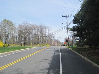
County Route 537 is a county highway in the U.S. state of New Jersey. The highway extends 66.2 miles (106.5 km) from Delaware Avenue in Camden to Oceanport Avenue in Oceanport. It is the state's fourth longest 500 series county route.

Adelphia is an unincorporated community located in northern Howell Township, Monmouth County, in the U.S. state of New Jersey. The area is served as United States Postal Service ZIP code 07710. The community borders Freehold Township, and residents who reside in Adelphia use a Freehold mailing address.

Smithburg is an unincorporated community located where the municipal boundaries of Freehold, Manalapan and Millstone townships intersect in Monmouth County, in the U.S. state of New Jersey. County Route 527 and Monmouth Road pass through the center of the quaint village of Smithburg.

Jerseyville is an unincorporated community located within Howell Township in Monmouth County, in the U.S. state of New Jersey. It is primarily a rural area within the northern part of the township, near Colts Neck and Freehold. Route 33 Business travels through Jerseyville, with some development, including a gas station, a convenience store, a church, and several residences.
Montrose is an unincorporated community located near the intersection of Dutch Lane Road and Boundary Road along the border of Colts Neck and Marlboro townships in Monmouth County, in the U.S. state of New Jersey. The town was located in "Atlantic Township" at one time prior to the name being changed to "Colts Neck". Prior to being called Montrose, the area was called "Barrentown".

New Canton is an unincorporated community located along the border of Robbinsville Township in Mercer County and Upper Freehold Township in Monmouth County, in the U.S. state of New Jersey. The area was once known as Cabbagetown and has been settled since the 18th century. The settlement is located at the intersection of Old York Road and New Canton-Stone Tavern Road just north of Interstate 195's interchange 8. The Upper Freehold side of the area contains farmland and new housing developments while the Robbinsville side features new commercial warehouse buildings including an Amazon.com Fulfillment Center opened in July 2014.

Emleys Hill is an unincorporated community located within Upper Freehold Township in Monmouth County, in the U.S. state of New Jersey. The settlement is located at the intersection of Emleys Hill Road and Burlington Path Road.

Fairfield is an unincorporated community located within Howell Township in Monmouth County, in the U.S. state of New Jersey. The community is centered on the intersection of County Route 524 (CR 524) and Ketchum Road, where the Colonial Era Our House Tavern is located. The area includes several small businesses, township offices and schools. There are also small farms and residential developments in the area. Fairfield was a stop on the Freehold and Jamesburg Agricultural Railroad.

Stone Tavern is an unincorporated community located on the border of Millstone and Upper Freehold townships in Monmouth County, in the U.S. state of New Jersey.
The Colts Neck Inn is a steakhouse located on County Route 537 in what is now Colts Neck Township, New Jersey. Established as the Colts Neck Tavern in 1717, the inn became known as the Colts Neck Hotel before becoming a restaurant. A separate Colts Neck Inn Hotel was incorporated in 1997.


