Atlantic County is a county located in the U.S. state of New Jersey. As of the 2020 census, the county was the state's 15th-most-populous county, with a population of 274,534, a drop of 15 from the 2010 census count of 274,549. Its county seat is the Mays Landing section of Hamilton Township. The county is part of the Jersey Shore and of the South Jersey region of the state.

Route 23 is a state highway in the northern part of New Jersey, United States. The route runs 52.63 miles (84.70 km) from Bloomfield Avenue and Prospect Avenue (CR 577) in Verona, Essex County, northwest to the border with New York at Montague Township in Sussex County, where the road continues to Port Jervis, New York, as CR 15. Route 23 heads through Essex and Passaic counties as a two- to four-lane surface road and becomes a six-lane freeway north of a complex interchange with U.S. Route 46 (US 46) and Interstate 80 (I-80) in Wayne. The freeway carries Route 23 north to a concurrency with US 202. Past the freeway portion, the route heads northwest along the border of Morris and Passaic counties as a four- to six-lane arterial road with a wide median at places, winding through mountainous areas and crossing the interchange with I-287 in Riverdale. The route continues northwest through Sussex County as a mostly two-lane surface road that passes through farmland and woodland as well as the communities of Franklin, Hamburg, and Sussex before reaching the New York state line, just south of an interchange with I-84 and US 6 in Port Jervis, in Montague Township near High Point State Park.

Route 77 is a state highway in the southern part of the U.S. state of New Jersey. It runs 22.55 mi (36.29 km) from an intersection with Route 49 in Bridgeton in Cumberland County north to a junction with Route 45 in Mullica Hill in Gloucester County. It is a mostly two-lane, undivided road traversing through farmland in Cumberland, Salem, and Gloucester Counties. Along the way, Route 77 intersects Route 56 in Upper Deerfield Township and U.S. Route 40 in Upper Pittsgrove Township.

Interstate 78 (I-78) is an east–west route stretching from Union Township, Lebanon County, Pennsylvania, to New York City. In New Jersey, I-78 is called the Phillipsburg–Newark Expressway and the Newark Bay Extension of the New Jersey Turnpike. The highway runs for 67.8 miles (109.1 km) in the northern part of the state of New Jersey from the I-78 Toll Bridge over the Delaware River at the Pennsylvania state line in Phillipsburg, Warren County, east to the Holland Tunnel under the Hudson River at the New York state line in Jersey City, Hudson County. The Phillipsburg–Newark Expressway portion of I-78, formally called the Lightning Division Memorial Highway, runs from the Phillipsburg area east across rural areas of Western New Jersey before entering suburban areas in Somerset County. The road crosses the Watchung Mountains, widening into a local–express lane configuration at Route 24 as it continues through urban areas to Newark. Here, I-78 intersects the mainline of the New Jersey Turnpike (I-95) and becomes the Newark Bay Extension, crossing the Newark Bay Bridge and continuing to Jersey City. The route, along with Route 139, follows a one-way pair of surface streets to the Holland Tunnel.

County Route 571 is a county highway in the U.S. state of New Jersey. The highway extends 43.9 miles (70.7 km) from Route 37 in Toms River to Route 27 in Princeton. Though it is designated a north–south county route by the New Jersey Department of Transportation, it is signed both as north–south and east–west inconsistently.

County Route 527 is a county highway in the U.S. state of New Jersey. The highway extends 84.8 mi (136.47 km) from Main Street in Toms River to Pompton Avenue in Cedar Grove. It passes through more counties (six) than any other county route in New Jersey. CR 527 is also the second longest 500-series county route in New Jersey after Route 519. The county route traverses through the northernmost stretches of the Pine Barrens in South Jersey, much of the Raritan Valley and Rahway Valley regions in Central Jersey, and the First and Second Watchung Mountains in North Jersey. It passes through Ocean, Monmouth, Middlesex, Somerset, Union, and Essex counties on the eastern side of the state.

County Route 524 is a county highway in the U.S. state of New Jersey. The highway extends 39.90 miles (64.21 km) from the White Horse Circle in Hamilton Township to Route 71 in Spring Lake Heights.

New York State Route 245 (NY 245) is a state highway in the Finger Lakes region of New York in the United States. The southern terminus of the route is at NY 21 in Naples. The northern terminus is at NY 5, U.S. Route 20 and NY 14A west of Geneva. From Geneva to Naples, NY 245 traverses the land from the north end of Seneca Lake to the south end of Canandaigua Lake in roughly a northeast to southwest direction.

Columbus is an unincorporated community located within Mansfield Township in Burlington County, in the U.S. state of New Jersey. The area is served as United States Postal Service ZIP Code 08022. Most of Mansfield Township's governmental offices are located in and around Columbus. It is also the main business district in the township with many businesses lining the main roads in the area. It is located at the junction of County Route 543 and U.S. Route 206 which is a major highway that heads north and south. US 206 originally passed through the center of Columbus on Atlantic Avenue and New York Avenue until it was moved to a short four-lane bypass of downtown in the late 1950s/early 1960s. The old surface route became state-maintained New Jersey Route 170 but became a county-maintained road in 1986.

Whitehouse, also spelled White House, is an unincorporated community located within Readington Township in Hunterdon County, New Jersey. The community lies along the former Jersey Turnpike, just west of Mechanicsville. The Whitehouse–Mechanicsville Historic District, which includes historic places in both Whitehouse and Mechanicsville, was added to the National Register of Historic Places on March 17, 2015.

U.S. Route 40 is a U.S. highway running from Silver Summit, Utah east to Atlantic City, New Jersey. The easternmost segment of the route runs 64.32 miles (103.51 km) through the southern part of New Jersey between the Delaware Memorial Bridge over the Delaware River in Pennsville Township, Salem County, where it continues into Delaware along with Interstate 295 (I-295), east to Atlantic Avenue and Pacific Avenue in Atlantic City, Atlantic County. The route passes through Salem, Gloucester, and Atlantic counties as well as the boroughs of Woodstown, Elmer, Newfield, and Buena. The route encounters a mix of rural, suburban, and urban environs throughout its journey across South Jersey.

The Society of African Missions, also known as the SMA Fathers, is a Catholic religious society of apostolic life of pontifical right for men founded by Melchior de Marion Brésillac in 1856. They serve the people of Africa and those of African descent.
Carrie Pilby is a coming-of-age novel by Caren Lissner, first published by Red Dress Ink in 2003, then re-released on July 1, 2010 for teenage readers under the new imprint Harlequin Teen. It was among the first novels published by Harlequin Enterprises's Red Dress Ink imprint.

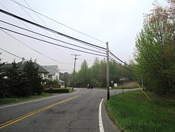
Smithburg is an unincorporated community located where the municipal boundaries of Freehold, Manalapan and Millstone townships intersect in Monmouth County, in the U.S. state of New Jersey. County Route 527 and Monmouth Road pass through the center of the quaint village of Smithburg.
Caren Lissner is an American novelist, essayist, and newspaper editor. Her published novels include Carrie Pilby (2003) and Starting from Square Two (2004).

Stone Tavern is an unincorporated community located on the border of Millstone and Upper Freehold townships in Monmouth County, in the U.S. state of New Jersey.
Cedar Ridge High School is a defunct public high school in Old Bridge Township, in Middlesex County, in the U.S. state of New Jersey, that opened in 1968 and closed in June 1994.

The New Brunswick Performing Arts Center is a complex in New Brunswick, New Jersey's Civic Square government and cultural district, adjacent to the State Theatre. Construction for the US$172 million, 23-story multi-use property began in 2017 and was completed in 2019. Its official opening took place September 4, 2019.
The statue of Frank Sinatra in Hoboken, New Jersey is located along Sinatra Park section of the Hudson River Waterfront Walkway.

The Hoboken mayoral election of 2021 was an election to determine who will hold the office of Mayor of Hoboken, New Jersey, in the upcoming term of 2022–2026. The election took place on November 2, 2021. Incumbent Mayor Ravinder Bhalla announced that he would seek reelection for a second term on June 3, 2021. Since there were no opponents, Bhalla ran unopposed for reelection for a second term.


