
Route 36 is a state highway in Monmouth County, New Jersey, United States. The 24.4-mile (39.27 km) long route, shaped as a backwards C, begins at an intersection with the Garden State Parkway and Hope Road on the border of Tinton Falls and Eatontown and runs east to Long Branch. From Long Branch, the route follows the Atlantic Ocean north to Sea Bright and turns west, running to the south of the Raritan Bay. Route 36 ends in Keyport at an interchange with the Garden State Parkway and Route 35. It varies in width from a six-lane divided highway to a two-lane undivided road. The route is signed east–west between Eatontown and Long Branch and north–south between Long Branch and Keyport.

Route 37 is a state highway located in Ocean County, New Jersey, United States. The route runs 13.4 mi (21.57 km) from a traffic circle with Route 70 in Lakehurst east to an interchange with Route 35 in Seaside Heights. A two– to six–lane divided highway its entire length, Route 37 serves as the major east–west route through the Toms River area as well as a main route to the Barnegat Peninsula, crossing the Barnegat Bay on the Thomas A. Mathis and J. Stanley Tunney Bridges. The route through Toms River is lined with many businesses and named Little League World Champions Boulevard in honor of Toms River East Little League's victory in the 1998 Little League World Series. Route 37 intersects many major roads in the Toms River area, including CR 527, the Garden State Parkway/US 9, Route 166, CR 549, and CR 571. The route experiences congestion from both development in the area and from traffic bound for the barrier islands in the summer.

Fair Haven is a borough situated in the Jersey Shore region within Monmouth County, in the U.S. state of New Jersey, in the New York metropolitan area. Fair Haven is located on the Rumson peninsula along the Navesink River and is bordered by Red Bank and Little Silver to the west. As of the 2020 United States census, the borough's population was 6,269, its highest decennial count ever and an increase of 148 (+2.4%) from the 2010 census count of 6,121, which in turn reflected an increase of 184 (+3.1%) from the 5,937 counted in the 2000 census.

Little Silver is a borough in Monmouth County, in the U.S. state of New Jersey. As of the 2020 United States census, the borough's population was 6,131, an increase of 181 (+3.0%) from the 2010 census count of 5,950, which in turn reflected a drop of 220 (−3.6%) from the 6,170 counted in the 2000 census.

Rumson is a borough in Monmouth County, in the U.S. state of New Jersey, and is part of the New York Metropolitan Area. As of the 2020 United States census, the borough's population was 7,343, an increase of 221 (+3.1%) from the 2010 census count of 7,122, which in turn reflected a decline of 15 (−0.2%) from 7,137 in 2000.

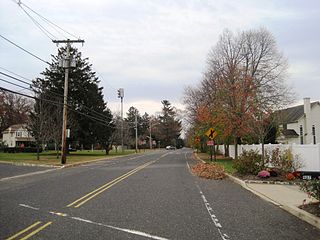
Shrewsbury Township is a township situated in the Jersey Shore region, within Monmouth County, in the U.S. state of New Jersey. As of the 2020 United States census, the township's population was 1,076, a decrease of 65 (−5.7%) from the 2010 census count of 1,141, which in turn reflected an increase of 43 (+3.9%) from the 1,098 counted in the 2000 census.

Sea Bright is a borough situated on the Jersey Shore, within Monmouth County, in the U.S. state of New Jersey. As of the 2020 United States census, the borough's population was 1,449, an increase of 37 (+2.6%) from the 2010 census count of 1,412, which in turn had reflected a decline of 406 (−22.3%) from the 1,818 counted in the 2000 census.

Seaside Park is a borough in Ocean County, in the U.S. state of New Jersey. It is part of the New Brunswick–Lakewood, NJ Metropolitan Division, which is part of the New York metropolitan area. As of the 2020 United States census, the borough's population was 1,436, a decrease of 143 (−9.1%) from the 2010 census count of 1,579, which in turn had reflected decline of 684 (−30.2%) from the 2,263 counted in the 2000 census. Seaside Park is situated on the Barnegat Peninsula, a long, narrow barrier peninsula that separates Barnegat Bay from the Atlantic Ocean.

The Navesink River is an estuary in the eastern United States in Monmouth County, New Jersey. Approximately eight miles (13 km) in length, it is surrounded by the communities of Middletown, Red Bank, Fair Haven, and Rumson.
The Rumson-Fair Haven Regional High School is a regional, four-year comprehensive public high school and school district, serving students in ninth through twelfth grades from the suburban communities of Fair Haven and Rumson, which are situated on a peninsula bounded by the Navesink and Shrewsbury Rivers and the Atlantic Ocean, in northern Monmouth County, in the U.S. state of New Jersey. The school has been accredited by the Middle States Association of Colleges and Schools Commission on Elementary and Secondary Schools since 1940. The high school is the lone facility of the Rumson-Fair Haven High School District.
The Fair Haven Public Schools is a comprehensive community public school district that serves students in pre-kindergarten through eighth grade from Fair Haven, in Monmouth County, in the U.S. state of New Jersey.
Wayside is an unincorporated community located along the border of Tinton Falls Borough and Ocean Township in Monmouth County, in the U.S. state of New Jersey. The community is largely residential though some churches, parks, and schools are located in the area. The main arterial roads in the community are Hope Road, Wayside Road, and West Park Avenue. Access to New Jersey Route 18 is available via nearby interchanges with Deal Road, West Park Avenue, and Wayside Road; the Garden State Parkway's exit 105 is also located north of Wayside. The building that once housed the 16-lane Wayside Bowl-O-Drome is still in use, now as an office building.
The Rumson School District is a community public school district that serves students in pre-kindergarten through eighth grade from the Borough of Rumson, in Monmouth County, in the U.S. state of New Jersey.

County Route 520 (CR 520) is a county highway in the U.S. state of New Jersey. CR 520 is a major road across Monmouth County connecting the county's central towns to the Jersey Shore at Sea Bright. The highway extends 22.3 miles (35.9 km) from Englishtown Road (CR 527) in Old Bridge to Ocean Avenue (Route 36) in Sea Bright.

Locust is an unincorporated community located within Middletown Township in Monmouth County, in the U.S. state of New Jersey. It is situated along the north banks of the Navesink River and Claypit Creek. Locust is one of the five designated historic districts in Middletown.

Toms River is a township located on the Jersey Shore in Ocean County, in the U.S. state of New Jersey. Its mainland portion is also a census-designated place of the same name, which serves as the county seat of Ocean County. Formerly known as the Township of Dover, voters in a 2006 referendum approved a change of the official name to the Township of Toms River, adopting the name of the largest unincorporated community within the township. The township is a bedroom suburb of New York City in the New York metropolitan area, and a regional commercial hub in central New Jersey.

West Allenhurst is an unincorporated community located within Ocean Township in Monmouth County, New Jersey, United States. The area is served as United States Postal Service ZIP code 07711. As of the 2000 United States Census, the population for ZIP Code Tabulation Area 07711 was 1,934. West Allenhurst is bordered by Allenhurst to the east, Deal to the northeast, and Interlaken to the south. Major arterial roads in the community are the east-west Corlies Avenue and the north-south Monmouth Road.

Prospertown is an unincorporated community located within the New Jersey townships of Jackson and Plumsted in Ocean County and Upper Freehold in Monmouth County. The community is home to Prospertown Lake and is adjacent to Six Flags Great Adventure, both located on County Route 537. The center of the community is located at the intersection of CR 537, Hawkin Road, and Emleys Hill Road. Most of the area consists of pine forests but there are some homes along the roads in the area.

Galilee is an unincorporated community located within Monmouth Beach in Monmouth County, in the U.S. state of New Jersey. The area is named for the Biblical city of Galilee and was founded as a fishing village. Located at the northern extent of Monmouth Beach, it is located along the peninsula where it begins to greatly narrow between the Shrewsbury River and the Atlantic Ocean. Single family homes typically make up the ocean side of the peninsula while condominiums and a marina are located on the river side. The Sea Bright–Monmouth Beach Seawall passes through the community and continues to neighboring Sea Bright.

Normandie is an unincorporated community located within Sea Bright in Monmouth County, in the U.S. state of New Jersey. The community is one of the four main built-up areas of Sea Bright and is a former stop on the New Jersey Southern Railroad. It is located along Route 36 between the CR 520 drawbridge to Rumson and Sandy Hook on a narrow strip of land between the Shrewsbury River and the Atlantic Ocean. The Sea Bright–Monmouth Beach Seawall passes through the neighborhood and Navesink Beach.


