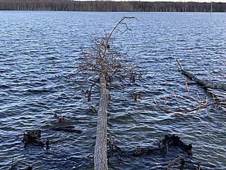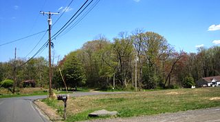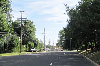
Howell Township is a township in Monmouth County, in the U.S. state of New Jersey. The township is the largest municipality in the county by total area, comprised of about 61.21 square miles (158.5 km2). It is located in the New York metropolitan area and has been a steadily growing bedroom community of New York City. As of the 2020 United States census, the township's population was 53,537, its highest decennial count ever and an increase of 2,462 (+4.8%) from the 2010 census count of 51,075, which in turn reflected an increase of 2,172 (+4.4%) from the 48,903 counted in the 2000 census.
The Howell Township Public Schools is a community public school district that serves students in pre-kindergarten through eighth grade from Howell Township, in Monmouth County, New Jersey, United States.

Adelphia is an unincorporated community located in northern Howell Township, Monmouth County, in the U.S. state of New Jersey. The area is served as United States Postal Service ZIP code 07710. The community borders Freehold Township, and residents who reside in Adelphia use a Freehold mailing address.

Brookside is a historic unincorporated community and census-designated place (CDP) located within Mendham Township in Morris County, in the U.S. state of New Jersey. It is located approximately 6 mi (9.7 km) west of Morristown. It is close to the Washington Valley Historic District in neighboring Morris Township.
Squankum is an unincorporated community located within Howell Township in Monmouth County, New Jersey, United States. The name Squankum was used for a town in Gloucester County, which was changed to present day Williamstown, due to postal regulations that prohibited the two towns from having the same name.

Breton Woods is an unincorporated community located within Brick Township, in Ocean County, New Jersey, United States. The community is located near the Metedeconk River and is bisected by Mantoloking Road. Except for commercial businesses located along Mantoloking Road, the area is made up of bungalows dotting the small roads throughout the area. A wood area of 31 acres near the community is known as Breton Woods. It was owned by the Archdiocese of Trenton, which had once intended or create a cemetery.

Rockefellows Mills is an unincorporated community located within Raritan Township in Hunterdon County, New Jersey, United States. The settlement is located along the South Branch Raritan River near Three Bridges. The river is spanned in the area by the historic Rockafellows Mill Bridge built in 1900 and part of the Raritan–Readington South Branch Historic District. Most of the area within the Raritan Township side of the river is forested however on the north side of the river in Readington Township, some farmland dots the area.

Snydertown is an unincorporated community located within East Amwell Township in Hunterdon County, New Jersey, United States. The settlement is located on the southern face of Sourland Mountain at the intersection of Linvale Road and Snydertown Road. In the past, a mill operated in Snydertown.

Gravel Hill or Gravelhill is an unincorporated community located within Monroe Township in Middlesex County, New Jersey, United States. Located in a rural part of Monroe Township, the area is made up of approximately half farmland and half forestland. Homes line the roads that run through the area.

Half Acre is an unincorporated community located within Monroe Township in Middlesex County, New Jersey, United States. The settlement is located roughly at the intersection of Prospect Plains Road and Half Acre Road in the center of the township. Some single-family homes and small businesses are located along those two roads and Cranbury-Half Acre Road but most of the area is made up of age-restricted housing developments including Concordia, Clearbrook Park, Greenbriar at Whittingham, and Encore at Monroe.

Bergerville is an unincorporated community located within Howell Township in Monmouth County, New Jersey, United States. The area was originally developed as a resort bungalow community in the first half of the 20th century.

Fairfield is an unincorporated community located within Howell Township in Monmouth County, New Jersey, United States. The community is centered on the intersection of County Route 524 (CR 524) and Ketchum Road, where the Colonial Era Our House Tavern is located. The area includes several small businesses, township offices and schools. There are also small farms and residential developments in the area. Fairfield was a stop on the Freehold and Jamesburg Agricultural Railroad.

Freewood Acres is an unincorporated community located within Howell Township in Monmouth County, New Jersey, United States. The area is made up of mostly single-story homes arranged along a street grid in the northern reaches of the Pine Barrens. U.S. Route 9 runs through the center of the community just north of its interchange with Interstate 195. The Land O'Pines Elementary School and Manasquan Reservoir County Park exist to the east of the community. It became the center of the Kalmyk American community in the latter part of the 20th century.

Lower Squankum is an unincorporated community located within Howell Township in Monmouth County, New Jersey, United States. The settlement is located along Lakewood-Farmingdale Road at its intersection with Herbertsville Road and Old Tavern Road in the eastern side of the township. It is also located near the boundary of Allaire State Park and is south of Interstate 195's exit 31. Nearby the community are the remains of the Lower Squankum Mill and the Lower Squankum Friends Burial Site, located within the median of CR 547 at the aforementioned interchange.

Ewansville or Ewanville is an unincorporated community located in Burlington County, New Jersey, United States. The community is centered on the crossing of U.S. Route 206 (US 206) and the North Branch Rancocas Creek just north of the former Philadelphia and Long Branch Railway. Ewansville was the site of a station on the aforementioned railroad and was the terminus for a short spur track to Vincentown.

West Farms is an unincorporated community located within Howell Township in Monmouth County, New Jersey, United States. The settlement is centered on the intersection of West Farms Road and Casino Drive, located to the west of Farmingdale and to the north of the Manasquan Reservoir. It was once home Jewish farmers who settled there in the early 20th century. The rural area is mostly made up of wooded areas with some houses and churches dotted along the two aforementioned roads. Numerous small farms are also located throughout the area.

Herbertsville is an unincorporated community located within Brick Township in Ocean County, New Jersey, United States. The suburban community is located in the northern reaches of the township centered about the intersection of Herbertsville Road and Lanes Mill Road.

Browns Mills Junction is an unincorporated community located within Pemberton Township in Burlington County, New Jersey, United States. The site, located about 1.6 miles (2.6 km) southwest of downtown Browns Mills, is located at the crossing of Junction Road and the Philadelphia and Long Branch Railway, later a part of the Pennsylvania Railroad. It was the site of a train station named Browns Mills in-the-Pines where a short branch connected the main line to Browns Mills. The settlement features a few houses along Junction Road and Mount Misery Road but is otherwise very forested as a part of the New Jersey Pine Barrens.

Comical Corner or Comical Corners is an unincorporated community located within Pemberton Township in Burlington County, New Jersey, United States. The site of the actual corners is at the intersection of Pemberton Road and Arneys Mount Road. The original name may have been "Conical Corner" based on the cone-like shape of the skewed intersection but had turned to "Comical Corner" based on a mishearing. The area, located just to the north of Pemberton Borough, is mostly rural and is surrounded by farmland on the two obtuse sides of the intersection.


