Pleasant Plains, New Jersey

Last updated

Pleasant Plains, New Jersey
Pleasant Plains, NJ.jpg
Looking south along South Middlebush Road (CR 615) approaching Claremont Road (CR 648)
Location map of Somerset County, New Jersey.svg
Red pog.svg
Pleasant Plains
Location in Somerset County
USA New Jersey relief location map.svg
Red pog.svg
Pleasant Plains
Location in New Jersey
Usa edcp relief location map.png
Red pog.svg
Pleasant Plains
Location in the United States
Coordinates: 40°27′11″N74°34′35″W / 40.453121°N 74.576459°W / 40.453121; -74.576459 [1] [2]
Country Flag of the United States.svg  United States
state Flag of New Jersey.svg  New Jersey
County Somerset
Township Franklin
Area
[3]
  Total3.22 sq mi (8.34 km2)
  Land3.21 sq mi (8.33 km2)
  Water0.01 sq mi (0.01 km2)  0.17%
Elevation
[4]
95 ft (29 m)
Population
 (2020) [5]
  Total792
  Density246.35/sq mi (95.11/km2)
Time zone UTC−05:00 (Eastern (EST))
  Summer (DST) UTC−04:00 (Eastern (EDT))
Area code(s) 609/640 and 732/848
FIPS code 34-59500 [1] [2] [6]
GNIS feature ID02584018 [1] [2]

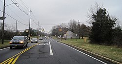
Pleasant Plains is an unincorporated community and census-designated place (CDP) [7] located in Franklin Township, in Somerset County, in the U.S. state of New Jersey. [8] [9] [10] As of the 2010 United States Census, the CDP's population was 922. [11] Having no distinct boundaries, a large area in the center of Franklin Township centered on the intersections of South Middlebush Road (County Route 615) with Claremont and Suydam Roads (the former also CR 648) is generally considered Pleasant Plains. [12]

Contents

History

Prior to the development of K. Hovnanian's Town and Country Estates in 1998, the area included little more than a collection of 18th and 19th century farms and rural lanes. Its historic rural character may be seen in an estimate from 1882 which listed the Pleasant Plains population at 46. [13]

An icon in the area has been the early 19th century general store and blacksmith shop buildings known since the late 1800s as Laird's Brothers Hardware and Laird's Corner Store. [14]

Another area feature is the Pleasant Plains Cemetery on South Middlebush Road just south of Laird's Corner that has been in use from early settlement of the area until the present day. [15]

Since the early 19th century (and possibly even earlier), the area featured a one-room schoolhouse known as the Pleasant Plains School. Located on the north side of Suydam Road about a half mile west of Laird's Corner, it remained in use until about 1931 when the Township started decommissioning its one-room schoolhouses in favor of larger regional schools. Moved across the road on log rollers, it was converted into a residence and used until the late 20th century when it was threatened with demolition to make way for the Town and County development. Instead, it was moved to the Township's Municipal Complex on DeMott Lane where it awaits further rehabilitation. [16]

The Six Mile Run Historic District listed on the New Jersey and National Register of Historic Places includes a number of properties in the Pleasant Plains area.

Geography

According to the United States Census Bureau, Pleasant Plains had a total area of 3.221 square miles (8.342 km2), including 3.215 square miles (8.328 km2) of land and 0.006 square miles (0.014 km2) of water (0.17%). [1] [2]

Demographics

Historical population
CensusPop.Note
2010 922
2020 792−14.1%
Population sources: 2010 [11] 2020 [5]

2010 census

The 2010 United States census counted 922 people, 254 households, and 236 families in the CDP. The population density was 286.8 per square mile (110.7/km2). There were 257 housing units at an average density of 79.9 per square mile (30.8/km2). The racial makeup was 40.13% (370) White, 21.80% (201) Black or African American, 0.22% (2) Native American, 33.62% (310) Asian, 0.00% (0) Pacific Islander, 2.82% (26) from other races, and 1.41% (13) from two or more races. Hispanic or Latino of any race were 5.10% (47) of the population. [11]

Of the 254 households, 57.1% had children under the age of 18; 85.0% were married couples living together; 5.5% had a female householder with no husband present and 7.1% were non-families. Of all households, 5.9% were made up of individuals and 0.8% had someone living alone who was 65 years of age or older. The average household size was 3.63 and the average family size was 3.73. [11]

30.4% of the population were under the age of 18, 5.6% from 18 to 24, 23.6% from 25 to 44, 32.9% from 45 to 64, and 7.5% who were 65 years of age or older. The median age was 41.1 years. For every 100 females, the population had 97.0 males. For every 100 females ages 18 and older there were 93.4 males. [11]

Cemetery

Cemetery information sign Pleasant Plains Cemetery, South Middlebush Road, NJ - gate.jpg
Cemetery information sign

The Pleasant Plains Cemetery, located on South Middlebush Road just south of Laird's Corner, was established in 1898. [15]

Related Research Articles

<span class="mw-page-title-main">Kingston, New Jersey</span> Populated place in Middlesex and Somerset counties, New Jersey, US

Kingston is an unincorporated community and census designated place (CDP) along the border of South Brunswick Township in Middlesex County and Franklin Township in Somerset County, and also located relatively near Princeton in Mercer County in the U.S. state of New Jersey. The historic settlement is in the Raritan Valley region, located along the course of the Millstone River. As of the 2010 United States Census, the CDP's population was 1,493, of which 1,222 were in South Brunswick Township and 271 in Franklin Township.

<span class="mw-page-title-main">Plainsboro Center, New Jersey</span> Populated place in Middlesex County, New Jersey, US

Plainsboro Center is an unincorporated community and census-designated place (CDP) located within Plainsboro Township, situated in southern Middlesex County, within the U.S. state of New Jersey. As of the 2020 United States census, the CDP's population was 2,760, its highest decennial count ever and an increase of 48 (+1.8%) from the 2,712 recorded at the 2010 census, which in turn reflected an increase of 503 (+22.8%) from the 2,209 counted in the 2000 census.

<span class="mw-page-title-main">Morganville, New Jersey</span> Populated place in Monmouth County, New Jersey, US

Morganville is an unincorporated community and census-designated place (CDP) within Marlboro Township, in Monmouth County, New Jersey. As of the 2010 United States Census, the CDP's population was 5,040.

<span class="mw-page-title-main">Franklin Township, Somerset County, New Jersey</span> Township in Somerset County, New Jersey, United States

Franklin Township is a township in Somerset County, in the U.S. state of New Jersey. It is centrally located in the Raritan Valley region, within the New York Metropolitan Area. As of the 2020 United States census, the township's population was 68,364, an increase of 6,064 (+9.7%) from the 2010 census count of 62,300, which in turn reflected an increase of 11,397 (+22.4%) from the 50,903 counted in the 2000 census. The township was the state's 19th most-populous municipality in 2020, after being ranked 22nd in 2010.

<span class="mw-page-title-main">Blackwells Mills, New Jersey</span> Populated place in Somerset County, New Jersey, US

Blackwells Mills is an unincorporated community and census-designated place (CDP) located in Franklin Township in Somerset County, in the U.S. state of New Jersey. As of the 2010 U.S. census, the CDP's population was 803.

Six Mile Run is an unincorporated community and census-designated place (CDP) located in Franklin Township, in Somerset County, in the U.S. state of New Jersey. As of the 2010 United States Census, the CDP's population was 3,184.

<span class="mw-page-title-main">Griggstown, New Jersey</span> Populated place in Somerset County, New Jersey, US

Griggstown is an unincorporated community and census-designated place (CDP) located within Franklin Township, in Somerset County, in the U.S. state of New Jersey. As of the 2010 United States Census, the CDP's population was 819. The area was first settled around 1733.

<span class="mw-page-title-main">Middlebush, New Jersey</span> Populated place in Somerset County, New Jersey, US

Middlebush is an unincorporated community and census-designated place (CDP) located in Franklin Township, in Somerset County, in the U.S. state of New Jersey. As of the 2010 United States Census, the CDP's population was 2,326. It is perhaps most distinguished as being the host section for Franklin Township's municipal complex.

<span class="mw-page-title-main">Blawenburg, New Jersey</span> Populated place in Somerset County, New Jersey, US

Blawenburg is an unincorporated community and census-designated place (CDP) located within Montgomery Township, in Somerset County, in the U.S. state of New Jersey. As of the 2010 United States Census, the CDP's population was 280. It is located at the juncture of two large roads, CR 518 and CR 601.

<span class="mw-page-title-main">East Millstone, New Jersey</span> Populated place in Somerset County, New Jersey, US

East Millstone is an unincorporated community and census-designated place (CDP) located in Franklin Township in Somerset County, in the U.S. state of New Jersey.

<span class="mw-page-title-main">Robbinsville (CDP), New Jersey</span> Populated place in Mercer County, New Jersey, US

Robbinsville is a census-designated place (CDP) located within Robbinsville Township in Mercer County, in the U.S. state of New Jersey. The area is served as United States Postal Service ZIP Code 08691. As of the 2010 United States Census, the population for the CDP was 3,041.

<span class="mw-page-title-main">Franklin Park, New Jersey</span> Populated place in Somerset County, New Jersey, US

Franklin Park is an unincorporated community and census-designated place (CDP) located within Franklin Township, in Somerset County, in the U.S. state of New Jersey. As of the 2010 United States Census, the CDP's population was 13,295. Route 27 bisects the village and serves as the dividing line between the two counties. The adjacent sections of South Brunswick and North Brunswick, Middlesex County on the east side of Route 27 are also known as Franklin Park, but are not included within the CDP's boundaries.

<span class="mw-page-title-main">Mercerville, New Jersey</span> Populated place in Mercer County, New Jersey, US

Mercerville is an unincorporated community and census-designated place (CDP) located within Hamilton Township, in Mercer County, in the U.S. state of New Jersey. As of the 2010 United States Census, the CDP's population was 13,230. Until after the 2000 census, the area was part of the Mercerville-Hamilton Square CDP. For the 2010 Census it was split into two CDPs, Mercerville and Hamilton Square.

<span class="mw-page-title-main">Asbury, New Jersey</span> Populated place in Warren County, New Jersey, US

Asbury is an unincorporated community and census-designated place (CDP) located within Franklin Township in Warren County, in the U.S. state of New Jersey, that was created as part of the 2010 United States Census. As of the 2010 Census, the CDP's population was 273.

Weston is an unincorporated community and census-designated place (CDP) located in Franklin Township, in Somerset County, in the U.S. state of New Jersey. As of the 2010 United States Census, the CDP's population was 1,235.

<span class="mw-page-title-main">Robertsville, New Jersey</span> Populated place in Monmouth County, New Jersey, US

Robertsville is a census-designated place and unincorporated community located within Marlboro Township, in Monmouth County, in the U.S. state of New Jersey. At the 2010 census, the CDP's population was 11,297.

Clyde is an unincorporated community and census-designated place (CDP) located in Franklin Township, in Somerset County, in the U.S. state of New Jersey. It was a station stop on the Penna RR's Millstone Branch. As of the 2010 United States Census, the CDP's population was 213.

East Franklin is an unincorporated community and census-designated place (CDP) located in Franklin Township, in Somerset County, in the U.S. state of New Jersey. At the 2010 United States Census, East Franklin's population was 8,669.

Franklin Center is an unincorporated community and census-designated place (CDP) located in Franklin Township, in Somerset County, in the U.S. state of New Jersey. As of the 2010 United States Census, the CDP's population was 4,460.

Broadway is an unincorporated community and census-designated place (CDP) located within Franklin Township, in Warren County, in the U.S. state of New Jersey, that was created as part of the 2010 United States Census. As of the 2010 Census, the CDP's population was 244.

References

  1. 1 2 3 4 Gazetteer of New Jersey Places, United States Census Bureau. Accessed July 21, 2016.
  2. 1 2 3 4 US Gazetteer files: 2010, 2000, and 1990, United States Census Bureau. Accessed September 4, 2014.
  3. "ArcGIS REST Services Directory". United States Census Bureau. Retrieved October 11, 2022.
  4. U.S. Geological Survey Geographic Names Information System: Pleasant Plains Census Designated Place, Geographic Names Information System. Accessed August 23, 2012.
  5. 1 2 Census Data Explorer: Pleasant Plains CDP, New Jersey, United States Census Bureau. Accessed June 15, 2023.
  6. Geographic Codes Lookup for New Jersey, Missouri Census Data Center. Accessed June 9, 2023.
  7. State of New Jersey Census Designated Places - BVP20 - Data as of January 1, 2020, United States Census Bureau. Accessed December 1, 2022.
  8. GCT-PH1 - Population, Housing Units, Area, and Density: 2010 - County -- County Subdivision and Place from the 2010 Census Summary File 1 for Somerset County, New Jersey Archived 2020-02-12 at archive.today , United States Census Bureau. Accessed February 11, 2013.
  9. 2006-2010 American Community Survey Geography for New Jersey, United States Census Bureau. Accessed February 11, 2013.
  10. New Jersey: 2010 - Population and Housing Unit Counts - 2010 Census of Population and Housing (CPH-2-32), United States Census Bureau, August 2012. Accessed February 11, 2013.
  11. 1 2 3 4 5 DP-1 - Profile of General Population and Housing Characteristics: 2010 Demographic Profile Data for Pleasant Plains CDP, New Jersey Archived 2020-02-12 at archive.today , United States Census Bureau. Accessed February 11, 2013.
  12. Brahms, pp. 430-432.
  13. Brahms, p. 430.
  14. Brahms, pp. 213, 430-431.
  15. 1 2 Brahms, p. 559.
  16. Brahms, pp. 355, 509.

Sources