Neshanic Station, New Jersey

Last updated

Neshanic Station, New Jersey
Neshanic United Methodist Church, Neshanic Station, NJ.jpg
Neshanic United Methodist Church
Location map of Somerset County, New Jersey.svg
Red pog.svg
Neshanic Station
Location in Somerset County
USA New Jersey relief location map.svg
Red pog.svg
Neshanic Station
Location in New Jersey
Usa edcp relief location map.png
Red pog.svg
Neshanic Station
Location in the United States
Coordinates: 40°30′29″N74°43′49″W / 40.50806°N 74.73028°W / 40.50806; -74.73028
Country Flag of the United States.svg  United States
State Flag of New Jersey.svg  New Jersey
Counties Somerset, Hunterdon
Townships Branchburg, Readington
Area
[1]
  Total
9.50 sq mi (24.60 km2)
  Land9.38 sq mi (24.29 km2)
  Water0.12 sq mi (0.31 km2)
Population
 (2020) [2]
  Total
5,224
  Density557.0/sq mi (215.08/km2)
Time zone UTC−05:00 (Eastern (EST))
  Summer (DST) UTC−04:00 (Eastern (EDT))
FIPS code 34-50100 [3]
GNIS feature ID878715 [4]

Neshanic Station is an unincorporated community and census-designated place (CDP) [5] located within Branchburg, Somerset County, and extending into Readington Township, Hunterdon County, in the U.S. state of New Jersey. [6] [7] In 2016, most of the community was listed on the National Register of Historic Places as the Neshanic Station Historic District. [8]

Contents

Demographics

Historical population
CensusPop.Note
2020 5,224
U.S. Decennial Census [9]
2020 [2]

Neshanic Station was first listed as a census designated place in the 2020 U.S. Census. [10]

As of 2020, the population was 5,224. [2]

History

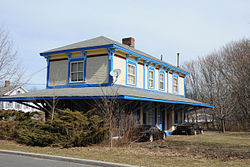
Neshanic Station comes from the Algonquian language meaning "double stream," and the community featured a station along the defunct South Branch Railroad, later a branch of the Central Railroad of New Jersey. The Lehigh Line of Norfolk Southern Railway (formerly the Lehigh Valley Railroad) still runs on tracks north of the community. Neshanic Station is situated at a latitude of 40.508N and a longitude of -74.73W. It is in the Eastern Standard Time Zone with an elevation of 92 feet. [11]

The South Branch Raritan River passes east of the community. The Elm Street Bridge is a lenticular truss bridge that carries Elm Street (Somerset County Route 667) over the river out of the community to River Road (CR 567).

Historic district

Neshanic Station Historic District
304 Maple Avenue, Neshanic Station, NJ.jpg
John G. Schenck House, "Shadow Lawn"
LocationMaple Avenue, Fairview Drive; Elm, Olive, Pearl, Main, Marshall Streets; Woodfern Road
Area112 acres (45 ha)
Architectural styleItalianate, Gothic Revival, Queen Anne
NRHP reference No. 15001051 [8]
NJRHP No.2903 [12]
Significant dates
Added to NRHPFebruary 8, 2016
Designated NJRHPDecember 17, 2015

The Neshanic Station Historic District is a historic district encompassing the village. The district was added to the National Register of Historic Places on February 8, 2016 for its significance in community development from 1857 to 1940. It includes 94 contributing buildings and 5 contributing structures. [13]

Points of interest

Neshanic Mills, also listed on the NRHP, is one of the last remaining grist mills along the South Branch Raritan River. [14]

Notable people

People who were born in, residents of, or otherwise closely associated with Neshanic Station include:

See also

References

  1. "ArcGIS REST Services Directory". United States Census Bureau. Retrieved October 11, 2022.
  2. 1 2 3 QuickFacts Neshanic Station CDP, New Jersey, United States Census Bureau. Accessed June 25, 2023.
  3. Geographic Codes Lookup for New Jersey, Missouri Census Data Center. Accessed June 9, 2023.
  4. "Neshanic Station". Geographic Names Information System . United States Geological Survey, United States Department of the Interior.
  5. State of New Jersey Census Designated Places - BVP20 - Data as of January 1, 2020, United States Census Bureau. Accessed December 1, 2022.
  6. Boundary Changes - New Jersey, United States Census Bureau. Accessed October 7, 2024. "Neshanic Station CDP... Located in Readington township (62250), Hunterdon County (019) and Branchburg township (07180), Somerset County (035)."
  7. "TIGERWEB: Neshanic Station CDP, New Jersey". Geography Division, U.S. Census Bureau. Retrieved October 2, 2024.
  8. 1 2 "Neshanic Station Historic District". National Park Service.
  9. "Census of Population and Housing". Census.gov. Retrieved June 4, 2016.
  10. "2020 Geography Changes". United States Census Bureau.
  11. Neshanic Station, New Jersey NJ, profile (Somerset County) - hotels, festivals, genealogy, newspapers - ePodunk
  12. "New Jersey and National Registers of Historic Places – Somerset County" (PDF). New Jersey Department of Environmental Protection – Historic Preservation Office. September 30, 2020. p. 4.
  13. Parsekian, Ann; Armstrong, Janice; Bertland, Dennis (February 2015). "National Register of Historic Places Inventory/Nomination: Neshanic Station Historic District". National Park Service. With accompanying 37 photos
  14. McCabe, Wayne T. (June 1977). "National Register of Historic Places Inventory/Nomination: Neshanic Mills". National Park Service. With accompanying 9 photos
  15. Jaffer, Nancy. "6-time Olympic rider Frank Chapot of N.J. dead at 84", Hunterdon County Democrat , June 20, 2016. Accessed June 26, 2016. "The six-time Olympian from Neshanic Station, who died Monday at age 84 after being in declining health, was a fierce patriot and competitor for national pride on behalf of the U.S. Equestrian Team."
  16. AnthonyGargiulo, Dartmouth Big Green football. Accessed August 6, 2020. "Hometown: Neshanic Station, N.J.; High School: Immaculata"