Route 47 is a state highway in the southern part of New Jersey. It runs 75.20 mi (121.02 km) from Atlantic Avenue in Wildwood, Cape May County, north to U.S. Route 130 in Brooklawn, Camden County. It is also referred to as Delsea Drive, as it connects the Delaware River near Brooklawn to the Atlantic Ocean in Wildwood. This name was assigned by the New Jersey Legislature in 1933. The route runs through rural areas of Cape May and southern Cumberland counties as a two-lane road. Traffic jams along this portion of Route 47 are commonplace in the summer vacation season and can stretch for miles due to the missing southern section of Route 55, where all Jersey Shore-bound traffic enters the small two-lane road. North of here, the route runs through the cities of Millville and Vineland before entering Gloucester County, where it passes through more rural areas as well as Clayton and Glassboro. Past Glassboro, it heads through suburban areas in Washington and Deptford townships before running through Westville and Brooklawn. Route 47 is the longest signed state route in New Jersey.

Route 49 is a state highway in the southern part of the U.S. state of New Jersey. It runs 53.80 mi (86.58 km) from an interchange with the New Jersey Turnpike, Interstate 295 (I-295), and U.S. Route 40 (US 40) in Deepwater, Salem County, southeast to Route 50 and County Route 557 in Tuckahoe, Cape May County. The route serves Salem, Cumberland, Atlantic, and Cape May counties, passing through rural areas and the communities of Salem, Bridgeton, and Millville along the way. It is a two-lane, undivided road for most of its length.

Route 50 is a state highway in the southern part of the U.S. state of New Jersey. It runs 26.02 mi (41.88 km) from an intersection with U.S. Route 9 and the Garden State Parkway in Upper Township, Cape May County, north to an intersection with US 30 and County Route 563 in Egg Harbor City, Atlantic County. The route, which is mostly a two-lane undivided road, passes through mostly rural areas of Atlantic and Cape May counties as well as the communities of Tuckahoe, Corbin City, Estell Manor, and Mays Landing. Route 50 intersects several roads, including Route 49 in Tuckahoe, US 40 in Mays Landing, and US 322 and the Atlantic City Expressway in Hamilton Township.

Route 54 is a state highway located in Atlantic County in New Jersey, United States. It is considered to be a southern extension of U.S. Route 206, running 11.86 mi (19.09 km) from an intersection with US 206 and US 30 in Hammonton south to an intersection with US 40 in Buena Vista Township. The road passes through the center of Hammonton before running into rural areas. It intersects US 322 and Route 73 in Folsom and the Atlantic City Expressway in Hammonton.

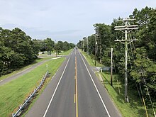
Route 55 is a freeway in the southern part of the U.S. state of New Jersey. Also known as the Veterans Memorial Highway, it runs 40.54 miles (65.24 km) from an intersection with Route 47 in Port Elizabeth north to an interchange with Route 42 in Gloucester County. The Route 55 freeway serves as a main road through Cumberland and Gloucester counties, serving Millville, Vineland, and Glassboro. It is used as a commuter route north to Philadelphia and, along with Route 47, as a route from the Delaware Valley to the Jersey Shore resorts in Cape May County. Route 55 has a posted speed limit of 65 miles per hour (105 km/h) for most of its length.

Route 56 is a state highway in the southern part of the U.S. state of New Jersey. Also known as Landis Avenue, it runs 9.19 mi (14.79 km) from an intersection with Route 77 and County Route 622 (CR 622) in Upper Deerfield Township, Cumberland County, to an intersection with Route 47 in Vineland, Cumberland County. The route serves as a connector between Bridgeton and Vineland. West of the interchange with Route 55 in Vineland, Route 56 is a two-lane undivided road that passes through rural areas of Cumberland County, also entering a corner of Salem County. East of Route 55, the route is a four-lane locally maintained road that runs through commercial areas of Vineland.

Route 347 is a state highway in the southern part of New Jersey in the United States. It is a bypass of Route 47 in Dennis Township, Cape May County, and Maurice River Township, Cumberland County, that is 8.58 mi (13.81 km) long and is completely county-maintained. Route 347 passes through dense woodland for most of its route as a two-lane undivided road. The road is a part of a major route linking the Philadelphia area with the Jersey Shore resorts of Cape May County. The route was created in the 1990s to replace Route 47 Alternate. It has been considered that Route 347 may be partially used for a potential future extension of Route 55, with improvements to the road planned.
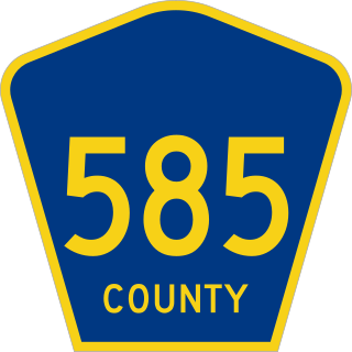
County Route 585 is a county highway in the U.S. state of New Jersey. The highway extends from MacArthur Boulevard in Somers Point to Absecon Boulevard in Absecon.
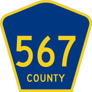
County Route 567 is a county highway in the U.S. state of New Jersey. The highway extends 10.02 miles (16.13 km) from Amwell Road in Hillsborough Township to Union Avenue in Raritan Borough.

County Route 561 is a county highway in the U.S. state of New Jersey. The highway extends 50.95 miles (82.00 km) from New York Road in Galloway Township to Federal Street in Camden.

County Route 557 is a county highway in the U.S. state of New Jersey. The highway extends 36.00 miles (57.94 km) from Delsea Drive in Dennis Township to Main Street in Franklin Township. It is also referred to as Tuckahoe Road.
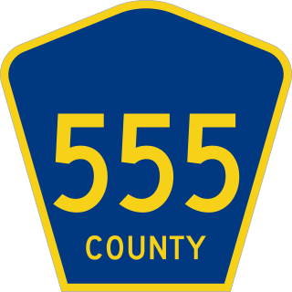
County Route 555 is a county highway in the U.S. state of New Jersey. The highway extends 34.20 miles (55.04 km) from Port Norris Road in Downe Township to Black Horse Pike in Washington Township in Gloucester County.

County Route 553 is a county highway in the U.S. state of New Jersey. The highway extends 51.22 miles (82.43 km) from Hands Landing Road/Ogden Avenue in Commercial Township to Broadway in Deptford Township.
County Route 552 is a county highway in the U.S. state of New Jersey. The highway extends 27.48 miles (44.22 km) from Laurel Street in Bridgeton to Harding Highway in Hamilton Township.

County Route 551 is a county highway in the U.S. state of New Jersey. The highway extends 34.57 miles (55.64 km) from Pennsville-Salem Road in Pennsville Township to Penn Street in Camden.

County Route 549 is a county highway in the U.S. state of New Jersey. The highway extends 17.82 miles (28.68 km) from Main Street at County Route 527 in Toms River to County Route 547 at Monmouth CR 21 in Howell. The highway has the distinction of being the only 500-series route left with two separate spur routes.
County Route 548 is a county highway in the U.S. state of New Jersey. The highway extends 9.18 miles (14.77 km) from Delsea Drive (Route 47 in Maurice River Township to Route 49 in Upper Township.

County Route 540 is a county highway in the U.S. state of New Jersey. The highway extends 43.16 miles (69.46 km) from the intersection of U.S. Route 130 (US 130) and Route 140 in Carneys Point Township to Harding Highway (US 40) in Buena Vista Township.

County Route 537 is a county highway in the U.S. state of New Jersey. The highway extends 66.22 miles (106.57 km) from Delaware Avenue in Camden to CR 11 in Oceanport. It is the state's fourth longest 500 series county route.

County Route 524 is a county highway in the U.S. state of New Jersey. The highway extends 39.90 miles (64.21 km) from the White Horse Circle in Hamilton Township to Route 71 in Spring Lake Heights.