Dennisville, New Jersey

Last updated

Dennisville, New Jersey
James House Dennisville.JPG
Location map of Cape May County, New Jersey.svg
Red pog.svg
Dennisville
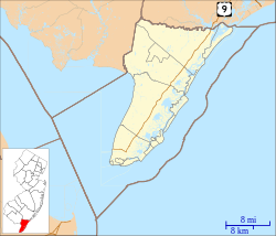
Location in Cape May County
USA New Jersey relief location map.svg
Red pog.svg
Dennisville
Location in New Jersey
Usa edcp relief location map.png
Red pog.svg
Dennisville
Location in the United States
Coordinates: 39°11′35″N74°49′31″W / 39.19306°N 74.82528°W / 39.19306; -74.82528
Country Flag of the United States.svg  United States
State Flag of New Jersey.svg  New Jersey
County Cape May
Township Dennis
Area
[1]
  Total4.58 sq mi (11.86 km2)
  Land4.40 sq mi (11.39 km2)
  Water0.18 sq mi (0.47 km2)
Elevation
7 ft (2 m)
Population
 (2020) [2]
  Total830
  Density188.77/sq mi (72.88/km2)
ZIP Code
08214
Area code(s) 609, 640
FIPS code 34-17590 [3]
GNIS feature ID0875895 [4]

Dennisville is an unincorporated community and census-designated place (CDP) [5] located within Dennis Township, in Cape May County, in the U.S. state of New Jersey. [6] It is part of the Ocean City Metropolitan Statistical Area. Its postal ZIP Code is 08214.

Contents

Dennisville is on the south side of Dennis Creek and is the most important community within Dennis Township. The main transportation artery is New Jersey Route 47 (Delsea Drive).
Demographics

As of the 2020 United States census, the population of the area was 830. [2]

Historical population
CensusPop.Note
2020 830
U.S. 2020 Decennial Census [2]

History

Dennisville was founded in 1726 by Anthony Ludlam. [7] The first post office in the area was Dennis Creek, established September 7, 1802, with Jeremiah Johnson as first postmaster. The name was changed to Dennisville in 1854. [8]

In the 1880s, a local industry sprung up—described by The New York Times as "the like of which does not exist anywhere else in the world"—in which cedar trees that had fallen as much as decades earlier were recovered from under the surface of local swamps. The trees, ranging in size from 4 to 6 feet (1.2 to 1.8 m) in diameter, were first discovered in 1812 and became the foundation of a thriving economic boom in the area for shingles and staves. [9]

Emergency services

Fire

Education

As with other parts of Dennis Township, the area is zoned to Dennis Township Public Schools (for grades K-8) and Middle Township Public Schools (for high school). The latter operates Middle Township High School.

Countywide schools include Cape May County Technical High School and Cape May County Special Services School District.

Notable people

People who were born in, residents of, or otherwise closely associated with Dennisville include:

Related Research Articles

<span class="mw-page-title-main">Mays Landing, New Jersey</span> Populated place in Atlantic County, New Jersey, US

Mays Landing is an unincorporated community and census-designated place (CDP) located within Hamilton Township, Atlantic County, in the U.S. state of New Jersey. At the 2010 U.S. census, May's Landing's population was 2,135. It is the county seat of Atlantic County.

<span class="mw-page-title-main">Cape May Court House, New Jersey</span> Populated place in Cape May County, New Jersey, US

Cape May Court House is an unincorporated community and census-designated place (CDP) located within Middle Township in Cape May County, in the U.S. state of New Jersey. It is part of the Ocean City metropolitan statistical area. As of the 2020 United States census, the CDP's population was 5,573, reflecting a 4.4% increase from the 5,338 enumerated at the 2010 U.S. census, in turn an increase of 13.5% from the 4,704 counted in the 2000 census. It is the county seat of Cape May County and serves as the principal administrative hub for the township. It constitutes part of the greater Philadelphia metropolitan area, or the Delaware Valley.

<span class="mw-page-title-main">Dennis Township, New Jersey</span> Township in Cape May County, New Jersey, United States

Dennis Township is a township in Cape May County, in the U.S. state of New Jersey. The township, and all of Cape May County, is part of the South Jersey region of the state and of the Ocean City metropolitan statistical area, and is part of the Philadelphia-Wilmington-Camden, PA-NJ-DE-MD combined statistical area, also known as the Delaware Valley or Philadelphia metropolitan area. As of the 2020 United States census, the township's population was 6,285, a decrease of 182 (−2.8%) from the 2010 census count of 6,467, which in turn reflected a decline of 25 (−0.4%) from the 6,492 counted in the 2000 census.

<span class="mw-page-title-main">Erma, New Jersey</span> Populated place in Cape May County, New Jersey, US

Erma is an unincorporated community and census-designated place (CDP) located within Lower Township in Cape May County, in the U.S. state of New Jersey. As of the 2020 United States census, the CDP's population was 2,031, a decline of 103 from the 2010 census count of 2,134.

<span class="mw-page-title-main">Lower Township, New Jersey</span> Township in Cape May County, New Jersey, United States

Lower Township is a township in Cape May County, in the U.S. state of New Jersey. The township, and all of Cape May County, is part of the Ocean City metropolitan statistical area, and is part of the Philadelphia-Wilmington-Camden, PA-NJ-DE-MD combined statistical area, also known as the Delaware Valley or Philadelphia metropolitan area. As of the 2020 United States census, the township's population was 22,057, a decrease of 809 (−3.5%) from the 2010 census count of 22,866, which in turn reflected a decrease of 79 (−0.3%) from the 22,945 counted in the 2000 census.

<span class="mw-page-title-main">Middle Township, New Jersey</span> Township in Cape May County, New Jersey, United States

Middle Township is a township in Cape May County, in the U.S. state of New Jersey. The township, and all of Cape May County, is part of the Ocean City metropolitan statistical area, and is part of the Philadelphia-Wilmington-Camden, PA-NJ-DE-MD combined statistical area, also known as the Delaware Valley or Philadelphia metropolitan area. As of the 2020 United States census, the township's population was 20,380, an increase of 1,469 (+7.8%) from the 2010 census count of 18,911, which in turn reflected an increase of 2,506 (+15.3%) from the 16,405 counted in the 2000 census. The township's Cape May Court House section is the county seat of Cape May County.

<span class="mw-page-title-main">North Cape May, New Jersey</span> Populated place in Cape May County, New Jersey, US

North Cape May is an unincorporated community and census-designated place (CDP) located within Lower Township in Cape May County, in the U.S. state of New Jersey. It is part of the Ocean City Metropolitan Statistical Area. At the 2010 United States Census, the CDP's population was 3,226. The Cape May–Lewes Ferry departs from the area. North Cape May is mostly a residential community, with no hotels but many vacation homes. Many people retire to the community.

<span class="mw-page-title-main">Rio Grande, New Jersey</span> Place in Cape May County, New Jersey, United States

Rio Grande is an unincorporated community and census-designated place (CDP) located within Middle Township and Lower Township in Cape May County, in the U.S. state of New Jersey.

<span class="mw-page-title-main">Upper Township, New Jersey</span> Township in Cape May County, New Jersey, United States

Upper Township is a large township in Cape May County, in the U.S. state of New Jersey. The township, and all of Cape May County, is part of the South Jersey region of the state and of the Ocean City metropolitan statistical area, which is part of the Philadelphia-Wilmington-Camden, PA-NJ-DE-MD combined statistical area, also known as the Delaware Valley or Philadelphia metropolitan area. As of the 2020 United States census, the township's population was 12,539, an increase of 166 (+1.3%) from the 2010 census count of 12,373, which in turn reflected an increase of 258 (+2.1%) from the 12,115 counted in the 2000 census.

<span class="mw-page-title-main">Villas, New Jersey</span> Place in Cape May County, New Jersey, United States

Villas, also known as the Villas, is an unincorporated community and census-designated place (CDP) located within Lower Township, in Cape May County, in the U.S. state of New Jersey. The locality is also home to the community of Miami Beach. At the 2010 census, the CDP's population was 9,483.

<span class="mw-page-title-main">Tuckahoe, New Jersey</span> Populated place in Cape May County, New Jersey, US

Tuckahoe is a census-designated place (CDP) unincorporated community located within Upper Township in Cape May County of New Jersey.

<span class="mw-page-title-main">Marmora, New Jersey</span> Populated place in Cape May County, New Jersey, US

Marmora is an unincorporated community and census-designated place (CDP) in Upper Township, in Cape May County, in the U.S. state of New Jersey. It is part of the Ocean City Metropolitan Statistical Area. Its postal ZIP Code is 08223. Its 1990 population was approximately 4,420 persons.

<span class="mw-page-title-main">Goshen, New Jersey</span> Populated place in Cape May County, New Jersey, US

Goshen is an unincorporated community and census-designated place (CDP) located within Middle Township, in Cape May County, in the U.S. state of New Jersey.

<span class="mw-page-title-main">Ocean View, New Jersey</span> Populated place in Cape May County, New Jersey, US

Ocean View is an unincorporated community and census-designated place (CDP) located within Dennis Township in Cape May County, in the U.S. state of New Jersey. The area is served as United States Postal Service ZIP Code 08230. The post office was established in 1872, with William Doolittle as the first postmaster.

<span class="mw-page-title-main">South Dennis, New Jersey</span> Populated place in Cape May County, New Jersey, US

South Dennis is an unincorporated community located within Dennis Township in Cape May County, in the U.S. state of New Jersey. It is part of the Ocean City Metropolitan Statistical Area. Its postal ZIP Code is 08245. The post office was established in 1873, with Robert Hutchinson as the first postmaster.

<span class="mw-page-title-main">Beesley's Point, New Jersey</span> Populated place in Cape May County, New Jersey, US

Beesley's Point is an unincorporated community and census-designated place (CDP) in Upper Township, in Cape May County, in the U.S. state of New Jersey. Beesley's Point is on Peck Bay across from Ocean City. Beesley's Point is home to the Beesley's Point Generating Station and one end of the now-closed Beesley's Point Bridge.

<span class="mw-page-title-main">Burleigh, New Jersey</span> Populated place in Cape May County, New Jersey, US

Burleigh is an unincorporated community and census-designated place (CDP) located within Middle Township in Cape May County, in the U.S. state of New Jersey; Until the 2000 census the area had been part of the Whitesboro-Burleigh CDP, which was split in 2010 into separate CDPs for Burleigh and Whitesboro. As of the 2010 United States Census, the CDP's population was 725.

<span class="mw-page-title-main">Belleplain, New Jersey</span> Populated place in Cape May County, New Jersey, US

Belleplain is an unincorporated community and census-designated place (CDP) located within Dennis Township in Cape May County, in the U.S. state of New Jersey. As of the 2010 United States census, the CDP's population was 597.

South Seaville is an unincorporated community located within Dennis Township in Cape May County, in the U.S. state of New Jersey. South Seaville is 4 miles (6.4 km) northwest of Sea Isle City. South Seaville has a post office with ZIP Code 08246.

Jonathan Evan Maslow was an American journalist and author who wrote extensively about nature, with a focus on obscure and little-known animals.

References

  1. "ArcGIS REST Services Directory". United States Census Bureau. Retrieved October 11, 2022.
  2. 1 2 3 Census Data Explorer: Dennisville CDP, New Jersey, United States Census Bureau. Accessed June 15, 2023.
  3. Geographic Codes Lookup for New Jersey, Missouri Census Data Center. Accessed June 9, 2023.
  4. "Dennisville". Geographic Names Information System . United States Geological Survey, United States Department of the Interior . Retrieved October 6, 2012.
  5. State of New Jersey Census Designated Places - BVP20 - Data as of January 1, 2020, United States Census Bureau. Accessed December 1, 2022.
  6. Locality Search, State of New Jersey. Accessed June 9, 2016.
  7. Cape May County: Dennisville, getnj.com. Accessed September 8, 2007.
  8. New Jersey Postal History: The Post Offices and First Postmasters, 17761976, p. 51. (1977) Kay, John L. and Smith, Chester M. Jr., Lawrence, Massachusetts: Quarterman Publications, Inc. ISBN   0-88000-095-3
  9. Staff. "A Buried Cedar Forest; Mining For Logs In A New Jersey Swamp. Novel Industry At Dennisville In Digging Up Valuable Trees Covered Up Many Ages Ago.", The New York Times , October 6, 1888. Accessed October 16, 2017. "Dennisville, N.J., Oct. 5.--An industry the like of which does not exist anywhere else in the world furnishes scores of people in this part of New-Jersey with remunerative employment, and has made comfortable fortunes for many citizens."
  10. Fox, Margalit. "Jonathan Maslow, 59, a Journalist and Naturalist, Dies", The New York Times , February 24, 2008. Accessed October 16, 2017. "Jonathan Maslow, a journalist and naturalist whose travels took him from the rain forests of Central America to the steppes of Central Asia, died on Tuesday in Greenwich, Conn. He was 59 and lived in Dennisville and Passaic Park, N.J."
  11. Jarrett Porter, Opera Saratoga. Accessed December 25, 2022. "Hometown: Dennisville, NJ"