
Dennis Township is a township in Cape May County, New Jersey, United States. It is part of the Ocean City Metropolitan Statistical Area. The township's population as of the 2010 United States Census was 6,467, reflecting a decline of 25 (-0.4%) from the 6,492 counted in the 2000 Census, which had in turn increased by 918 (+16.5%) from the 5,574 counted in the 1990 Census.

Route 83 is a state highway in the U.S. state of New Jersey. It is completely within Dennis Township, New Jersey, running 3.81 mi (6.13 km) from an intersection with Route 47 to an intersection with U.S. Route 9 (US 9). The route, which passes through woodland and some residential development, is also known as the Trooper Bertram T. Zimmerman III Memorial Highway in honor of a New Jersey State Police officer who was killed along Route 83 in 2004 while responding to an armed robbery.

The Mullica River is a 50.6-mile-long (81.4 km) river in southern New Jersey in the United States. The Mullica was once known as the Little Egg Harbor River.

The Tuckahoe River is a 27.6-mile-long (44.4 km) blackwater river in southern New Jersey in the United States.
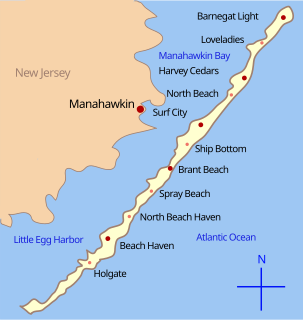
Little Egg Harbor is a brackish bay along the coast of southeast New Jersey. It was originally called Egg Harbor by the Dutch sailors because of the eggs found in nearby gull nests.
Cedar Creek is an 18.9-mile-long (30.4 km) tributary of Barnegat Bay in Ocean County in the southern New Jersey Pine Barrens in the United States.
West Creek is a 12.3-mile-long (19.8 km) tributary of Delaware Bay in Cape May County, New Jersey in the United States.
East Creek is a 4.8-mile-long (7.7 km) tributary of Delaware Bay in Cape May County, New Jersey in the United States.
Sluice Creek is a 5.3-mile-long (8.5 km) tributary of Dennis Creek in Cape May County, New Jersey in the United States.
Roaring Ditch is a tidal waterway approximately 1.6 mi (2.6 km) in length connecting East Creek and Dennis Creek in Cape May County, New Jersey in the United States.
Turtle Creek is a 1.9-mile-long (3.1 km) tributary of the Mullica River in southern New Jersey in the United States.
Oyster Creek is a 10.4-mile-long (16.7 km) tributary of Barnegat Bay in southeastern New Jersey in the United States.

Dennisville is an unincorporated community located within Dennis Township, in Cape May County, New Jersey, United States. It is part of the Ocean City Metropolitan Statistical Area. Its postal ZIP Code is 08214.

Green Creek is an unincorporated community located within Middle Township, in Cape May County, New Jersey, United States. It is located on Route 47. It is a very low-lying area with a highest elevation of just above 20 feet (6.1 m). The community is located about 3 miles (4.8 km) west of Rio Grande and about 2 miles (3.2 km) from the Delaware Bay. It is mostly residential with areas of agriculture and commerce along the main road, Delsea Drive. The United States Postal Service ZIP Code is 08219. The post office was established in 1829 with Matthew Marcy as the first postmaster.

South Dennis is an unincorporated community located within Dennis Township in Cape May County, New Jersey, United States. It is part of the Ocean City Metropolitan Statistical Area. Its postal ZIP Code is 08245. The post office was established in 1873, with Robert Hutchinson as the first postmaster.
The Forked River Nuclear Power Plant was a proposed nuclear power plant in Lacey Township in Ocean County, New Jersey. It was proposed as a single 1,070 MW reactor in 1969 to be built by Combustion Engineering and operated by Jersey Central Power and Light. The facility would have been located on a site between JCP&L's existing Oyster Creek Nuclear Generating Station and the Garden State Parkway. Unlike the Oyster Creek Plant, the Forked River Plant would have a cooling tower to prevent the release of hot water into Oyster Creek and Barnegat Bay.
Dennisville Historic District is a historic district in the unincorporated community of Dennisville in Dennis Township, Cape May County, New Jersey. The district is bounded by Petersburg Road, Main Street, Church Road, Hall Avenue, Fidler and Academy Roads, and Route 47 It was added to the National Register of Historic Places in 1987.

Jessie Creek Winery is a winery in the Dias Creek section of Middle Township in Cape May County, New Jersey. The vineyard was first planted in 2002, and opened to the public in 2012. Jessie Creek has 5 acres of grapes under cultivation, and produces 1,200 cases of wine per year. The winery's name is an amalgamation of Jessie, the name of the former owner's mother, and Dias Creek.
