Marmora, New Jersey

Last updated

Marmora, New Jersey
US 9 southbound, Marmora (1), January 2021.jpg
View along Shore Road (US 9) southbound at Roosevelt Boulevard (CR 623)
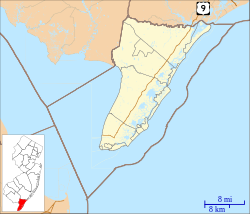
Location map of Cape May County, New Jersey.svg
Red pog.svg
Marmora
Location in Cape May County
USA New Jersey relief location map.svg
Red pog.svg
Marmora
Location in New Jersey
Usa edcp relief location map.png
Red pog.svg
Marmora
Location in the United States
Coordinates: 39°16′00″N74°38′42″W / 39.26667°N 74.64500°W / 39.26667; -74.64500
Country Flag of the United States.svg  United States
State Flag of New Jersey.svg  New Jersey
County Cape May
Township Upper
Area
[1]
  Total2.02 sq mi (5.22 km2)
  Land2.01 sq mi (5.20 km2)
  Water0.01 sq mi (0.02 km2)
Elevation
23 ft (7 m)
Population
 (2020) [2]
  Total2,413
  Density1,201.69/sq mi (463.88/km2)
ZIP Code
08223
FIPS code 34-44280 [3]
GNIS feature ID0878138 [4]

Marmora is an unincorporated community and census-designated place (CDP) [5] in Upper Township, in Cape May County, in the U.S. state of New Jersey. [6] It is part of the Ocean City Metropolitan Statistical Area. Its postal ZIP Code is 08223. Its 1990 population was approximately 4,420 persons.

Contents

A post office was established in 1890, with James Corson as the first postmaster. [7]
Demographics

As of the 2020 United States census, the population was 2,413. [2]

Historical population
CensusPop.Note
2020 2,413
U.S. Decennial Census [8]
2020 [2]

Education

Upper Township School District operates public schools for K-8. Upper Township Primary School and Upper Township Elementary School have Marmora addresses while Upper Township Middle School has a Petersburg address. Ocean City High School of Ocean City School District has high school students from Upper Township.

Countywide schools include Cape May County Technical High School and Cape May County Special Services School District.

The Roman Catholic Diocese of Camden operates Bishop McHugh Regional School, a Catholic K-8 school, in Ocean View, Dennis Township, [9] which has a Cape May Courthouse postal address. [10] It is the parish school of Marmora/Woodbine Catholic Church and three other churches. [11]

Related Research Articles

<span class="mw-page-title-main">Avalon, New Jersey</span> Borough in Cape May County, New Jersey, US

Avalon is a borough in Cape May County, in the U.S. state of New Jersey. It is located on Seven Mile Island. As of the 2020 United States census, the borough's population was 1,243, a decrease of 91 (−6.8%) from the 2010 census count of 1,334, which in turn declined by 809 (−37.8%) from the 2,143 counted in the 2000 census. The borough's population swells to as many as 45,000 during the summer.

<span class="mw-page-title-main">Cape May Court House, New Jersey</span> Populated place in Cape May County, New Jersey, US

Cape May Court House is an unincorporated community and census-designated place (CDP) located within Middle Township in Cape May County, in the U.S. state of New Jersey. It is part of the Ocean City metropolitan statistical area. As of the 2020 United States census, the CDP's population was 5,573, reflecting a 4.4% increase from the 5,338 enumerated at the 2010 U.S. census, in turn an increase of 13.5% from the 4,704 counted in the 2000 census. It is the county seat of Cape May County and serves as the principal administrative hub for the township. It constitutes part of the greater Philadelphia metropolitan area, or the Delaware Valley.

<span class="mw-page-title-main">Dennis Township, New Jersey</span> Township in Cape May County, New Jersey, US

Dennis Township is a township in Cape May County, in the U.S. state of New Jersey. The township, and all of Cape May County, is part of the South Jersey region of the state and of the Ocean City metropolitan statistical area, and is part of the Philadelphia-Wilmington-Camden, PA-NJ-DE-MD combined statistical area, also known as the Delaware Valley or Philadelphia metropolitan area. As of the 2020 United States census, the township's population was 6,285, a decrease of 182 (−2.8%) from the 2010 census count of 6,467, which in turn reflected a decline of 25 (−0.4%) from the 6,492 counted in the 2000 census.

<span class="mw-page-title-main">Erma, New Jersey</span> Populated place in Cape May County, New Jersey, US

Erma is an unincorporated community and census-designated place (CDP) located within Lower Township in Cape May County, in the U.S. state of New Jersey. As of the 2020 United States census, the CDP's population was 2,031, a decline of 103 from the 2010 census count of 2,134.

<span class="mw-page-title-main">Lower Township, New Jersey</span> Township in Cape May County, New Jersey, US

Lower Township is a township in Cape May County, in the U.S. state of New Jersey. The township, and all of Cape May County, is part of the Ocean City metropolitan statistical area, and is part of the Philadelphia-Wilmington-Camden, PA-NJ-DE-MD combined statistical area, also known as the Delaware Valley or Philadelphia metropolitan area. As of the 2020 United States census, the township's population was 22,057, a decrease of 809 (−3.5%) from the 2010 census count of 22,866, which in turn reflected a decrease of 79 (−0.3%) from the 22,945 counted in the 2000 census.

<span class="mw-page-title-main">Middle Township, New Jersey</span> Township in Cape May County, New Jersey, US

Middle Township is a township in Cape May County, in the U.S. state of New Jersey. The township, and all of Cape May County, is part of the Ocean City metropolitan statistical area, and is part of the Philadelphia-Wilmington-Camden, PA-NJ-DE-MD combined statistical area, also known as the Delaware Valley or Philadelphia metropolitan area. As of the 2020 United States census, the township's population was 20,380, its highest decennial census count ever and an increase of 1,469 (+7.8%) from the 2010 census count of 18,911, which in turn had reflected an increase of 2,506 (+15.3%) from the 16,405 counted at the 2000 census. The township's Cape May Court House section is the county seat of Cape May County.

<span class="mw-page-title-main">North Cape May, New Jersey</span> Populated place in Cape May County, New Jersey, US

North Cape May is an unincorporated community and census-designated place (CDP) located within Lower Township in Cape May County, in the U.S. state of New Jersey. It is part of the Ocean City Metropolitan Statistical Area. At the 2010 United States Census, the CDP's population was 3,226. The Cape May–Lewes Ferry departs from the area. North Cape May is mostly a residential community, with no hotels but many vacation homes. Many people retire to the community.

<span class="mw-page-title-main">Sea Isle City, New Jersey</span> City in Cape May County, New Jersey, US

Sea Isle City is a city in Cape May County, in the U.S. state of New Jersey. The city, and all of Cape May County, is part of the South Jersey region of the state and of the Ocean City metropolitan statistical area, and is part of the Philadelphia-Wilmington-Camden, PA-NJ-DE-MD combined statistical area, also known as the Delaware Valley or Philadelphia metropolitan area. As of the 2020 United States census, the city's year-round population was 2,104, a decrease of 10 (−0.5%) from the 2010 census count of 2,114, which in turn reflected a decline of 721 (−25.4%) from the 2,835 counted in the 2000 census. Visitors raise the population to as much as 40,000 during the peak summer season from Memorial Day to Labor Day. Sea Isle City is located on Ludlam Island, which also contains the Strathmere section of Upper Township.

<span class="mw-page-title-main">Stone Harbor, New Jersey</span> Borough in Cape May County, New Jersey, US

Stone Harbor is a borough in Cape May County, in the U.S. state of New Jersey. The borough, and all of Cape May County, is part of the South Jersey region of the state and of the Ocean City metropolitan statistical area, which is part of the Philadelphia-Wilmington-Camden, PA-NJ-DE-MD combined statistical area, also known as the Delaware Valley or Philadelphia metropolitan area. It occupies the southern portion of Seven Mile Island together with its northern neighbor Avalon. It is a resort community that attracts visitors looking to enjoy its beaches, sailing facilities and commercial center. The community attracts a large number of vacationers from the Mid-Atlantic region and Quebec.

<span class="mw-page-title-main">Strathmere, New Jersey</span> Populated place in Cape May County, New Jersey, US

Strathmere is an unincorporated community and census-designated place (CDP) located within Upper Township in Cape May County, in the U.S. state of New Jersey. As of the 2020 United States census, the CDP's population was 137, a decrease of 21 (−13.3%) from the 158 counted at the 2010 U.S. census, which reflected a decrease of 17 (−9.7%) from the 175 enumerated at the 2000 census.

<span class="mw-page-title-main">Upper Township, New Jersey</span> Township in Cape May County, New Jersey, US

Upper Township is a large township in Cape May County, in the U.S. state of New Jersey. The township, and all of Cape May County, is part of the South Jersey region of the state and of the Ocean City metropolitan statistical area, which is part of the Philadelphia-Wilmington-Camden, PA-NJ-DE-MD combined statistical area, also known as the Delaware Valley or Philadelphia metropolitan area. As of the 2020 United States census, the township's population was 12,539, an increase of 166 (+1.3%) from the 2010 census count of 12,373, which in turn reflected an increase of 258 (+2.1%) from the 12,115 counted in the 2000 census.

<span class="mw-page-title-main">Villas, New Jersey</span> Place in Cape May County, New Jersey, United States

Villas, also known as the Villas, is an unincorporated community and census-designated place (CDP) located within Lower Township, in Cape May County, in the U.S. state of New Jersey. The locality is also home to the community of Miami Beach. At the 2010 census, the CDP's population was 9,483.

<span class="mw-page-title-main">Woodbine, New Jersey</span> Borough in Cape May County, New Jersey, US

Woodbine is a borough in Cape May County, in the U.S. state of New Jersey. The borough, and all of Cape May County, is part of the South Jersey region of the state and of the Ocean City metropolitan statistical area, which is part of the Philadelphia-Wilmington-Camden, PA-NJ-DE-MD combined statistical area, also known as the Delaware Valley or Philadelphia metropolitan area. As of the 2020 United States census, the borough's population was 2,128, a decrease of 344 (−13.9%) from the 2010 census count of 2,472, which in turn reflected a decline of 244 (−9.0%) from the 2,716 counted in the 2000 census.

<span class="mw-page-title-main">Forked River, New Jersey</span> Place in Ocean County, New Jersey, United States

Forked River is an unincorporated community and census-designated place (CDP) located within Lacey Township, in Ocean County, in the U.S. state of New Jersey. As of the 2020 United States census, the CDP's population was 5,274, an increase of 30 (+0.6%) from the 5,244 enumerated at the 2010 census, which in turn reflected an increase of 330 (+6.7%) from the 4.914 counted in the 2000 census.

<span class="mw-page-title-main">Manahawkin, New Jersey</span> Populated place in Ocean County, New Jersey, US

Manahawkin is an unincorporated community and census-designated place (CDP) located within Stafford Township, in Ocean County, in the U.S. state of New Jersey. As of the 2020 United States census, the CDP's population was 2,413, its highest decennial count ever and an increase of 110 (+4.8%) from the 2,303 recorded at the 2010 census, which in turn had reflected an increase of 299 (+14.9%) from the 2,004 counted at the 2000 census. Manahawkin has been thought to be a Lenape word meaning "land of good corn", although this has been disputed by recent scholars claiming that it translates to "fertile land sloping into the water."

<span class="mw-page-title-main">Dennisville, New Jersey</span> Populated place in Cape May County, New Jersey, US

Dennisville is an unincorporated community and census-designated place (CDP) located within Dennis Township, in Cape May County, in the U.S. state of New Jersey. It is part of the Ocean City Metropolitan Statistical Area. Its postal ZIP Code is 08214.

<span class="mw-page-title-main">Ocean View, New Jersey</span> Populated place in Cape May County, New Jersey, US

Ocean View is an unincorporated community and census-designated place (CDP) located within Dennis Township in Cape May County, in the U.S. state of New Jersey. The area is served as United States Postal Service ZIP Code 08230. The post office was established in 1872, with William Doolittle as the first postmaster.

<span class="mw-page-title-main">Beesley's Point, New Jersey</span> Populated place in Cape May County, New Jersey, US

Beesley's Point is an unincorporated community and census-designated place (CDP) in Upper Township, in Cape May County, in the U.S. state of New Jersey. Beesley's Point is on Peck Bay across from Ocean City. Beesley's Point is home to the Beesley's Point Generating Station and one end of the now-closed Beesley's Point Bridge.

Palermo is an unincorporated community and census-designated place (CDP) located in Upper Township, in Cape May County, in the U.S. state of New Jersey.

References

  1. "ArcGIS REST Services Directory". United States Census Bureau. Retrieved October 11, 2022.
  2. 1 2 3 Census Data Explorer: Marmora CDP, New Jersey, United States Census Bureau. Accessed June 15, 2023.
  3. Geographic Codes Lookup for New Jersey, Missouri Census Data Center. Accessed June 9, 2023.
  4. "Marmora". Geographic Names Information System . United States Geological Survey, United States Department of the Interior . Retrieved October 6, 2012.
  5. State of New Jersey Census Designated Places - BVP20 - Data as of January 1, 2020, United States Census Bureau. Accessed December 1, 2022.
  6. Locality Search, State of New Jersey. Accessed June 9, 2016.
  7. Stevens, Lewis Townsend (1897). The History of Cape May County, New Jersey: From the Aboriginal Times to the Present Day. Star of the Cape Publishing Co. p. 469.
  8. "Census of Population and Housing". Census.gov. Retrieved June 4, 2016.
  9. Leach, Ben (September 10, 2010). "Bishop McHugh Regional Catholic School in Ocean View opens doors to kindergartners, pre-K students". Press of Atlantic City . Retrieved September 14, 2020. Bishop McHugh Regional Catholic School in the Ocean View section of Dennis Township
  10. "Zoning Map" (PDF). Dennis Township . Retrieved September 14, 2020. - Compare to the address: "2221 Rt. 9 North, Cape May Court House, NJ 08210"
  11. "About". Bishop McHugh Regional School. Retrieved September 14, 2020.