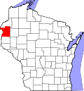
Dresser, Wisconsin | |
---|---|
Coordinates: 45°21′26″N92°38′4″W / 45.35722°N 92.63444°W | |
Country | United States |
State | Wisconsin |
County | Polk |
Area | |
• Total | 1.90 sq mi (4.92 km2) |
• Land | 1.90 sq mi (4.91 km2) |
• Water | 0.00 sq mi (0.01 km2) |
Elevation | 928 ft (283 m) |
Population | |
• Total | 895 |
• Estimate (2019) [4] | 866 |
• Density | 456.99/sq mi (176.41/km2) |
Time zone | UTC-6 (Central (CST)) |
• Summer (DST) | UTC-5 (CDT) |
ZIP | 54009 |
Area code(s) | 715 & 534 |
FIPS code | 55-20850 [5] |
GNIS feature ID | 1564104 [2] |
Website | www |
Dresser is a village in Polk County, Wisconsin, United States. The population was 895 at the 2010 census. It is along Wisconsin Highway 35.
The community has the name of Samuel B. Dresser, an early settler. [6]
Dresser is located at 45°21′26″N92°38′4″W / 45.35722°N 92.63444°W (45.357187, -92.634513). [7]
According to the United States Census Bureau, the village has a total area of 1.94 square miles (5.02 km2), all of it land. [8]
Census | Pop. | Note | %± |
---|---|---|---|
1930 | 285 | — | |
1940 | 294 | 3.2% | |
1950 | 365 | 24.1% | |
1960 | 498 | 36.4% | |
1970 | 533 | 7.0% | |
1980 | 670 | 25.7% | |
1990 | 614 | −8.4% | |
2000 | 732 | 19.2% | |
2010 | 895 | 22.3% | |
2019 (est.) | 866 | [4] | −3.2% |
U.S. Decennial Census [9] |
As of the census [3] of 2010, there were 895 people, 361 households, and 231 families living in the village. The population density was 461.3 inhabitants per square mile (178.1/km2). There were 382 housing units at an average density of 196.9 per square mile (76.0/km2). The racial makeup of the village was 98.1% White, 0.2% African American, 0.4% Asian, 0.1% Pacific Islander, 0.7% from other races, and 0.4% from two or more races. Hispanic or Latino of any race were 1.9% of the population.
There were 361 households, of which 34.6% had children under the age of 18 living with them, 47.6% were married couples living together, 10.2% had a female householder with no husband present, 6.1% had a male householder with no wife present, and 36.0% were non-families. 27.1% of all households were made up of individuals, and 10.2% had someone living alone who was 65 years of age or older. The average household size was 2.48 and the average family size was 3.00.
The median age in the village was 34.6 years. 27.5% of residents were under the age of 18; 5.5% were between the ages of 18 and 24; 32.5% were from 25 to 44; 22.1% were from 45 to 64; and 12.5% were 65 years of age or older. The gender makeup of the village was 48.4% male and 51.6% female.
As of the census [5] of 2000, there were 732 people, 302 households, and 206 families living in the village. The population density was 384.6 people per square mile (148.8/km2). There were 312 housing units at an average density of 163.9 per square mile (63.4/km2). The racial makeup of the village was 98.22% White, 0.14% African American, 0.82% Native American, 0.14% from other races, and 0.68% from two or more races. Hispanic or Latino of any race were 0.55% of the population.
There were 302 households, out of which 32.5% had children under the age of 18 living with them, 55.3% were married couples living together, 8.6% had a female householder with no husband present, and 31.5% were non-families. 24.8% of all households were made up of individuals, and 7.6% had someone living alone who was 65 years of age or older. The average household size was 2.42 and the average family size was 2.91.
In the village, the population was spread out, with 26.0% under the age of 18, 7.8% from 18 to 24, 32.1% from 25 to 44, 22.1% from 45 to 64, and 12.0% who were 65 years of age or older. The median age was 35 years. For every 100 females, there were 96.8 males. For every 100 females age 18 and over, there were 99.3 males.
The median income for a household in the village was $37,500, and the median income for a family was $44,028. Males had a median income of $31,935 versus $22,042 for females. The per capita income for the village was $17,926. About 6.4% of families and 5.6% of the population were below the poverty line, including 3.2% of those under age 18 and 9.3% of those age 65 or over.
Dresser is home to the Traprock Quarry, Trollhaugen Ski/Snowboard Area, F&A Dairy, and a UFE Manufacturing plant. The village also has a gas station, auto repair, bar, restaurants, a library, elementary school, and several little parks. It is the home of Tenere, Inc., a manufacturing company owned by a private equity firm. [10]
In 2018, a television news outlet broadcast video of Chief of Police Ryan Haass having several drinks at a bar, and reported that soon after leaving that bar he drove his vehicle into a ditch, then abandoned his vehicle and went home. After a citizen filed a complaint with the city, a hearing was held which determined that no disciplinary action was indicated. The village attorney did, however, recommend that the chief keep the board up-to-date on his efforts towards sobriety. [11] [12]
Hanamāʻulu is a census-designated place (CDP) in Kauaʻi County, Hawaiʻi, United States. It is the ancient birthplace of Kawelo, a member of Kauai's ruling family. The population was 4,994 at the 2020 census, up from 3,272 at the 2000 census.
Applegate is a village in Sanilac County of the U.S. state of Michigan. The population was 241 at the 2020 census. Applegate is in the southeast corner of Washington Township on the boundary with Sanilac Township.
Kingston is a village in Tuscola County in the U.S. state of Michigan. The population was 440 at the 2010 census. The village is located at the southern edge of Kingston Township and is partially within Koylton Township.
Velda Village Hills is a city in northeastern St. Louis County, Missouri, United States. The population was 1,055 at the 2010 census.
Berwyn is a village in Custer County, Nebraska, United States. The population was 83 at the 2010 census.
Odell is a village in Gage County, Nebraska, United States. The population was 260 at the 2020 census.
Spring Valley is a village in Greene County, Ohio, United States. The population was 415 at the 2020 census. It is part of the Dayton Metropolitan Statistical Area.
Killbuck is a village in Holmes County, Ohio, United States, along Killbuck Creek. The population was 810 at the 2020 census.
Martinsburg is a village in Knox County, Ohio, United States. The population was 222 at the 2020 census.
Port Jefferson is a village in Salem Township, Shelby County, Ohio, United States. The population was 308 at the 2020 census.
Congress is a village in Wayne County, Ohio, United States. The population was 132 at the 2020 census.
Patton is a borough in Cambria County, Pennsylvania, United States. It is 19 miles (31 km) northwest of Altoona, in an agricultural region. It is part of the Johnstown, Pennsylvania Metropolitan Statistical Area. The population was 1,728 at the 2020 census.
Richland is a borough in Lebanon County, Pennsylvania. It is part of the Lebanon County, Pennsylvania metropolitan statistical area. The population was 1,490 at the 2020 census.
Rives is a town in Obion County, Tennessee. The population was 312 at the 2020 census. It is part of the Union City, TN–KY Micropolitan Statistical Area.
Oceana is a town in Wyoming County, West Virginia. The population was 1,462 at the time of the 2020 census. Oceana is the oldest city in Wyoming County and was the county seat until 1907.
Combined Locks is a village in Outagamie County, Wisconsin, United States. The population was 3,328 at the 2010 census.
Chester is a village in Orange County, New York, United States. The population was 3,993 at the 2020 census. It was named after the City of Chester in the Cheshire region of northwest England. Chester is part of the Poughkeepsie–Newburgh–Middletown, NY Metropolitan Statistical Area as well as the larger New York–Newark–Bridgeport, NY-NJ-CT-PA Combined Statistical Area.
The Village of Superior is a village in Douglas County, Wisconsin, United States. The population was 664 at the 2010 census. The village is located within the Town of Superior and is located immediately south of and adjacent to the City of Superior.
Winter is a village in Sawyer County, Wisconsin, United States. The population was 233 at the 2010 census. The village is within the Town of Winter.
Star Prairie is a village in St. Croix County in the U.S. state of Wisconsin. The population was 561 at the 2010 census. The village is located along the Apple River on the boundary between the Town of Star Prairie and the Town of Stanton.