Clayton (village), Wisconsin

Last updated
Clayton, Wisconsin
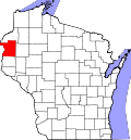
Polk County Wisconsin Incorporated and Unincorporated areas Clayton Highlighted.svg
Location of Clayton in Polk County, Wisconsin.
Coordinates: 45°19′36″N92°10′23″W / 45.32667°N 92.17306°W / 45.32667; -92.17306 Coordinates: 45°19′36″N92°10′23″W / 45.32667°N 92.17306°W / 45.32667; -92.17306
Country Flag of the United States.svg  United States
State Flag of Wisconsin.svg  Wisconsin
County Polk
Area
[1]
  Total3.34 sq mi (8.65 km2)
  Land3.21 sq mi (8.32 km2)
  Water0.13 sq mi (0.33 km2)
Elevation
[2]
1,211 ft (369 m)
Population
 (2010) [3]
  Total571
  Estimate 
(2019) [4]
545
  Density169.73/sq mi (65.54/km2)
Time zone UTC-6 (Central (CST))
  Summer (DST) UTC-5 (CDT)
Area code(s) 715 & 534
FIPS code 55-15100 [5]
GNIS feature ID1563136 [2]

Clayton is a village in Polk County, Wisconsin, United States. The population was 571 at the 2010 census. The village is located within the Town of Clayton.

Contents

History

A post office called Clayton has been in operation since 1876. [6] The village was named for Clayton Rodgers, foreman at a local mill. [7]

Geography

Clayton is located at 45°19′36″N92°10′23″W / 45.326659°N 92.172985°W / 45.326659; -92.172985 (45.326659, -92.172985). [8]

According to the United States Census Bureau, the village has a total area of 3.24 square miles (8.39 km2), of which, 3.11 square miles (8.05 km2) of it is land and 0.13 square miles (0.34 km2) is water. [9]

Demographics

Historical population
CensusPop.
1910 220
1920 30438.2%
1930 34112.2%
1940 3677.6%
1950 350−4.6%
1960 324−7.4%
1970 306−5.6%
1980 42538.9%
1990 4505.9%
2000 50712.7%
2010 57112.6%
Est. 2019545 [4] −4.6%
U.S. Decennial Census [10]

2010 census

As of the census [3] of 2010, there were 571 people, 208 households, and 149 families living in the village. The population density was 183.6 inhabitants per square mile (70.9/km2). There were 225 housing units at an average density of 72.3 per square mile (27.9/km2). The racial makeup of the village was 96.0% White, 0.7% African American, 0.2% Native American, 1.2% from other races, and 1.9% from two or more races. Hispanic or Latino of any race were 2.1% of the population.

There were 208 households, of which 48.6% had children under the age of 18 living with them, 39.9% were married couples living together, 24.0% had a female householder with no husband present, 7.7% had a male householder with no wife present, and 28.4% were non-families. 24.0% of all households were made up of individuals, and 7.2% had someone living alone who was 65 years of age or older. The average household size was 2.75 and the average family size was 3.10.

The median age in the village was 29.1 years. 33.6% of residents were under the age of 18; 11.5% were between the ages of 18 and 24; 27.5% were from 25 to 44; 19.8% were from 45 to 64; and 7.7% were 65 years of age or older. The gender makeup of the village was 49.2% male and 50.8% female.

2000 census

As of the census [5] of 2000, there were 507 people, 199 households, and 125 families living in the village. The population density was 162.6 people per square mile (62.7/km2). There were 208 housing units at an average density of 66.7/sq mi (25.7/km2). The racial makeup of the village was 97.83% White, 1.18% Black or African American, 0.20% Native American, 0.20% Asian, and 0.59% from two or more races. 0.00% of the population were Hispanic or Latino of any race.

There were 199 households, out of which 38.7% had children under the age of 18 living with them, 42.2% were married couples living together, 14.1% had a female householder with no husband present, and 36.7% were non-families. 29.1% of all households were made up of individuals, and 14.1% had someone living alone who was 65 years of age or older. The average household size was 2.55 and the average family size was 3.15.

In the village, the population was spread out, with 32.0% under the age of 18, 9.7% from 18 to 24, 32.9% from 25 to 44, 15.8% from 45 to 64, and 9.7% who were 65 years of age or older. The median age was 30 years. For every 100 females, there were 93.5 males. For every 100 females age 18 and over, there were 94.9 males.

The median income for a household in the village was $29,135, and the median income for a family was $34,375. Males had a median income of $29,583 versus $22,500 for females. The per capita income for the village was $14,988. About 10.6% of families and 18.7% of the population were below the poverty line, including 25.2% of those under age 18 and 14.5% of those age 65 or over.

Related Research Articles

Clayton, Illinois Village in Illinois, United States

Clayton is a village in Adams County, Illinois, United States. The population was 709 at the 2010 census. It is part of the Quincy, IL–MO Micropolitan Statistical Area.

Clayton, Iowa City in Iowa, United States

Clayton is a city in Clayton County, Iowa, United States. The population was 43 at the 2010 census, down from 55 in 2000. Clayton is located directly on the Mississippi River and is only accessible via a very steep road.

Garber, Iowa City in Iowa, United States

Garber is a city in Clayton County, Iowa, United States. The population was 88 at the 2010 census, down from 103 in 2000.

Osterdock, Iowa City in Iowa, United States

Osterdock is a city located in Clayton County, Iowa, United States. As of the 2010 census, the city had a total population of 59, up from 50 in 2000.

St. Olaf, Iowa City in Iowa, United States

St. Olaf is a city in Clayton County, Iowa, United States. The population was 108 at the 2010 census, down from 136 in 2000. Swiss Valley has a large cheese packaging plant in St. Olaf.

Clayton Township, Arenac County, Michigan Civil township in Michigan, United States

Clayton Township is a civil township of Arenac County in the U.S. state of Michigan. The population was 1,097 at the 2010 census.

Clayton, Michigan Village in Michigan, United States

Clayton is a village in Lenawee County of the U.S. state of Michigan. The population was 344 at the 2010 census. The village is situated on the boundary between Hudson Township on the west and Dover Township on the east, with a portion of the village in each.

Uplands Park, Missouri Village in Missouri, United States

Uplands Park is a village in St. Louis County, Missouri, United States. The population was 445 at the 2010 census. The village is one of many small majority black communities located in the Natural Bridge corridor of mid-St. Louis County, characterized by small homes on small lots.

Minerva Park, Ohio Village in Ohio, United States

Minerva Park is a village in Franklin County, Ohio, United States. The population was 1,272 at the 2010 census.

Clayton, Ohio City in Ohio, United States

Clayton is a city in Montgomery county in the U.S. state of Ohio. The population was 13,209 at the 2010 census. It is part of the Dayton Metropolitan Statistical Area.

Hamden, Ohio Village in Ohio, United States

Hamden is a village in Vinton County, Ohio, United States. The population was 879 at the 2010 census.

Clearview, West Virginia Village in West Virginia, United States

Clearview is a village in Ohio County, West Virginia, United States. It is part of the Wheeling, West Virginia Metropolitan Statistical Area. The population was 565 at the 2010 census.

Friesland, Wisconsin Village in Wisconsin, United States

Friesland is a village in Columbia County, Wisconsin, United States. The population was 356 at the 2010 census. It is part of the Madison Metropolitan Statistical Area.

Coleman, Wisconsin Village in Wisconsin, United States

Coleman is a village in Marinette County, Wisconsin, United States. The population was 724 at the 2010 census. It is part of the Marinette, WI–MI Micropolitan Statistical Area.

Bay City, Wisconsin Village in Wisconsin, United States

Bay City is a village on the Mississippi River in Pierce County, Wisconsin, United States. The population was 500 at the 2010 census.

Clayton, Winnebago County, Wisconsin Town in Wisconsin, United States

Clayton is a town in Winnebago County, Wisconsin, United States. The population was 3,951 at the 2010 census. The unincorporated communities of Larsen, Medina Junction, and Mikesville are located within the town.

Clayton, Kansas City in Kansas, United States

Clayton is a city in Decatur and Norton counties in the U.S. state of Kansas. As of the 2010 census, the city population was 59.

Lennon, Michigan Village in Michigan, United States

Lennon is a village in the U.S. state of Michigan. The population was 511 at the 2010 census. The village is located along M-13 within Venice Township in Shiawassee County to the west and Clayton Township in Genesee County to the east.

Cassville, Wisconsin Village in Wisconsin, United States

Cassville is a village in Grant County, Wisconsin, United States. The population was 947 at the 2010 census. The village is located along the Mississippi River within the Town of Cassville.

Clayton, Polk County, Wisconsin Town in Wisconsin, United States

Clayton is a town in Polk County, Wisconsin, United States. The population was 571 at the 2000 census. The Village of Clayton is located within the town. The unincorporated communities of Joel and Richardson are also located in the town.

References

  1. "2019 U.S. Gazetteer Files". United States Census Bureau. Retrieved August 7, 2020.
  2. 1 2 "US Board on Geographic Names". United States Geological Survey. 2007-10-25. Retrieved 2008-01-31.
  3. 1 2 "U.S. Census website". United States Census Bureau . Retrieved 2012-11-18.
  4. 1 2 "Population and Housing Unit Estimates". United States Census Bureau. May 24, 2020. Retrieved May 27, 2020.
  5. 1 2 "U.S. Census website". United States Census Bureau . Retrieved 2008-01-31.
  6. "Polk County". Jim Forte Postal History. Retrieved 3 April 2015.
  7. Chicago and North Western Railway Company (1908). A History of the Origin of the Place Names Connected with the Chicago & North Western and Chicago, St. Paul, Minneapolis & Omaha Railways. p. 171.
  8. "US Gazetteer files: 2010, 2000, and 1990". United States Census Bureau. 2011-02-12. Retrieved 2011-04-23.
  9. "US Gazetteer files 2010". United States Census Bureau. Archived from the original on 2012-06-26. Retrieved 2012-11-18.
  10. "Census of Population and Housing". Census.gov. Retrieved June 4, 2016.