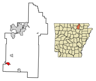
Eureka, Polk County, Wisconsin

Last updated
Eureka, Wisconsin
WIMap-doton-Eureka.png
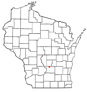
Location of Eureka, Wisconsin
Coordinates: 45°30′59″N92°38′41″W / 45.51639°N 92.64472°W / 45.51639; -92.64472
Country Flag of the United States.svg  United States
State Flag of Wisconsin.svg  Wisconsin
County Polk
Area
  Total54.7 sq mi (141.8 km2)
  Land53.8 sq mi (139.5 km2)
  Water0.9 sq mi (2.3 km2)
Elevation
[1]
1,047 ft (319 m)
Population
 (2000)
  Total1,338
  Density24.8/sq mi (9.6/km2)
Time zone UTC-6 (Central (CST))
  Summer (DST) UTC-5 (CDT)
Area code(s) 715 & 534
FIPS code 55-24450 [2]
GNIS feature ID1583176 [1]
Website http://townofeureka.org

Eureka is a town in Polk County, Wisconsin, United States. The population was 1,338 at the 2000 census. The unincorporated community of Eureka Center is located in the town.

Contents

The town in the setting for the 1957 film All Mine to Give was the Eureka in Winnebago County, Wisconsin, not this one in Polk County.

Geography

According to the United States Census Bureau, the town has a total area of 54.7 square miles (141.8 km2), of which, 53.8 square miles (139.5 km2) of it is land and 0.9 square miles (2.3 km2) of it (1.64%) is water.

Demographics

As of the census [2] of 2000, there were 1,338 people, 503 households, and 367 families residing in the town. The population density was 24.8 people per square mile (9.6/km2). There were 567 housing units at an average density of 10.5 per square mile (4.1/km2). The racial makeup of the town was 98.73% White, 0.37% African American, 0.22% Native American, 0.07% Asian, and 0.60% from two or more races. Hispanic or Latino of any race were 0.37% of the population.

There were 503 households, out of which 30.8% had children under the age of 18 living with them, 63.2% were married couples living together, 5.2% had a female householder with no husband present, and 27.0% were non-families. 19.3% of all households were made up of individuals, and 6.4% had someone living alone who was 65 years of age or older. The average household size was 2.66 and the average family size was 3.09.

In the town, the population was spread out, with 26.8% under the age of 18, 7.2% from 18 to 24, 28.5% from 25 to 44, 26.2% from 45 to 64, and 11.4% who were 65 years of age or older. The median age was 39 years. For every 100 females, there were 109.4 males. For every 100 females age 18 and over, there were 109.4 males.

The median income for a household in the town was $45,625, and the median income for a family was $50,476. Males had a median income of $35,184 versus $23,333 for females. The per capita income for the town was $19,343. About 3.3% of families and 5.5% of the population were below the poverty line, including 7.1% of those under age 18 and 7.5% of those age 65 or over.

Education

Coordinates: 44°00′16″N88°50′30″W / 44.00444°N 88.84167°W / 44.00444; -88.84167

Related Research Articles

<span class="mw-page-title-main">Sidney, Arkansas</span> Town in Arkansas, United States

Sidney is a town in Sharp County, Arkansas, United States. The population was 181 at the 2010 census.
<span class="mw-page-title-main">Oaktown, Indiana</span> Town in Indiana, United States

Oaktown is a town in Busseron Township, Knox County, Indiana. The population was 608 at the 2010 census.

<span class="mw-page-title-main">Washburn, Maine</span> Town in the state of Maine, United States

Washburn is a town in Aroostook County, Maine, United States. It was incorporated on February 25, 1861, and named after Israel Washburn, the governor of Maine at the time. The population was 1,527 at the 2020 census. Benjamin C. Wilder House, which was built in 1852, is located on Main Street in Washburn and predates the town's incorporation by nine years.

<span class="mw-page-title-main">Beltrami, Minnesota</span> City in Minnesota, United States

Beltrami is a city in Polk County, Minnesota, United States and was named in honor of Giacomo Costantino Beltrami, an Italian exile, who traveled to the Red river and the upper Mississippi in 1823. Officially incorporated in 1902, there had been settlers in the area since 1870. It is part of the Grand Forks, ND-MN Metropolitan Statistical Area. The population was 88 at the 2020 census.

<span class="mw-page-title-main">Lengby, Minnesota</span> City in Minnesota, United States

Lengby is a city in Polk County, Minnesota, United States. It is part of the Grand Forks ND-MN Metropolitan Statistical Area. The population was 92 at the 2020 census.

<span class="mw-page-title-main">McIntosh, Minnesota</span> City in Minnesota, United States

McIntosh is a city in Polk County, Minnesota, United States. It is part of the Grand Forks, ND-MN Metropolitan Statistical Area. The population was 606 at the 2020 census.

<span class="mw-page-title-main">West Hurley, New York</span> CDP in New York, United States

West Hurley is a hamlet in Ulster County, New York, United States. The population was 1,917 at the 2020 census.

<span class="mw-page-title-main">Benton Ridge, Ohio</span> Village in Ohio, United States

Benton Ridge is a village in Hancock County, Ohio, United States. The population was 299 at the 2010 census. It is within the boundaries of the Liberty-Benton Local School district.

<span class="mw-page-title-main">Falls City, Oregon</span> City in Oregon, United States

Falls City is a city in Polk County, Oregon, United States. The population was 1,051 at the 2020 census. It is part of the Salem Metropolitan Statistical Area.

<span class="mw-page-title-main">Linden, Tennessee</span> Town in Tennessee, United States

Linden is a town in and the county seat of Perry County, Tennessee, United States. The population was 1,015 at the 2000 census and 908 at the 2010 showing a loss of 107. Linden was officially incorporated in 1850.

<span class="mw-page-title-main">Bancroft, West Virginia</span> Town in West Virginia, United States

Bancroft is a town in Putnam County, West Virginia, United States, along the Kanawha River. The population was 389 at the 2020 census. Bancroft is a part of the Huntington-Ashland, WV-KY-OH, Metropolitan Statistical Area (MSA). As of the 2010 census, the MSA had a population of 287,702. New definitions from February 28, 2013 placed the population at 363,000. It officially became a town in 1952. The town was named for George Bancroft, a coal mine operator.

<span class="mw-page-title-main">Roosevelt, Burnett County, Wisconsin</span> Town in Wisconsin, United States

Roosevelt is a town in Burnett County in the U.S. state of Wisconsin. The population was 199 at the 2010 census. The unincorporated community of Timberland is located in the town.

<span class="mw-page-title-main">Underhill, Wisconsin</span> Town in Wisconsin, United States

Underhill is a town in Oconto County, Wisconsin, United States. The population was 846 at the 2000 census. The unincorporated communities of Hintz and Underhill are located in the town. The unincorporated community of Mosling is also located partially in the town.

<span class="mw-page-title-main">Apple River, Wisconsin</span> Town in Wisconsin, United States

The Town of Apple River is located in Polk County, Wisconsin, United States. The population was 1,067 at the 2000 census. The unincorporated community of Range is located partially in the town.

<span class="mw-page-title-main">Black Brook, Wisconsin</span> Town in Wisconsin, United States

Black Brook is a town in Polk County, Wisconsin, United States. The population was 1,208 at the 2000 census.

<span class="mw-page-title-main">Laketown, Wisconsin</span> Town in Wisconsin, United States

Laketown is a town in Polk County, Wisconsin, United States. The population was 918 at the 2000 census. The unincorporated community of Atlas is located in the town. The unincorporated communities of Cushing and Pole Cat Crossing are also located partially in the town.

<span class="mw-page-title-main">Deerfield (town), Dane County, Wisconsin</span> Town in Wisconsin, USA

Deerfield is a town in Dane County, Wisconsin, United States. The population was 1,470 at the 2000 census. The Village of Deerfield is located within the town. The unincorporated communities of London and Old Deerfield are located in the town.

<span class="mw-page-title-main">Balsam Lake, Wisconsin</span> Village in Wisconsin, United States

Balsam Lake is a village in, and the county seat of Polk County, Wisconsin, United States. The population was 1,009 at the 2010 census. The village is located within the Town of Balsam Lake.

Clear Lake is a town in Polk County, Wisconsin, United States. The population was 800 at the 2000 census. The Village of Clear Lake is located within the town.

<span class="mw-page-title-main">Eureka, Winnebago County, Wisconsin</span> Census-designated place in Wisconsin, United States

Eureka is an unincorporated census-designated place in the town of Rushford, in Winnebago County, Wisconsin, United States. It is located on the Fox River at the intersection of county highways K & E southwest of Omro. At the 2020 census, its population was 247.

References

  1. 1 2 "US Board on Geographic Names". United States Geological Survey. 2007-10-25. Retrieved 2008-01-31.
  2. 1 2 "U.S. Census website". United States Census Bureau . Retrieved 2008-01-31.