Milltown, Wisconsin

Last updated

Milltown, Wisconsin
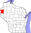
Polk County Wisconsin Incorporated and Unincorporated areas Milltown Highlighted.svg
Location of Milltown in Polk County, Wisconsin.
Coordinates: 45°29′35″N92°27′48″W / 45.49306°N 92.46333°W / 45.49306; -92.46333
Country Flag of the United States.svg  United States
State Flag of Wisconsin.svg  Wisconsin
County Polk
Area
[1]
  Total1.84 sq mi (4.76 km2)
  Land1.81 sq mi (4.69 km2)
  Water0.03 sq mi (0.07 km2)
Elevation
[2]
1,198 ft (365 m)
Population
 (2010) [3]
  Total917
  Estimate 
(2019) [4]
877
  Density484.26/sq mi (186.98/km2)
Time zone UTC-6 (Central (CST))
  Summer (DST) UTC-5 (CDT)
Area code(s) 715 & 534
FIPS code 55-52100 [5]
GNIS feature ID1569527 [2]
Website www.milltown-wi.com

Milltown is a village in Polk County, Wisconsin, United States. The population was 917 at the 2010 census. The village is located within the Town of Milltown.

Contents

Geography

Milltown is located at 45°31′39″N92°30′19″W / 45.52750°N 92.50528°W / 45.52750; -92.50528 (45.527684, -92.505386). [6]

According to the United States Census Bureau, the village has a total area of 1.78 square miles (4.61 km2), of which, 1.75 square miles (4.53 km2) of it is land and 0.03 square miles (0.08 km2) is water. [7]

Milltown is along Wisconsin Highways 35 and 46, and Polk County Road G.

Demographics

Historical population
CensusPop.Note
1910 250
1920 44076.0%
1930 4502.3%
1940 4694.2%
1950 58023.7%
1960 6084.8%
1970 6344.3%
1980 73215.5%
1990 7867.4%
2000 88813.0%
2010 9173.3%
2019 (est.)877 [4] −4.4%
U.S. Decennial Census [8]

2010 census

As of the census [3] of 2010, there were 917 people, 416 households, and 237 families living in the village. The population density was 524.0 inhabitants per square mile (202.3/km2). There were 473 housing units at an average density of 270.3 per square mile (104.4/km2). The racial makeup of the village was 97.4% White, 0.3% African American, 0.9% Native American, 0.5% from other races, and 0.9% from two or more races. Hispanic or Latino of any race were 1.2% of the population.

There were 416 households, of which 31.0% had children under the age of 18 living with them, 36.3% were married couples living together, 13.0% had a female householder with no husband present, 7.7% had a male householder with no wife present, and 43.0% were non-families. 36.3% of all households were made up of individuals, and 15.4% had someone living alone who was 65 years of age or older. The average household size was 2.19 and the average family size was 2.79.

The median age in the village was 39.6 years. 24.4% of residents were under the age of 18; 6.5% were between the ages of 18 and 24; 25.6% were from 25 to 44; 27.5% were from 45 to 64; and 16% were 65 years of age or older. The gender makeup of the village was 50.1% male and 49.9% female.

2000 census

As of the census [5] of 2000, there were 888 people, 420 households, and 235 families living in the village. The population density was 501.8 people per square mile (193.7/km2). There were 437 housing units at an average density of 246.9 per square mile (95.3/km2). The racial makeup of the village was 97.18% White, 1.13% Native American, 0.68% from other races, and 1.01% from two or more races. 0.79% of the population were Hispanic or Latino of any race.

There were 420 households, out of which 25.0% had children under the age of 18 living with them, 38.6% were married couples living together, 12.1% had a female householder with no husband present, and 44.0% were non-families. 38.6% of all households were made up of individuals, and 21.0% had someone living alone who was 65 years of age or older. The average household size was 2.11 and the average family size was 2.76.

In the village, the population was spread out, with 22.5% under the age of 18, 7.5% from 18 to 24, 27.3% from 25 to 44, 19.1% from 45 to 64, and 23.5% who were 65 years of age or older. The median age was 40 years. For every 100 females, there were 85.0 males. For every 100 females age 18 and over, there were 85.9 males.

The median income for a household in the village was $28,309, and the median income for a family was $36,875. Males had a median income of $30,446 versus $22,031 for females. The per capita income for the village was $17,284. About 5.2% of families and 11.5% of the population were below the poverty line, including 7.6% of those under age 18 and 15.3% of those age 65 or over.

Education

Notable people

Related Research Articles

<span class="mw-page-title-main">Sherrard, Illinois</span> Village in Illinois, United States

Sherrard is a village in Mercer County, Illinois, United States. The population was 692 at the 2020 census.

<span class="mw-page-title-main">Milltown, Indiana</span> Town in Indiana, United States

Milltown is a town in Blue River and Spencer townships in Harrison County and Whiskey Run Township in Crawford County, Indiana. The population was 818 at the time of the 2010 census.

Stacyville is a town in Penobscot County, Maine, United States, in the foothills of Mount Katahdin. The population was 380 at the 2020 census.

<span class="mw-page-title-main">Trommald, Minnesota</span> City in Minnesota, United States

Trommald is a city in Crow Wing County, Minnesota, United States. The population was 98 at the 2010 census. It is part of the Brainerd Micropolitan Statistical Area.

<span class="mw-page-title-main">Nielsville, Minnesota</span> City in Minnesota, United States

Nielsville is a city in Polk County, Minnesota, United States. It is part of the Grand Forks, ND-MN Metropolitan Statistical Area. The population was 78 at the 2020 census.

<span class="mw-page-title-main">Knapp, Jackson County, Wisconsin</span> Town in Wisconsin, United States

Knapp is a town in Jackson County, Wisconsin, in the United States. As of the 2000 census, the town population was 275. The unincorporated community of Lapham Junction is located in the town.

<span class="mw-page-title-main">Brokaw, Wisconsin</span> Village in Wisconsin, United States

Brokaw is a former village in Marathon County, Wisconsin, United States. It is part of the Wausau, Wisconsin Metropolitan Statistical Area. The population was 251 at the 2010 census. Brokaw merged with the village of Maine, Wisconsin on October 1, 2018.

<span class="mw-page-title-main">Coleman, Wisconsin</span> Village in Wisconsin, United States

Coleman is a village in Marinette County, Wisconsin, United States. The population was 726 at the 2020 census. It is part of the Marinette, WI–MI Micropolitan Statistical Area.

<span class="mw-page-title-main">Frederic, Wisconsin</span> Village in Wisconsin, United States

Frederic is a village in Polk County, Wisconsin, United States. The population was 1,137 at the 2010 census. It was established as a village in 1901.

<span class="mw-page-title-main">Weyerhaeuser, Wisconsin</span> Village in Wisconsin, United States

Weyerhaeuser is a village in Rusk County, Wisconsin, United States. The population was 238 at the 2010 census.

<span class="mw-page-title-main">Exeland, Wisconsin</span> Village in Wisconsin, United States

Exeland is a village in Sawyer County, Wisconsin, United States. The population was 229 at the 2020 census.

<span class="mw-page-title-main">Dorchester, Wisconsin</span> Village in Wisconsin, United States

Dorchester is a village in Clark and Marathon counties in the U.S. state of Wisconsin, along the 45th parallel. It is part of the Wausau, Wisconsin Metropolitan Statistical Area. The population was 876 at the 2010 census. Of this, 871 were in Clark County, and only 5 were in Marathon County.

<span class="mw-page-title-main">Dallas, Wisconsin</span> Village in Wisconsin, United States

Dallas is a village in Barron County in the U.S. state of Wisconsin. The population was 409 at the 2010 census. The village is located within the Town of Dallas.

<span class="mw-page-title-main">Unity, Wisconsin</span> Village in Wisconsin, United States

Unity is a village in Clark and Marathon counties in the U.S. state of Wisconsin. It is part of the Wausau, Wisconsin Metropolitan Statistical Area. The population was 343 at the 2010 census. Of this, 204 were in Marathon County, and 139 were in Clark County. The village is located in northeastern town of Unity in Clark County and northwestern town of Brighton in Marathon County.

<span class="mw-page-title-main">Lowell, Wisconsin</span> Village in Wisconsin, United States

Lowell is a village in Dodge County, Wisconsin, United States, along the Beaver Dam River. The population was 340 at the 2010 census. The village is located within the Town of Lowell.

<span class="mw-page-title-main">Hazel Green, Wisconsin</span> Village in Wisconsin, United States

Hazel Green is a village in Grant and Lafayette counties in the U.S. state of Wisconsin. The population was 1,256 at the 2010 census. Of this, 1,243 were in Grant County, and only 13 were in Lafayette County. The village is located mostly within the Town of Hazel Green in Grant County; only a small portion extends into the Town of Benton in Lafayette County.

<span class="mw-page-title-main">Mount Hope, Wisconsin</span> Village in Wisconsin, United States

Mount Hope is a village in Grant County, Wisconsin, United States. The population was 225 at the 2010 census. The village is located within the Town of Mount Hope.

Milltown is a town in Polk County, Wisconsin, United States. The population was 1,146 at the 2000 census. The village of Milltown is located within the town.

<span class="mw-page-title-main">Aniwa, Wisconsin</span> Village in Wisconsin, United States

Aniwa is a village in Shawano County, Wisconsin, United States. The population was 260 at the 2010 census. The village is located within the Town of Aniwa. U.S. Route 45 runs north–south through the village.

<span class="mw-page-title-main">Baldwin, Wisconsin</span> Village in Wisconsin, United States

Baldwin is a village in St. Croix County, Wisconsin, United States. The population was 3,957 at the 2010 census, a growth rate of 48% from 2000. The village is adjacent to the Town of Baldwin.

References

  1. "2019 U.S. Gazetteer Files". United States Census Bureau. Retrieved August 7, 2020.
  2. 1 2 "US Board on Geographic Names". United States Geological Survey. October 25, 2007. Retrieved January 31, 2008.
  3. 1 2 "U.S. Census website". United States Census Bureau . Retrieved November 18, 2012.
  4. 1 2 "Population and Housing Unit Estimates". United States Census Bureau. May 24, 2020. Retrieved May 27, 2020.
  5. 1 2 "U.S. Census website". United States Census Bureau . Retrieved January 31, 2008.
  6. "US Gazetteer files: 2010, 2000, and 1990". United States Census Bureau. February 12, 2011. Retrieved April 23, 2011.
  7. "US Gazetteer files 2010". United States Census Bureau. Archived from the original on January 25, 2012. Retrieved November 18, 2012.
  8. "Census of Population and Housing". Census.gov. Retrieved June 4, 2015.
  9. 'Wisconsin Blue Book 1925,' Biographical Sketch of George A. Nelson, pg. 676
  10. Minnesota Legislators Past and Present-Howard I. Nelson
  11. 'Wisconsin Blue Book 1956,' Biographical Sketch of Raymond A. Peabody, pg. 37