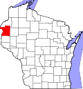
Johnstown, Polk County, Wisconsin

Last updated

Johnstown, Wisconsin
WIMap-doton-Johnstown.png
Location of Johnstown, Polk County, Wisconsin
Coordinates: 45°30′46″N92°13′39″W / 45.51278°N 92.22750°W / 45.51278; -92.22750
Country Flag of the United States.svg  United States
State Flag of Wisconsin.svg  Wisconsin
County Polk
Area
  Total37.1 sq mi (96.1 km2)
  Land35.8 sq mi (92.6 km2)
  Water1.3 sq mi (3.5 km2)
Elevation
[1]
1,253 ft (382 m)
Population
 (2000)
  Total520
  Density14.5/sq mi (5.6/km2)
Time zone UTC-6 (Central (CST))
  Summer (DST) UTC-5 (CDT)
Area code(s) 715 & 534
FIPS code 55-38400 [2]
GNIS feature ID1583457 [1]

Johnstown is a town in Polk County, Wisconsin, United States. The population was 520 at the 2000 census.

Contents

Geography

According to the United States Census Bureau, the town has a total area of 37.1 square miles (96.1 km2), of which, 35.8 square miles (92.6 km2) of it is land and 1.3 square miles (3.5 km2) of it (3.61%) is water.

Demographics

At the 2000 census there were 520 people in 203 households, including 154 families, in the town. The population density was 14.5 people per square mile (5.6/km2). There were 418 housing units at an average density of 11.7 per square mile (4.5/km2). The racial makeup of the town was 81.15% White, 18.27% Native American, 0.58% from two or more races. Hispanic or Latino of any race were 0.96%. [2]

There were 203 households, out of which 29.1% had children under the age of 18 living with them, 57.1% were married couples living together, 11.8% had a female householder with no husband present, and 24.1% were non-families. 21.7% of households were one person, and 7.9% were one person aged 65 or older. The average household size was 2.56 and the average family size was 2.97.

The age distribution was 26.3% under the age of 18, 6.5% from 18 to 24, 21.7% from 25 to 44, 30.8% from 45 to 64, and 14.6% 65 or older. The median age was 42 years. For every 100 females, there were 109.7 males. For every 100 females age 18 and over, there were 111.6 males.

The median household income was $37,500 and the median family income was $38,750. Males had a median income of $33,000 versus $21,875 for females. The per capita income for the town was $17,368. 18.5% of the population and 14.7% of families were below the poverty line. Out of the total population, 22.3% of those under the age of 18 and 6.8% of those 65 and older were living below the poverty line.

Related Research Articles

<span class="mw-page-title-main">Eagle Lake, Maine</span> Town in the state of Maine, United States

Eagle Lake is a town in Aroostook County, Maine, United States. The population was 772 at the 2020 census. The town was named by a body of troops heading from Bangor to the Aroostook War for the many eagles that they saw around the lake. A total of 49.0% of the population speaks French, reflecting a trend in Northeastern Maine.

<span class="mw-page-title-main">Ludlow, Maine</span> Town in the state of Maine, United States

Ludlow is a town in Aroostook County, Maine, United States. The population was 434 at the 2020 census.

<span class="mw-page-title-main">Washburn, Maine</span> Town in the state of Maine, United States

Washburn is a town in Aroostook County, Maine, United States. It was incorporated on February 25, 1861, and named after Israel Washburn, the governor of Maine at the time. The population was 1,527 at the 2020 census. Benjamin C. Wilder House, which was built in 1852, is located on Main Street in Washburn and predates the town's incorporation by nine years.

<span class="mw-page-title-main">Weston, Maine</span> Town in the state of Maine, United States

Weston is a town in Aroostook County, Maine, United States. The population was 245 at the 2020 census.

<span class="mw-page-title-main">Hartford, Maine</span> Town in the state of Maine, United States

Hartford is a town in Oxford County, Maine, United States. Hartford is included in the Lewiston-Auburn metropolitan New England City and Town Area. The population was 1,203 at the 2020 census.

<span class="mw-page-title-main">Brooks, Maine</span> Town in the state of Maine, United States

Brooks is a town in Waldo County, Maine, United States. The population was 1,010 at the 2020 census.

<span class="mw-page-title-main">Tuscumbia, Missouri</span> Town in Missouri, United States

Tuscumbia is a village in and the county seat of Miller County, Missouri, United States. The population was 203 at the 2010 census, at which time it was a town.

<span class="mw-page-title-main">Dixon, Montana</span> CDP in Montana, United States

Dixon is a census-designated place (CDP) in Sanders County, Montana, United States. The population was 216 at the 2000 census.

<span class="mw-page-title-main">Washington Township, Wyoming County, Pennsylvania</span> Township in Pennsylvania, United States

Washington Township is a township in Wyoming County, Pennsylvania, United States. The population was 1,337 at the 2020 census.

<span class="mw-page-title-main">Central City, South Dakota</span> City in South Dakota, United States

Central City is a city in Lawrence County, South Dakota, United States. The population was 93 at the 2020 census.

<span class="mw-page-title-main">Junior, West Virginia</span> Town in West Virginia, United States

Junior is a town in Barbour County, West Virginia, United States, situated along the Tygart Valley River. The population was 384 at the 2020 census.

<span class="mw-page-title-main">West Milford, West Virginia</span> Town in West Virginia, United States

West Milford is a town in Harrison County, West Virginia, United States. The population was 452 at the 2020 census.

<span class="mw-page-title-main">Belle, West Virginia</span> Town in West Virginia, United States

Belle is a town in Kanawha County, West Virginia, United States, situated along the Kanawha River. The population was 1,171 at the 2020 census. Belle was incorporated on December 13, 1958 by the Kanawha County Circuit Court. It is the home of the Belle Bulldogs Elementary School.

<span class="mw-page-title-main">Reedy, West Virginia</span> Town in West Virginia, United States

Reedy is a town in Roane County, West Virginia, United States. The population was 152 at the 2020 census.

<span class="mw-page-title-main">Sherman, Sheboygan County, Wisconsin</span> Town in Wisconsin, United States

Sherman is a town in Sheboygan County, Wisconsin, United States whose population was 1,520 at the 2000 census. It is included in the Sheboygan, Wisconsin Metropolitan Statistical Area. The unincorporated communities of Gooseville and Silver Creek are located in the town.

<span class="mw-page-title-main">Forest, St. Croix County, Wisconsin</span> Town in Wisconsin, United States

Forest is a town in St. Croix County, Wisconsin, United States. The population was 590 at the 2000 census. The unincorporated community of Forest is located in the town.

<span class="mw-page-title-main">Dodgeville (town), Wisconsin</span> Town in Wisconsin, United States

Dodgeville is a town in Iowa County, Wisconsin, United States. The population was 1,407 at the 2000 census. The City of Dodgeville and the unincorporated community of Pleasant Ridge are located in the town.

<span class="mw-page-title-main">Wilton, Wisconsin</span> Village in Wisconsin, United States

Wilton is a village in Monroe County, Wisconsin, United States. The population was 504 at the 2010 census. The village is located partially within the Town of Wilton and partially within the Town of Wellington.

The Town of La Valle is located in Sauk County, Wisconsin, United States. La Valle is a name derived from French meaning "the valley". The population was 1,203 at the 2000 census. The Village of La Valle is located within the town.

<span class="mw-page-title-main">Spooner (town), Wisconsin</span> Town in Wisconsin, United States

Spooner is a town in Washburn County, Wisconsin, United States. The population was 677 at the 2000 census. The City of Spooner is located mostly within the southwest corner of the town.

References

  1. 1 2 "US Board on Geographic Names". United States Geological Survey. October 25, 2007. Retrieved January 31, 2008.
  2. 1 2 "U.S. Census website". United States Census Bureau . Retrieved January 31, 2008.