West Denmark, Wisconsin | |
|---|---|
 West Denmark, Wisconsin  West Denmark, Wisconsin | |
| Coordinates: 45°34′12″N92°30′35″W / 45.57000°N 92.50972°W | |
| Country | |
| State | |
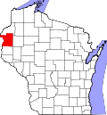
| County | Polk |
| Elevation | 1,253 ft (382 m) |
| Time zone | UTC-6 (Central (CST)) |
| • Summer (DST) | UTC-5 (CDT) |
| Area codes | 715 & 534 |
| GNIS feature ID | 1576495 [1] |
West Denmark is an unincorporated community located in the town of Luck, Polk County, Wisconsin, United States. [1] West Denmark is 1,250 feet [381 m] above sea level. [2]
West Denmark is known throughout its area for its active community and strong roots in Danish culture. There are many events that fill this community with joy, these include an Æbleskiver Dinner, Fastelavn celebration, and a summer family camp. Most of these celebrations are held on the grounds of the West Denmark Lutheran Church.