Balsam Lake, Wisconsin

Last updated
Balsam Lake, Wisconsin
Balsam Lake Wisconsin Downtown WIS46.jpg
Downtown Balsam Lake
Polk County Wisconsin Incorporated and Unincorporated areas Balsam Lake Highlighted.svg
Location of Balsam Lake
in Polk County, Wisconsin
Coordinates: 45°27′02″N92°27′17″W / 45.4506814°N 92.4548533°W / 45.4506814; -92.4548533 Coordinates: 45°27′02″N92°27′17″W / 45.4506814°N 92.4548533°W / 45.4506814; -92.4548533
Country Flag of the United States.svg  United States
State Flag of Wisconsin.svg  Wisconsin
County Polk
Area
[1]
  Total3.41 sq mi (8.83 km2)
  Land2.17 sq mi (5.61 km2)
  Water1.24 sq mi (3.21 km2)
Elevation
[2]
1,089 ft (332 m)
Population
 (2010) [3]
  Total1,009
  Estimate 
(2019) [4]
982
  Density452.95/sq mi (174.91/km2)
Time zone UTC-6 (Central (CST))
  Summer (DST) UTC-5 (CDT)
ZIP Code
54810
Area codes 715 & 534
FIPS code 55-04475 [5]
GNIS feature ID1582745 [2]
Website www.balsamlakevillage.com/WP/

Balsam Lake is a village in, and the county seat of Polk County, Wisconsin, United States. The population was 1,009 at the 2010 census. The village is located within the Town of Balsam Lake.

Contents

History

The sign for Balsam Lake on WIS46 Balsam Lake Wisconsin Sign WIS46.jpg
The sign for Balsam Lake on WIS46

The area in and around Balsam Lake was originally inhabited by a large band of Chippewa Indians. They referred to the area as "Innenehinduc," which means "place of the evergreen." This may have been due to the large amount of Canadian Yew, an evergreen shrub, which grew in abundance there.

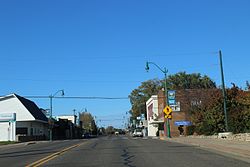
The town was organized on January 8, 1870, and was named after the lake that lay within its borders. The first businesses included a blacksmith shop, a bank, a creamery, two sawmills, a hardware store, and a general store. Governmental buildings included a courthouse and a log schoolhouse. [6]

Today, Balsam Lake is the home of the Polk County Government Center.

The town celebrates its history, and the history of the United States, with its annual Freedom Festival, which takes place on the Thursday through Sunday surrounding the Fourth of July.

Geography

Balsam Lake is located at 45°27′28″N92°27′17″W / 45.45778°N 92.45472°W / 45.45778; -92.45472 (45.45805, -92.454872). [7]

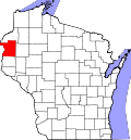
According to the United States Census Bureau, the village has a total area of 3.39 square miles (8.78 km2), of which, 2.16 square miles (5.59 km2) of it is land and 1.23 square miles (3.19 km2) is water. [8]

Wisconsin Highway 46 and Polk County Road I are main routes in the community. U.S. Highway 8 and Wisconsin Highway 65 are nearby.

Demographics

Historical population
CensusPop.
1910 279
1920 251−10.0%
1930 31525.5%
1940 45243.5%
1950 4888.0%
1960 54110.9%
1970 64819.8%
1980 74915.6%
1990 7925.7%
2000 95019.9%
2010 1,0096.2%
2019 (est.)982 [4] −2.7%
U.S. Decennial Census [9]

2010 census

Water tower Balsam Lake Wisconsin Water Tower.jpg
Water tower

As of the census [3] of 2010, there were 1,009 people, 434 households, and 257 families living in the village. The population density was 467.1 inhabitants per square mile (180.3/km2). There were 732 housing units at an average density of 338.9 per square mile (130.9/km2). The racial makeup of the village was 94.2% White, 0.9% African American, 2.6% Native American, 0.3% Asian, 0.5% from other races, and 1.6% from two or more races. Hispanic or Latino of any race were 0.7% of the population.

There were 434 households, of which 22.8% had children under the age of 18 living with them, 43.8% were married couples living together, 9.2% had a female householder with no husband present, 6.2% had a male householder with no wife present, and 40.8% were non-families. 35.9% of all households were made up of individuals, and 17.3% had someone living alone who was 65 years of age or older. The average household size was 2.12 and the average family size was 2.66.

The median age in the village was 45 years. 17.4% of residents were under the age of 18; 9% were between the ages of 18 and 24; 23.7% were from 25 to 44; 28.6% were from 45 to 64; and 21.2% were 65 years of age or older. The gender makeup of the village was 51.5% male and 48.5% female.

2000 census

As of the census [5] of 2000, there were 950 people, 428 households, and 264 families living in the village. The population density was 469.1 people per square mile (180.7/km2). There were 673 housing units at an average density of 332.3 per square mile (128.0/km2). The racial makeup of the village was 96.00% White, 2.95% Native American, 0.21% Asian, 0.21% Pacific Islander, and 0.63% from two or more races. 0.42% of the population were Hispanic or Latino of any race.

There were 428 households, out of which 20.6% had children under the age of 18 living with them, 49.5% were married couples living together, 8.2% had a female householder with no husband present, and 38.1% were non-families. 32.7% of all households were made up of individuals, and 15.2% had someone living alone who was 65 years of age or older. The average household size was 2.10 and the average family size was 2.62.

In the village, the population was spread out, with 18.2% under the age of 18, 7.8% from 18 to 24, 23.2% from 25 to 44, 26.1% from 45 to 64, and 24.7% who were 65 years of age or older. The median age was 46 years. For every 100 females, there were 105.6 males. For every 100 females age 18 and over, there were 104.5 males.

The median income for a household in the village was $34,276, and the median income for a family was $42,708. Males had a median income of $31,397 versus $24,028 for females. The per capita income for the village was $19,576. About 4.8% of families and 7.7% of the population were below the poverty line, including 7.0% of those under age 18 and 10.4% of those age 65 or over.

Education

Historic Sites

Polk County Courthouse Polk County Courthouse.JPG
Polk County Courthouse

Related Research Articles

<span class="mw-page-title-main">Polk County, Wisconsin</span> County in Wisconsin, United States

Polk County is a county in the U.S. state of Wisconsin. As of the 2020 census, the population was 44,977. Its county seat is Balsam Lake. The county was created in 1853.

<span class="mw-page-title-main">Crystal Lake, Barron County, Wisconsin</span> Town in Wisconsin, United States

Crystal Lake is a town in Barron County in the U.S. state of Wisconsin. The population was 757 at the 2010 census. The unincorporated community of Comstock is located in the town.

<span class="mw-page-title-main">White Lake, Wisconsin</span> Village in Wisconsin, United States

White Lake is a village in Langlade County, Wisconsin, United States. The population was 363 at the 2010 census.

<span class="mw-page-title-main">Amery, Wisconsin</span> City in Wisconsin, United States

Amery is a city in Polk County, Wisconsin, United States, along the Apple River. It is a part of Wisconsin's 7th congressional district. The population was 2,902 at the 2010 census. The city was named in honor of William Amery, a carpenter who held several local offices in the 1870s.

<span class="mw-page-title-main">Bone Lake, Wisconsin</span> Town in Wisconsin, United States

Bone Lake is a town in Polk County, Wisconsin, United States. The population was 710 at the 2000 census.

<span class="mw-page-title-main">Centuria, Wisconsin</span> Village in Wisconsin, United States

Centuria is a village in Polk County, Wisconsin, United States. The population was 948 at the 2010 census.

<span class="mw-page-title-main">Random Lake, Wisconsin</span> Village in Wisconsin, United States

Random Lake is a village in Sheboygan County, Wisconsin, United States. The population was 1,594 at the 2010 census. It is part of the Sheboygan, Wisconsin Metropolitan Statistical Area.

Turtle Lake is a town in Barron County, Wisconsin, United States. The population was 624 at the 2010 census. The Village of Turtle Lake is located just north of the town. The unincorporated community of Twin Town is located partially in the town.

<span class="mw-page-title-main">Turtle Lake, Wisconsin</span> Village in Wisconsin, United States

Turtle Lake is a village in Barron and Polk counties in the U.S. state of Wisconsin. The population was 1,064 at the 2010 census. Of this, 972 were in Barron County, and 93 were in Polk County. The village is located between the towns of Almena, in Barron County, and Beaver, in Polk County.

<span class="mw-page-title-main">Grantsburg, Wisconsin</span> Village in Wisconsin, United States

Grantsburg is a village in Burnett County, Wisconsin, United States. The population was 1,341 at the 2010 census. The village is located within the Town of Grantsburg. It was established by Canute Anderson.

Siren is a town in Burnett County in the U.S. state of Wisconsin. The population was 936 at the 2010 census. The village of Siren is located within the town.

<span class="mw-page-title-main">Oxford, Wisconsin</span> Village in Wisconsin, United States

Oxford is a village in Marquette County, Wisconsin, United States. The population was 537 at the 2020 census. The village is located within the Town of Oxford. The Union Pacific Railroad runs through the town and over Neenah Lake to the northwest.

Balsam Lake is a town in Polk County, Wisconsin, United States. The population was 1,384 at the 2000 census. The Village of Balsam Lake is located within the town. The unincorporated community of Lykens is also located in the town.

Clear Lake is a town in Polk County, Wisconsin, United States. The population was 800 at the 2000 census. The Village of Clear Lake is located within the town.

<span class="mw-page-title-main">Clear Lake, Wisconsin</span> Village in Wisconsin, United States

Clear Lake is a village in Polk County, Wisconsin, United States. The population was 1,070 at the 2010 census. The village is adjacent to the Town of Clear Lake along U.S. Highway 63.

<span class="mw-page-title-main">Luck, Wisconsin</span> Village in Wisconsin, United States

Luck is a village in Polk County, Wisconsin, United States. The population was 1,119 at the 2010 census.

<span class="mw-page-title-main">Milltown, Wisconsin</span> Village in Wisconsin, United States

Milltown is a village in Polk County, Wisconsin, United States. The population was 917 at the 2010 census. The village is located within the Town of Milltown.

Milltown is a town in Polk County, Wisconsin, United States. The population was 1,146 at the 2000 census. The village of Milltown is located within the town.

<span class="mw-page-title-main">Osceola, Wisconsin</span> Village in Wisconsin, United States

Osceola is a village in Polk County, Wisconsin, United States. The population was 2,568 at the 2010 census. Located mostly within the Town of Osceola, the village sits on the border with Minnesota, separated by the St. Croix River. It is along Wisconsin Highway 35.

<span class="mw-page-title-main">Rib Lake, Wisconsin</span> Village in Wisconsin, United States

Rib Lake is a village in Taylor County, Wisconsin, United States located at the junction of Wisconsin Highway 102 and Taylor County Highway D. The population was 910 at the 2010 census. The village is completely surrounded by the Town of Rib Lake.

References

  1. "2019 U.S. Gazetteer Files". United States Census Bureau. Retrieved August 7, 2020.
  2. 1 2 "US Board on Geographic Names". United States Geological Survey. 2007-10-25. Retrieved 2008-01-31.
  3. 1 2 "U.S. Census website". United States Census Bureau . Retrieved 2012-11-18.
  4. 1 2 "Population and Housing Unit Estimates". United States Census Bureau. May 24, 2020. Retrieved May 27, 2020.
  5. 1 2 "U.S. Census website". United States Census Bureau . Retrieved 2008-01-31.
  6. "Balsam Lake, Wisconsin". Archived from the original on 2001-03-30. Retrieved 8 July 2013.
  7. "US Gazetteer files: 2010, 2000, and 1990". United States Census Bureau. 2011-02-12. Retrieved 2011-04-23.
  8. "US Gazetteer files 2010". United States Census Bureau. Archived from the original on January 12, 2012. Retrieved 2012-11-18.
  9. "Census of Population and Housing". Census.gov. Retrieved June 4, 2015.