Lykens, Wisconsin | |
|---|---|
 Lykens, Wisconsin  Lykens, Wisconsin | |
| Coordinates: 45°25′28″N92°28′09″W / 45.42444°N 92.46917°W | |
| Country | |
| State | |
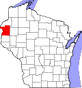
| County | Polk |
| Elevation | 332 m (1,089 ft) |
| Time zone | UTC-6 (Central (CST)) |
| • Summer (DST) | UTC-5 (CDT) |
| Area codes | 715 & 534 |
| GNIS feature ID | 1577712 [1] |
Lykens is an unincorporated community located in the town of Balsam Lake, Polk County, Wisconsin, United States. [1] Lykens Lake is a 20 acre lake located in Polk County. It has a maximum depth of 10 feet. [2]