Argonne, Wisconsin

Last updated

Argonne, Wisconsin
Post office, Argonne, WI.jpg
Post office in the community of Argonne
WIMap-doton-Argonne.png
Location of Argonne, Wisconsin
Coordinates: 45°43′58″N88°51′8″W / 45.73278°N 88.85222°W / 45.73278; -88.85222
Country Flag of the United States.svg  United States
State Flag of Wisconsin.svg  Wisconsin
County Forest
Area
  Total108.3 sq mi (280.5 km2)
  Land108.2 sq mi (280.3 km2)
  Water0.1 sq mi (0.2 km2)
Elevation
[1]
1,663 ft (507 m)
Population
 (2010)
  Total512
  Density4.7/sq mi (1.8/km2)
Time zone UTC-6 (Central (CST))
  Summer (DST) UTC-5 (CDT)
Area codes 715 & 534
FIPS code 55-02625 [2]
GNIS feature ID1582709 [1]

Argonne is a town in Forest County, Wisconsin, United States. The population was 512 at the 2010 census. [3] The census-designated place of Argonne is located in the town. The unincorporated community of Wisconsin Junction is also located in the town.

Contents

History

Argonne depot in 1963 SOO depot at Argonne, WI in September 1963 (33668032413).jpg
Argonne depot in 1963

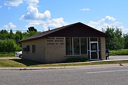
Argonne was originally named Van Zile after Abraham Van Zile, who platted the area in 1888. A post office was established a year later. The town's name was changed to North Crandon in 1892 and later to Argonne—after the French Forest of Argonne—in 1929 to honor veterans of World War I. [4]

The town is located on the rail line from Minneapolis towards Sault Ste. Marie which was the origin of the Minneapolis, St. Paul and Sault Ste. Marie Railroad. Whereas that line runs roughly east-to-west, another line diverges southwards at Wisconsin Junction just west of Argonne. This line to Neenah was one the last to be used by a mixed train, i. e. a train carrying both freight and passengers. From the late 1960s into the 1980s, the trains no longer carried dedicated passenger cars but riders could use the Caboose. [5]

Geography

According to the United States Census Bureau, the town has a total area of 108.3 square miles (280 km2), of which 108.2 square miles (280 km2) is land and 0.1 square miles (0.26 km2), or 0.06%, is water.

Demographics

As of the census [2] of 2000, there were 532 people, 194 households, and 135 families residing in the town. The population density was 4.9 people per square mile (1.9/km2). There were 314 housing units at an average density of 2.9 per square mile (1.1/km2). The racial makeup of the town was 95.49% White, 0.19% African American, 3.20% Native American, 0.19% Asian, 0.19% from other races, and 0.75% from two or more races. Hispanic or Latino of any race were 0.94% of the population.

There were 194 households, out of which 36.1% had children under the age of 18 living with them, 58.8% were married couples living together, 4.1% had a female householder with no husband present, and 29.9% were non-families. 24.7% of all households were made up of individuals, and 10.3% had someone living alone who was 65 years of age or older. The average household size was 2.74 and the average family size was 3.35.

In the town, the population was spread out, with 27.6% under the age of 18, 11.1% from 18 to 24, 29.3% from 25 to 44, 18.8% from 45 to 64, and 13.2% who were 65 years of age or older. The median age was 35 years. For every 100 females, there were 112.8 males. For every 100 females age 18 and over, there were 115.1 males.

The median income for a household in the town was $40,909, and the median income for a family was $44,821. Males had a median income of $35,417 versus $20,625 for females. The per capita income for the town was $18,169. About 7.7% of families and 10.1% of the population were below the poverty line, including 9.2% of those under age 18 and 7.1% of those age 65 or over.

Notable people

45°39′35″N88°52′45″W / 45.65972°N 88.87917°W / 45.65972; -88.87917

Related Research Articles

<span class="mw-page-title-main">Bruce Township, Chippewa County, Michigan</span> Civil township in Michigan, United States

Bruce Township is a civil township of Chippewa County in the U.S. state of Michigan. As of the 2020 census, the township population was 2,000.

<span class="mw-page-title-main">Rudyard Township, Michigan</span> Civil township in Michigan, United States

Rudyard Township is a civil township of Chippewa County in the U.S. state of Michigan. As of the 2020 census, the township population was 1,289. In 2023, Rudyard Township was designated the "Snowy Owl Capital of Michigan".

<span class="mw-page-title-main">Norway, Michigan</span> City in Michigan, United States

Norway is a city in Dickinson County in the U.S. state of Michigan. The population was 2,840 at the 2020 census. It is part of the Iron Mountain, MI–WI micropolitan statistical area.

<span class="mw-page-title-main">Iron River, Michigan</span> City in Michigan, United States

Iron River is a city in Iron County in the U.S. state of Michigan. As of the 2020 census, the city population was 3,007. The city is situated at the southeast corner of Iron River Township, but is administratively autonomous.

<span class="mw-page-title-main">Mueller Township, Michigan</span> Civil township in Michigan, United States

Mueller Township is a civil township of Schoolcraft County in the U.S. state of Michigan. The population was 260 in 2020.

<span class="mw-page-title-main">Thompson Township, Michigan</span> Civil township in Michigan, United States

Thompson Township is a civil township of Schoolcraft County in the U.S. state of Michigan. As of 2020, its population was 808.

Herrings is a hamlet and former village in Jefferson County, New York, United States. The population was 90 at the 2010 census, down from 129 in 2000. The hamlet is named after two brothers who owned a paper mill in the area.

<span class="mw-page-title-main">Mylo, North Dakota</span> City in North Dakota, United States

Mylo is a city in Rolette County, North Dakota, United States. The population was 21 at the 2020 census. Other than a United States Post Office, there are no businesses or services at Mylo.

<span class="mw-page-title-main">Artas, South Dakota</span> Town in South Dakota, United States

Artas is a town in Campbell County, South Dakota, United States. The population was 7 at the 2020 census.

<span class="mw-page-title-main">Webster, Burnett County, Wisconsin</span> Village in Wisconsin, United States

Webster is a village in Burnett County in the U.S. state of Wisconsin. The population was 653 at the 2010 census. It is along Wisconsin Highway 35.

<span class="mw-page-title-main">Marion, Grant County, Wisconsin</span> Town in Wisconsin, United States

Marion is a town in Grant County, Wisconsin, United States. The population was 517 at the 2000 census.

<span class="mw-page-title-main">Clifton, Monroe County, Wisconsin</span> Town in Wisconsin, United States

Clifton is a town in Monroe County, Wisconsin, United States. The population was 693 at the 2000 census.

<span class="mw-page-title-main">Junction City, Wisconsin</span> Village in Wisconsin, United States

Junction City is a village in Portage County, Wisconsin, United States. The population was 439 at the 2010 census.

<span class="mw-page-title-main">Bruce, Wisconsin</span> Village in Wisconsin, United States

Bruce is a village in Rusk County, Wisconsin, United States. The population was 779 at the 2010 census. The village was founded in 1884 by the Sault Ste. Marie Land and Improvement Company. The land company was incorporated and led by the principal officers of the Minneapolis, Sault Ste. Marie and Atlantic Railway, which operated its ceremonial first train over its line to Bruce in November 1884. It was named for Alanson C. Bruce who operated a logging camp in the area.

<span class="mw-page-title-main">Ladysmith, Wisconsin</span> City in Wisconsin, United States

Ladysmith is a city and the county seat of Rusk County, Wisconsin, United States. The population was 3,216 at the 2020 census.

Luck is a town in Polk County, Wisconsin, United States. The population was 881 at the 2000 census. The village of Luck is located within the town. The unincorporated community of West Denmark is located in the town. The unincorporated community of Pole Cat Crossing is also located partially in the town.

<span class="mw-page-title-main">Osceola, Polk County, Wisconsin</span> Town in Wisconsin, United States

Osceola is a town in Polk County, Wisconsin, United States. The population was 2,085 at the 2000 census. The village of Osceola is located mostly within the town. The unincorporated community of Nye is also located in the town.

<span class="mw-page-title-main">Prentice, Wisconsin</span> Village in Wisconsin, United States

Prentice is a village in Price County, Wisconsin, United States, near where Highway 13 crosses the Jump River. The population was 660 at the 2010 census. The village is located within the Town of Prentice.

Hawkins is a town in Rusk County, Wisconsin, United States. The population was 170 at the 2000 census. The Village of Hawkins is located within the town.

<span class="mw-page-title-main">Hawkins, Wisconsin</span> Village in Wisconsin, United States

Hawkins is a village in Rusk County in north-central Wisconsin, United States. The population was 305 at the 2010 census. The village is located within the Town of Hawkins.

References

  1. 1 2 "US Board on Geographic Names". United States Geological Survey. October 25, 2007. Retrieved January 31, 2008.
  2. 1 2 "U.S. Census website". United States Census Bureau . Retrieved January 31, 2008.
  3. "Race, Hispanic or Latino, Age, and Housing Occupancy: 2010 Census Redistricting Data (Public Law 94-171) Summary File (QT-PL), Argonne town, Wisconsin". United States Census Bureau . Retrieved August 12, 2011.
  4. Gard, Robert (2015). The Romance of Wisconsin Place Names (2nd ed.). Madison, WI: Wisconsin Historical Society Press. p. 11. ISBN   978-0-87020-707-5.
  5. Wiedrich, Bob (February 24, 1986). "Seeing America of old on ride in Soo Caboose". Chicago Tribune . Retrieved October 10, 2021.
  6. 'Wisconsin Blue Book 1929,' Biographical Sketch of Joseph D. Grandine, pg. 549