Mole Lake, Wisconsin

Last updated
Mole Lake, Wisconsin
Census-designated place
MoleLakeWisconsinSignWIS55.jpg
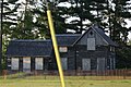
Welcome sign and houses in Mole Lake
USA Wisconsin location map.svg
Red pog.svg
Mole Lake, Wisconsin
Coordinates: 45°28′47″N88°58′59″W / 45.47972°N 88.98306°W / 45.47972; -88.98306 Coordinates: 45°28′47″N88°58′59″W / 45.47972°N 88.98306°W / 45.47972; -88.98306
Country United States
State Wisconsin
County Forest
Area
  Total4.160 sq mi (10.77 km2)
  Land3.698 sq mi (9.58 km2)
  Water0.462 sq mi (1.20 km2)
Elevation
1,552 ft (473 m)
Population
 (2010)
  Total435
  Density100/sq mi (40/km2)
Time zone UTC-6 (Central (CST))
  Summer (DST) UTC-5 (CDT)
Area code(s) 715 & 534
FIPS Code 55-53500
GNIS feature ID1569643 [1]

Mole Lake, Wisconsin is a census-designated place located in the town of Nashville in Forest County, Wisconsin, United States.

Contents

Description

The community is located on Wisconsin Highway 55 in the Mole Lake Indian Reservation. [2] As of the 2010 census, its population is 435. [3] Mole Lake has an area of 4.160 square miles (10.77 km2); 3.698 square miles (9.58 km2) of this is land, and 0.462 square miles (1.20 km2) is water. It is named after the Mole Lake tribe. The tribe's Mole Lake Casino is located in the community. [4]

Images

See also

Related Research Articles

<span class="mw-page-title-main">Madison County, New York</span> County in New York, United States

Madison County is a county located in the U.S. state of New York. As of the 2020 census, the population was 68,016. Its county seat is Wampsville. The county is named after James Madison, the fourth president of the United States, and was first formed in 1806.

<span class="mw-page-title-main">Waushara County, Wisconsin</span> County in Wisconsin, United States

Waushara County is a county located in the U.S. state of Wisconsin. As of the 2020 census, the population was 24,520. Its county seat is Wautoma.

<span class="mw-page-title-main">Stateline, Nevada</span> CDP in Nevada, United States

Stateline is a census-designated place (CDP) on the southeastern shore of Lake Tahoe in Douglas County, Nevada, United States. It lies next to the California state line and City of South Lake Tahoe. The population was 842 at the 2010 census. The population swells considerably during the busy winter and summer seasons, due to the high number of hotel rooms and rental accommodations available.

<span class="mw-page-title-main">Koshkonong, Wisconsin</span> Town in Wisconsin, United States

Koshkonong is a town in Jefferson County, Wisconsin, United States. The population was 3,692 at the 2010 census. The town entirely surrounds the city of Fort Atkinson. The unincorporated communities of Koshkonong Mounds and Vinnie Ha Ha are located in the town. The unincorporated communities of Blackhawk Island and Koshkonong, as well as The Census-designated place of Lake Koshkonong are also located partially in the town.

<span class="mw-page-title-main">Crandon, Wisconsin</span> City in Wisconsin, United States

Crandon is a city in Forest County, Wisconsin, United States; it is in the northeastern part of the state, about 100 miles (160 km) north of Green Bay. The population was 1,713 at the 2020 census. It is the county seat of Forest County and is the only incorporated community in the county. The city is located adjacent to the Town of Crandon.

<span class="mw-page-title-main">L'Anse Indian Reservation</span> Indian reservation in Michigan, United States

The L'Anse Indian Reservation is the land base of the federally recognized Keweenaw Bay Indian Community of the historic Lake Superior Band of Chippewa Indians.. The reservation is located primarily in two non-contiguous sections on either side of the Keweenaw Bay in Baraga County in the Upper Peninsula of the U.S. state of Michigan. The Keweenaw Bay Community also manages the separate Ontonagon Indian Reservation.

<span class="mw-page-title-main">Lac du Flambeau Band of Lake Superior Chippewa</span> Ojibwa Native American tribe

The Lac du Flambeau Band of Lake Superior Chippewa is a federally recognized Ojibwa Native American tribe. It had 3,415 enrolled members as of 2010. The Lac du Flambeau Indian Reservation lies mostly in the Town of Lac du Flambeau in south-western Vilas County, and in the Town of Sherman in south-eastern Iron County in the U.S. state of Wisconsin. It has a land area of 107.1 square miles (277.4 km2) and a 2020 census resident population of 3,518 persons. Its major settlement is the unincorporated Lac du Flambeau, which had a population of 1,845 persons.

<span class="mw-page-title-main">Bad River Band of the Lake Superior Tribe of Chippewa Indians</span> Indian tribe in Wisconsin, United States

The Bad River LaPointe Band of the Lake Superior Tribe of Chippewa Indians or Bad River Tribe for short are a federally recognized tribe of Ojibwe people. The tribe had 6,945 members as of 2010. The Bad River Reservation is located on the south shore of Lake Superior and has a land area of about 193.11 square miles (500.15 km2) in northern Wisconsin, straddling Ashland and Iron counties. Odanah, the administrative and cultural center, is located five miles (8.0 km) east of the town of Ashland on U.S. Highway 2. The reservation population was 1,545 in 2020. Most of the reservation is managed as undeveloped forest and wetland, providing a habitat for wild rice and other natural resources.

<span class="mw-page-title-main">Fond du Lac Indian Reservation</span> Indian reservation in northern Minnesota

The Fond du Lac Indian Reservation is an Indian reservation in northern Minnesota near Cloquet in Carlton and Saint Louis counties. Off-reservation holdings are located across the state in Douglas County, in the northwest corner of Wisconsin. The total land area of these tribal lands is 154.49 square miles (400.1 km2). It is the land-base for the Fond du Lac Band of Lake Superior Chippewa. Before the establishment of this reservation, the Fond du Lac Band of Lake Superior Chippewa were located at the head of Lake Superior, closer to the mouth of the Saint Louis River, where Duluth has developed.

Mille Lacs Indian Reservation is the popular name for the land-base for the Mille Lacs Band of Ojibwe in Central Minnesota, about 100 miles (160 km) north of Minneapolis-St. Paul. The contemporary Mille Lacs Band reservation has significant land holdings in Mille Lacs, Pine, Aitkin and Crow Wing counties, as well as other land holdings in Kanabec, Morrison, and Otter Tail Counties. Mille Lacs Indian Reservation is also the name of a formal Indian reservation established in 1855. It is one of the two formal reservations on which the contemporary Mille Lacs Band retains land holdings. The contemporary Mille Lacs band includes several aboriginal Ojibwe bands and villages, whose members reside in communities throughout central Minnesota.

<span class="mw-page-title-main">Lac Courte Oreilles Band of Lake Superior Chippewa Indians</span>

The Lac Courte Oreilles Tribe is one of six federally recognized bands of Ojibwe people located in present-day Wisconsin. It had 7,275 enrolled members as of 2010. The band is based at the Lac Courte Oreilles Indian Reservation in northwestern Wisconsin, which surrounds Lac Courte Oreilles. The main reservation's land is in west-central Sawyer County, but two small plots of off-reservation trust land are located in Rusk, Burnett, and Washburn counties. The reservation was established in 1854 by the second Treaty of La Pointe.

<span class="mw-page-title-main">Sokaogon Chippewa Community</span>

The Sokaogon Chippewa Community, or the Mole Lake Band of Lake Superior Chippewa, is a federally recognized tribe of the Lake Superior Chippewa, many of whom reside on the Mole Lake Indian Reservation, located southwest of the city of Crandon, in the Town of Nashville, Forest County, Wisconsin. The reservation is located partly in the community of Mole Lake, Wisconsin.

<span class="mw-page-title-main">Forest County Potawatomi Community</span>

The Forest County Potawatomi Community is a federally recognized tribe of Potawatomi people with approximately 1,400 members as of 2010. The community is based on the Forest County Potawatomi Indian Reservation, which consists of numerous non-contiguous plots of land in southern Forest County and northern Oconto County, Wisconsin, United States. The community also administers about 7 acres (28,000 m2) of off-reservation trust land in the city of Milwaukee. According to the U.S. Census Bureau, the reservation and off-reservation trust land together have a total area of 22.72 square miles (58.8 km2). The combined population of Forest County Potawatomi Community and Off-Reservation Trust Land was 594 in the 2020 census. The nation's administrative and cultural center are located about three miles east of Crandon, Wisconsin.

<span class="mw-page-title-main">Stockbridge–Munsee Community</span> Federally-recognized Native American tribe

The Stockbridge–Munsee Community also known as the Mohican Nation Stockbridge–Munsee Band is a federally recognized Native American tribe formed in the late eighteenth century from communities of so-called "praying Indians", descended from Christianized members of two distinct groups: Mohicans and Wappinger from the praying town of Stockbridge, Massachusetts, and Munsees, from the area where present-day New York, Pennsylvania and New Jersey meet. Their land-base, the Stockbridge–Munsee Indian Reservation, consists of a checkerboard of 24.03 square miles (62.2 km2) in the towns of Bartelme and Red Springs in Shawano County, Wisconsin. Among their enterprises is the North Star Mohican Resort and Casino.

Sayner is a census-designated place in the Town of Plum Lake in Vilas County, Wisconsin, United States. It is located at the intersection of Highway 155 and County N, about 15 miles northwest of Eagle River. As of the 2010 census, its population was 207. Sayner has an area of 1.828 square miles (4.73 km2); 1.826 square miles (4.73 km2) of this is land, and 0.002 square miles (0.0052 km2) is water. Sayner got its name from Orrin W. Sayner, who settled the area in 1891, two years before any other settlers took up homes in the town. In 1895, the Milwaukee Road extended its Valley Line north from Woodruff to Star Lake, with a stop in Sayner. The line primarily carried lumber from area forests, later carried tourists and had been abandoned in the middle 20th century.

<span class="mw-page-title-main">Ho-Chunk Nation of Wisconsin</span> Ethnic group

The Ho-Chunk Nation is a federally recognized tribe of the Ho-Chunk with traditional territory across five states in the United States: Wisconsin, Illinois, Iowa, Minnesota, and Missouri. The other federally recognized tribe of Ho-Chunk people is the Winnebago Tribe of Nebraska. The tribe separated when its members were forcibly relocated first to an eastern part of Iowa known as the Neutral Ground, then to Minnesota, South Dakota and later to the current reservation in Nebraska.

<span class="mw-page-title-main">Finland, Minnesota</span> Unincorporated community in Minnesota, US

Finland is an unincorporated community and census-designated place (CDP) in Crystal Bay and Beaver Bay townships, Lake County, Minnesota, United States. As of the 2020 census, its population was 195.

<span class="mw-page-title-main">St. Croix Chippewa Indians of Wisconsin</span>

The St. Croix Chippewa Indians of Wisconsin are a federally recognized tribe of Ojibwe people located in northwestern Wisconsin, along the St. Croix River valley and watershed. The band had 1,054 members as of 2010.

<span class="mw-page-title-main">Butte des Morts, Wisconsin</span> Census-designated place in Wisconsin, United States

Butte des Morts is an unincorporated census-designated place in the town of Winneconne, in Winnebago County, Wisconsin, United States.

<span class="mw-page-title-main">Horton Bay, Michigan</span> Census-designated place & unincorporated community in Michigan, United States

Horton Bay is an unincorporated community and census-designated place (CDP) in Charlevoix County in the U.S. state of Michigan. The population of the CDP was 485 at the 2020 census. The community is located within Bay Township on northeastern shores of Lake Charlevoix.

References

  1. U.S. Geological Survey Geographic Names Information System: Mole Lake, Wisconsin
  2. "Mole Lake, WI Profile: Facts & Data".
  3. "U.S. Census website". U.S. Census Bureau . Retrieved 14 April 2011.
  4. "Home". molelake.com.

See also

Commons-logo.svg Media related to Mole Lake, Wisconsin at Wikimedia Commons