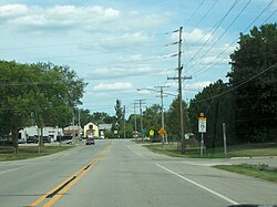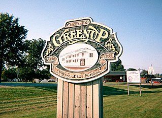
Greenup is a village in Cumberland County, Illinois, United States, along the Embarras River. The population was 1,365 at the 2020 census. It is part of the Charleston–Mattoon Micropolitan Statistical Area.

Glen Echo Park was a village in St. Louis County, Missouri, United States. The population was 122 at the 2020 census. The community took its name from the nearby Glen Echo Country Club.
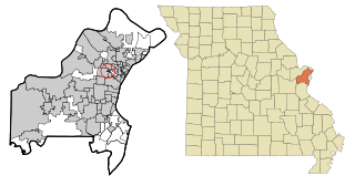
Sycamore Hills is a village in St. Louis County, Missouri, United States. The population is 560 at the 2020 census.

Murdock is a village in Cass County, Nebraska, United States. The population was 270 according to the 2020 census.

Uplands Park is a village in St. Louis County, Missouri, United States. The population was 445 at the 2010 census. The village is one of many small majority black communities located in the Natural Bridge corridor of mid-St. Louis County, characterized by small homes on small lots.
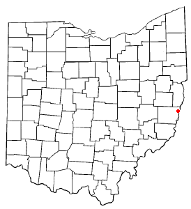
Brookside is a village in eastern Belmont County, Ohio, United States. The population was 538 at the 2020 census. It is part of the Wheeling metropolitan area.

Wells Township is a township in Fulton County, Pennsylvania, United States. The population was 498 at the 2020 census. Wells Township was initially settled in 1760. It was originally known as Aughwick Township when it was incorporated in 1849. The name was changed to Wells Township on April 2, 1850.

Ringgold Township is a township in Jefferson County, Pennsylvania, United States. The population was 772 at the 2020 census.

Clearview is a village in Ohio County, West Virginia, United States. It is part of the Wheeling, West Virginia Metropolitan Statistical Area. The population was 565 at the 2010 census.

Bellevue is a village in Brown County, Wisconsin. It was a town until incorporating as a village on February 14, 2003. The population was 15,935 at the time of the 2020 census. Bellevue is part of the Green Bay metropolitan area. Bellevue sits around 4.34 miles (6.99 km) east from central Green Bay.

Rantoul is a town in Calumet County in the U.S. state of Wisconsin. The population was 798 at the 2010 census. The unincorporated community of Wells is located partially in the town.

Avoca is a village in Iowa County, Wisconsin, United States. The population was 637 at the 2010 census. It is part of the Madison Metropolitan Statistical Area. It is named after Avoca in Ireland.

Taylor is a village in Jackson County, Wisconsin, United States, along the Trempealeau River. The population was 484 at the 2020 census.

Combined Locks is a village in Outagamie County, Wisconsin, United States. The population was 3,328 at the 2010 census.

Bay City is a village on the Mississippi River in Pierce County, Wisconsin, United States. The population was 500 at the 2010 census.

Wilson is a village in St. Croix County, Wisconsin, United States. The population was 184 at the 2010 census.

Lonetree is a census-designated place (CDP) in Uinta County, Wyoming, United States. The population was 49 at the 2010 census.

Verona is a village in Montgomery and Preble counties in the U.S. state of Ohio. The population was 403 at the 2020 census. It is part of the Dayton Metropolitan Statistical Area.

Unity is a village in Clark and Marathon counties in the U.S. state of Wisconsin. It is part of the Wausau, Wisconsin Metropolitan Statistical Area. The population was 343 at the 2010 census. Of this, 204 were in Marathon County, and 139 were in Clark County. The village is located in northeastern town of Unity in Clark County and northwestern town of Brighton in Marathon County.

Fox Lake is a city in Dodge County, Wisconsin, United States. The population was 1,519 at the 2010 census. The city is located within the Town of Fox Lake.