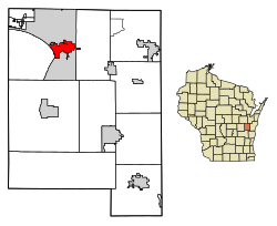
Sherwood, Wisconsin | |
---|---|
![]() | |
![]() Location of Sherwood in Calumet County, Wisconsin. | |
Coordinates: 44°10′25″N88°16′31″W / 44.17361°N 88.27528°W | |
Country | ![]() |
State | ![]() |
County | Calumet |
Area | |
• Total | 3.52 sq mi (9.11 km2) |
• Land | 3.46 sq mi (8.96 km2) |
• Water | 0.06 sq mi (0.15 km2) |
Elevation | 892 ft (272 m) |
Population (2020) | |
• Total | 3,270 |
• Density | 880.38/sq mi (339.95/km2) |
Time zone | UTC-6 (Central (CST)) |
• Summer (DST) | UTC-5 (CDT) |
Area code | 920 |
FIPS code | 55-73525 [3] |
GNIS feature ID | 1574041 [2] |
Website | villageofsherwood |
Sherwood is a village in Calumet County, Wisconsin, United States. The population was 2,713 at the 2010 census. The former historical unincorporated community of High Cliff is located within present-day Sherwood. [4] [5]
The village began as a named unincorporated community within the Town of Harrison, and is named for a Civil War veteran stagecoach driver, who later operated a tavern in the area. Sherwood was incorporated as a village on June 28, 1968. [6]
According to the United States Census Bureau, the village has a total area of 3.52 square miles (9.12 km2), of which, 3.46 square miles (8.96 km2) of it is land and 0.06 square miles (0.16 km2) is water. [7]
Census | Pop. | Note | %± |
---|---|---|---|
1970 | 350 | — | |
1980 | 372 | 6.3% | |
1990 | 837 | 125.0% | |
2000 | 1,550 | 85.2% | |
2010 | 2,713 | 75.0% | |
2020 | 3,270 | 20.5% | |
U.S. Decennial Census [8] |
Sherwood is located at 44°10′25″N88°16′31″W / 44.17361°N 88.27528°W (44.173538, -88.275256). [9]
At the 2010 census there were 2,713 people, 986 households, and 830 families living in the village. The population density was 784.1 inhabitants per square mile (302.7/km2). There were 1,027 housing units at an average density of 296.8 per square mile (114.6/km2). The racial makup of the village was 96.8% White, 0.5% African American, 0.5% Native American, 0.8% Asian, 0.4% from other races, and 1.0% from two or more races. Hispanic or Latino of any race were 1.5%. [10]
Of the 986 households 40.3% had children under the age of 18 living with them, 76.5% were married couples living together, 4.9% had a female householder with no husband present, 2.8% had a male householder with no wife present, and 15.8% were non-families. 12.2% of households were one person and 4.4% were one person aged 65 or older. The average household size was 2.75 and the average family size was 3.00.
The median age in the village was 40 years. 28.1% of residents were under the age of 18; 3.7% were between the ages of 18 and 24; 28.1% were from 25 to 44; 29.9% were from 45 to 64; and 10.2% were 65 or older. The gender makeup of the village was 49.9% male and 50.1% female.
At the 2000 census there were 1,550 people, 572 households, and 463 families living in the village. The population density was 531.9 people per square mile (205.7/km2). There were 593 housing units at an average density of 203.5 per square mile (78.7/km2). The racial makup of the village was 98.13% White, 0.19% African American, 0.32% Native American, 0.90% Asian, 0.13% from other races, and 0.32% from two or more races. Hispanic or Latino of any race were 0.97%. [3]
Of the 572 households 36.2% had children under the age of 18 living with them, 75.0% were married couples living together, 4.2% had a female householder with no husband present, and 18.9% were non-families. 13.8% of households were one person and 5.2% were one person aged 65 or older. The average household size was 2.71 and the average family size was 3.02.
The age distribution was 27.3% under the age of 18, 5.5% from 18 to 24, 34.2% from 25 to 44, 24.5% from 45 to 64, and 8.6% 65 or older. The median age was 36 years. For every 100 females, there were 101.8 males. For every 100 females age 18 and over, there were 101.6 males.
The median household income was $63,913 and the median family income was $67,303. Males had a median income of $46,384 versus $32,772 for females. The per capita income for the village was $27,035. About 3.9% of families and 4.9% of the population were below the poverty line, including 5.0% of those under age 18 and 16.0% of those age 65 or over.
Whitmore Village is a census-designated place (CDP) in Honolulu County, Hawaiʻi, United States. The population was 4,887 at the 2020 census.
Hillsdale is a village in Rock Island County, Illinois, United States. The population was 531 at the time of the 2020 census, up from 523 at the 2010 census.
Van Wert is a city in northern Decatur County, Iowa, United States. The population was 178 at the time of the 2020 census.
Thornburg is a village in Keokuk County, Iowa, United States. The population was 45 at the time of the 2020 census. Its sole enterprise is the Tri-County Community School, a public school serving grades K-12.
St. Marys or Saint Marys is a city in Warren County, Iowa, United States. The population was 108 at the time of the 2020 census.
Crawfordsville is a city in Washington County, Iowa, United States. It is part of the Iowa City, Iowa Metropolitan Statistical Area. The population was 277 at the 2020 census.
Norway is a city in Dickinson County in the U.S. state of Michigan. The population was 2,840 at the 2020 census. It is part of the Iron Mountain, MI–WI micropolitan statistical area.
Tarrants is a village in central Pike County, Missouri, United States. The population was 22 at the 2010 census.
Clearwater is a village in Antelope County, Nebraska, United States. The population was 419 at the 2010 census.
Milligan is a village in Fillmore County, Nebraska, United States. The population was 241 at the 2020 census.
Glencoe is a town in Buffalo County in the U.S. state of Wisconsin. The population was 485 at the 2010 census. The unincorporated community of Glencoe is located in the town.
Pigeon Falls is a village in Trempealeau County, Wisconsin, United States. The population was 411 at the 2010 census.
Readstown is a village in Vernon County, Wisconsin, United States. The population was 376 at the 2020 census.
Belleville is a village in Dane and Green counties in the U.S. state of Wisconsin. The population was 2,491 at the 2020 census. Of this, 1,909 were in Dane County, and 582 were in Green County.
Lowell is a village in Dodge County, Wisconsin, United States, along the Beaver Dam River. The population was 309 at the 2020 census. The village is located within the Town of Lowell.
Boscobel is a city in Grant County, Wisconsin, United States. The population was 3,286 at the 2020 census. Approximately 0.6 mi. (1 km) to the north of the city, across a riparian swamp, is the Wisconsin River. U.S. Route 61 crosses the Wisconsin River at Boscobel. To the south, the city is bordered by the Town of Boscobel.
Winter is a village in Sawyer County, Wisconsin, United States. The population was 233 at the 2010 census. The village is within the Town of Winter.
Baldwin is a village in St. Croix County, Wisconsin, United States. The population was 3,957 at the 2010 census, a growth rate of 48% from 2000. The village is adjacent to the Town of Baldwin.
Star Prairie is a village in St. Croix County in the U.S. state of Wisconsin. The population was 561 at the 2010 census. The village is located along the Apple River on the boundary between the Town of Star Prairie and the Town of Stanton.
Plainfield is a village in Waushara County, Wisconsin, United States. The village is located almost entirely within the Town of Plainfield. A tiny portion extends into adjacent Town of Oasis. The population was 897 at the 2010 census.