Winneconne, Wisconsin

Last updated

Winneconne, Wisconsin
WinneconneWisconsinDowntown2WIS116.jpg
Downtown Winneconne
Winnebago County Wisconsin Incorporated and Unincorporated areas Winneconne Highlighted.svg
Location of Winneconne in Winnebago County, Wisconsin.
Coordinates: 44°6′12″N88°41′22″W / 44.10333°N 88.68944°W / 44.10333; -88.68944
Country Flag of the United States.svg  United States
State Flag of Wisconsin.svg  Wisconsin
County Winnebago
Government
Area
[1]
  Total1.92 sq mi (4.97 km2)
  Land1.48 sq mi (3.84 km2)
  Water0.44 sq mi (1.13 km2)
Elevation
[2]
748 ft (228 m)
Population
 (2010) [3]
  Total2,544
  Estimate 
(2019) [4]
2,484
  Density1,673.85/sq mi (646.29/km2)
Time zone UTC-6 (Central (CST))
  Summer (DST) UTC-5 (CDT)
Area code 920
FIPS code 55-87925 [5]
GNIS feature ID1576880 [2]
Website Official website

Winneconne is a village in Winnebago County, Wisconsin. The population was 2,383 at the time of the 2010 census. The village is located within the Town of Winneconne. Developed along the Wolf River, the community is in the middle of the Wolf Chain of lakes, including Poygan, Winneconne, and Butte des Morts. It is host to numerous bass fishing tournaments.

Contents

History

This area was originally occupied by succeeding cultures of indigenous peoples. The historic Menominee people were settled in the area at the time of European encounter. French fur traders from Quebec were among the first to interact with them, followed by Catholic Jesuit missionaries. The area was ruled by Great Britain as part of the Province of Quebec and then acquired by the United States.

Winneconne's European-American settlement began in the mid-19th century with Yankees who migrated from New England and the Northern Tier, added to by waves of immigrants: Irish, Germans, and Norwegians. Originally, Winneconne had many different spellings: Winneconnah, Winnekonah, Wau-nau-ko, and Winnikning, which were transliterations from the Menominee and other Indian names for the site. The Indian meanings of these names ranged from "land of dirty water" to "land of skull and bones", referring to a prehistoric burial mound known as Butte des Morts by the French. In 1851 the recently constituted village board officially settled the spelling of the name as Winneconne.

Joseph Edwards (1809–1902) was the first postmaster. He was a migrant from Hopewell, Bedford County, Pennsylvania via 15 years farming in Richland County, Ohio. He first settled with his family in Winneconne in 1849, building the first frame house in the village. After living here a few years, he moved to Dayton, Waupaca County, Wisconsin for more farming. He and his wife Mary (Wright) Edwards returned to this village in 1886. She died in 1895; and four of their nine children survived him: Mrs. D.C. Reed was still living in the village; son Oscar A. Edwards lived in Rhinelander, and two married daughters lived in Tacoma, Washington. [6]

After the Treaty of Poygan in 1852, by which the Menominee ceded more land in this area to the United States, Winneconne expanded its land west of the Wolf River. Chief Oshkosh negotiated with the President to keep other lands in this area, as more than 2500 of his people refused to move to Minnesota, as was desired by the federal government. The Menominee Indian Tribe of Wisconsin is federally recognized.

Because of the expansion of the village, people needed to cross the river more frequently. Initially the Menominee would transport people and goods by canoe. In 1853, settler J.D. Rush built a float bridge, and set up toll stations to recover his costs. Since then a total of four bridges have been built, including the current one.

In Winneconne's early years, mills were built along the river as the first industries, to process lumber, grain, and operate tanneries. Commercial fishing was also a thriving business. The many shipyards built and repaired fleets then made up primarily of wooden boats and ships.

With its many rivers and lakes, Winneconne has been known as a "hunting and fishing paradise." [7] Some resort housing has been built in the area.

Improvements continue in the area. The Wolf River Bridge, carrying WIS 116, was built in 1934 during the Great Depression with support from the federal government, under President Franklin D. Roosevelt's WPA projects for investment in infrastructure. [8] This non-redundant bascule bridge is now functionally obsolete because of its narrow deck width and aging materials. As it is very important to the Main Street of the village, and connections to other cities in the region, the state has approved a new bridge to carry WIS 116. A new bridge will also have fishing platforms, as does the current one. [9]

Secession

In 1967, as a result of the town name being inadvertently left off the official Wisconsin road map, a secret committee led by Vera Wentzel-Kitchen of the Arrowhead Restaurant formulated a plan to secede from Wisconsin, set up toll gates on local roads, and begin annexation of nearby communities, starting with the city of Oshkosh, to form a Sovereign State of Winneconne. [10] As an alternative plan, they sought annexation by another state, preferably one with better weather. The deadline for secession was July 21, 1967. A proclamation was issued, naming village president "James Coughlin to be president of the new state of Winneconne; Vera Kitchen to be prime minister and custodian of Vera’s Kitchen Cabinet". The secession was not recognized by any formal government and was merely a gesture indicative of the village's displeasure with state officials. [10] Wisconsin Governor Warren P. Knowles met with village officials; as a result, Winneconne reconciled with the state of Wisconsin on July 22, 1967. An annual Sovereign State Days celebration commemorates the event, and a logo showing poison ivy, a skunk, a sheepshead, and a dodo bird is displayed throughout the town. [11]

Geography

Winneconne is located at 44°6'39" North, 88°42'51" West (44.111029, -88.714311). [12]

According to the United States Census Bureau, the village has a total area of 1.95 square miles (5.05 km2), of which, 1.53 square miles (3.96 km2) of it is land and 0.42 square miles (1.09 km2) is water. [13]

The city was built along the banks of the Wolf Chain, which includes Lake Poygan, Lake Winneconne, and Lake Butte des Morts. Many bass fishing tournaments are based in Winneconne due to its central location on the chain.

Demographics

Historical population
CensusPop.Note
1870 1,159
1880 978−15.6%
1890 1,08611.0%
1900 1,042−4.1%
1910 940−9.8%
1920 745−20.7%
1930 82110.2%
1940 93113.4%
1950 1,07815.8%
1960 1,27318.1%
1970 1,61126.6%
1980 1,93520.1%
1990 2,0596.4%
2000 2,40116.6%
2010 2,383−0.7%
2019 (est.)2,484 [4] 4.2%
U.S. Decennial Census [14]

2010 census

As of the census [3] of 2010, there were 2,383 people, 1,027 households, and 678 families residing in the village. The population density was 1,557.5 inhabitants per square mile (601.4/km2). There were 1,198 housing units at an average density of 783.0 per square mile (302.3/km2). The racial makeup of the village was 97.5% White, 0.2% African American, 0.4% Native American, 0.3% Asian, 0.8% from other races, and 0.8% from two or more races. Hispanic or Latino of any race were 1.3% of the population.

There were 1,027 households, of which 29.4% had children under the age of 18 living with them, 54.3% were married couples living together, 7.5% had a female householder with no husband present, 4.2% had a male householder with no wife present, and 34.0% were non-families. 28.7% of all households were made up of individuals, and 12.4% had someone living alone who was 65 years of age or older. The average household size was 2.32 and the average family size was 2.87.

The median age in the village was 43.7 years. 22.6% of residents were under the age of 18; 7% were between the ages of 18 and 24; 22.5% were from 25 to 44; 31.1% were from 45 to 64; and 16.7% were 65 years of age or older. The gender makeup of the village was 49.1% male and 50.9% female.

2000 census

As of the census [5] of 2000, there were 2,401 people, 945 households, and 687 families residing in the village. The population density was 1,503.4 people per square mile (579.4/km2). There were 1,060 housing units at an average density of 663.7 per square mile (255.8/km2). The racial makeup of the village was 98.75% White, 0.00% Black or African American, 0.50% Native American, 0.12% Asian, 0.00% Pacific Islander, 0.08% from other races, and 0.54% from two or more races. 0.62% of the population were Hispanic or Latino of any race.

There were 945 households, out of which 36.0% had children under the age of 18 living with them, 59.4% were married couples living together, 9.2% had a female householder with no husband present, and 27.2% were non-families. 23.4% of all households were made up of individuals, and 11.5% had someone living alone who was 65 years of age or older. The average household size was 2.53 and the average family size was 3.01.

In the village, the population was spread out, with 27.1% under the age of 18, 6.5% from 18 to 24, 27.9% from 25 to 44, 23.5% from 45 to 64, and 15.0% who were 65 years of age or older. The median age was 39 years. For every 100 females, there were 97.6 males. For every 100 females age 18 and over, there were 91.6 males.

The median income for a household in the village was $44,886, and the median income for a family was $53,477. Males had a median income of $41,047 versus $24,688 for females. The per capita income for the village was $20,316. 4.7% of the population and 3.4% of families were below the poverty line. 3.6% of those under the age of 18 and 9.8% of those 65 and older were living below the poverty line.

Winneconne Public Library

The Winneconne Public Library, located at 31 South 2nd Street in the heart of the village, offers Internet access, adult book discussion groups, children's programs, lending books and other media. The library has 35,000 holdings, approximately 30,000 of which are books and the balance consisting of video, audio, and other materials in electronic format. The library hosts the Winneconne Vital Records Database, where genealogists can search for birth, marriage and death records from Winneconne newspapers. The Winneconne Library belongs to the Winnefox Library System, which serves a population of over 300,000 from Fond du Lac, Green Lake, Marquette, Waushara, and Winnebago counties.

Images

Related Research Articles

<span class="mw-page-title-main">Winnebago County, Wisconsin</span> County in Wisconsin, United States

Winnebago County is a county in the U.S. state of Wisconsin. As of the 2020 census, the population was 171,730. Its county seat is Oshkosh. It was named for the historic Winnebago people, a federally recognized Native American tribe now known as the Ho-Chunk Nation. Chief Oshkosh was a Menominee leader in the area. Winnebago County comprises the Oshkosh-Neenah, WI Metropolitan Statistical Area, which is included in the Appleton-Oshkosh-Neenah, WI Combined Statistical Area.

<span class="mw-page-title-main">Pardeeville, Wisconsin</span> Village in Wisconsin, United States

Pardeeville is a village in Columbia County, Wisconsin, United States. The population was 2,115 at the 2010 census. It is part of the Madison Metropolitan Statistical Area.

<span class="mw-page-title-main">Algoma, Wisconsin</span> City in Wisconsin, United States

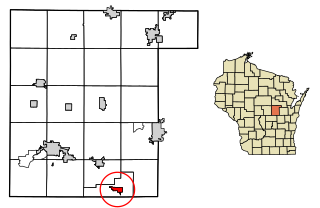
Algoma is a city in Kewaunee County in the U.S. state of Wisconsin. The population was 3,243 at the 2020 census. Algoma is part of the Green Bay Metropolitan Statistical Area.

<span class="mw-page-title-main">Meeme, Wisconsin</span> Town in Wisconsin, United States

Meeme is a town in Manitowoc County, Wisconsin, United States. The population was 1,538 at the 2000 census. Its Menominee name is Omīnīw which means "pigeon". The Menominee sold this land to the United States in the 1831 Treaty of Washington.

<span class="mw-page-title-main">Hortonville, Wisconsin</span> Village in Wisconsin, United States

Hortonville is a village in Outagamie County, Wisconsin, United States. The population was 2,711 at the 2010 census.

<span class="mw-page-title-main">Shiocton, Wisconsin</span> Village in Wisconsin, United States

Shiocton is a village in Outagamie County, Wisconsin, United States. The population was 921 at the 2010 census. It is wholly surrounded by the Town of Bovina.

<span class="mw-page-title-main">Poy Sippi, Wisconsin</span> Town in Wisconsin, United States

Poy Sippi is a town in Waushara County, Wisconsin, United States. The population was 972 at the 2000 census. The census-designated place of Poy Sippi is located in the town. The unincorporated communities of Borth and Fountain Valley are also located in the town.

<span class="mw-page-title-main">Algoma, Winnebago County, Wisconsin</span> Town in Wisconsin, United States

Algoma is a town in Winnebago County, Wisconsin, United States. The population was 6,822 at the 2010 census. The unincorporated communities of Highland Shore, Leonards Point, Melrose Park, and Oakwood are located in the town.

<span class="mw-page-title-main">Poygan, Wisconsin</span> Town in Wisconsin, United States

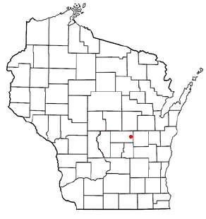
Poygan is a town in Winnebago County, Wisconsin, United States. The population was 1,301 at the 2010 census.

<span class="mw-page-title-main">Middle Village, Wisconsin</span> CDP in Wisconsin, United States

Middle Village is a census-designated place (CDP), in the towns of Menominee and Red Springs, in Menominee and Shawano counties in the U.S. state of Wisconsin. It does not have any legal status as an incorporated municipality. The population was 290 at the 2020 census.

<span class="mw-page-title-main">New London, Wisconsin</span> City in Wisconsin, United States

New London is a city in Outagamie and Waupaca counties Wisconsin, United States. Founded in 1851, the population was 7,295 at the 2010 census. Of this, 5,685 were in Waupaca County, and 1,640 were in Outagamie County.

<span class="mw-page-title-main">Menasha, Wisconsin</span> City in Wisconsin, United States

Menasha is a city in Calumet and Winnebago counties in the U.S. state of Wisconsin. The population was 18,268 at the 2020 census. Of this, 15,144 were in Winnebago County, and 2,209 were in Calumet County. The city is located mostly in Winnebago County; only a small portion is in Calumet County. Doty Island is located partially in Menasha, which it shares with Neenah. The city's name comes from the Winnebago word meaning "thorn" or "island". In the Menominee language, it is known as Menāēhsaeh, meaning "little island".

<span class="mw-page-title-main">Green Lake, Wisconsin</span> City in Wisconsin, United States

Green Lake is a city in and county seat of Green Lake County, Wisconsin, United States. The city had a population of 1,001 in the 2020 census. It is located on the north side of Green Lake. The Town of Green Lake is located on the south side of Big Green Lake, opposite the city.

<span class="mw-page-title-main">Mosinee, Wisconsin</span> City in Wisconsin, United States

Mosinee is a city in Marathon County, Wisconsin. It is part of the Wausau, Wisconsin Metropolitan Statistical Area. The population was 4,452 at the time of the 2020 census.

<span class="mw-page-title-main">Fremont, Wisconsin</span> Village in Wisconsin, United States

Fremont is a village in Waupaca County, Wisconsin, United States. It is surrounded by Town of Fremont. The population was 679 at the 2010 census. Fremont has been referred to as the "White Bass Capital of the World."

<span class="mw-page-title-main">Neenah, Wisconsin</span> Human settlement in Wisconsin, USA, since 1835

Neenah is a city in Winnebago County, Wisconsin, in the north central United States. It is situated on the banks of Lake Winnebago, Little Lake Butte des Morts, and the Fox River, approximately forty miles (64 km) southwest of Green Bay. Neenah's population was 27,319 at the 2020 census.
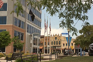
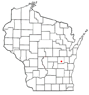
Winneconne is a town in Winnebago County, Wisconsin, United States. The population was 2,350 at the 2010 census. The Village of Winneconne is located within the town, on both sides of the Wolf River. The unincorporated community of Butte des Morts, named for a French and Native American trading war, is also located in the town. The town's water resources of rivers and lakes makes it a center of hunting and fishing, including winter ice fishing.

<span class="mw-page-title-main">Oshkosh (town), Wisconsin</span> Town in Wisconsin, United States

Oshkosh is a town in Winnebago County, Wisconsin, United States. The population was 2,475 at the 2010 census. It is a northern suburb of the larger City of Oshkosh which it is located adjacent to and partially within. The unincorporated communities of Nichols Shore Acres, Plummer Point, Shangri La Point, and Winnebago are located within the town.

<span class="mw-page-title-main">Wolf River (Fox River tributary)</span> Principal tributary of Fox River of Green Bay in eastern Wisconsin

The Wolf River is a 225 mi (362 km) long tributary of the Fox River in northeastern Wisconsin in the Great Lakes region of the United States. The river is one of the two National Scenic Rivers in Wisconsin, along with the St. Croix River. The scenic portion is 24 miles (39 km) long. The river and its parent the Fox River and associated lakes are known for their sturgeon which spawn every spring upstream on the lower river until blocked by the Shawano Dam. The river flows through mostly undeveloped forestland southerly from central Forest County in the north to Lake Poygan in the south. The lake is part of the Winnebago Pool of lakes fed by both the Fox and Wolf Rivers. The Fox-Wolf basin is usually considered to be a single unified basin and the rivers themselves may be referred to as the Fox-Wolf River system.

<span class="mw-page-title-main">Lake Poygan</span>

Lake Poygan, located in the U.S. state of Wisconsin near the village of Winneconne, is an expansive widening of the Wolf River totaling over 14,000 acres (57 km2). Lake Poygan is part of the Winnebago Pool or Wolf Chain, a series of interconnected lakes fed by both the Fox and Wolf rivers. The eastern third of the lake is often referred to as Lake Winneconne. In the Menominee language it is called Pawāhekaneh, "Wild Rice Threshing Lake", referring to the traditional importance of wild rice cultivation to the local economy.

References

  1. "2019 U.S. Gazetteer Files". United States Census Bureau. Retrieved August 7, 2020.
  2. 1 2 "US Board on Geographic Names". United States Geological Survey. October 25, 2007. Retrieved January 31, 2008.
  3. 1 2 "U.S. Census website". United States Census Bureau . Retrieved November 18, 2012.
  4. 1 2 "Population and Housing Unit Estimates". United States Census Bureau. May 24, 2020. Retrieved May 27, 2020.
  5. 1 2 "U.S. Census website". United States Census Bureau . Retrieved January 31, 2008.
  6. "Winneconne Pioneer", The Daily Northwestern (Oshkosh, Wisconsin), March 1, 1902
  7. "Winneconne Area -- History of the Area". winneconne.org. Retrieved April 25, 2015.
  8. History of Winneconne, Wisconsin Archived February 10, 2012, at the Wayback Machine , official village website
  9. "WIS 116 - Winneconne, Winnebago County", Wisconsin Dept. of Transportation
  10. 1 2 Bath, Dane (July 21, 1967). "Left Off Wisconsin Map, Town to 'Secede'". Chicago Tribune . p. 9. Retrieved March 25, 2020 via Newspapers.com. Lock-green.svg
  11. History of the Sovereign State of Winneconne.
  12. "US Gazetteer files: 2010, 2000, and 1990". United States Census Bureau. February 12, 2011. Retrieved April 23, 2011.
  13. "US Gazetteer files 2010". United States Census Bureau. Archived from the original on January 25, 2012. Retrieved November 18, 2012.
  14. "Census of Population and Housing". Census.gov. Retrieved June 4, 2015.