Utica, Winnebago County, Wisconsin

Last updated
Utica, Wisconsin
WIMap-doton-Utica b.png
Location of Utica, Winnebago County, Wisconsin
Coordinates: 43°56′44″N88°42′2″W / 43.94556°N 88.70056°W / 43.94556; -88.70056 Coordinates: 43°56′44″N88°42′2″W / 43.94556°N 88.70056°W / 43.94556; -88.70056
Country United States
State Wisconsin
County Winnebago
Area
  Total35.9 sq mi (92.9 km2)
  Land35.5 sq mi (92.0 km2)
  Water0.3 sq mi (0.8 km2)
Elevation
[1]
869 ft (265 m)
Population
 (2010)
  Total1,299
  Density37/sq mi (14.1/km2)
Time zone UTC-6 (Central (CST))
  Summer (DST) UTC-5 (CDT)
Area code(s) 920
FIPS code 55-82175 [2]
GNIS feature ID1584323 [1]
Website www.townofutica.org
Residence of J.H. Maxwell, 19th century. Residence of J.H. Maxwell, Utica, Winnebago County, Wisconsin, from 1880 book History of Winnebago County, Wisconsin, and early history of the Northwest.jpg
Residence of J.H. Maxwell, 19th century.

Utica (formerly Welaunee) is a town in Winnebago County, Wisconsin, United States. The population was 1,299 at the 2010 census. [3] The unincorporated communities of Elo, Fisk, and Pickett are located in the town.

Contents

History

The town's first European settlement was in 1846, the area then being part of the Town of Rushford, Wisconsin. Among the first known settlers were people named Leth, Harris, Armine Pickett, D. H. Nash, Lucius Hawley, E. B. Fish, J. M. Little and Hiram McKee. McKee, a Wesleyan Methodist was the first clergyman in town and held the first religious meeting. The first settlement was made on Liberty Prairie, in the central part of this township. (Liberty Prairie took its name from the attachment of many of the early settlers to the principles of the newly organized Liberty Party. On the Fourth of July 1846, the first season of the new settlement was celebrated by these pioneers in a grove, "with the doctrines of '76 declared as their political creed, an oration delivered by Rev. H. McKee, and the prairie christened with the imposing name of 'Liberty.'") Nearly the whole township was claimed within two years, and March 11, 1848 it was organized as a separate town under the name of Utica; the first town meeting was held at the house of Mr. Lucius Hawley, D. H. Nash was elected to the office of chairman of the board supervisors and Ely N. Hyde, town clerk. The town continued under the name of Utica until 1856, at which time it was changed to Welaunee.

As of 1856 there were two post offices in the town, Welaunee or Weelaunee [now Pickett] and Fisks Corners [now Fisk]. [4]

Geography

According to the United States Census Bureau, the town has a total area of 35.9 square miles (92.9 km2), of which 35.5 square miles (92.0 km2) is land and 0.31 square miles (0.8 km2), or 0.88%, is water. [3]

Economy

Utica Energy is an ethanol plant in Utica.

Demographics

In 1855 there were six schoolhouses with 276 students, and a total of 824 inhabitants. The population was principally composed of emigrants from the older states, with a large portion of Welsh.

As of the census [2] of 2000, there were 1,168 people, 453 households, and 353 families residing in the town. The population density was 32.6 people per square mile (12.6/km2). There were 469 housing units at an average density of 13.1 per square mile (5.1/km2). The racial makeup of the town was 99.23% White, 0.17% Native American, 0.17% Asian, 0.17% from other races, and 0.26% from two or more races.

There were 453 households, out of which 32.0% had children under the age of 18 living with them, 70.0% were married couples living together, 4.0% had a female householder with no husband present, and 21.9% were non-families. 18.1% of all households were made up of individuals, and 9.5% had someone living alone who was 65 years of age or older. The average household size was 2.58 and the average family size was 2.92.

In the town, the population was spread out, with 25.4% under the age of 18, 4.9% from 18 to 24, 28.9% from 25 to 44, 27.7% from 45 to 64, and 13.0% who were 65 years of age or older. The median age was 41 years. For every 100 females there were 106.7 males. For every 100 females age 18 and over, there were 98.0 males.

The median income for a household in the town was $49,800, and the median income for a family was $54,938. Males had a median income of $34,375 versus $23,409 for females. The per capita income for the town was $21,518. About 1.7% of families and 3.8% of the population were below the poverty line, including 4.8% of those under age 18 and 5.4% of those age 65 or over.

Notable people

Related Research Articles

Winnebago County, Wisconsin County in Wisconsin, United States

Winnebago County is a county in the U.S. state of Wisconsin. As of the 2020 census, the population was 171,730. Its county seat is Oshkosh. It was named for the historic Winnebago people, a federally recognized Native American tribe now known as the Ho-Chunk Nation. Chief Oshkosh was a leader in the area. Winnebago County comprises the Oshkosh-Neenah, WI Metropolitan Statistical Area, which is included in the Appleton-Oshkosh-Neenah, WI Combined Statistical Area.

Long Prairie, Minnesota County seat and city in Minnesota, United States

Long Prairie is a city in Todd County, Minnesota, United States. The population was 3,458 at the 2010 census. It is the county seat.

Deerfield, New York Town in New York, United States

Deerfield is a town in Oneida County, New York, United States. The population was 4,273 at the 2010 census.

Calumet, Wisconsin Town in Wisconsin, United States

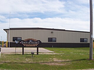
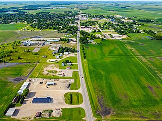
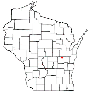
Calumet is a town in Fond du Lac County, Wisconsin, United States. The population was 1,514 at the 2000 census. The unincorporated communities of Artesia Beach, Calumet Harbor, Garnet, Highland Park, Johnsburg, Laudolff Beach, Marytown, Pipe, Pukwana Beach, Winnebago Heights, and Winnebago Park are located within the town. The unincorporated community of Calumetville is located partially in the town.

Koshkonong, Wisconsin Town in Wisconsin, United States

Koshkonong is a town in Jefferson County, Wisconsin, United States. The population was 3,692 at the 2010 census. The town entirely surrounds the city of Fort Atkinson. The unincorporated communities of Koshkonong Mounds and Vinnie Ha Ha are located in the town. The unincorporated communities of Blackhawk Island and Koshkonong is also located partially in the town.

Algoma, Winnebago County, Wisconsin Town in Wisconsin, United States

Algoma is a town in Winnebago County, Wisconsin, United States. The population was 6,822 at the 2010 census. The unincorporated communities of Highland Shore, Leonards Point, Melrose Park, and Oakwood are located in the town.

Black Wolf, Wisconsin Town in Wisconsin, United States

Black Wolf is a town in Winnebago County, Wisconsin, United States. The population was 2,410 at the 2010 census. The unincorporated communities of Black Wolf, Black Wolf Point, Decorah Beach, Little Point, Paukotuk, and Point Comfort are located in the town.

Clayton, Winnebago County, Wisconsin Town in Wisconsin, United States

Clayton is a town in Winnebago County, Wisconsin, United States. The population was 3,951 at the 2010 census. The unincorporated communities of Larsen, Medina Junction, and Mikesville are located within the town.

Menasha (town), Wisconsin Town in Wisconsin, United States

Menasha was a town in Winnebago County, Wisconsin, United States. The population was 18,498 at the 2010 census, making it the second most populous town in the state of Wisconsin at the time of its dissolution. The unincorporated community of Waverly Beach was located partially in the town. In an April 2016 referendum, the portion of the town west of Little Lake Butte des Morts voted to become the village of Fox Crossing. The remaining portions of the town were annexed to Fox Crossing on September 22, 2016, effectively ending the existence of the town.

Nepeuskun, Wisconsin Town in Wisconsin, United States

Nepeuskun, sometimes called Nepeuskin is a town in Winnebago County, Wisconsin, United States. The population was 710 at the 2010 census. The unincorporated communities of Koro and Rush Lake are located in the town.

Poygan, Wisconsin Town in Wisconsin, United States

Poygan is a town in Winnebago County, Wisconsin, United States. The population was 1,301 at the 2010 census.

Vinland, Wisconsin Town in Wisconsin, United States

Vinland is a town in Winnebago County, Wisconsin, United States. The population was 1,765 at the 2010 census. The unincorporated community of Allenville is located in the town.

Winchester, Winnebago County, Wisconsin Town in Wisconsin, United States

Winchester is a town in Winnebago County, Wisconsin, United States. The population was 1,763 at the 2010 census. The census-designated place of Winchester is located in the town. The unincorporated communities of Clarks Point, Indian Shores, Lasleys Point, and Piacenza are also located in the town.

Mazomanie, Wisconsin Village in Wisconsin, United States

Mazomanie is a village in Dane County, Wisconsin, United States. The population was 1,652 at the 2010 census. The village is located within the Town of Mazomanie. It is part of the Madison Metropolitan Statistical Area.

Fox Lake, Wisconsin City in Wisconsin, United States

Fox Lake is a city in Dodge County, Wisconsin, United States. The population was 1,519 at the 2010 census. The city is located within the Town of Fox Lake.

Clinton (town), Rock County, Wisconsin Town in Wisconsin, United States

Clinton is a town in Rock County in the U.S. state of Wisconsin. The population was 2,190 at the 2000 census. The Village of Clinton and the unincorporated community of Bergen are located in the town.

Star Prairie is a town in St. Croix County, Wisconsin, United States. The population was 2,944 at the 2000 census. The Village of Star Prairie is located on the eastern boundary of the town. The unincorporated communities of Huntington and Johannesburg are located in the town.

Omro (town), Wisconsin Town in Wisconsin, United States

Omro is a town in Winnebago County, Wisconsin, United States. The population was 2,116 at the 2010 census. The City of Omro is located within the town. The unincorporated communities of Harbor Springs, Reighmoor, Rivermoor, and Zion are located in the town.

Omro, Wisconsin City in Wisconsin, United States

Omro is a city in Winnebago County, Wisconsin, United States. The population was 3,517 at the 2010 census. The city is located along the Fox River, approximately 10 miles west of Oshkosh, Wisconsin.

Oshkosh (town), Wisconsin Town in Wisconsin, United States

Oshkosh is a town in Winnebago County, Wisconsin, United States. The population was 2,475 at the 2010 census. The City of Oshkosh is located adjacent to and partially within the town. The unincorporated communities of Fairview Beach, Nichols Shore Acres, Plummer Point, Shangri La Point, and Winnebago are located within the town.

References

  1. 1 2 U.S. Geological Survey Geographic Names Information System: Utica, Winnebago County, Wisconsin
  2. 1 2 "U.S. Census website". United States Census Bureau . Retrieved 2008-01-31.
  3. 1 2 "Geographic Identifiers: 2010 Demographic Profile Data (G001): Utica town, Winnebago County, Wisconsin". U.S. Census Bureau, American Factfinder. Archived from the original on February 12, 2020. Retrieved January 31, 2013.
  4. Mitchel, Martin and Osborn, Joseph H. Geographical and statistical history of the county of Winnebago ... to which is prefixed a general view of the state of Wisconsin, together with a census table from its first settlement to the present time. Oskosh: Mitchel and Smith, 1856; pp. 110-111
  5. THE BLUE BOOK OF THE STATE OF WISCONSIN. 1881. p. 527.
  6. 'Wisconsin Blue Book 1875,' Biographical Sketch of Frank A. Leach, pg. 338
  7. 'Wisconsin Blue Book 1901,' Biographical Sketch of Henry Irwin Weed,' pg. 734-735