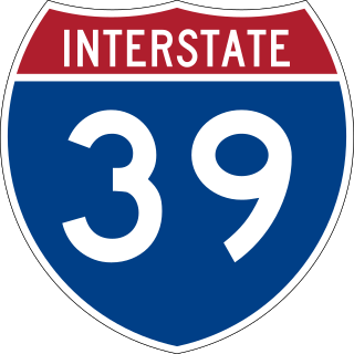
Interstate 39 (I-39) is a highway in the Midwestern United States. I-39 runs from Normal, Illinois, at I-55 to State Trunk Highway 29 (WIS 29) in the town of Rib Mountain, Wisconsin, which is approximately six miles (9.7 km) south of Wausau. I-39 was designed to replace U.S. Route 51 (US 51), which, in the early 1980s, was one of the busiest two-lane highways in the United States. I-39 was built in the 1980s and 1990s.

Interstate 94 (I-94) is an east–west Interstate Highway connecting the Great Lakes and northern Great Plains regions of the United States. Its western terminus is just east of Billings, Montana, at a junction with I-90; its eastern terminus is in Port Huron, Michigan, where it meets with I-69 and crosses the Blue Water Bridge into Sarnia, Ontario, Canada, where the route becomes Ontario Highway 402. It thus lies along the primary overland route from Seattle to Toronto and is the only east–west Interstate Highway to have a direct connection to Canada.

Interstate 43 (I-43) is a 191.55-mile-long (308.27 km) Interstate Highway located entirely within the US state of Wisconsin, connecting I-39/I-90 in Beloit with Milwaukee and I-41, U.S. Highway 41 (US 41) and US 141 in Green Bay. State Trunk Highway 32 (WIS 32) runs concurrently with I-43 in two sections and I-94, I-894, US 10, US 41, US 45, and WIS 57 overlap I-43 once each. There are no auxiliary or business routes connected to I-43, though an alternate route to direct traffic during road closures is signed along local and state highways from Milwaukee County north into Brown County.

U.S. Highway 151 (US 151) is a United States Numbered Highway that runs through the states of Iowa and Wisconsin. The southern terminus for US 151 is at a junction with Interstate 80 (I-80) in Iowa County, Iowa, and its northern terminus is at Manitowoc, Wisconsin. The route, from south to north follows a northeasterly path through the two states.

U.S. Route 51 or U.S. Highway 51 is a major south–north United States highway that extends 1,277 miles (2,055 km) from the western suburbs of New Orleans, Louisiana, to within 150 feet (46 m) of the Wisconsin–Michigan state line. As most of the United States Numbered Highways ending with "1", it is a cross-country north–south route extending from the Gulf Coast region to the Great Lakes region. Much of the highway in northern Illinois and southern Wisconsin runs parallel to or is cosigned with Interstate 39 (I-39) and much of the route in several states also parallels the Illinois Central Railroad. From LaPlace, Louisiana, Mississippi, to Memphis, Tennessee, much of that portion of US 51 runs largely parallel or is concurrent with Interstate 55 (I-55). The highway's northern terminus is between Hurley, Wisconsin, and Ironwood, Michigan, where it ends with a roundabout at US 2. Its southern terminus is in Laplace, Louisiana, ending at US 61. US 51 is routed through the states of Louisiana, Mississippi, Tennessee, Kentucky, Illinois, and Wisconsin.
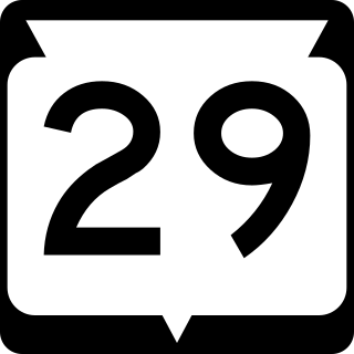
State Trunk Highway 29 is a state highway running east–west across central Wisconsin. It is a major east–west corridor connecting the Twin Cities and the Chippewa Valley with Wausau and Green Bay. A multi-year project to convert the corridor to a four-lane freeway or expressway from Elk Mound to Green Bay was completed in 2005. The remainder of WIS 29 is two-lane surface road or urban multi-lane road.
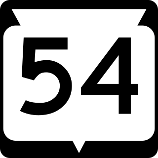
State Trunk Highway 54 is a Wisconsin state highway running east–west across central Wisconsin. It is 243.12 miles (391.26 km) in length.

State Trunk Highway 33 is a Wisconsin state highway running east–west across central Wisconsin. It is 200.84 miles (323.22 km) in length.

State Trunk Highway 16 is a Wisconsin state highway running from Pewaukee across the state to La Crosse. Much of its route in the state parallels the former mainline of the Milwaukee Road and current mainline of the Canadian Pacific Railway. Interstate 90 (I-90) or I-94 parallels Highway 16 for most of its length in the state. It serves local traffic in nearby cities including La Crosse, Tomah, Wisconsin Dells, Portage, Columbus, Watertown, Oconomowoc and Waukesha. The highway is mainly two-lane surface road or urban multi-lane expressway from La Crosse to Oconomowoc, and it is a freeway east of Oconomowoc.

State Trunk Highway 11 is a state highway running east–west across southern Wisconsin. The highway connects Dubuque, Iowa with the cities of Janesville, Racine and Elkhorn. Most of the route is two-lane road with the exception of an expressway bypass of Monroe, a multilane bypass of Janesville, a section where it is concurrent with I-39 and I-90, a combined freeway/divided highway bypass of Burlington to the south, where it is partially concurrent with WI 36 and WI 83, and urban multilane highway in the greater Racine area.

State Trunk Highway 13 is a state highway running north–south across northwest and central Wisconsin. WIS 13 serves as a major north–south route connecting the communities of Wisconsin Dells, Wisconsin Rapids, Marshfield and Ashland. WIS 13 is part of the Lake Superior Circle Tour from its northern/western terminus to Ashland at is eastern junction with U.S. Highway 2 (US 2). The road also provides access to the Apostle Islands National Lakeshore off the Lake Superior shoreline at Bayfield. The highway is two-lane surface road with the exception of various urban multilane road sections.

U.S. Highway 10 (US 10) in Wisconsin runs east–west across the central part of the state. It runs from the Prescott Drawbridge over the St. Croix River at Prescott east to the dock in Manitowoc where SS Badger crosses Lake Michigan to Ludington, Michigan. The highway is also designated as the Vietnam War Veterans Memorial Highway for its entire length.

State Trunk Highway 26 is a state highway in the U.S. state of Wisconsin. The route is partially a divided highway with a few freeway bypass sections for roughly 50 miles (80 km). The remaining sections of WIS 26 are a two-lane road. WIS 26 provides direct access from Janesville to Oshkosh via Fort Atkinson, Watertown, and Waupun.

State Trunk Highway 60, often called Highway 60, STH-60 or WIS 60, is a state highway in the U.S. state of Wisconsin. It runs east–west in southern Wisconsin from Prairie du Chien on the Mississippi River at the Iowa state line to the village of Grafton near Lake Michigan.
U.S. Highway 51 (US 51) in the U.S. state of Wisconsin runs north–south through the central part of the state. It enters from Illinois at Beloit, and runs north to its northern terminus in Hurley at a roundabout junction with US 2. Some of the route of US 51 runs concurrently with Interstate 39 (I-39).

U.S. Highway 12 in the U.S. state of Wisconsin runs east–west across the western to southeast portions of the state. It enters from Minnesota running concurrently with Interstate 94 (I-94) at Hudson, parallels the Interstate to Wisconsin Dells, and provides local access to cities such as Menomonie, Eau Claire, Black River Falls, Tomah, and Mauston. It then provides an alternative route for traffic between northwestern Wisconsin and Madison and is the anchor route for the Beltline Highway around Madison. Finally, it serves southeastern Wisconsin, connecting Madison with Fort Atkinson, Whitewater, Elkhorn, and Lake Geneva. The West Beltline Highway and the segment between Elkhorn and Genoa City are freeways, and the segment between Sauk City and Middleton is an expressway. The remainder of the road is a two-lane surface road or an urban multilane arterial. Between Hudson and west of Warrens, the road closely parallels the former main line of the Chicago, St. Paul, Minneapolis and Omaha Railway, now operated by Union Pacific Railroad.

U.S. Highway 41 (US 41) is a north–south highway United States Numbered Highway in eastern Wisconsin. It runs from Pleasant Prairie on the Illinois border north to Marinette on the Michigan border. Most of the route is concurrent with Interstate 41 in the state, with the exception of the portion between Howard, a suburb of Green Bay, and Marinette.

U.S. Highway 45 runs north–south through the eastern and northern portions of the state of Wisconsin. Also called Highway 45, it runs from the state line with Illinois near the village of Bristol in Kenosha County to the Michigan state line at the town of Land O' Lakes in Vilas County, a total of about 305 miles (491 km).
Interstate 94 (I-94) runs east–west through the western, central, and southeastern portions of the US state of Wisconsin. A total of 348.23 miles (560.42 km) of I-94 lie in the state.

Interstate 90 (I-90) runs east–west through the western, central and southern portions of the U.S. state of Wisconsin. About 187 miles (301 km) of I-90 lie in the state.

