Sauk City, Wisconsin

Last updated

Sauk City, Wisconsin
Sauk County Wisconsin Incorporated and Unincorporated areas Sauk City Highlighted.svg
Location of Sauk City in Sauk County, Wisconsin.
Coordinates: 43°16′27″N89°43′42″W / 43.27417°N 89.72833°W / 43.27417; -89.72833
Country Flag of the United States.svg  United States
State Flag of Wisconsin.svg  Wisconsin
County Sauk
Area
[1]
  Total1.76 sq mi (4.57 km2)
  Land1.54 sq mi (3.99 km2)
  Water0.22 sq mi (0.58 km2)
Elevation
[2]
741 ft (226 m)
Population
 (2020) [3]
  Total3,518
  Density2,261.52/sq mi (873.22/km2)
Time zone UTC-6 (Central (CST))
  Summer (DST) UTC-5 (CDT)
Area code 608
FIPS code 55-71650 [4]
GNIS feature ID1573732 [2]
Website http://www.saukcity.net

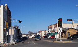
Sauk City is a village in Sauk County, Wisconsin, United States. The population was 3,518 as of the 2020 census. The first incorporated village in the state, [5] the community was founded by Agoston Haraszthy and his business partner, Robert Bryant.

Contents

History

Historical marker. Sauk City historical marker.jpg
Historical marker.

Impressed by the beautiful scenery, Agoston Haraszthy, a charismatic Hungarian sometimes called "Count" Haraszthy, purchased a small plot of land along the Wisconsin River in 1840. Later, with his English-born business partner, Robert Bryant, Haraszthy bought additional land and founded the town of Haraszthy (originally called Széptáj, Hungarian for "beautiful place"). [6]

In 1849, the name of the town was changed to Westfield. Three years later, in 1852, it was changed again, this time to the current name of Sauk City. The community was incorporated as a village in 1854, making Sauk City the oldest incorporated village in the state. [7]

In 1852, German immigrants founded the Sauk City Free Congregation ( Freie Gemeinde ). This group, a liberal religious society, celebrated German music, literature, and culture. It met in a private home until 1884, when Park Hall was built as a meeting house. The building is now home to the Sauk County Free Congregation, a Unitarian Universalist fellowship.[ citation needed ]

In the Harper's Weekly magazine of November 21, 1914, Sauk City was named "America's Foremost City". The article cited a pageant, attended by 4000 people, which enacted scenes from the village's history, and concluded with the naming of the school principal as the Civic Secretary, charged with making the school the center of the life of the town. To that end, the ballot box was transferred from the town hall to the school house.[ citation needed ]

Geography

Sauk City is located at 43°16′27″N89°43′42″W / 43.27417°N 89.72833°W / 43.27417; -89.72833 (43.274130, -89.728310). [8] It is on U.S. Route 12, approximately 18 miles (29 km) northwest of suburban Madison.[ citation needed ]

According to the United States Census Bureau, the village has a total area of 1.76 square miles (4.56 km2), of which 1.54 square miles (3.99 km2) is land and 0.22 square miles (0.57 km2) is water. [9]

Demographics

Historical population
CensusPop.Note
1880 917
1890 876−4.5%
1900 810−7.5%
1910 8677.0%
1920 1,16234.0%
1930 1,137−2.2%
1940 1,32516.5%
1950 1,75532.5%
1960 2,09519.4%
1970 2,38513.8%
1980 2,70313.3%
1990 3,01911.7%
2000 3,1093.0%
2010 3,4109.7%
2020 3,5183.2%
U.S. Decennial Census [10]

2020 census

As of the census of 2020, [11] the population was 3,518. The population density was 2,282.9 inhabitants per square mile (881.4/km2). There were 1,572 housing units at an average density of 1,020.1 per square mile (393.9/km2). The racial makeup of the village was 89.3% White, 0.5% Black or African American, 0.5% Asian, 0.4% Native American, 3.3% from other races, and 6.0% from two or more races. Ethnically, the population was 6.2% Hispanic or Latino of any race. [12]

2010 census

As of the census [3] of 2010, there were 3,410 people, 1,431 households, and 871 families living in the village. The population density was 2,243.4 inhabitants per square mile (866.2/km2). There were 1,508 housing units at an average density of 992.1 per square mile (383.1/km2). The racial makeup of the village was 94.6% White, 0.2% African American, 0.9% Native American, 0.4% Asian, 2.8% from other races, and 1.1% from two or more races. Hispanic or Latino of any race were 5.0% of the population.[ citation needed ]

Out of a total of 1,431 households, 31.7% had children under the age of 18 living with them, 45.2% were married couples living together, 10.2% had a female householder with no husband present, 5.5% had a male householder with no wife present, and 39.1% were non-families. 32.8% of all households were made up of individuals, and 13.8% had someone living alone who was 65 years of age or older. The average household size was 2.30 and the average family size was 2.93.[ citation needed ]

The median age in the village was 39.3 years. 23.8% of residents were under the age of 18; 7% were between the ages of 18 and 24; 27.2% were from 25 to 44; 24.9% were from 45 to 64; and 17.2% were 65 years of age or older. The gender makeup of the village was 47.2% male and 52.8% female.[ citation needed ]

2000 census

As of the census [4] of 2000, there were 3,109 residents, 1,285 households, and 796 families living in the village. The population density was 2,078.0 people per square mile (800.3/km2). There were 1,314 housing units at an average density of 878.3 per square mile (338.2/km2). The racial makeup of the village was 97.01% White, 0.39% African American, 0.23% Native American, 0.19% Asian, 1.45% from other races, and 0.74% from two or more races. Hispanic or Latino of any race were 3.76% of the population.[ citation needed ]

Out of a total of 1,285 households, 30.8% had children under the age of 18 living with them, 49.8% were married couples living together, 8.7% had a female householder with no husband present, and 38.0% were non-families. 32.5% of all households were made up of individuals, and 14.6% had someone living alone who was 65 years of age or older. The average household size was 2.33 and the average family size was 2.99.[ citation needed ]

In the village, the population was spread out, with 24.2% under the age of 18, 7.5% from 18 to 24, 29.9% from 25 to 44, 19.2% from 45 to 64, and 19.3% who were 65 years of age or older. The median age was 38 years. For every 100 females, there were 92.4 males. For every 100 females age 18 and over, there were 87.3 males.[ citation needed ]

The median income for a household in the village was $36,378, and the median income for a family was $45,156. Males had a median income of $29,908 versus $22,996 for females. The per capita income for the village was $17,705. About 10.0% of families and 12.5% of the population were below the poverty line, including 18.4% of those under age 18 and 17.6% of those age 65 or over.[ citation needed ]

Economy

Original Culver's Location.jpg
Original Culver's Location Monument.jpg
Original Culver's location (not original building) and monument on Phillips Boulevard.

Sauk City is the site of the first Culver's restaurant, which opened July 18, 1984. Culver's corporate headquarters are located in neighboring Prairie du Sac.[ citation needed ]

In 1939, Arkham House, a firm devoted to preserving in print the work of H. P. Lovecraft and other dark fantasists, was founded by August Derleth and Donald Wandrei in Sauk City, where the firm continues to be headquartered.[ citation needed ]

Cuca Records was founded by James Kirchstein in 1959 and was located on Water Street next to Kirchstein's Super Market (founded by James's father, Frank Kirchstein, which was in business from the 1930s to 1982 and featured polka music on 8-track tapes in the store). Cuca Records produced records until the early 1970s, including polka, folk, and jazz.[ citation needed ]

Sauk City is also where Jacob Leinenkugel [ who? ] of the Leinenkugel Brewing Company was[ when? ] born and raised.[ citation needed ]

Other information

Sauk City is adjacent to Prairie du Sac, located directly to the north. Both communities are located on the west bank of the Wisconsin River. They share a municipal boundary, as well as a school system, police department, and hospital, but have separate fire departments and libraries. The Sauk City Fire Department is the oldest organized volunteer department in the state of Wisconsin, having been founded in 1854. Efforts have been made to join the two villages into a single entity, Sauk Prairie, but these have failed because of tax differences between the communities.[ citation needed ]

Sauk Prairie High School, located in Prairie du Sac, serves the villages of Sauk City and Prairie du Sac. The school's mascot is the eagle, so named because of the population of eagles found on the Wisconsin River adjacent to Sauk Prairie.[ citation needed ]

Notable people

Images

Buildings and structures

See also

Related Research Articles

<span class="mw-page-title-main">Sauk County, Wisconsin</span> County in Wisconsin, United States

Sauk County is a county in Wisconsin. It is named after a large village of the Sauk people. As of the 2020 census, the population was 65,763. Its county seat and largest city is Baraboo. The county was created in 1840 from Wisconsin Territory and organized in 1844. Sauk County comprises the Baraboo, WI Micropolitan Statistical Area and is included in the Madison metropolitan area.

<span class="mw-page-title-main">Richland County, Wisconsin</span> County in Wisconsin, United States

Richland County is a county in the U.S. state of Wisconsin. As of the 2020 census, the population was 17,304. Its county seat is Richland Center. The county was created from the Wisconsin Territory in 1842 and organized in 1850. It is named for the high quality of its soil.

<span class="mw-page-title-main">Lynwood, Illinois</span> Village in Illinois, United States

Lynwood is a village in Cook County, Illinois, United States and a suburb of Chicago. The population was 9,116 at the 2020 census.

<span class="mw-page-title-main">Prairie Village, Kansas</span> City in Kansas, United States

Prairie Village is a city in Johnson County, Kansas, United States, and located within the Kansas City Metropolitan Area. As of the 2020 census, the population of the city was 22,957.

<span class="mw-page-title-main">Sauk Centre, Minnesota</span> City in Minnesota, United States

Sauk Centre is a city in Stearns County, Minnesota, United States. The population was 4,555 at the 2020 census. Sauk Centre is part of the St. Cloud Metropolitan Statistical Area.

<span class="mw-page-title-main">Roxbury, Wisconsin</span> Town in Wisconsin, United States

The Town of Roxbury is located in Dane County, Wisconsin, United States. The population was 1,871 at the 2020 census. The unincorporated communities of Alden Corners and Roxbury are located in the town. The unincorporated community of Lutheran Hill is also located partially in the town.

<span class="mw-page-title-main">Honey Creek, Sauk County, Wisconsin</span> Town in Wisconsin, United States

Honey Creek is a town in Sauk County, Wisconsin, United States. The town took its name from the nearby stream of the same name. The population was 749 at the 2020 census. The unincorporated communities of Denzer and Leland are located in the town.

<span class="mw-page-title-main">Lake Delton, Wisconsin</span> Village in Wisconsin, United States

Lake Delton is a village located on the Wisconsin River in Sauk County, Wisconsin, United States. The population was 3,501 at the 2020 census. Lake Delton, along with the nearby Wisconsin Dells, is a resort area and a center for tourism in the upper Midwest. Lake Delton is included in the Baraboo Micropolitan Area which comprises part of the larger Madison Combined Statistical Area.

<span class="mw-page-title-main">North Freedom, Wisconsin</span> Village in Wisconsin, United States

North Freedom is a village along the Baraboo River in Sauk County, Wisconsin, United States. Population was 701 as reported by the 2010 census.

<span class="mw-page-title-main">Plain, Wisconsin</span> Village in Wisconsin, United States

Plain is a village in Sauk County, Wisconsin, United States. The population was 773 at the 2010 census.

<span class="mw-page-title-main">West Baraboo, Wisconsin</span> Village in Wisconsin, United States

West Baraboo is a village along the Baraboo River in Sauk County, Wisconsin, United States. The population was 1,627 at the 2020 census. It is part of the Baraboo micropolitan statistical area.

<span class="mw-page-title-main">Cazenovia, Wisconsin</span> Village in Wisconsin, United States

Cazenovia is a village in Richland and Sauk Counties in the U.S. state of Wisconsin. The population was 318 at the 2010 census. Of this, 314 were in Richland County, and only 4 were in Sauk County.

<span class="mw-page-title-main">Lodi, Wisconsin</span> City in Wisconsin, United States

Lodi is a city in Columbia County, Wisconsin, United States. The population was 3,189 at the 2020 census. Lodi is part of the Madison Metropolitan Statistical Area.

<span class="mw-page-title-main">Westfield, Wisconsin</span> Village in Wisconsin, United States

Westfield is a village in Marquette County, Wisconsin, United States. The population was 1,254 at the 2010 census. The village is located mostly within the Town of Westfield. A small portion extends east into the adjacent Town of Harris. The Marquette County fairgrounds is located within the village limits on the south side.

<span class="mw-page-title-main">Baraboo, Wisconsin</span> City in Wisconsin, United States

Baraboo is the largest city in and the county seat of Sauk County, Wisconsin, United States. The largest city in the county, Baraboo is the principal city of the Baraboo Micropolitan Statistical Area which comprises a portion of the Madison Combined Statistical area. Its 2020 population was 12,556. It is situated on the Baraboo River.

<span class="mw-page-title-main">La Valle, Wisconsin</span> Village in Wisconsin, United States

La Valle is a village in Sauk County, Wisconsin, United States, along the Baraboo River. The population was 367 at the 2010 census. The village is located within the Town of La Valle.

<span class="mw-page-title-main">Merrimac, Wisconsin</span> Village in Wisconsin, United States

Merrimac is a village in Sauk County, Wisconsin, United States, northwest of Madison. The population was 420 at the 2010 census. The village is located within the Town of Merrimac.

The Town of Prairie du Sac is located in southwestern Sauk County, Wisconsin, United States. The population was 1,138 at the 2000 census. The Village of Prairie du Sac is located within the town. The unincorporated community of Loddes Mill is also located in the town.

<span class="mw-page-title-main">Prairie du Sac, Wisconsin</span> Village in Wisconsin, United States

Prairie du Sac is a village in Sauk County, Wisconsin, United States. The population was 4,420 at the 2020 census. The village is surrounded by the Town of Prairie du Sac, the Wisconsin River, and the village of Sauk City; together, Prairie du Sac and Sauk City are referred to as Sauk Prairie.

The Town of Spring Green is located in Sauk County, Wisconsin, United States. The January 1, 2021 final population estimate for the town is 1,728. Approximately 1,374 of the estimated population for the Town of Spring Green in Sauk County are of voting age.

References

  1. "2019 U.S. Gazetteer Files". United States Census Bureau. Retrieved August 7, 2020.
  2. 1 2 "US Board on Geographic Names". United States Geological Survey. October 25, 2007. Retrieved January 31, 2008.
  3. 1 2 "U.S. Census website". United States Census Bureau . Retrieved November 18, 2012.
  4. 1 2 "U.S. Census website". United States Census Bureau . Retrieved January 31, 2008.
  5. 2003 Wisconsin Senate Joint Resolution 51
  6. Cole, Harry Ellsworth (1918). A Standard History of Sauk County, Wisconsin: Volume I. Lewis Publishing Co.
  7. State of Wisconsin Legislature (2003). "Senate Joint Resolution 51" (PDF).
  8. "US Gazetteer files: 2010, 2000, and 1990". United States Census Bureau. February 12, 2011. Retrieved April 23, 2011.
  9. "2020 Gazetteer Files". census.gov. U.S. Census Bureau. Retrieved July 28, 2022.
  10. "Census of Population and Housing". Census.gov. Retrieved June 4, 2015.
  11. "2020 Decennial Census: Sauk City village, Wisconsin". data.census.gov. U.S. Census Bureau. Retrieved July 28, 2022.
  12. "QuickFacts Sauk County, Wisconsin". census.gov. U.S. Census Bureau. Retrieved July 20, 2023.