Loganville, Wisconsin

Last updated
Loganville, Wisconsin
DowntownLoganville.JPG
Downtown Loganville
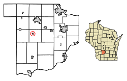
Sauk County Wisconsin Incorporated and Unincorporated areas Loganville Highlighted.svg
Location of Loganville in Sauk County, Wisconsin.
Coordinates: 43°26′23″N90°2′14″W / 43.43972°N 90.03722°W / 43.43972; -90.03722 Coordinates: 43°26′23″N90°2′14″W / 43.43972°N 90.03722°W / 43.43972; -90.03722
Country Flag of the United States.svg  United States
State Flag of Wisconsin.svg  Wisconsin
County Sauk
Area
[1]
  Total0.27 sq mi (0.70 km2)
  Land0.27 sq mi (0.69 km2)
  Water0.01 sq mi (0.01 km2)
Elevation
[2]
935 ft (285 m)
Population
 (2010) [3]
  Total300
  Estimate 
(2019) [4]
298
  Density1,124.53/sq mi (434.99/km2)
Time zone UTC-6 (Central (CST))
  Summer (DST) UTC-5 (CDT)
Area code(s) 608
FIPS code 55-45400 [5]
GNIS feature ID1568495 [2]

Loganville is a village in Sauk County, Wisconsin, United States. The population was 300 at the 2010 census. The village was named for Chauncey P. Logan who built the first house in 1853. [6]

Contents

Geography

Loganville is located at 43°26′23″N90°2′14″W / 43.43972°N 90.03722°W / 43.43972; -90.03722 (43.439816, -90.037094). [7]

According to the United States Census Bureau, the village has a total area of 0.26 square miles (0.67 km2), of which, 0.25 square miles (0.65 km2) of it is land and 0.01 square miles (0.03 km2) is water. [8]

Demographics

Historical population
CensusPop.
1920 265
1930 228−14.0%
1940 2363.5%
1950 2505.9%
1960 220−12.0%
1970 199−9.5%
1980 23920.1%
1990 228−4.6%
2000 27621.1%
2010 3008.7%
Est. 2019298 [4] −0.7%
U.S. Decennial Census [9]

2010 census

As of the census [3] of 2010, there were 300 people, 126 households, and 82 families living in the village. The population density was 1,200.0 inhabitants per square mile (463.3/km2). There were 139 housing units at an average density of 556.0 per square mile (214.7/km2). The racial makeup of the village was 98.0% White, 0.3% African American, 0.3% Native American, 0.3% Pacific Islander, 0.3% from other races, and 0.7% from two or more races. Hispanic or Latino of any race were 1.3% of the population.

There were 126 households, of which 32.5% had children under the age of 18 living with them, 46.8% were married couples living together, 14.3% had a female householder with no husband present, 4.0% had a male householder with no wife present, and 34.9% were non-families. 27.0% of all households were made up of individuals, and 12.7% had someone living alone who was 65 years of age or older. The average household size was 2.38 and the average family size was 2.87.

The median age in the village was 37.9 years. 24.3% of residents were under the age of 18; 8.9% were between the ages of 18 and 24; 27.4% were from 25 to 44; 26.1% were from 45 to 64; and 13.3% were 65 years of age or older. The gender makeup of the village was 48.0% male and 52.0% female.

2000 census

As of the census [5] of 2000, there were 276 people, 119 households, and 81 families living in the village. The population density was 1,408.2 people per square mile (532.8/km2). There were 130 housing units at an average density of 663.3 per square mile (251.0/km2). The racial makeup of the village was 100.00% White. Hispanic or Latino of any race were 0.36% of the population.

There were 119 households, out of which 33.6% had children under the age of 18 living with them, 52.1% were married couples living together, 10.9% had a female householder with no husband present, and 31.9% were non-families. 28.6% of all households were made up of individuals, and 11.8% had someone living alone who was 65 years of age or older. The average household size was 2.32 and the average family size was 2.85.

In the village, the population was spread out, with 24.6% under the age of 18, 7.2% from 18 to 24, 34.8% from 25 to 44, 21.7% from 45 to 64, and 11.6% who were 65 years of age or older. The median age was 36 years. For every 100 females, there were 95.7 males. For every 100 females age 18 and over, there were 92.6 males.

The median income for a household in the village was $34,688, and the median income for a family was $38,250. Males had a median income of $28,750 versus $20,000 for females. The per capita income for the village was $15,737. About 5.6% of families and 7.9% of the population were below the poverty line, including 11.1% of those under the age of eighteen and 16.7% of those 65 or over.

Education

Loganville is served by the School District of Reedsburg, which has 4 elementary schools, 1 intermediate school, 1 middle school, and 1 high school. Loganville Elementary School is the only school located in Loganville.

Notable people

Images

Related Research Articles

Blue River, Colorado Statutory Town in State of Colorado, United States

The Town of Blue River is a Statutory Town in Summit County, Colorado, United States. The town population was 849 at the 2010 United States Census.

Ocean City, Florida CDP in Florida, United States

Ocean City is a census-designated place (CDP) in Okaloosa County, Florida, United States. The population was 5,594 at the 2000 census. It is part of the Fort Walton Beach–Crestview–Destin Metropolitan Statistical Area.

Cooper, Maine Town in Maine, United States

Cooper is a town in Washington County, Maine, United States. The community was named after General John Cooper, a landowner. The population was 154 at the 2010 census.

Nassau, Minnesota City in Minnesota, United States

Nassau is a city in Lac qui Parle County, Minnesota, United States. The population was 72 at the 2010 census.

Ralston, Nebraska City in Nebraska, United States

Ralston is a city in Douglas County, Nebraska, United States. The population was 5,943 at the 2010 census. Ralston is surrounded on three sides by the city of Omaha, and by Sarpy County on the south side.

Boardman, North Carolina Town in North Carolina, United States

Boardman is a town in Columbus County, North Carolina, United States. The population was 157 at the 2010 census.

Old Washington, Ohio Village in Ohio, United States

Old Washington is a village in Guernsey County, Ohio, United States. The population was 279 at the 2010 census.

Reading Township, Adams County, Pennsylvania Township in Pennsylvania, United States

Reading Township is a township in Adams County, Pennsylvania, United States. The population was 5,780 at the 2010 census.

Loganville, Pennsylvania Borough in Pennsylvania, United States

Loganville, founded in 1820 and named after Colonel Henry Logan, is a borough in York County, Pennsylvania, United States. The population was 1,240 at the 2010 census.

Summit, South Dakota Town in South Dakota, United States

Summit is a town in Roberts County, South Dakota, United States. The population was 288 at the 2010 census.

Poplar, Wisconsin Village in Wisconsin, United States

Poplar is a village in Douglas County, Wisconsin, United States. The population was 603 at the 2010 census.

Bagley, Wisconsin Village in Wisconsin, United States

Bagley is a village in Grant County in the U.S. state of Wisconsin located on the Upper Mississippi River about 9 miles (15 km) south of Prairie du Chien, Wisconsin. The population was 379 at the 2010 census. It is a popular riverside destination in the summer, when the population can quadruple. The village was named for Vermont natives Alfred and Mary Bagley, who owned the site.

Frederic, Wisconsin Village in Wisconsin, United States

Frederic is a village in Polk County, Wisconsin, United States. The population was 1,137 at the 2010 census.

Glenbeulah, Wisconsin Village in Wisconsin, United States

Glenbeulah is a village in Sheboygan County, Wisconsin, United States. The population was 463 at the 2010 census. It is included in the Sheboygan, Wisconsin Metropolitan Statistical Area. Glenbeulah is situated on the Mullet River.

Okauchee Lake, Wisconsin CDP in Wisconsin, United States

Okauchee Lake is a census-designated place (CDP) in Waukesha County, Wisconsin, United States. The population was 4,422 at the 2010 census. Okauchee Lake is located in the town of Oconomowoc.

Arlington, Wisconsin Village in Wisconsin, United States

Arlington is a village in Columbia County, Wisconsin, United States. The population was 819 at the 2010 census. The village is located within the Town of Arlington. It is part of the Madison Metropolitan Statistical Area.

Wyocena, Wisconsin Village in Wisconsin, United States

Wyocena is a village in Columbia County, Wisconsin, United States. The population was 768 at the 2010 census. The village is located within the Town of Wyocena. It is part of the Madison Metropolitan Statistical Area.

Pepin, Wisconsin Village in Wisconsin, United States

Pepin is a village in Pepin County, Wisconsin, United States. The population was 837 at the 2010 census. The village is located within the Town of Pepin.

Clayton (village), Wisconsin Village in Wisconsin, United States

Clayton is a village in Polk County, Wisconsin, United States. The population was 571 at the 2010 census. The village is located within the Town of Clayton.

Plainfield, Wisconsin Village in Wisconsin, United States

Plainfield is a village in Waushara County, Wisconsin, United States. The village is located almost entirely within the Town of Plainfield. A tiny portion extends into adjacent Town of Oasis. The population was 897 at the 2010 census.

References

  1. "2019 U.S. Gazetteer Files". United States Census Bureau. Retrieved August 7, 2020.
  2. 1 2 "US Board on Geographic Names". United States Geological Survey. 2007-10-25. Retrieved 2008-01-31.
  3. 1 2 "U.S. Census website". United States Census Bureau . Retrieved 2012-11-18.
  4. 1 2 "Population and Housing Unit Estimates". United States Census Bureau. May 24, 2020. Retrieved May 27, 2020.
  5. 1 2 "U.S. Census website". United States Census Bureau . Retrieved 2008-01-31.
  6. Gard, Robert E.; Sorden, L. G. The Romance of Wisconsin Place Names (1st ed.). New York, NY: October House. p. 71.
  7. "US Gazetteer files: 2010, 2000, and 1990". United States Census Bureau. 2011-02-12. Retrieved 2011-04-23.
  8. "US Gazetteer files 2010". United States Census Bureau. Archived from the original on 2012-07-02. Retrieved 2012-11-18.
  9. "Census of Population and Housing". Census.gov. Retrieved June 4, 2015.
  10. 'Wisconsin Blue Book 1905,' Biographical Sketch of David B. Hulburt, pg. 1117