Weyauwega | |
---|---|
City | |
Coordinates: 44°19′N88°56′W / 44.317°N 88.933°W | |
Country | United States |
State | Wisconsin |
County | Waupaca |
Area | |
• Total | 1.66 sq mi (4.30 km2) |
• Land | 1.54 sq mi (3.98 km2) |
• Water | 0.12 sq mi (0.32 km2) |
Population | |
• Total | 1,900 |
• Estimate (2019) [3] | 1,761 |
• Density | 1,146.48/sq mi (442.71/km2) |
Time zone | UTC-6 (Central (CST)) |
• Summer (DST) | UTC-5 (CDT) |
ZIP codes | 54983 |
Area code | 920 |
FIPS code | 55-86400 |
Website | www.cityofweyauwega-wi.gov |
Weyauwega is a city in Waupaca County, Wisconsin, United States. The population was 1,900 at the 2010 census. [4] The city is located mostly within the Town of Weyauwega, though it is politically independent of the town. Small portions extend north into the adjacent Town of Royalton. The city is commonly referred to as "Wega" by local residents. The name "Weyauwega" ( /waɪ.əˈwiːɡə/ wy-ə-WEE-gə) is described by the Weyauwega Chamber of Commerce as potentially meaning "Here we rest" in a local indigenous language because the town's origin was a stopping/resting point between two rivers when Native Americans had to portage their canoes. Given the local indigenous culture is described as Menominee the language may be the Menominee language if this etymology for Weyauwega is correct.
European colonist activity in the area began with a small building set up by fur traders, from which the town later grew.
Weyauwega is located at 44°19′N88°56′W / 44.317°N 88.933°W (44.322, -88.933). [5]
According to the United States Census Bureau, the city has a total area of 1.71 square miles (4.43 km2), of which, 1.58 square miles (4.09 km2) is land and 0.13 square miles (0.34 km2) is water. [6]
Census | Pop. | Note | %± |
---|---|---|---|
1880 | 722 | — | |
1890 | 706 | −2.2% | |
1900 | 911 | 29.0% | |
1910 | 967 | 6.1% | |
1920 | 938 | −3.0% | |
1930 | 1,067 | 13.8% | |
1940 | 1,173 | 9.9% | |
1950 | 1,207 | 2.9% | |
1960 | 1,239 | 2.7% | |
1970 | 1,377 | 11.1% | |
1980 | 1,549 | 12.5% | |
1990 | 1,665 | 7.5% | |
2000 | 1,806 | 8.5% | |
2010 | 1,900 | 5.2% | |
2019 (est.) | 1,761 | [3] | −7.3% |
U.S. Decennial Census [7] |
As of the census [2] of 2010, there were 1,900 people, 746 households, and 473 families living in the city. The population density was 1,202.5 inhabitants per square mile (464.3/km2). There were 815 housing units at an average density of 515.8 per square mile (199.2/km2). The racial makeup of the city was 96.4% White, 0.3% African American, 0.2% Native American, 0.2% Asian, 0.1% Pacific Islander, 1.6% from other races, and 1.3% from two or more races. Hispanic or Latino of any race were 6.1% of the population.
There were 746 households, of which 33.1% had children under the age of 18 living with them, 43.4% were married couples living together, 12.5% had a female householder with no husband present, 7.5% had a male householder with no wife present, and 36.6% were non-families. 29.8% of all households were made up of individuals, and 11.7% had someone living alone who was 65 years of age or older. The average household size was 2.43 and the average family size was 2.98.
The median age in the city was 38.2 years. 25.3% of residents were under the age of 18; 8.9% were between the ages of 18 and 24; 24.9% were from 25 to 44; 23.7% were from 45 to 64; and 17.3% were 65 years of age or older. The sex demographics of the city were 49.7% male and 50.3% female.
As of the census [8] of 2000, there were 1,806 people, 720 households, and 460 families living in the city. The population density was 1,201.7 people per square mile (464.9/km2). There were 763 housing units at an average density of 507.7 per square mile (196.4/km2). The racial makeup of the city was 97.84% White, 0.39% Black or African American, 0.22% Native American, 0.17% Asian, 0.28% from other races, and 1.11% from two or more races. 0.94% of the population were Hispanic or Latino of any race.
There were 720 households, out of which 31.4% had children under the age of 18 living with them, 50.4% were married couples living together, 9.7% had a female householder with no husband present, and 36.0% were non-families. 29.6% of all households were made up of individuals, and 13.6% had someone living alone who was 65 years of age or older. The average household size was 2.39 and the average family size was 2.98.
In the city, the population was spread out, with 25.3% under the age of 18, 7.6% from 18 to 24, 29.0% from 25 to 44, 18.9% from 45 to 64, and 19.2% who were 65 years of age or older. The median age was 37 years. For every 100 females, there were 92.9 males. For every 100 females age 18 and over, there were 87.6 males.
The median income for a household in the city was $34,556, and the median income for a family was $42,067. Males had a median income of $32,073 versus $22,609 for females. The per capita income for the city was $16,755. About 3.8% of families and 6.5% of the population were below the poverty line, including 2.7% of those under age 18 and 11.5% of those age 65 or over.
Weyauwega is located on Wisconsin Highway 110. U.S. Route 10 and Wisconsin Highway 49 are located just south and west of the city. The Yellowstone Trail ran through the city, and its former route is denoted by signs through the downtown and northern portions of the city.
Weyauwega is served by the Weyauwega-Fremont School District, [9] which has an enrollment of about 963 students. The district has a high school, a middle school, and two elementary schools, one in Weyauwega and another in nearby Fremont, Wisconsin.
St. Peter Lutheran School is a 3K-8 grade school of the Wisconsin Evangelical Lutheran Synod in Weyauwega. [10] [11]
Weyauwega has been host to the annual event Horse and Buggy Days since 1961. The event celebrates the past significance of the horse and buggy in the community. The event is presented by the Weyauwega Chamber of Commerce and features a parade, music and other activities. [12]
The Waupaca County Fair has been held in Weyauwega since 1874 at the Waupaca County Fairgrounds at the East end of the City of Weyauwega. [13]
In 1996 An 81-car freight train derailed causing a large fire and several explosions from the hazardous materials in the train cars, prompting an evacuation of the town for two weeks until the fires burned out.
Waupaca County is a county in the U.S. state of Wisconsin. As of the 2020 census, the population was 51,812. The county seat is Waupaca. The county was created in 1851 and organized in 1853. It is named after the Waupaca River, a Menominee language name meaning 'white sand bottom', 'pale water', or 'tomorrow river'.
Portage County is a county in the U.S. state of Wisconsin. As of the 2020 census, the population was 70,377. Its county seat is Stevens Point.
Buffalo City is a city in Buffalo County in the U.S. state of Wisconsin. The population was 1,023 at the 2010 census.
Schofield is a city in Marathon County, Wisconsin, United States. It is part of the Wausau, Wisconsin Metropolitan Statistical Area. The population was 2,157 at the 2020 census. The city was named for William Scholfield, who came to the area in the 1851 to open a sawmill. The city has since dropped the "L" from its name.
Tigerton is a village in Shawano County, Wisconsin, United States. The population was 741 at the 2010 census.
Big Falls is a village in Waupaca County, Wisconsin, United States. The population was 61 at the 2010 census.
Caledonia is a town in Waupaca County, Wisconsin, United States. The population was 1,712 at the 2020 census. The unincorporated communities of North Readfield and Readfield are located in the town.
Dupont is a town in Waupaca County, Wisconsin, United States. The population was 741 at the 2000 census.
Embarrass is a village in Waupaca County, Wisconsin, United States. The population was 404 at the 2010 census.
Helvetia is a town in Waupaca County, Wisconsin, in the United States. As of the 2000 census, the town population was 649.
Larrabee is a town in Waupaca County, Wisconsin, United States. The population was 1,301 at the 2000 census. The unincorporated community of Buckbee is located in the town.
Lind is a town in Waupaca County, Wisconsin, United States. The population was 1,381 at the 2000 census and 1,585 in 2018. The unincorporated community of Lind Center and the ghost town of Hatton are located in the town.
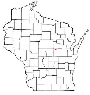
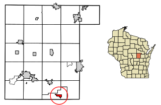
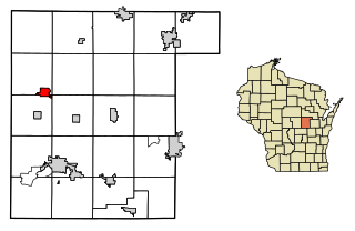
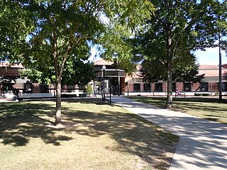
Manawa is a city in Waupaca County, Wisconsin, United States. The population was 1,441 at the 2020 census.
Wyoming is a town in Waupaca County, Wisconsin, United States. The population was 285 at the 2000 census. The ghost town of Granite City was located in the town.
Delafield is a city in Waukesha County, Wisconsin, along the Bark River. The population was 7,085 at the 2010 census.
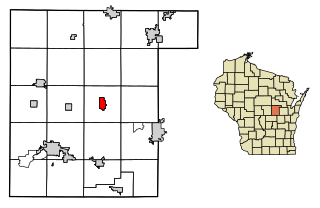
Fremont is a village in Waupaca County, Wisconsin, United States. It is surrounded by Town of Fremont. The population was 679 at the 2010 census. Fremont has been referred to as the "White Bass Capital of the World."
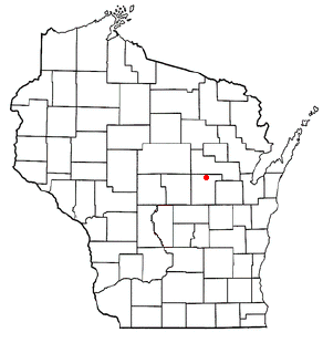
Iola is a village in Waupaca County, Wisconsin, United States. The population was 1,236 at the 2020 census. The village is bordered by the towns of Iola and Scandinavia. The community was named after a Potawatomi girl.
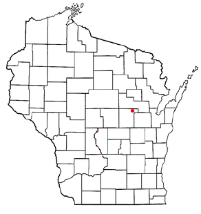
Scandinavia is a village in the Town of Scandinavia in Waupaca County, Wisconsin, United States. The population was 328 at the 2010 census.
Waupaca is a town in Waupaca County, Wisconsin, United States. The population was 1,155 at the 2000 census. The City of Waupaca is located mostly within the town, though it is politically independent. The ghost town of Granite Quarry was also located partially in the town.
Waupaca is a city in and the county seat of Waupaca County in the U.S. state of Wisconsin. The population was 6,282 at the 2020 census.
{{cite book}}
: CS1 maint: multiple names: authors list (link)