History
Founding
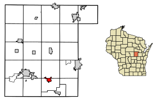
Gill's Landing was named for John Gill, who built the town in order to accommodate boat traffic, in 1843. A plank road was built to nearby Weyauwega in 1852. [4]
Swing Bridge
In 1871, a swing bridge was built by Portage, Winnebago, and Superior Railway just north of Gill's Landing. Construction was finished on July 22, and the first train crossed the bridge on September 30. This project was one of the largest accomplishments of the railway and connected eastern and western Wisconsin. In 1902, a depot was built. [5] This bridge is 1,292 feet long, [6] and was the first railroad bridge built over the Wolf River. [7] In 2010, a renovation to fix the swing bridge was completed.
Today
Today, the community has few residents and is more focused on tourism from businesses and the nearby boat landing.

The Mississippi River is the second-longest river and chief river of the second-largest drainage system in North America, second only to the Hudson Bay drainage system. From its traditional source of Lake Itasca in northern Minnesota, it flows generally south for 2,340 miles (3,770 km) to the Mississippi River Delta in the Gulf of Mexico. With its many tributaries, the Mississippi's watershed drains all or parts of 32 U.S. states and two Canadian provinces between the Rocky and Appalachian mountains. The main stem is entirely within the United States; the total drainage basin is 1,151,000 sq mi (2,980,000 km2), of which only about one percent is in Canada. The Mississippi ranks as the thirteenth-largest river by discharge in the world. The river either borders or passes through the states of Minnesota, Wisconsin, Iowa, Illinois, Missouri, Kentucky, Tennessee, Arkansas, Mississippi, and Louisiana.

Waupaca County is a county in the U.S. state of Wisconsin. As of the 2020 census, the population was 51,812. The county seat is Waupaca. The county was created in 1851 and organized in 1853. It is named after the Waupaca River, a Menominee language name meaning 'white sand bottom', 'pale water', or 'tomorrow river'.

Nenana (Lower Tanana: Toghotili; is a home rule city in the Yukon-Koyukuk Census Area of the Unorganized Borough in the Interior of the U.S. state of Alaska. Nenana developed as a Lower Tanana community at the confluence where the tributary Nenana River enters the Tanana. The population was 378 at the 2010 census, down from 402 in 2000.

Lind is a town in Waupaca County, Wisconsin, United States. The population was 1,381 at the 2000 census and 1,585 in 2018. The unincorporated community of Lind Center and the ghost town of Hatton are located in the town.

Little Wolf is a town in Waupaca County, Wisconsin, United States.
Hammond is a town in St. Lawrence County, New York, United States. The population was 1,191 at the 2010 census. The name is derived from early land owner Abijah Hammond.
Weyauwega is a city in Waupaca County, Wisconsin, United States. The population was 1,900 at the 2010 census. The city is located mostly within the Town of Weyauwega, though it is politically independent of the town. Small portions extend north into the adjacent Town of Royalton. The city is commonly referred to as "Wega" by local residents. The name "Weyauwega" is described by the Weyauwega Chamber of Commerce as potentially meaning "Here we rest" in a local indigenous language because the town's origin was a stopping/resting point between two rivers when Native Americans had to portage their canoes. Given the local indigenous culture is described as Menominee the language may be the Menominee language if this etymology for Weyauwega is correct.

A swing bridge is a movable bridge that has as its primary structural support a vertical locating pin and support ring, usually at or near to its center of gravity, about which the swing span can then pivot horizontally as shown in the animated illustration to the right. Small swing bridges as found over canals may be pivoted only at one end, opening as would a gate, but require substantial underground structure to support the pivot.

The Milwaukee River is a river in the state of Wisconsin. It is about 104 miles (167 km) long. Once a locus of industry, the river is now the center of a housing boom. New condos now crowd the downtown and harbor districts of Milwaukee attracting young professionals to the area. The river is also ribboned with parks as it winds through various neighborhoods. Kayaks and fishing boats share the river with party boats. An extensive Riverwalk featuring art displays, boat launches and restaurants lines its banks in downtown Milwaukee.

The Weyauwega derailment was a railroad accident that occurred in Weyauwega, Wisconsin, United States, in the early morning hours of March 4, 1996. The derailed train was carrying a large quantity of hazardous material, which immediately caught fire. The fire, which involved the train cars and an adjacent feed mill, burned for more than two weeks after the actual derailment, resulting in the emergency evacuation of 2,300 people for 18 days, including the entire city of Weyauwega, with about 1,700 evacuees.
New Hamburg is a small hamlet along the Hudson River in Dutchess County, New York, United States. It is located in the southern corner of the Town Of Poughkeepsie.
Bird's Point is an unincorporated community in Mississippi County, Missouri, United States. It lies on an island or former island in the Mississippi River, near the confluence of the Ohio and Mississippi Rivers and is situated directly across from Cairo, Illinois. This is the point where the U.S. Route 60 bridge connects with Cairo.

Nelson is a census-designated place in Clark County, Nevada, United States. The community is in the Pacific Standard Time zone. The location of Nelson is in El Dorado Canyon, Eldorado Mountains. The town is in the southeast region of the Eldorado Valley. As of the 2010 census it had a population of 37.

The La Crosse Rail Bridge is a swing bridge that spans the Mississippi River between La Crescent, Minnesota and La Crosse, Wisconsin. The first bridge in this location initially was designed and ready to build by June 1876, and was completed in November 1876 by the Milwaukee and St. Paul Railway, a predecessor of the Chicago, Milwaukee, St. Paul and Pacific Railroad. It was later replaced in 1902. It is at the Western end of the Canadian Pacific Railway Tomah Subdivision. Amtrak's Empire Builder crosses this bridge.

Kentucky Dam is a hydroelectric dam on the Tennessee River on the county line between Livingston and Marshall counties in the U.S. state of Kentucky. The dam is the lowermost of nine dams on the river owned and operated by the Tennessee Valley Authority, which built the dam in the late 1930s and early 1940s to improve navigation on the lower part of the river and reduce flooding on the lower Ohio and Mississippi rivers. It was a major project initiated during the New Deal of President Franklin D. Roosevelt's administration, to invest in infrastructure to benefit the country. The dam impounds the Kentucky Lake of 160,000 acres (65,000 ha), which is the largest of TVA's reservoirs and the largest artificial lake by area in the Eastern United States. It was designated as an National Historic Civil Engineering Landmark by the American Society of Civil Engineers in 1996 and listed on the National Register of Historic Places in 2017.

The original Wisconsin Central Railroad Company was a major early railroad that operated throughout northern Wisconsin. It built lines up through the forested wilderness, and opened large tracts to logging and settlement. It established stations which would grow into a string of cities and towns between Stevens Point and Ashland, including Marshfield and Medford, and it connected these places to Chicago and St. Paul. It also played a major role in building Chicago's Grand Central Station.

The Tye River is a 35.4-mile-long (57.0 km) tributary of the James River in central Virginia in the United States. Originating on the eastern slope of the Blue Ridge Mountains in Nelson County, and fed by the Piney and Buffalo rivers, by way of the James River it is part of the watershed of the Chesapeake Bay.
The Tomorrow/Waupaca River is a river that flows wholly within the U.S. state of Wisconsin. It is called the Tomorrow River where it rises between Polonia and Rosholt in northeast Portage County; it flows through Nelsonville and Amherst. As it exits the village of Amherst, the Tomorrow enters the Town of Amherst, where it joins Bear Creek to become the Waupaca River. It flows into Waupaca County and through the city of Waupaca. There it adjoins the Crystal River and enters Weyauwega before converging with the Wolf River in eastern Waupaca County.
Louis Bostedo was an American businessman from Weyauwega, Wisconsin who spent a single term in 1856 as a member of the Wisconsin State Assembly from a district which encompassed the sparsely populated Oconto, Outagamie, Shawano and Waupaca counties.
Koss is an unincorporated community in Menominee County, Michigan, United States. Koss is located in Lake Township, 4.9 miles (7.9 km) west-southwest of Stephenson.


