Marengo, Wisconsin

Last updated

Marengo, Wisconsin
Marengo Town Hall.jpg
The Marengo Town Hall
WIMap-doton-Marengo.png
Location of Marengo, Wisconsin
Coordinates: 46°19′39″N90°51′42″W / 46.32750°N 90.86167°W / 46.32750; -90.86167
Country Flag of the United States.svg  United States
State Flag of Wisconsin.svg  Wisconsin
County Ashland
Area
  Total72.4 sq mi (187.6 km2)
  Land71.5 sq mi (185.2 km2)
  Water0.9 sq mi (2.4 km2)
Elevation
[1]
1,332 ft (406 m)
Population
 (2010)
  Total390
  Density5/sq mi (2.1/km2)
Time zone UTC-6 (Central (CST))
  Summer (DST) UTC-5 (CDT)
Area code(s) 715 & 534
FIPS code 55-49200 [2]
GNIS feature ID1583651 [1]

Marengo is a town in Ashland County in the U.S. state of Wisconsin. The population was 390 at the 2010 census. [3]

Contents

History

In 1849, Charles Whittlesey named the adjacent river as the Maringouin Fork of the Bad River:

“The second branch [of the Bad River] from the west having, as I could learn, no name, I have called it theMaringouin Forkin my map in commemoration of the myriads of mosquitoes that inhabit its banks, that being the name the half-breed French give to those pests of the Bad River region. The Maringouin has its sources near Long Lake, on the west, and on the south interlocks with the upper branches of the Chippewa River, among some lakes, enclosed by drift ridges, which are, by barometrical measurement, eight hundred and seventy-one feet above Lake Superior.”

~ Geological Report on That Portion of Wisconsin Bordering on the South Shore of Lake Superior. Surveyed in the Year 1849, Under the Direction of David Dale Owen, United States Geologist, by Charles Whittlesey, Head of Sub-Corps, page 432. [4]

Geography

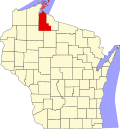
The town of Marengo is located in northwest Ashland County, south of the town of White River, west of the towns of Ashland and Morse, and north of the town of Gordon. To the west are the towns of Grandview and Lincoln in Bayfield County. The Brunsweiler River, a tributary of the Marengo River and thence the Bad River, flows south to north through the town, passing through several small lakes.

According to the United States Census Bureau, the town has a total area of 72.4 square miles (187.6 km2), of which 71.5 square miles (185.2 km2) is land and 0.93 square miles (2.4 km2), or 1.26%, is water. [3]

Demographics

As of the census [2] of 2000, there were 362 people, 132 households, and 99 families residing in the town. The population density was 5.1 people per square mile (2.0/km2). There were 191 housing units at an average density of 2.7 per square mile (1.0/km2). The racial makeup of the town was 96.96% White, 2.49% Native American, 0.28% Asian and 0.28% Pacific Islander. Hispanic or Latino of any race were 0.28% of the population. 32.5% were of Finnish, 23.8% German, 6.5% Swedish, 5.9% United States or American, and 5.6% Norwegian ancestry according to Census 2000.

There were 132 households, out of which 40.2% had children under the age of 18 living with them, 62.1% were married couples living together, 8.3% had a female householder with no husband present, and 25.0% were non-families. 21.2% of all households were made up of individuals, and 7.6% had someone living alone who was 65 years of age or older. The average household size was 2.74 and the average family size was 3.19.

In the town, the population was spread out, with 32.0% under the age of 18, 5.8% from 18 to 24, 27.1% from 25 to 44, 23.8% from 45 to 64, and 11.3% who were 65 years of age or older. The median age was 35 years. For every 100 females, there were 104.5 males. For every 100 females age 18 and over, there were 103.3 males.

The median income for a household in the town was $33,036, and the median income for a family was $34,861. Males had a median income of $31,250 versus $17,188 for females. The per capita income for the town was $16,487. About 10.7% of families and 14.0% of the population were below the poverty line, including 14.8% of those under age 18 and 16.7% of those age 65 or over.

Related Research Articles

<span class="mw-page-title-main">Ashland County, Wisconsin</span> County in Wisconsin, United States

Ashland County is a county located in the U.S. state of Wisconsin. As of the 2020 census, the population was 16,027. Its county seat is Ashland. The county was formed on March 27, 1860, from La Pointe County. The county partly overlaps with the reservation of the Bad River Band of the Lake Superior Tribe of Chippewa Indians.

<span class="mw-page-title-main">Marengo, Illinois</span> City in Illinois, United States

Marengo is a city in McHenry County, Illinois, United States on the Kishwaukee River. It lies approximately 60 miles west northwest of Chicago and approximately 30 miles east of Rockford. Per the 2020 census, the population was 7,568.

<span class="mw-page-title-main">Ashland, New Hampshire</span> Town in New Hampshire, United States

Ashland is a town in Grafton County, New Hampshire, United States. The population was 1,938 at the 2020 census, down from 2,076 at the 2010 census. Located near the geographical center of the state, Ashland is home to Scribner-Fellows State Forest.

<span class="mw-page-title-main">Litchfield, New York</span> Town in New York, United States

Litchfield is a town in Herkimer County, New York, United States. The population was 1,513 at the 2010 census. The town is named after Litchfield, Connecticut, the source of some early settlers of the city.

<span class="mw-page-title-main">Agenda, Wisconsin</span> Town in Wisconsin, United States

Agenda is a town in Ashland County in the U.S. state of Wisconsin. The population was 422 at the 2010 census. The unincorporated communities of Holts Landing and Petes Landing are located in the town.

<span class="mw-page-title-main">Gingles, Wisconsin</span> Town in Wisconsin, United States

Gingles is a town in Ashland County in the U.S. state of Wisconsin. The population was 778 at the 2010 census. The unincorporated community of White River is located in the town.

<span class="mw-page-title-main">Gordon, Ashland County, Wisconsin</span> Town in Wisconsin, United States

Gordon is a town in Ashland County in the U.S. state of Wisconsin. The population was 283 at the 2010 census. The unincorporated communities of Clam Lake and Morse are located in the town.

<span class="mw-page-title-main">Odanah, Wisconsin</span> Census-designated place in Wisconsin, United States

Odanah is an unincorporated community and census-designated place (CDP) in Ashland County, Wisconsin, in the town of Sanborn, United States, on the banks of the Bad River. The population was 47 at the 2020 census.

<span class="mw-page-title-main">Sanborn, Wisconsin</span> Town in Wisconsin, United States

Sanborn is a town in Ashland County in the U.S. state of Wisconsin. The population was 1,331 at the 2010 census. The unincorporated communities of Bayfront, Birch, Birch Hill, Diaperville, Franks Field, New Odanah, Odanah, and Sedgwick are located in the town. Long Island, one of the Apostle Islands, is also a part of the town. The entire town is part of the Bad River Reservation of the Bad River Band of the Lake Superior Tribe of Chippewa Indians.

<span class="mw-page-title-main">White River, Wisconsin</span> Town in Wisconsin, United States

White River is a town in Ashland County, Wisconsin, United States. The population was 921 at the 2010 census. The census-designated place of Marengo and unincorporated communities of Sanborn and part of Jolmaville are located in the town.

<span class="mw-page-title-main">Eileen, Wisconsin</span> Town in Wisconsin, United States

Eileen is a town in Bayfield County, Wisconsin, United States. The population was 681 at the 2010 census. The unincorporated community of Ashland Junction is located in the town.

<span class="mw-page-title-main">Iron River, Wisconsin</span> Town in Wisconsin, United States

Iron River is a town in Bayfield County, Wisconsin, United States. The population was 1,123 at the 2010 census. The census-designated place of Iron River is located in the town. The unincorporated community of Topside is also located in the town.

<span class="mw-page-title-main">Webb Lake, Wisconsin</span> Town in Wisconsin, United States

Webb Lake is a town in Burnett County in the U.S. state of Wisconsin. The population was 311 at the 2010 census. It is along Wisconsin Highway 77 near County Road H. The unincorporated community of Webb Lake is located within the town of Webb Lake.

<span class="mw-page-title-main">Colburn, Chippewa County, Wisconsin</span> Town in Wisconsin, United States

Colburn is a town in Chippewa County in the U.S. state of Wisconsin. The population was 856 at the 2010 census, up from 727 at the 2000 census. The unincorporated communities of Colburn and Huron are located in the town. The unincorporated community of Brownville is located partially in the town.

<span class="mw-page-title-main">Lafayette, Chippewa County, Wisconsin</span> Town in Wisconsin, United States

Lafayette is a town in Chippewa County in the U.S. state of Wisconsin. The population was 5,765 at the 2010 census. The census-designated place of Lake Wissota is located within the town. The unincorporated community of Bateman is also located in the town.

<span class="mw-page-title-main">Brooklyn, Green Lake County, Wisconsin</span> Town in Wisconsin, United States

Brooklyn is a town in Green Lake County, Wisconsin, United States. The population was 1,904 at the 2000 census. The unincorporated communities of Pleasant Point and Sherwood Forest are located in the town.

Ashland is a town in Ashland County, Wisconsin. The population was 594 at the time of the 2010 census. The city of Ashland, population 7,908, is located about 15 miles (24 km) northwest of the town. The unincorporated communities of High Bridge, Minersville, North York, and part of Jolmaville are located in the town.

<span class="mw-page-title-main">Ashland, Wisconsin</span> City in Wisconsin, United States

Ashland is a city in Ashland and Bayfield counties in the U.S. state of Wisconsin. It is the county seat of Ashland County. The city is a port on Lake Superior, near the head of Chequamegon Bay. The population was 7,908 at the 2020 census, all of whom resided in the Ashland County portion of the city. The unpopulated Bayfield County portion is in the city's southwest, bordered by the easternmost part of the Town of Eileen.

Solon Springs is a town in Douglas County, Wisconsin, United States. As of the 2010 census, the town had a total population of 910. The Village of Solon Springs is located within the town. The unincorporated community of Sauntry is also located in the town.

<span class="mw-page-title-main">Hayward (town), Wisconsin</span> Town in Wisconsin, United States

Hayward is a town in Sawyer County, Wisconsin, United States. The population was 3,279 at the 2000 census. The town is located near the City of Hayward. The census-designated place of Chief Lake is located in the town.

References

  1. 1 2 "US Board on Geographic Names". United States Geological Survey. October 25, 2007. Retrieved January 31, 2008.
  2. 1 2 "U.S. Census website". United States Census Bureau . Retrieved January 31, 2008.
  3. 1 2 "Geographic Identifiers: 2010 Demographic Profile Data (G001): Marengo town, Ashland County, Wisconsin". U.S. Census Bureau, American Factfinder. Retrieved September 6, 2013.
  4. "Geological Report on That Portion of Wisconsin Bordering on the South Shore of Lake Superior. Surveyed in the Year 1849, Under the Direction of David Dale Owen, United States Geologist, by Charles Whittlesey, Head of Sub-Corps, page 432". Chequamegon History Collections. 1849. Retrieved June 14, 2021.