Glidden, Wisconsin

Last updated

Glidden, Wisconsin
Glidden Wisconsin Downtown Looking East.jpg
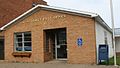
Looking east at downtown Glidden
USA Wisconsin location map.svg
Red pog.svg
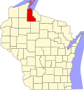
Glidden
Location within the state of Wisconsin
Coordinates: 46°8′6″N90°34′43″W / 46.13500°N 90.57861°W / 46.13500; -90.57861
Country United States
State Wisconsin
County Ashland
Town Jacobs
Area
  Total2.151 sq mi (5.57 km2)
  Land2.151 sq mi (5.57 km2)
  Water0 sq mi (0 km2)
Population
 (2010)
  Total507
  Density240/sq mi (91/km2)
Time zone UTC-6 (Central (CST))
  Summer (DST) UTC-5 (CDT)
ZIP codes
54527
Area code(s) 715 & 534
GNIS feature ID1579335 [1]
Public Transit Bay Area Rural Transit

Glidden (also Chippewa Crossing) [1] is an unincorporated census-designated place in the town of Jacobs in Ashland County, Wisconsin, United States. It is located on County Highway N near Wisconsin Highway 13. As of the 2010 census, its population was 507. [2]

Contents

History

The community is named after Charles R. Glidden, a founder of the Wisconsin Central Railroad, along which it is located. [3] Marion Park Pavilion was built in 1938 during the depression and is listed in the National Register of Historic Places. In 1963, a 10 ft 7 in (3.23 m), 665-pound (302 kg) Black Bear was hunted in the Glidden area. [4] The town immediately took on the title of "Black Bear Capital of the World", and many local businesses made "Black Bear" a part of their name. Glidden Public School also changed its mascot from the Viking to the Black Bear.

Geography

Glidden is located at 46°8′6″N90°34′43″W / 46.13500°N 90.57861°W / 46.13500; -90.57861 (46.1349525, -90.5785090). [1] According to the U.S. Census Bureau, it has an area of 2.151 square miles (5.57 km2), all of it land. [5]

Education

Local children are a part of the Chequamegon School District, which was created for the 2009–10 school year. [6] Elementary students of the former Glidden School District - which served all students from the towns of Gordon, Jacobs, Peeksville, and Shanagolden, plus those from parts of the towns of Namakagon and Spider Lake- attend the Glidden campus building. Middle school students attend Chequamegon Middle School, which is also at the Glidden campus. High school students attend Chequamegon High School in Park Falls, Wisconsin.
Glidden Public School was the home to all area students through the 2008–09 school year. The school's mascot was the Black Bear. The school was a part of a sports co-op with the Butternut School District from 2006–09 and won Indianhead Conference championships in baseball (2006) and softball (2009).

Transportation

Bus service to the community is provided by Bay Area Rural Transit.

Notable person

Images

Related Research Articles

<span class="mw-page-title-main">Vilas County, Wisconsin</span> County in Wisconsin, United States

Vilas County is a county in the state of Wisconsin, United States. As of the 2020 census, the population was 23,047. Its county seat is Eagle River. The county partly overlaps the reservation of the Lac du Flambeau Band of Lake Superior Chippewa.

<span class="mw-page-title-main">Milwaukee County, Wisconsin</span> County in Wisconsin, United States

Milwaukee County is a county located in the U.S. state of Wisconsin. At the 2020 census, the population was 939,489, down from 947,735 in 2010. It is both the most populous and most densely populated county in Wisconsin, and the 45th most populous county nationwide; Milwaukee, its eponymous county seat, is also the most populous city in the state. The county was created in 1834 as part of Michigan Territory and organized the following year.

<span class="mw-page-title-main">Dane County, Wisconsin</span> County in Wisconsin, United States

Dane County is a county in the U.S. state of Wisconsin. As of the 2020 census, the population was 561,504, making it the second-most populous county in Wisconsin after Milwaukee County. The county seat is Madison, which is also the state capital. Dane County is the central county of the Madison metropolitan area, as well as the Madison–Janesville–Beloit combined statistical area.

<span class="mw-page-title-main">Ashland County, Wisconsin</span> County in Wisconsin, United States

Ashland County is a county located in the U.S. state of Wisconsin. As of the 2020 census, the population was 16,027. Its county seat is Ashland. The county was formed on March 27, 1860, from La Pointe County. The county partly overlaps with the reservation of the Bad River Band of the Lake Superior Tribe of Chippewa Indians.

<span class="mw-page-title-main">Calhoun County, Mississippi</span> County in Mississippi, United States

Calhoun County is a county located in the U.S. state of Mississippi. As of the 2020 census, the population was 13,266. Its county seat is Pittsboro. The county is named after John C. Calhoun, the U.S. Vice President and U.S. Senator from South Carolina.

<span class="mw-page-title-main">Crittenden County, Arkansas</span> County in Arkansas, United States

Crittenden County is a county located in the U.S. state of Arkansas. As of the 2020 census, the population was 48,163. The county seat is Marion, and the largest city is West Memphis.

<span class="mw-page-title-main">Turrell, Arkansas</span> City in Arkansas, United States

Turrell is a city in Crittenden County, Arkansas, United States. Per the 2020 census, the population was 517.

<span class="mw-page-title-main">Iron River, Wisconsin</span> Town in Wisconsin, United States

Iron River is a town in Bayfield County, Wisconsin, United States. The population was 1,123 at the 2010 census. The census-designated place of Iron River is located in the town. The unincorporated community of Topside is also located in the town.

<span class="mw-page-title-main">Neillsville, Wisconsin</span> City in Wisconsin, United States

Neillsville is a city and county seat of Clark County, Wisconsin. The population was 2,384 at the 2020 census.

<span class="mw-page-title-main">Park Falls, Wisconsin</span> City in Wisconsin, United States

Park Falls is a city in Price County, Wisconsin, United States. The population was 2,462 at the 2010 census. Located in the woods of north central Wisconsin, primarily the Chequamegon National Forest, Park Falls is a small community divided by the North Fork of the Flambeau River, a popular destination for fishing, canoeing and whitewater rafting.

<span class="mw-page-title-main">Phelps, Wisconsin</span> Town in Wisconsin, United States

Phelps is a town in Vilas County, Wisconsin, United States. The population was 1,238 in 2020. The unincorporated community of Phelps is located in the town.

<span class="mw-page-title-main">Ashland, Wisconsin</span> City in Wisconsin, United States

Ashland is a city in Ashland and Bayfield counties in the U.S. state of Wisconsin. It is the county seat of Ashland County. The city is a port on Lake Superior, near the head of Chequamegon Bay. The population was 7,908 at the 2020 census, all of whom resided in the Ashland County portion of the city. The unpopulated Bayfield County portion is in the city's southwest, bordered by the easternmost part of the Town of Eileen.

<span class="mw-page-title-main">Washburn, Wisconsin</span> City in Wisconsin, United States

Washburn is a city and the county seat of Bayfield County, in the U.S. state of Wisconsin. The population was 2,051 at the 2020 census. The city is just east of and adjacent to the Town of Washburn. It is in northern Wisconsin, on the shore of Lake Superior's Chequamegon Bay.

<span class="mw-page-title-main">Platteville, Wisconsin</span> City in Wisconsin, United States

Platteville is the largest city in Grant County, Wisconsin. The population was 11,836 at the 2020 census, up from 11,224 at the 2010 census. Much of this growth is likely due to the enrollment increase of the University of Wisconsin–Platteville. It is the principal city of the Platteville Micropolitan Statistical area, which has an estimated population of 51,938. Platteville is located atop the greater Platte River valley in the southern Driftless Region of Wisconsin, an area known for its karst topography and rolling hills.

<span class="mw-page-title-main">Tomah, Wisconsin</span> City in Wisconsin, United States

Tomah is a city in Monroe County, Wisconsin, United States. The population was 9,570 as of the 2020 census. The city is surrounded by the Town of Tomah and the Town of La Grange.

<span class="mw-page-title-main">Hayward, Wisconsin</span> City in Wisconsin, United States

Hayward is a city in Sawyer County, Wisconsin, United States, next to the Namekagon River. Its population was 2,533 at the 2020 census. It is the county seat of Sawyer County. The city is surrounded by the Town of Hayward. The City of Hayward was formally organized in 1883.

<span class="mw-page-title-main">Chequamegon–Nicolet National Forest</span> Nature preserve in northern Wisconsin, U.S.

The Chequamegon–Nicolet National Forest is a 1,530,647-acre (6,194.31 km2) U.S. National Forest in northern Wisconsin in the United States. Due to logging in the early part of the 20th century, very little old growth forest remains. Some of the trees there were planted by the Civilian Conservation Corps in the 1930s. The national forest land trees and vegetation are part of the North Woods Ecoregion that prevails throughout the upper Great Lakes region.

Herbster is a census-designated place (CDP) in the Town of Clover in Bayfield County, Wisconsin, United States, located on the south shore of Lake Superior. Herbster is 7 miles (11 km) east of Port Wing and 8 miles (13 km) west of Cornucopia on Wisconsin Highway 13, the main route through the community. The primary north/south route is by Lenawee Road / Forest Road 262, leading from Lake Superior to the Chequamegon National Forest. As of the 2010 census, its population was 104. Herbster has an area of 5.572 square miles (14.43 km2), all of it land.

Clam Lake is an unincorporated, census-designated place in the town of Gordon in Ashland County, Wisconsin, United States. It is located on Wisconsin Highway 77 near County Highway GG. The entire area lies within the Chequamegon National Forest, an 860,000 acre area spread across northern Wisconsin. As of the 2010 census, its population was 37.

<span class="mw-page-title-main">La Pointe (town), Wisconsin</span> Town in Wisconsin, United States

La Pointe is a town in Ashland County in the U.S. state of Wisconsin. The population was 428 at the 2020 census. The town includes all of the Apostle Islands except for the westernmost four, which lie in the towns of Bayfield and Russell in Bayfield County. The town includes the unincorporated community of La Pointe on Madeline Island, the largest of the Apostle Islands. The communities of Middleport and Old Fort are also located in the town. Its name in the Anishinaabe language is Mooningwanekaaning, meaning "The Home of the Golden Breasted Woodpecker".

References

  1. 1 2 3 U.S. Geological Survey Geographic Names Information System: Glidden, Wisconsin
  2. "U.S. Census website". U.S. Census Bureau. Archived from the original on July 9, 2021. Retrieved April 4, 2011.
  3. A Timeline History of The Wisconsin Central Railway Archived July 5, 2008, at the Wayback Machine , July 24, 2002, accessed July 23, 2008
  4. http://freepages.genealogy.rootsweb.ancestry.com/~kehring/GliddenBlackBear.jpg Archived October 25, 2012, at the Wayback Machine [ bare URL image file ]
  5. "US Gazetteer files: 2010, 2000, and 1990". United States Census Bureau. February 12, 2011. Archived from the original on August 24, 2019. Retrieved April 23, 2011.
  6. "New Chequamegon School District Starts - WJFW". Archived from the original on July 17, 2011. Retrieved June 24, 2010.
  7. "University of Wisconsin–Madison College of Engineering-Franklin Matthias". Archived from the original on March 6, 2016. Retrieved January 28, 2015.