
The United States Numbered Highway System is an integrated network of roads and highways numbered within a nationwide grid in the contiguous United States. As the designation and numbering of these highways were coordinated among the states, they are sometimes called Federal Highways, but the roadways were built and have always been maintained by state or local governments since their initial designation in 1926.
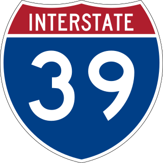
Interstate 39 (I-39) is a highway in the Midwestern United States. I-39 runs from Normal, Illinois, at I-55 to State Trunk Highway 29 (WIS 29) in the town of Rib Mountain, Wisconsin, which is approximately six miles (9.7 km) south of Wausau. I-39 was designed to replace U.S. Route 51 (US 51), which, in the early 1980s, was one of the busiest two-lane highways in the United States. I-39 was built in the 1980s and 1990s.

Interstate 43 (I-43) is a 191.55-mile-long (308.27 km) Interstate Highway located entirely within the US state of Wisconsin, connecting I-39/I-90 in Beloit with Milwaukee and I-41, U.S. Highway 41 (US 41) and US 141 in Green Bay. State Trunk Highway 32 (WIS 32) runs concurrently with I-43 in two sections and I-94, I-894, US 10, US 41, US 45, and WIS 57 overlap I-43 once each. There are no auxiliary or business routes connected to I-43, though an alternate route to direct traffic during road closures is signed along local and state highways from Milwaukee County north into Brown County.

U.S. Route 2 or U.S. Highway 2 (US 2) is an east–west United States Numbered Highway spanning 2,571 miles (4,138 km) across the northern continental United States. US 2 consists of two segments connected by various roadways in southern Canada. Unlike some routes, which are disconnected into segments because of encroaching Interstate Highways, the two portions of US 2 were designed to be separate in the original 1926 highway plan.

U.S. Route 51 or U.S. Highway 51 is a major south–north United States highway that extends 1,277 miles (2,055 km) from the western suburbs of New Orleans, Louisiana, to within 150 feet (46 m) of the Wisconsin–Michigan state line. As most of the United States Numbered Highways ending with "1", it is a cross-country north–south route extending from the Gulf Coast region to the Great Lakes region. Much of the highway in northern Illinois and southern Wisconsin runs parallel to or is cosigned with Interstate 39 (I-39) and much of the route in several states also parallels the Illinois Central Railroad. From LaPlace, Louisiana, Mississippi, to Memphis, Tennessee, much of that portion of US 51 runs largely parallel or is concurrent with Interstate 55 (I-55). The highway's northern terminus is between Hurley, Wisconsin, and Ironwood, Michigan, where it ends with a roundabout at US 2. Its southern terminus is in Laplace, Louisiana, ending at US 61. US 51 is routed through the states of Louisiana, Mississippi, Tennessee, Kentucky, Illinois, and Wisconsin.

Illinois Route 75 is an east–west state highway in north-central Illinois. It runs from downtown Freeport at Illinois Route 26 to WIS 67 at the Wisconsin state line southeast of Beloit, Wisconsin. This is a distance of 41.64 miles (67.01 km).

State Trunk Highway 67 is a Wisconsin state highway running from the Wisconsin–Illinois state line east of Beloit north to U.S. Highway 151 (US 151) east of Chilton. With the inclusion of the new Oconomowoc bypass, WIS 67 is approximately 160 miles (260 km) in length.

State Trunk Highway 13 is a state highway running north–south across northwest and central Wisconsin. WIS 13 serves as a major north–south route connecting the communities of Wisconsin Dells, Wisconsin Rapids, Marshfield and Ashland. WIS 13 is part of the Lake Superior Circle Tour from its northern/western terminus to Ashland at is eastern junction with U.S. Highway 2 (US 2). The road also provides access to the Apostle Islands National Lakeshore off the Lake Superior shoreline at Bayfield. The highway is two-lane surface road with the exception of various urban multilane road sections.

State Trunk Highway 15 is a 14.8-mile (23.8 km)state highway in Outagamie County in the US state of Wisconsin that runs east–west and provides a shortcut to Appleton from U.S. Highway 45 (US 45) for travelers inbound from points north and west. Most of WIS 15 was once part of US 45, which was redirected south of New London to bypass Appleton and provide direct access to Oshkosh and points south.

State Trunk Highway 81 is a state highway in the U.S. state of Wisconsin. It runs east–west in southwest and south central Wisconsin from Cassville to Beloit. Between Brodhead and Monroe it run concurrently with WIS 11 for 13 miles (21 km). The route was originally designated as a state highway in the early 1920s, but there were three different designations along the route. It was not signed as WIS 81 along the entire route until 1934.
U.S. Highway 51 (US 51) in the U.S. state of Wisconsin runs north–south through the central part of the state. It enters from Illinois at Beloit, and runs north to its northern terminus in Hurley at a roundabout junction with US 2. Some of the route of US 51 runs concurrently with Interstate 39 (I-39).

The History of State Highways in Virginia begins with Virginia's State Highway Commission, which was formed by the General Assembly in 1906. In 1918 the General Assembly designated a 4002-mile (6441 km) state highway system to be maintained by the commission. Beginning in 1922, the commission was authorized to add annually mileage equal to 2.5% of the original system. These highways were numbered from 1 into the 20s; by 1922 suffixed spurs had been added. In 1923, the first renumbering was implemented, in which State Routes 1 to 9 became 31 to 39. The spurs were renamed to use numbers rather than letters, and four-digit numbers were used for spurs of spurs or for "rollovers".

State Route 13 is a primary state highway in the U.S. state of Virginia. Known as Old Buckingham Road, the state highway runs 24.08 miles (38.75 km) from U.S. Route 60 and SR 45 in Cumberland east to US 60 in Plain View. SR 13 parallels US 60 to the south through eastern Cumberland County and western Powhatan County and passes through the latter county's seat of Powhatan. The state highway is the only state-numbered highway in Virginia that shares a number with a U.S. Highway but does not form a state-numbered extension of that U.S. Highway. SR 13's number comes from being a segment of the original cross-state SR 13 in 1918; that highway included portions of modern US 60. In 1933, US 60 was shifted to its present corridor between Buena Vista and Richmond, replacing SR 13. Two years later, SR 13 was assigned to Old Buckingham Road when US 60 was moved to its present alignment from Cumberland to east of Powhatan.

State Trunk Highway 41 was a number assigned to a state highway in the U.S. state of Wisconsin from 1917 to 1926, along the following present-day corridors in 1926:

State Trunk Highway 51 was a number assigned to two different state highways in the U.S. state of Wisconsin:

State Trunk Highway 61 was a number assigned to a state highway in the U.S. state of Wisconsin. It traveled roughly along:

U.S. Highway 24 (US-24) in the state of Kansas runs east–west across the northern half of the state for 435.95 miles (701.59 km). The route mostly connects rural communities across the High Plains of Kansas, while also later providing an Interstate alternate between Topeka, Lawrence, and Kansas City. US-24 both enters and exits the state running concurrently with Interstate 70 (I-70). Along with US-40, the road has largely been replaced by the more modern Interstate in its functionality as a long-distance route.

The Wisconsin State Trunk Highway System is the state highway system of the U.S. state of Wisconsin, including Wisconsin's segments of the Interstate Highway System and the United States Numbered Highway System, in addition to its other state trunk highways. These separate types of highways are respectively designated with an I-, US, or STH- prefix. The system also includes minor roads designated as Scenic Byways, four routes intended to promote tourism to scenic and historic areas of the state; and as Rustic Roads, lightly traveled and often unpaved local roads which the state has deemed worthy of preservation and protection. The state highway system, altogether totaling 11,753 miles (18,915 km) across all of Wisconsin's 72 counties, is maintained by the Wisconsin Department of Transportation (WisDOT).
Several special routes exist for U.S. Route 51.
