Doylestown is a village in Columbia County, Wisconsin, United States. The population was 297 at the 2010 census. It is part of the Madison Metropolitan Statistical Area.

Taylor is a village in Jackson County, Wisconsin, United States, along the Trempealeau River. The population was 484 at the 2020 census.

Brokaw is a former village in Marathon County, Wisconsin, United States. It is part of the Wausau, Wisconsin Metropolitan Statistical Area. The population was 251 at the 2010 census. Brokaw merged with the village of Maine, Wisconsin on October 1, 2018.

Boaz is a village in Richland County, Wisconsin, United States. According to the 2010 census, the population of the village was 156.

Weyerhaeuser is a village in Rusk County, Wisconsin, United States. The population was 238 at the 2010 census.

Woodville is a village in St. Croix County, Wisconsin, United States. The population was 1,344 at the 2010 census.

Ontario is a village in Vernon County, Wisconsin, United States. The population was 554 at the 2010 census.

Big Falls is a village in Waupaca County, Wisconsin, United States. The population was 61 at the 2010 census.

Ogdensburg is a village in Waupaca County, Wisconsin, United States. The population was 185 at the 2010 census.

Dorchester is a village in Clark and Marathon counties in the U.S. state of Wisconsin, along the 45th parallel. It is part of the Wausau, Wisconsin Metropolitan Statistical Area. The population was 876 at the 2010 census. Of this, 871 were in Clark County, and only 5 were in Marathon County.

Viola is a village in Richland (mostly) and Vernon counties in the U.S. state of Wisconsin. The population was 699 at the 2010 census. Of this, 477 were in Richland County, and 222 were in Vernon County.

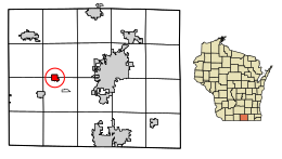
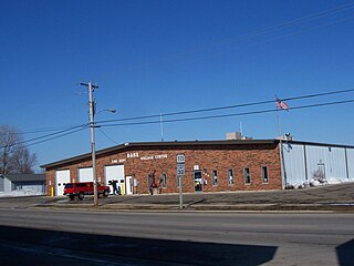
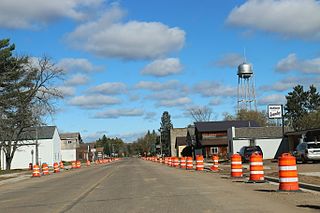
Randolph is a village in Columbia and Dodge Counties in the U.S. state of Wisconsin. The population was 1,811 at the 2010 census. Of this, 1,339 were in Dodge County, and 472 were in Columbia County. The village is located at the southeast corner of the Town of Randolph in Columbia County, although only a tiny portion of the village lies within the town. Most of the village lies within the Town of Westford in Dodge County. Small portions also lie within the Town of Fox Lake to the north and the Town of Courtland in Columbia County.
Dane is a village in Dane County, Wisconsin, United States. The population was 1,117 at the 2020 census. Located in the Town of Dane, the village is part of the Madison Metropolitan Statistical Area.

Fairchild is a village in Eau Claire County, Wisconsin, United States. The population was 550 at the 2010 census. The village is located within the Town of Fairchild.

Eden is a village in Fond du Lac County, Wisconsin, United States. The population was 884 at the 2020 census. The village is located within the Town of Eden.

Mount Hope is a village in Grant County, Wisconsin, United States. The population was 225 at the 2010 census. The village is located within the Town of Mount Hope.

Woodman is a village in Grant County in the U.S. state of Wisconsin. The population was 132 at the 2010 census. The village is located within the Town of Woodman.

Milltown is a village in Polk County, Wisconsin, United States. The population was 917 at the 2010 census. The village is located within the Town of Milltown.
Radisson is a village in Sawyer County, Wisconsin, United States, along the Couderay River. The population was 273 at the 2020 census, and 241 at the 2010 census. The village is located within the Town of Radisson and was named in honor of the early French explorer, Pierre-Esprit Radisson (c.1636–1710).

Aniwa is a village in Shawano County, Wisconsin, United States. The population was 260 at the 2010 census. The village is located within the Town of Aniwa. U.S. Route 45 runs north–south through the village.