Orfordville, Wisconsin | |
---|---|
Coordinates: 42°37′45″N89°15′24″W / 42.62917°N 89.25667°W | |
Country | United States |
State | Wisconsin |
County | Rock |
Area | |
• Total | 1.19 sq mi (3.07 km2) |
• Land | 1.19 sq mi (3.07 km2) |
• Water | 0.00 sq mi (0.00 km2) |
Elevation | 889 ft (271 m) |
Population | |
• Total | 1,473 |
• Density | 1,262.01/sq mi (487.43/km2) |
Time zone | UTC-6 (Central (CST)) |
• Summer (DST) | UTC-5 (CDT) |
ZIP Code | 53576 |
Area code | 608 |
FIPS code | 55-60250 [4] |
GNIS feature ID | 1570857 [2] |
Website | http://www.orfordville.org |
Orfordville is a village in Rock County, Wisconsin, United States. It is located at the intersection of Highway 11, Highway 213, and the Wisconsin and Southern Railroad. The population was 1,473 at the 2020 census.
The origin of its name came when a surveyor suggested Orford after a town in New Hampshire. It remained that until the establishment of a post office, when it was confused with Oxford, Wisconsin. The name was then changed to Orfordville at the suggestion of the postmaster general. [5]
Orfordville is located at 42°37′45″N89°15′24″W / 42.62917°N 89.25667°W (42.629300, −89.256755). [6] The elevation is 889 feet (271 m).
According to the United States Census Bureau, the village has a total area of 1.17 square miles (3.03 km2), all of it land. [7]
Census | Pop. | Note | %± |
---|---|---|---|
1880 | 153 | — | |
1910 | 449 | — | |
1920 | 496 | 10.5% | |
1930 | 502 | 1.2% | |
1940 | 510 | 1.6% | |
1950 | 543 | 6.5% | |
1960 | 665 | 22.5% | |
1970 | 888 | 33.5% | |
1980 | 1,143 | 28.7% | |
1990 | 1,219 | 6.6% | |
2000 | 1,272 | 4.3% | |
2010 | 1,442 | 13.4% | |
2020 | 1,473 | 2.1% | |
U.S. Decennial Census [8] |
As of the census [3] of 2010, there were 1,442 people, 542 households, and 394 families living in the village. The population density was 1,232.5 inhabitants per square mile (475.9/km2). There were 575 housing units at an average density of 491.5 per square mile (189.8/km2). The racial makeup of the village was 96.1% White, 0.6% African American, 0.1% Native American, 0.3% Asian, 1.9% from other races, and 1.0% from two or more races. Hispanic or Latino of any race were 4.4% of the population.
There were 542 households, of which 41.0% had children under the age of 18 living with them, 55.2% were married couples living together, 10.5% had a female householder with no husband present, 7.0% had a male householder with no wife present, and 27.3% were non-families. 23.1% of all households were made up of individuals, and 10.3% had someone living alone who was 65 years of age or older. The average household size was 2.66 and the average family size was 3.11.
The median age in the village was 37.1 years. 29.3% of residents were under the age of 18; 6.7% were between the ages of 18 and 24; 27.5% were from 25 to 44; 25.3% were from 45 to 64, and 11.2% were 65 years of age or older. The gender makeup of the village was 47.3% male and 52.7% female.
As of the census [4] of 2000, there were 1,272 people, 455 households, and 348 families living in the village. The population density was 1,093.5 people per square mile (422.2 people/km2). There were 469 housing units at an average density of 403.2 per square mile (155.7/km2). The racial makeup of the village was 97.41% White, 0.55% African American, 0.08% Native American, 0.94% from other races, and 1.02% from two or more races. Hispanic or Latino of any race were 2.28% of the population.
There were 455 households, out of which 41.5% had children under the age of 18 living with them, 59.6% were married couples living together, 11.9% had a female householder with no husband present, and 23.5% were non-families. 17.8% of all households were made up of individuals, and 6.8% had someone living alone who was 65 years of age or older. The average household size was 2.78 and the average family size was 3.14.
In the village, the population was spread out, with 31.0% under the age of 18, 7.8% from 18 to 24, 30.4% from 25 to 44, 20.2% from 45 to 64, and 10.6% who were 65 years of age or older. The median age was 33 years. For every 100 females, there were 94.5 males. For every 100 females age 18 and over, there were 93.0 males.
The median income for a household in the village was $46,875, and the median income for a family was $50,192. Males had a median income of $38,125 versus $25,050 for females. The per capita income for the village was $18,169. About 6.0% of families and 5.9% of the population were below the poverty line, including 7.2% of those under age 18 and 7.0% of those aged 65 or over.
Orfordville is the home of the Parkview School District's high school, Parkview High School. The village is also home to one of the school district's two grade schools, Parkview Elementary School. In 2015, a new high school was built and the high school was remodeled to become Parkview Elementary. [9] After construction ended, all schools in the Parkview district were located in Orfordville.[ citation needed ]
Orfordville was previously served by intercity trains at the Orfordville Depot.
St. Paul is a small town on the border of Decatur and Shelby counties in the U.S. state of Indiana. The population was 1,031 at the 2010 census.
Waco is a village in York County, Nebraska, United States. The population was 236 at the 2010 census.
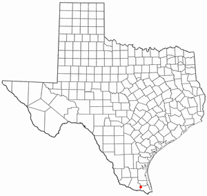
Santa Rosa is a town in Cameron County, Texas, United States. The population was 2,873 at the 2010 census. It is part of the Brownsville–Harlingen–Raymondville and the Matamoros–Brownsville metropolitan areas.
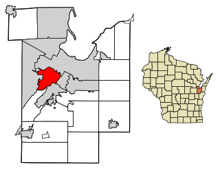
DeForest is a village in Dane County, Wisconsin, United States, along the Yahara River. The population was 10,811 at the 2020 census. It is part of the Madison Metropolitan Statistical Area.
Iron Ridge is a village in Dodge County, Wisconsin, United States. The population was 929 at the 2010 census. The village was founded on a railroad line, named for the iron mined in the area. Its ZIP code is 53035.
Sister Bay is a village in Door County, Wisconsin, United States. The population was 876 at the 2010 census.
St. Cloud is a village in Fond du Lac County, Wisconsin, United States, along the Sheboygan River. The population was 477 at the 2010 census. St. Cloud is part of The Holyland region in northeastern Fond du Lac County.
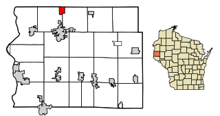
Alma Center is a village in Jackson County, Wisconsin, United States. The population was 503 at the 2010 census. The village is located within the Town of Alma.
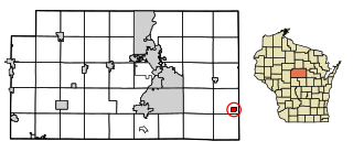
Hatley is a village in Marathon County, Wisconsin, United States. It is part of the Wausau, Wisconsin Metropolitan Statistical Area. The population was 574 at the 2010 census.
Stratford is a village in Marathon County, Wisconsin, United States. It is part of the Wausau, Wisconsin Metropolitan Statistical Area. The population was 1,578 at the 2010 census.
Combined Locks is a village in Outagamie County, Wisconsin, United States. The population was 3,328 at the 2010 census.
Hartland is a village along the Bark River in Waukesha County, Wisconsin, United States, that is a suburb of Milwaukee. The population was 9,501 at the 2020 census.
Withee is a village in Clark County in the U.S. state of Wisconsin. The population was 487 at the 2010 census. The village is located mostly within the Town of Hixon, with a small portion extending south into the Town of Longwood.
The Village of Superior is a village in Douglas County, Wisconsin, United States. The population was 664 at the 2010 census. The village is located within the Town of Superior and is located immediately south of and adjacent to the City of Superior.
Oakfield is a village in Fond du Lac County, Wisconsin, United States. The population was 1,052 at the 2020 census. The village is located within the Town of Oakfield.
Melrose is a village in Jackson County, Wisconsin, United States. The population was 503 at the 2010 census. The village is located within the Town of Melrose.
Elderon is a village in Marathon County, Wisconsin, United States. It is part of the Wausau, Wisconsin Metropolitan Statistical Area. The population was 179 at the 2010 census.
Westfield is a village in Marquette County, Wisconsin, United States. The population was 1,254 at the 2010 census. The village is located mostly within the Town of Westfield. A small portion extends east into the adjacent Town of Harris. The Marquette County fairgrounds is located within the village limits on the south side.
Winter is a village in Sawyer County, Wisconsin, United States. The population was 233 at the 2010 census. The village is within the Town of Winter.
Star Prairie is a village in St. Croix County in the U.S. state of Wisconsin. The population was 561 at the 2010 census. The village is located along the Apple River on the boundary between the Town of Star Prairie and the Town of Stanton.