Clinton (village), Rock County, Wisconsin

Last updated

Clinton
Downtown Clinton, WI.jpg
Downtown Clinton, July 2020
Rock County Wisconsin Incorporated and Unincorporated areas Clinton Highlighted.svg
Location of Clinton in Rock County, Wisconsin.
Coordinates: 42°33′24″N88°51′52″W / 42.55667°N 88.86444°W / 42.55667; -88.86444
Country Flag of the United States.svg  United States
State Flag of Wisconsin.svg  Wisconsin
County Rock
Government
  TypeVillage Board
  Village PresidentConnie Tracy
Area
[1]
  Total1.43 sq mi (3.71 km2)
  Land1.43 sq mi (3.71 km2)
  Water0.00 sq mi (0.00 km2)
Population
 (2020) [2]
  Total2,221
  Density1,494.41/sq mi (577.00/km2)
Time zone UTC-6 (Central (CST))
  Summer (DST) UTC-5 (CDT)
Zip Code
53525
Area code 608
FIPS code 55-15625
GNIS feature ID1582983
Website Official website

Clinton is a village in Rock County, Wisconsin, United States. The population was 2,221 in the 2020 census. The village is located within the town of Clinton. The Norwegian-American Jefferson Prairie Settlement was located near the village.

Contents

Geography

Clinton is located at 42°33′23″N88°51′52″W / 42.55639°N 88.86444°W / 42.55639; -88.86444 (42.556596, -88.864453). [3]

According to the United States Census Bureau, the village has a total area of 1.40 square miles (3.63 km2), all of it land. [4]

Demographics

Historical population
CensusPop.Note
1890 856
1900 8711.8%
1910 8973.0%
1920 9384.6%
1930 902−3.8%
1940 9030.1%
1950 1,13826.0%
1960 1,27412.0%
1970 1,3334.6%
1980 1,75131.4%
1990 1,8495.6%
2000 2,16216.9%
2010 2,154−0.4%
2020 2,2213.1%
U.S. Decennial Census [5]

2010 census

As of the census [2] of 2010, there were 2,154 people, 801 households, and 546 families living in the village. The population density was 1,538.6 inhabitants per square mile (594.1/km2). There were 872 housing units at an average density of 622.9 per square mile (240.5/km2). The racial makeup of the village was 92.9% White, 0.6% African American, 0.1% Native American, 0.3% Asian, 4.3% from other races, and 1.8% from two or more races. Hispanic or Latino of any race were 8.0% of the population.

There were 801 households, of which 37.7% had children under the age of 18 living with them, 49.7% were married couples living together, 13.1% had a female householder with no husband present, 5.4% had a male householder with no wife present, and 31.8% were non-families. 27.3% of all households were made up of individuals, and 11.5% had someone living alone who was 65 years of age or older. The average household size was 2.58 and the average family size was 3.16.

The median age in the village was 36.6 years. 27.6% of residents were under the age of 18; 7.4% were between the ages of 18 and 24; 24.4% were from 25 to 44; 25.5% were from 45 to 64, and 15% were 65 years of age or older. The gender makeup of the village was 48.5% male and 51.5% female.

2000 census

As of the census [6] of 2000, there were 2,162 people, 771 households, and 541 families living in the village. The population density was 1,652.0 people per square mile (637.2/km2). There were 815 housing units at an average density of 622.7/sq mi (240.2/km2). The racial makeup of the village was 96.48% White, 0.23% Black or African American, 0.19% Native American, 0.42% Asian, 1.85% from other races, and 0.83% from two or more races. 3.19% of the population were Hispanic or Latino of any race.

There were 771 households, out of which 38.1% had children under the age of 18 living with them, 55.0% were married couples living together, 11.4% had a female householder with no husband present, and 29.8% were non-families. 24.8% of all households were made up of individuals, and 12.3% had someone living alone who was 65 years of age or older. The average household size was 2.70 and the average family size was 3.27.

In the village, the population was spread out, with 29.7% under the age of 18, 8.2% from 18 to 24, 27.6% from 25 to 44, 19.8% from 45 to 64, and 14.7% who were 65 years of age or older. The median age was 35 years. For every 100 females, there were 90.1 males. For every 100 females age 18 and over, there were 83.1 males.

The median income for a household in the village was $45,987, and the median income for a family was $54,514. Males had a median income of $38,167 versus $25,189 for females. The per capita income for the village was $18,015. About 4.5% of families and 7.2% of the population were below the poverty line, including 6.3% of those under age 18 and 13.7% of those aged 65 or over.

Transportation

Clinton was served by the Chicago, Milwaukee, St. Paul and Pacific Railroad, better known as the Milwaukee Road, and the Chicago and North Western Railroad (C&NW). It was on the Racine & Southwestern branch line of the Milwaukee Road and on the C&NW line between Harvard, Illinois, and Janesville, Wisconsin. In its 1980 bankruptcy, the Milwaukee Road disposed of the Southwestern Line. The Union Pacific Railroad, which took over the C&NW, operates today in Clinton on former C&NW tracks and on a remnant of the former Milwaukee Road west to Beloit, where it provides a rail connection to Fairbanks-Morse. [7] [ clarification needed ]

Education

The Clinton Community School District provides K-12 public education.

Events

Clinton is the home of the annual Stoopball League of America (SLA) championship in July. "Taste of Clinton" held each year Father's Day weekend.

Notable residents

See also

Related Research Articles

<span class="mw-page-title-main">Fowler, Michigan</span> Village in Michigan, United States

Fowler is a village in Clinton County in the U.S. state of Michigan. The population was 1,226 at the 2020 census. The village is located within Dallas Township.

<span class="mw-page-title-main">Clinton, Minnesota</span> Village in Minnesota, United States

Clinton is a city in Big Stone County, Minnesota, United States. The city was named for New York Governor DeWitt Clinton. The population was 386 at the 2020 census.

<span class="mw-page-title-main">Malta, Ohio</span> Village in Ohio, United States

Malta is a village in Morgan County, Ohio, United States. The population was 559 at the 2020 census.

<span class="mw-page-title-main">Cleveland (village), Wisconsin</span> Village in Wisconsin, United States

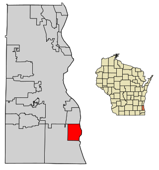
Cleveland is a village in Manitowoc County, Wisconsin, United States. The population was 1,485 at the 2010 census.

<span class="mw-page-title-main">South Milwaukee, Wisconsin</span> City in Wisconsin, United States

South Milwaukee is a city in Milwaukee County, Wisconsin, United States. The population was 20,795 at the 2020 census.

<span class="mw-page-title-main">Cashton, Wisconsin</span> Village in Wisconsin, United States

Cashton is a village in Monroe County, Wisconsin, United States. The population was 1,158 at the 2020 census.

<span class="mw-page-title-main">Wyeville, Wisconsin</span> Village in Wisconsin, United States

Wyeville is a village in Monroe County, Wisconsin, United States. It is located on Wisconsin Highway 21. The population was 147 at the 2010 census.

<span class="mw-page-title-main">Junction City, Wisconsin</span> Village in Wisconsin, United States

Junction City is a village in Portage County, Wisconsin, United States. The population was 439 at the 2010 census.

<span class="mw-page-title-main">Union Grove, Wisconsin</span> Village in Wisconsin, United States

Union Grove is a village in Racine County, Wisconsin, United States. The population was 4,806 at the 2020 census.

<span class="mw-page-title-main">Exeland, Wisconsin</span> Village in Wisconsin, United States

Exeland is a village in Sawyer County, Wisconsin, United States. The population was 229 at the 2020 census.

<span class="mw-page-title-main">Waldo, Wisconsin</span> Village in Wisconsin, United States

Waldo is a village along the Onion River in Sheboygan County, Wisconsin, United States. The population was 503 at the 2010 census. It has a post office with ZIP code 53093. It is included in the Sheboygan, Wisconsin Metropolitan Statistical Area.

<span class="mw-page-title-main">Lyons, Wisconsin</span> Town in Wisconsin, United States

Lyons is a town in Walworth County, Wisconsin, United States. The population was 3,648 at the 2020 census. The unincorporated communities of Lyons and Springfield are located within the town.

<span class="mw-page-title-main">Butler, Waukesha County, Wisconsin</span> Village in Wisconsin, United States

Butler is a village in Waukesha County, Wisconsin, United States. The population was 1,787 at the 2020 census.

<span class="mw-page-title-main">Montfort, Wisconsin</span> Village in Wisconsin, United States

Montfort is a village in Grant and Iowa Counties in the U.S. state of Wisconsin. The population was 718 at the 2010 census. Of this, 622 were in Grant County, and 96 were in Iowa County.

<span class="mw-page-title-main">Newburg, Wisconsin</span> Village in Ozaukee and Washington counties, Wisconsin

Newburg is a village in Ozaukee and Washington counties in the U.S. state of Wisconsin. The population was 1,254 at the 2010 census. Of this, 1,157 were in Washington County, and only 97 were in Ozaukee County.

<span class="mw-page-title-main">Howard, Wisconsin</span> Village in Wisconsin, United States

Howard is a village in Brown and Outagamie counties in the U.S. state of Wisconsin. The population was 17,399 at the 2010 census. It is part of the Green Bay Metropolitan Statistical Area.

<span class="mw-page-title-main">Clinton (town), Rock County, Wisconsin</span> Town in Wisconsin, United States

The Town of Clinton is a located in Rock County in the U.S. state of Wisconsin. The population was 2,190 at the 2000 census. The Village of Clinton is located in the town, though it is politically independent. The unincorporated community of Bergen is located in the town.

<span class="mw-page-title-main">Darien, Wisconsin</span> Village in Wisconsin, United States

Darien is a village in Walworth County, Wisconsin, United States. The population was 1,573 at the 2020 census. The village is located within the Town of Darien.

<span class="mw-page-title-main">East Troy, Wisconsin</span> Village in Wisconsin, United States

East Troy is a Village in Walworth County, Wisconsin, United States. The population was 5,673 at the 2020 census. The Village is located southwest of the Town of East Troy. A small portion extends into the adjacent Town of Troy.

<span class="mw-page-title-main">Port Edwards, Wisconsin</span> Village in Wisconsin, United States

Port Edwards is a village in Wood County, Wisconsin, United States. The village is located northeast and adjacent to the Town of Port Edwards. The population was 1,818 at the 2010 census.

References

  1. "2019 U.S. Gazetteer Files". United States Census Bureau. Retrieved August 7, 2020.
  2. 1 2 "U.S. Census website". United States Census Bureau . Retrieved November 18, 2012.
  3. "US Gazetteer files: 2010, 2000, and 1990". United States Census Bureau. February 12, 2011. Retrieved April 23, 2011.
  4. "US Gazetteer files 2010". United States Census Bureau. Archived from the original on July 2, 2012. Retrieved November 18, 2012.
  5. "Census of Population and Housing". Census.gov. Retrieved June 4, 2015.
  6. "U.S. Census website". United States Census Bureau . Retrieved January 31, 2008.
  7. "Clinton Railroad History and Photos". Archived from the original on March 2, 2015. Retrieved June 18, 2012.