Darien, Wisconsin

Last updated • 3 min readFrom Wikipedia, The Free Encyclopedia

Darien, Wisconsin
Darien, WI.jpg
The Darien sign and water tower as seen from U.S. Highway 14/North Walworth Street in August 2024.
Walworth County Wisconsin Incorporated and Unincorporated areas Darien Highlighted.svg
Location of Darien in Walworth County, Wisconsin.
Coordinates: 42°36′54″N88°43′14″W / 42.61500°N 88.72056°W / 42.61500; -88.72056
Country Flag of the United States.svg  United States
State Flag of Wisconsin.svg  Wisconsin
County Walworth
Area
[1]
  Total
1.29 sq mi (3.34 km2)
  Land1.29 sq mi (3.34 km2)
  Water0.00 sq mi (0.00 km2)
Elevation
[2]
925 ft (282 m)
Population
 (2020) [3]
  Total
1,573
  Density1,231.60/sq mi (475.66/km2)
Time zone UTC-6 (Central (CST))
  Summer (DST) UTC-5 (CDT)
ZIP Code
53113, 53114
Area code 262
FIPS code 55-18850 [4]
GNIS feature ID1583050 [2]
Website Village of Darien

Darien ( /dɛəriˈɛn/ or /dɛəriˈæn/ ) is a village in Walworth County, Wisconsin, United States. [5] The population was 1,573 at the 2020 census. The village is located within the Town of Darien.

Contents

Geography

Darien is located at 42°36′2″N88°42′30″W / 42.60056°N 88.70833°W / 42.60056; -88.70833 (42.600732, -88.708391). [6]

According to the United States Census Bureau, the village has a total area of 1.29 square miles (3.34 km2), all of it land. [7]

Demographics

Historical population
CensusPop.Note
1880 427
1890 354−17.1%
1960 805
1970 8394.2%
1980 1,15237.3%
1990 1,1580.5%
2000 1,57235.8%
2010 1,5800.5%
2020 1,573−0.4%
U.S. Decennial Census [8]

2010 census

As of the census [3] of 2010, there were 1,580 people, 549 households, and 419 families living in the village. The population density was 1,224.8 inhabitants per square mile (472.9/km2). There were 611 housing units at an average density of 473.6 per square mile (182.9/km2). The racial makeup of the village was 86.0% White, 0.8% African American, 0.4% Native American, 0.6% Asian, 10.8% from other races, and 1.5% from two or more races. Hispanic or Latino of any race were 22.0% of the population.

There were 549 households, of which 40.6% had children under the age of 18 living with them, 56.5% were married couples living together, 13.7% had a female householder with no husband present, 6.2% had a male householder with no wife present, and 23.7% were non-families. 16.4% of all households were made up of individuals, and 4.6% had someone living alone who was 65 years of age or older. The average household size was 2.88 and the average family size was 3.21.

The median age in the village was 33.5 years. 28.9% of residents were under the age of 18; 8.8% were between the ages of 18 and 24; 28.5% were from 25 to 44; 25.5% were from 45 to 64; and 8.2% were 65 years of age or older. The gender makeup of the village was 50.2% male and 49.8% female.

2000 census

As of the census [4] of 2000, there were 1,572 people, 537 households, and 411 families living in the village. The population density was 1,225.0 people per square mile (474.2/km2). There were 560 housing units at an average density of 436.4 per square mile (168.9/km2). The racial makeup of the village was 93.13% White, 0.51% Black or African American, 0.25% Native American, 0.06% Pacific Islander, 4.39% from other races, and 1.65% from two or more races. 14.12% of the population were Hispanic or Latino of any race.

There were 537 households, out of which 42.6% had children under the age of 18 living with them, 59.8% were married couples living together, 10.8% had a female householder with no husband present, and 23.3% were non-families. 18.8% of all households were made up of individuals, and 6.1% had someone living alone who was 65 years of age or older. The average household size was 2.92 and the average family size was 3.35.

In the village, the population was spread out, with 32.6% under the age of 18, 9.2% from 18 to 24, 31.0% from 25 to 44, 20.2% from 45 to 64, and 6.9% who were 65 years of age or older. The median age was 31 years. For every 100 females, there were 102.3 males. For every 100 females age 18 and over, there were 100.2 males.

The median income for a household in the village was $46,800, and the median income for a family was $53,625. Males had a median income of $35,568 versus $25,278 for females. The per capita income for the village was $17,638. About 4.9% of families and 6.8% of the population were below the poverty line, including 6.4% of those under age 18 and 6.7% of those age 65 or over.

Transportation

Darien was a stop on the Racine & Southwestern branch line of the Chicago, Milwaukee, St. Paul and Pacific Railroad, better known as the Milwaukee Road. In its 1980 bankruptcy, the Milwaukee Road disposed of the Southwestern Line. The Wisconsin & Southern continues to service Darien from a connection at Bardwell to the west. [9]

Notable people

Related Research Articles

<span class="mw-page-title-main">Verde Village, Arizona</span> CDP in Yavapai County, Arizona

Verde Village is a census-designated place (CDP) in Yavapai County, Arizona, United States. The population was 11,605 at the 2010 census. It is a retirement and bedroom community for Cottonwood.

<span class="mw-page-title-main">Corfu, New York</span> Village in New York, United States

Corfu is a village in Genesee County, New York, United States. The population was 709 at the 2010 census. It is named after the Greek island of Corfu.

<span class="mw-page-title-main">New Albany, Pennsylvania</span> Borough in Pennsylvania, United States

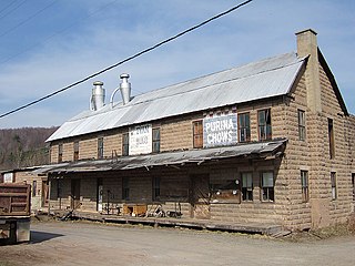
New Albany is a borough in Bradford County, Pennsylvania, United States. It is part of Northeastern Pennsylvania. The population was 254 at the 2020 census.

<span class="mw-page-title-main">Green Township, Indiana County, Pennsylvania</span> Township in Pennsylvania, United States

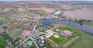
Green Township is a township in Indiana County, Pennsylvania, United States. Green Township was formed from Wheatfield Township circa 1816 and was named for the great evergreen forests covering the area. The population was 3,457 at the 2020 census. The township includes the communities of Bencetown, Berringer, Commodore, Cookport, Cush Cushion, Dixonville, Fleming Summit, Grisemore, Leard, Lovejoy, Martintown, Pine Flats, Prosperity Hill, Purchase Line, Shanktown, Starford, Spruce, Utah, Uniontown, and Wandin.

<span class="mw-page-title-main">East Norwegian Township, Pennsylvania</span> Township in Pennsylvania, United States

East Norwegian Township is a township in Schuylkill County, Pennsylvania, United States. The population was 864 at the 2020 census.

<span class="mw-page-title-main">Ward Township, Pennsylvania</span> Township in Pennsylvania, United States

Ward Township is a township in Tioga County, Pennsylvania, United States. The population was 223 at the 2020 census. It is the only township in Tioga County that is not in Pennsylvania's 5th congressional district, instead being located in the 10th.

<span class="mw-page-title-main">Neosho, Wisconsin</span> Village in Wisconsin, United States

Neosho is a village in Dodge County, Wisconsin, United States. The population was 591 at the 2020 census.

<span class="mw-page-title-main">Brandon, Wisconsin</span> Village in Wisconsin, United States

Brandon is a village in Fond du Lac County, Wisconsin, United States. The population was 882 at the 2020 census.

<span class="mw-page-title-main">Monticello, Green County, Wisconsin</span> Village in Wisconsin, United States

Monticello is a village in Green County, Wisconsin, United States. The population was 1,217 as of the 2010 census.

<span class="mw-page-title-main">Newburg, Wisconsin</span> Village in Ozaukee and Washington counties, Wisconsin

Newburg is a village in Ozaukee and Washington counties in the U.S. state of Wisconsin. The population was 1,254 at the 2010 census. Of this, 1,157 were in Washington County, and only 97 were in Ozaukee County.

<span class="mw-page-title-main">Cazenovia, Wisconsin</span> Village in Wisconsin, United States

Cazenovia is a village in Richland and Sauk Counties in the U.S. state of Wisconsin. The population was 318 at the 2010 census. Of this, 314 were in Richland County, and only 4 were in Sauk County.

<span class="mw-page-title-main">Birnamwood, Wisconsin</span> Village in Wisconsin, United States

Birnamwood is a village in Marathon and Shawano counties in the U.S. state of Wisconsin. It is part of the Wausau, Wisconsin Metropolitan Statistical Area. The population was 818 at the 2010 census. Of this, 802 were in Shawano County, and 16 were in Marathon County. The village is located mostly within the town of Birnamwood in Shawano County; only a small portion extends into the town of Norrie in adjacent Marathon County.

<span class="mw-page-title-main">Stockbridge, Wisconsin</span> Village in Wisconsin, United States

Stockbridge is a village in Calumet County, Wisconsin, United States. The population was 678 at the 2020 census. The village lies within the Town of Stockbridge.

<span class="mw-page-title-main">Hustisford, Wisconsin</span> Village in Wisconsin, United States

Hustisford is a village in Dodge County, Wisconsin, United States. The population was 1,101 at the 2020 census. The village is located within the town of Hustisford.

Colfax is a town in Dunn County, Wisconsin, United States. The population was 909 at the 2000 census.

Oakfield is a town in Fond du Lac County, Wisconsin, United States. The population was 767 at the 2000 census. The Village of Oakfield is located within the town. The unincorporated community of Oak Center is also located in the town.

<span class="mw-page-title-main">Rosendale (town), Wisconsin</span>

Rosendale is a town in Fond du Lac County, Wisconsin, United States. The population was 783 at the 2000 census. The village of Rosendale is located partially within the town. The unincorporated communities of Rosendale Center and West Rosendale are also located in the town.

<span class="mw-page-title-main">Fennimore, Wisconsin</span> City in Grant County, Wisconsin

Fennimore is a city in Grant County, Wisconsin, United States. The population was 2,497 at the 2010 census. The city's area was separated from the Town of Fennimore, which remains as an adjacent rural area.

<span class="mw-page-title-main">Rochester, Wisconsin</span> Village in Wisconsin

Rochester is a village in Racine County, Wisconsin, United States. The population was 3,785 at the 2020 census. The village is located within the former Town of Rochester. On November 4, 2008, the village of Rochester voted to consolidate with the Town of Rochester.

<span class="mw-page-title-main">Darien (town), Wisconsin</span>

Darien is a town in Walworth County, Wisconsin, United States. The population was 1,651 at the 2020 census. The Village of Darien is located within the town. The unincorporated community of Bardwell is located in the town. The unincorporated communities of Allen's Grove and Fairfield are also located partially in the town.

References

  1. "2019 U.S. Gazetteer Files". United States Census Bureau. Retrieved August 7, 2020.
  2. 1 2 "US Board on Geographic Names". United States Geological Survey. October 25, 2007. Retrieved January 31, 2008.
  3. 1 2 "U.S. Census website". United States Census Bureau . Retrieved November 18, 2012.
  4. 1 2 "U.S. Census website". United States Census Bureau . Retrieved January 31, 2008.
  5. "A Great Place to Live, Work, and Play!" . Retrieved November 18, 2016.
  6. "US Gazetteer files: 2010, 2000, and 1990". United States Census Bureau. February 12, 2011. Retrieved April 23, 2011.
  7. "US Gazetteer files 2010". United States Census Bureau. Archived from the original on July 2, 2012. Retrieved November 18, 2012.
  8. "Census of Population and Housing". Census.gov. Retrieved June 4, 2015.
  9. Darien Railroad History and Photos