Como, Wisconsin

Last updated
Como, Wisconsin
CDP
WIMap-doton-Como.png
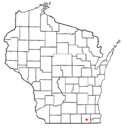
Location of Como, Wisconsin
Coordinates: 42°36′34″N88°29′24″W / 42.60944°N 88.49000°W / 42.60944; -88.49000 Coordinates: 42°36′34″N88°29′24″W / 42.60944°N 88.49000°W / 42.60944; -88.49000
Country United States
State Wisconsin
County Walworth
Area
  Total3.5 sq mi (9.1 km2)
  Land3.0 sq mi (7.8 km2)
  Water0.5 sq mi (1.3 km2)
Elevation
[1]
915 ft (279 m)
Population
 (2010)
  Total2,631
  Density750/sq mi (290/km2)
Time zone UTC-6 (Central (CST))
  Summer (DST) UTC-5 (CDT)
Area code(s) 262
FIPS code 55-16575 [2]
GNIS feature ID1563298 [1]

Como is a census-designated place (CDP), in the town of Geneva, Walworth County, Wisconsin, United States. The population was 2,631 at the 2010 census. [3]

Contents

Geography

Como is located at 42°36′34″N88°29′24″W / 42.60944°N 88.49000°W / 42.60944; -88.49000 (42.609428, -88.489993). [4]

According to the United States Census Bureau, the CDP has a total area of 3.5 square miles (9.1 km2), of which, 3.0 square miles (7.8 km2) of it is land and 0.5 square miles (1.3 km2) of it (14.16%) is water.

Demographics

At the 2000 census there were 1,870 people, 786 households, and 510 families in the CDP. The population density was 617.0 people per square mile (238.3/km2). There were 1,214 housing units at an average density of 400.6/sq mi (154.7/km2). The racial makeup of the CDP was 93.42% White, 0.70% African American, 0.11% Native American, 0.16% Asian, 4.06% from other races, and 1.55% from two or more races. Hispanic or Latino of any race were 7.01%. [2]

Of the 786 households 26.1% had children under the age of 18 living with them, 52.0% were married couples living together, 7.1% had a female householder with no husband present, and 35.1% were non-families. 28.2% of households were one person and 10.7% were one person aged 65 or older. The average household size was 2.38 and the average family size was 2.87.

The age distribution was 22.2% under the age of 18, 6.6% from 18 to 24, 30.0% from 25 to 44, 24.7% from 45 to 64, and 16.5% 65 or older. The median age was 40 years. For every 100 females, there were 104.1 males. For every 100 females age 18 and over, there were 102.4 males.

The median household income was $43,750 and the median family income was $49,395. Males had a median income of $30,469 versus $21,747 for females. The per capita income for the CDP was $22,780. About 3.0% of families and 3.1% of the population were below the poverty line, including 9.0% of those under age 18 and 1.3% of those age 65 or over.

Related Research Articles

Livengood, Alaska CDP in Alaska, United States

Livengood is a census-designated place (CDP) in Yukon-Koyukuk Census Area, Alaska, United States. The population was 13 at the 2010 census, down from 29 in 2000.

Mojave Ranch Estates, Arizona CDP in Arizona, United States

Mojave Ranch Estates is a census-designated place (CDP) in Mohave County, Arizona, United States. The population was 28 at the 2000 census.

Landmark, Arkansas CDP in Arkansas, United States

Landmark is a census-designated place (CDP) in Pulaski County, Arkansas, United States. The population was 3,555 at the 2010 census. It is part of the Little Rock–North Little Rock–Conway Metropolitan Statistical Area.

Forest Lake, Illinois Census-designated place in Illinois, United States

Forest Lake is an unincorporated community and census-designated place (CDP) in Ela Township of Lake County, Illinois, United States. It is about 35 miles (56 km) northwest of downtown Chicago. The population was 1,659 at the 2010 census. The community was founded in 1935 as a vacation community for Chicago residents.

Fox Lake Hills, Illinois Census-designated place in Illinois, United States

Fox Lake Hills is an unincorporated community and census-designated place (CDP) in Lake Villa Township, Lake County, Illinois, United States. The population was 2,591 at the 2010 census.

Lake Catherine, Illinois Census-designated place in Illinois, United States

Lake Catherine is an unincorporated community and census-designated place (CDP) in Lake County, Illinois, United States. The population was 1,379 at the 2010 census.

Venetian Village, Illinois Census-designated place in Illinois, United States

Venetian Village is a census-designated place (CDP) in Lake County, Illinois, United States. The population was 2,826 at the 2010 census.

Pistakee Highlands, Illinois Unincorporated in Illinois, United States

Pistakee Highlands is a census-designated place (CDP) in McHenry County, Illinois, United States. It consists primarily of an unincorporated area of McHenry County adjoining Pistakee Bay, within the McHenry post office, and is located just northeast of Johnsburg. The population was 3,454 at the 2010 census.

Simms, Montana CDP in Montana, United States

Simms is a census-designated place (CDP) in Cascade County, Montana, United States. The population was 354 at the 2010 census. It is part of the Great Falls, Montana Metropolitan Statistical Area.

Sun Prairie, Montana CDP in Montana, United States

Sun Prairie is a census-designated place (CDP) in Cascade County, Montana, United States. The population was 1,630 at the 2010 census. It is part of the Great Falls Metropolitan Statistical Area.

Johnson Lane, Nevada Census-designated place in Nevada, United States

Johnson Lane is a census-designated place (CDP) in Douglas County, Nevada, United States. It lies in the south side of the Carson City metropolitan area. The population was 6,490 at the 2010 census.

Rock Springs, New Mexico CDP in New Mexico, United States

Rock Springs is a census-designated place (CDP) in McKinley County, New Mexico, United States. The population was 558 at the 2000 census.

Sheep Springs, New Mexico CDP in New Mexico, United States

Sheep Springs is a census-designated place (CDP) in San Juan County, New Mexico, United States. The population was 237 at the 2000 census. It is part of the Farmington Metropolitan Statistical Area.

Belfonte, Oklahoma CDP in Oklahoma, United States

Belfonte is a census-designated place (CDP) in Sequoyah County, Oklahoma, United States. It is part of the Fort Smith, Arkansas-Oklahoma Metropolitan Statistical Area. The population was 426 at the 2000 census.

Remy, Oklahoma CDP in Oklahoma, United States

Remy is a census-designated place (CDP) in Sequoyah County, Oklahoma, United States. It is part of the Fort Smith, Arkansas-Oklahoma Metropolitan Statistical Area. The population was 411 at the 2000 census.

Boaz, West Virginia CDP in West Virginia, United States

Boaz is a census-designated place (CDP) in Wood County, West Virginia, in the United States. It is part of the Parkersburg-Marietta-Vienna, WV-OH Metropolitan Statistical Area. As of the 2010 census, the CDP population was 1,297.

Lake Koshkonong, Wisconsin Census-designated place in Wisconsin, United States

Lake Koshkonong is a census-designated place (CDP) in the town of Sumner, Jefferson County, Wisconsin, United States. The population was 1,204 at the 2010 census. Lake Koshkonong is in the area.

Wind Lake, Wisconsin CDP in Wisconsin, United States

Wind Lake is a census-designated place (CDP) in Racine County, Wisconsin, United States. The population was 5,342 at the 2010 census. Wind Lake is in the town of Norway.

Potter Lake, Wisconsin CDP in Wisconsin, United States

Potter Lake is a census-designated place (CDP) in the town of Troy, Walworth County, Wisconsin, United States. The population was 1,107 at the 2010 census.

Hebron (CDP), Wisconsin Census-designated place in Wisconsin, United States

Hebron is a census-designated place (CDP) in the town of Hebron, Jefferson County, Wisconsin, United States. The population was 224 at the 2010 census. It is located on the Bark River.

References

  1. 1 2 "US Board on Geographic Names". United States Geological Survey. 2007-10-25. Retrieved 2008-01-31.
  2. 1 2 "U.S. Census website". United States Census Bureau . Retrieved 2008-01-31.
  3. "U.S. Census website". U.S. Census Bureau . Retrieved 29 March 2011.
  4. "US Gazetteer files: 2010, 2000, and 1990". United States Census Bureau. 2011-02-12. Retrieved 2011-04-23.