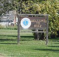
Boaz, Wisconsin | |
---|---|
Coordinates: 43°19′51″N90°31′38″W / 43.33083°N 90.52722°W | |
Country | United States |
State | Wisconsin |
County | Richland |
Area | |
• Total | 0.36 sq mi (0.93 km2) |
• Land | 0.36 sq mi (0.93 km2) |
• Water | 0.00 sq mi (0.00 km2) |
Elevation | 751 ft (229 m) |
Population | |
• Total | 156 |
146 | |
• Density | 405.56/sq mi (156.56/km2) |
Time zone | UTC-6 (Central (CST)) |
• Summer (DST) | UTC-5 (CDT) |
Area code | 608 |
FIPS code | 55-08600 [5] |
GNIS feature ID | 1561987 [2] |
Boaz is a village in Richland County, Wisconsin, United States. According to the 2010 census, the population of the village was 156.
Boaz is located at 43°19′51″N90°31′38″W / 43.33083°N 90.52722°W (43.330793, -90.527280). [6]
According to the United States Census Bureau, the village has a total area of 0.36 square miles (0.93 km2), all of it land. [7]
Boaz was the boyhood home of Richard M. Brewer, the first leader of the Regulators in the Lincoln County (New Mexico) War. [8] A skeleton of a mastodon, the Boaz mastodon, was found in 1897, near Boaz. [9]
Census | Pop. | Note | %± |
---|---|---|---|
1880 | 75 | — | |
1940 | 230 | — | |
1950 | 188 | −18.3% | |
1960 | 117 | −37.8% | |
1970 | 126 | 7.7% | |
1980 | 161 | 27.8% | |
1990 | 131 | −18.6% | |
2000 | 137 | 4.6% | |
2010 | 156 | 13.9% | |
2019 (est.) | 146 | [4] | −6.4% |
U.S. Decennial Census [10] |
As of the census [3] of 2010, there were 156 people, 67 households, and 40 families living in the village. The population density was 433.3 inhabitants per square mile (167.3/km2). There were 68 housing units at an average density of 188.9 per square mile (72.9/km2). The racial makeup of the village was 98.7% White and 1.3% Asian. Hispanic or Latino of any race were 0.6% of the population.
There were 67 households, of which 20.9% had children under the age of 18 living with them, 50.7% were married couples living together, 4.5% had a female householder with no husband present, 4.5% had a male householder with no wife present, and 40.3% were non-families. 29.9% of all households were made up of individuals, and 9% had someone living alone who was 65 years of age or older. The average household size was 2.33 and the average family size was 2.75.
The median age in the village was 49.3 years. 19.2% of residents were under the age of 18; 7% were between the ages of 18 and 24; 19.3% were from 25 to 44; 32.1% were from 45 to 64; and 22.4% were 65 years of age or older. The gender makeup of the village was 52.6% male and 47.4% female.
As of the census [5] of 2000, there were 137 people, 64 households, and 41 families living in the village. The population density was 383.2 people per square mile (146.9/km2). There were 67 housing units at an average density of 187.4 per square mile (71.9/km2). The racial makeup of the village was 99.27% White and 0.73% Native American.
There were 64 households, out of which 28.1% had children under the age of 18 living with them, 45.3% were married couples living together, 10.9% had a female householder with no husband present, and 35.9% were non-families. 26.6% of all households were made up of individuals, and 7.8% had someone living alone who was 65 years of age or older. The average household size was 2.14 and the average family size was 2.61.
In the village, the population was spread out, with 21.2% under the age of 18, 10.2% from 18 to 24, 29.9% from 25 to 44, 24.1% from 45 to 64, and 14.6% who were 65 years of age or older. The median age was 40 years. For every 100 females, there were 95.7 males. For every 100 females age 18 and over, there were 89.5 males.
The median income for a household in the village was $31,563, and the median income for a family was $32,000. Males had a median income of $22,500 versus $22,500 for females. The per capita income for the village was $16,883. There were 16.7% of families and 13.2% of the population living below the poverty line, including 41.7% of under eighteens and none of those over 64.
Bellevue is a village in Brown County, Wisconsin. It was a town until incorporating as a village on February 14, 2003. The population was 15,935 at the time of the 2020 census. Bellevue is part of the Green Bay metropolitan area. Bellevue sits around 4.34 miles (6.99 km) east from central Green Bay.
Maple Bluff is a village in Dane County, Wisconsin, United States. The population was 1,368 at the 2020 census. A suburb of Madison, it is part of the Madison Metropolitan Statistical Area.
Fairwater is a village in Fond du Lac County, Wisconsin, United States. The population was 346 at the 2020 census. The town of Metomen surrounds the village.
Avoca is a village in Iowa County, Wisconsin, United States. The population was 553 at the 2020 census. It is part of the Madison Metropolitan Statistical Area. It is named after Avoca in Ireland.
White Lake is a village in Langlade County, Wisconsin, United States. The population was 262 at the 2020 census.
Kellnersville is a village in Manitowoc County, Wisconsin, United States. The population was 307 at the 2020 census.
Warrens is a village in Monroe County, Wisconsin, United States off I-94. The population was 544 at the 2020 census.
Park Ridge is a village in Portage County, Wisconsin, United States and is a suburb of Stevens Point. It is included in the Stevens Point Micropolitan Statistical Area. The population was 530 at the 2020 census.
Tigerton is a village in Shawano County, Wisconsin, United States. The population was 741 at the 2010 census.
La Farge is a village along the Kickapoo River in Vernon County, Wisconsin, United States. Its population was 730 at the 2020 census.
Embarrass is a village in Waupaca County, Wisconsin, United States. The population was 404 at the 2010 census.
Biron is a village in Wood County, Wisconsin, United States. The population was 839 at the 2010 census. It is the site of ND Paper's Biron Mill.
Cazenovia is a village in Richland and Sauk Counties in the U.S. state of Wisconsin. The population was 318 at the 2010 census. Of this, 314 were in Richland County, and only 4 were in Sauk County.
Pulaski is a village in Brown, Oconto, and Shawano counties in the U.S. state of Wisconsin. The population was 3,539 at the 2010 census. Of this, 3,321 were in Brown County, 218 in Shawano County, and none in Oconto County.
Forestville is a village in Door County, Wisconsin, United States, along the Ahnapee River. The population was 482 at the 2020 census. The village is located within the Town of Forestville. The village uses the 54213 ZIP code. The Ahnapee State Trail passes through the village on the southwest.
Fennimore is a city in Grant County, Wisconsin, United States. The population was 2,764 at the 2020 census. The city's area was separated from the Town of Fennimore, which remains as an adjacent rural area.
Patch Grove is a village in Grant County, Wisconsin, United States. The population was 201 at the 2020 census. The village is located within the Town of Patch Grove.
Darien is a village in Walworth County, Wisconsin, United States. The population was 1,573 at the 2020 census. The village is located within the Town of Darien.
Rudolph is a village in Wood County, Wisconsin, United States. The population was 439 at the 2010 census. The village is located within the Town of Rudolph.
Madawaska is a census-designated place (CDP) comprising the main village within the town of Madawaska in Aroostook County, Maine, United States. The population of the CDP was 2,967 at the 2010 census, out of a population of 4,035 for the entire town.
Media related to Boaz, Wisconsin at Wikimedia Commons