Hixton, Wisconsin

Last updated

Hixton, Wisconsin
Hixton, Wisconsin.jpg
Jackson County Wisconsin Incorporated and Unincorporated areas Hixton Highlighted.svg
Location of Hixton in Jackson County, Wisconsin.
Coordinates: 44°23′14″N90°59′39″W / 44.38722°N 90.99417°W / 44.38722; -90.99417
Country Flag of the United States.svg  United States
State Flag of Wisconsin.svg  Wisconsin
County Jackson
Area
[1]
  Total1.14 sq mi (2.95 km2)
  Land1.14 sq mi (2.95 km2)
  Water0.00 sq mi (0.00 km2)
Elevation
[2]
965 ft (294 m)
Population
 (2010) [3]
  Total433
  Estimate 
(2019) [4]
424
  Density371.60/sq mi (143.51/km2)
Time zone UTC-6 (Central (CST))
  Summer (DST) UTC-5 (CDT)
Area code(s) 715 & 534
FIPS code 55-35100 [5]
GNIS feature ID1566491 [2]
Website villageofhixton.com

Hixton is a village in Jackson County, Wisconsin, United States, along the Trempealeau River. The population was 433 at the 2010 census. The village is located within the Town of Hixton.

Contents

History

The community was started by John L. Hicks, who came to the area in 1854. [6] The town of Hixton (formed out of a piece of Albion) was formed and named in 1856. The community was at first named Williamport, and later Pole Grove. The local post office was established in 1856 as "Pole Grove," and was renamed Hixton in 1874. [6] The Green Bay and Minnesota Railroad came through the area and opened a station at Hixton in 1873. [6] The community was incorporated in 1920. [7]

Geography

Hixton is located at 44°22′55″N91°0′53″W / 44.38194°N 91.01472°W / 44.38194; -91.01472 (44.382042, -91.014849). [8]

According to the United States Census Bureau, the village has a total area of 1.09 square miles (2.82 km2), all of it land. [9]

Wisconsin Highway 95 runs through the village, and is also an exit on Interstate 94, which runs through the northeast part of the village.

Demographics

Historical population
CensusPop.Note
1930 270
1940 30111.5%
1950 3154.7%
1960 310−1.6%
1970 300−3.2%
1980 36421.3%
1990 345−5.2%
2000 44629.3%
2010 433−2.9%
2019 (est.)424 [4] −2.1%
U.S. Decennial Census [10]

2010 census

As of the census [3] of 2010, there were 433 people, 200 households, and 121 families living in the village. The population density was 397.2 inhabitants per square mile (153.4/km2). There were 219 housing units at an average density of 200.9 per square mile (77.6/km2). The racial makeup of the village was 94.9% White, 3.0% Native American, 0.2% Asian, 0.2% from other races, and 1.6% from two or more races. Hispanic or Latino of any race were 1.4% of the population.

There were 200 households, of which 24.5% had children under the age of 18 living with them, 43.5% were married couples living together, 11.0% had a female householder with no husband present, 6.0% had a male householder with no wife present, and 39.5% were non-families. 34.5% of all households were made up of individuals, and 18% had someone living alone who was 65 years of age or older. The average household size was 2.17 and the average family size was 2.71.

The median age in the village was 40.3 years. 21.9% of residents were under the age of 18; 7.5% were between the ages of 18 and 24; 25.6% were from 25 to 44; 28.5% were from 45 to 64; and 16.6% were 65 years of age or older. The gender makeup of the village was 51.3% male and 48.7% female.

2000 census

As of the census [5] of 2000, there were 446 people, 203 households, and 116 families living in the village. The population density was 416.4 people per square mile (160.9/km2). There were 217 housing units at an average density of 202.6 per square mile (78.3/km2). The racial makeup of the village was 98.65% White, 1.12% Native American, and 0.22% from two or more races. 0.22% of the population were Hispanic or Latino of any race.

There were 203 households, out of which 25.6% had children under the age of 18 living with them, 48.3% were married couples living together, 5.4% had a female householder with no husband present, and 42.4% were non-families. 35.0% of all households were made up of individuals, and 18.7% had someone living alone who was 65 years of age or older. The average household size was 2.20 and the average family size was 2.89.

In the village, the population was spread out, with 23.3% under the age of 18, 6.1% from 18 to 24, 27.4% from 25 to 44, 20.4% from 45 to 64, and 22.9% who were 65 years of age or older. The median age was 41 years. For every 100 females, there were 102.7 males. For every 100 females age 18 and over, there were 103.6 males.

The median income for a household in the village was $28,839, and the median income for a family was $41,500. Males had a median income of $28,958 versus $18,587 for females. The per capita income for the village was $16,314. About 3.5% of families and 8.3% of the population were below the poverty line, including 9.7% of those under age 18 and 13.6% of those age 65 or over.

Images

Related Research Articles

Deblois is a town in Washington County, Maine, United States. The town was named after T.A. Deblois, president of the Bank of Portland. The population was 74 at the 2020 census.

<span class="mw-page-title-main">South Browning, Montana</span> Census-designated place in Montana, United States

South Browning is a census-designated place (CDP) in Glacier County, Montana, United States. The population was 1,785 at the 2010 census. South Browning is a rural village on the Blackfeet Indian Reservation. It is bordered to the north by the town of Browning.
<span class="mw-page-title-main">Rockland, Brown County, Wisconsin</span> Town in Wisconsin, United States

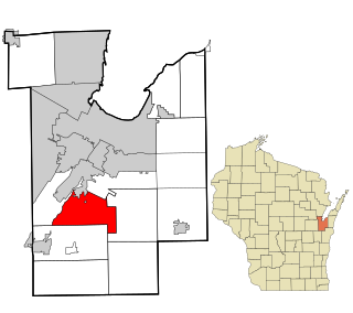
Rockland is a town in Brown County in the U.S. state of Wisconsin. The population was 1,734 at the 2010 census.

<span class="mw-page-title-main">Poynette, Wisconsin</span> Village in Wisconsin, United States

Poynette is a village in Columbia County, Wisconsin, United States. The population was 2,575 at the 2022 United States census. It is part of the Madison Metropolitan Statistical Area.
<span class="mw-page-title-main">Hollandale, Wisconsin</span> Village in Wisconsin, United States

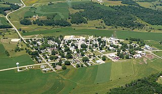
Hollandale is a village in Iowa County, Wisconsin, United States. The population was 306 at the 2020 census. It is part of the Madison Metropolitan Statistical Area.

<span class="mw-page-title-main">Curran, Wisconsin</span> Town in Wisconsin, United States

Curran is a town in Jackson County, Wisconsin, United States. The population was 343 at the 2010 census.

<span class="mw-page-title-main">Bay City, Wisconsin</span> Village in Wisconsin, United States

Bay City is a village on the Mississippi River in Pierce County, Wisconsin, United States. The population was 500 at the 2010 census.

<span class="mw-page-title-main">Footville, Wisconsin</span> Village in Wisconsin, United States

Footville is a village in Rock County, Wisconsin, United States. The population was 772 at the 2020 census.

<span class="mw-page-title-main">Weyerhaeuser, Wisconsin</span> Village in Wisconsin, United States

Weyerhaeuser is a village in Rusk County, Wisconsin, United States. The population was 238 at the 2010 census.

<span class="mw-page-title-main">Readstown, Wisconsin</span> Village in Wisconsin, United States

Readstown is a village in Vernon County, Wisconsin, United States. The population was 376 at the 2020 census.

<span class="mw-page-title-main">Dousman, Wisconsin</span> Village in Wisconsin, United States

Dousman is a village in Waukesha County, Wisconsin, United States. The population was 2,419 at the 2020 census.
<span class="mw-page-title-main">Wild Rose, Wisconsin</span> Village in Wisconsin, United States

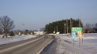
Wild Rose is a village in Waushara County, Wisconsin, United States. The population was 725 at the 2010 census.

<span class="mw-page-title-main">Milladore, Wisconsin</span> Village in Wisconsin, United States

Milladore is a village in Wood County and overlapping into Portage County in the U.S. state of Wisconsin. The population was 276 at the 2010 census. Most of the village is located within the Town of Milladore in Wood County, while only a very small portion of the village lies in Portage County. All of its 2010 census population resided in the Wood County portion of the village.

<span class="mw-page-title-main">Lowell, Wisconsin</span> Village in Wisconsin, United States

Lowell is a village in Dodge County, Wisconsin, United States, along the Beaver Dam River. The population was 340 at the 2010 census. The village is located within the Town of Lowell.

<span class="mw-page-title-main">Highland (village), Iowa County, Wisconsin</span> Village in Wisconsin, United States

Highland is a village in Iowa County, Wisconsin, United States. The population was 842 at the 2010 census. It is part of the Madison Metropolitan Statistical Area. The village is located within the Town of Highland.

<span class="mw-page-title-main">Ridgeway (town), Wisconsin</span> Town in Iowa County, Wisconsin, US

Ridgeway is a town in Iowa County, Wisconsin, United States. The population was 563 at the 2020 census. The Village of Ridgeway is located within the town. The unincorporated community of Hyde is also located in the town.

<span class="mw-page-title-main">Hixton (town), Wisconsin</span> Town in Wisconsin, United States

Hixton is a town in Jackson County, Wisconsin, United States. The population was 611 at the 2000 census. The Village of Hixton is located within the town. The unincorporated community of Sechlerville is also located in the town.

<span class="mw-page-title-main">Casco, Wisconsin</span> Village in Wisconsin, United States

Casco is a village in Kewaunee County, Wisconsin, United States. The population was 583 at the 2010 census. It is part of the Green Bay Metropolitan Statistical Area. The village is located within the Town of Casco. Casco is named after Casco Bay on the coast of Maine, the previous home of Edward Decker, an early logger in Kewaunee County.
<span class="mw-page-title-main">Belmont, Wisconsin</span> Village in Wisconsin, United States

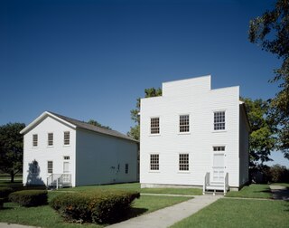
Belmont is a village in Lafayette County, Wisconsin, United States. The population was 989 at the 2020 census. It was the original capital of the Wisconsin Territory during the first legislative assembly in 1836.

<span class="mw-page-title-main">Spencer, Wisconsin</span> Village in Wisconsin, United States

Spencer is a village in Marathon County, Wisconsin. It is part of the Wausau, Wisconsin Metropolitan Statistical Area. The population was 1,925 at the 2010 census.

References

  1. "2019 U.S. Gazetteer Files". United States Census Bureau. Retrieved August 7, 2020.
  2. 1 2 "US Board on Geographic Names". United States Geological Survey. October 25, 2007. Retrieved January 31, 2008.
  3. 1 2 "U.S. Census website". United States Census Bureau . Retrieved November 18, 2012.
  4. 1 2 "Population and Housing Unit Estimates". United States Census Bureau. May 24, 2020. Retrieved May 27, 2020.
  5. 1 2 "U.S. Census website". United States Census Bureau . Retrieved January 31, 2008.
  6. 1 2 3 Anderson, Jean (August 22, 1976). Sechlerville Never Caught On, La Crosse Tribune
  7. 1930 Census - Wisconsin population data, pdf p. 14
  8. "US Gazetteer files: 2010, 2000, and 1990". United States Census Bureau. February 12, 2011. Retrieved April 23, 2011.
  9. "US Gazetteer files 2010". United States Census Bureau. Archived from the original on January 25, 2012. Retrieved November 18, 2012.
  10. "Census of Population and Housing". Census.gov. Retrieved June 4, 2015.