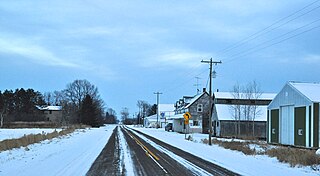
Jackson County is a county located in the U.S. state of Wisconsin. As of the 2010 census, the population was 20,449. Its county seat is Black River Falls. Jackson County was formed from Crawford County in 1853. It was named for President Andrew Jackson.
U.S. Highway 10 (US 10) in Wisconsin runs east–west across the central part of the state. It runs from the Prescott Drawbridge over the St. Croix River at Prescott east to the dock in Manitowoc where the SS Badger crosses Lake Michigan to Ludington, Michigan. The highway is also designated as the Vietnam War Veterans Memorial Highway for its entire length.
U.S. Highway 12 in the U.S. state of Wisconsin runs east–west across the western to southeast portions of the state. It enters from Minnesota running concurrently with Interstate 94 (I-94) at Hudson, parallels the Interstate to Wisconsin Dells, and provides local access to cities such as Menomonie, Eau Claire, Black River Falls, Tomah and Mauston. It then provides an alternative route for traffic between northwestern Wisconsin and Madison and is the anchor route for the Beltline Highway around Madison. Finally, it serves southeastern Wisconsin, connecting Madison with Fort Atkinson, Whitewater, Elkhorn and Lake Geneva. The West Beltline Highway and the segment between Elkhorn and Genoa City are freeways, and the segment between Sauk City and Middleton is an expressway. The remainder of the road is a two-lane surface road or an urban multi-lane arterial. Between Hudson and west of Warrens, the road closely parallels the former main line of the Omaha Road, now operated by Union Pacific Railroad.

Northfield is an unincorporated community located in the town of Northfield, Jackson County, Wisconsin, United States. Northfield is located at the junction of Interstate 94 and Wisconsin Highway 121 7 miles (11 km) northwest of Hixton.

North Bend is an unincorporated community in the town of North Bend, Jackson County, Wisconsin, United States. North Bend is located on the Black River and Wisconsin Highway 54 6.7 miles (10.8 km) west-southwest of Melrose.

Big Foot Prairie is an unincorporated community in both McHenry County, Illinois and Walworth County, Wisconsin, United States. The Illinois portion of the community, which is larger, is located in Chemung Township, while the Wisconsin portion is located in the Town of Walworth. Big Foot Prairie is located on U.S. Route 14, 5 miles (8.0 km) north of Harvard.

Kellner is an unincorporated community located in Portage and Wood counties, Wisconsin, United States. The Portage County portion of Kellner is located in the town of Grant, while the Wood County portion is located in the town of Grand Rapids. Kellner is located at the junction of County Highways U and WW 5.5 miles (8.9 km) east-southeast of Wisconsin Rapids.

Clifford is an unincorporated community in Lincoln, Oneida, and Price counties, Wisconsin, United States. Clifford is located in the towns of Somo in Lincoln County, Lynne in Oneida County, and Knox in Price County. The community is located on U.S. Route 8 12 miles (19 km) east of Prentice.

City Point is an unincorporated community located in the town of City Point, Jackson County, Wisconsin, United States. City Point is located on Wisconsin Highway 54 25 miles (40 km) west of Wisconsin Rapids.

Winnebago Mission is an unincorporated community located in the town of Komensky, Jackson County, Wisconsin, United States. Winnebago is 6 miles (9.7 km) northeast of Black River Falls.

Franklin is an unincorporated community located in the town of Franklin, Jackson County, Wisconsin, United States. Franklin is located on County Highway C 8 miles (13 km) east-northeast of Ettrick.

Price is an unincorporated community located in the town of Garfield, Jackson County, Wisconsin, United States. Price is located along U.S. Route 10 5 miles (8.0 km) west-southwest of Fairchild.

Requa is an unincorporated community located in the town of Garfield, Jackson County, Wisconsin, United States. Requa is located along U.S. Route 10 and the North Buffalo River 3.5 miles (5.6 km) east of Osseo.

Levis is an unincorporated community located in the town of Garfield, Jackson County, Wisconsin, United States. Levis is located on County Highway B and the South Buffalo River 6 miles (9.7 km) east-southeast of Osseo.

County Line is an unincorporated community located on the border of Marinette and Oconto counties, in the U.S. state of Wisconsin. The Marinette County portion of the community is located in the town of Grover, while the Oconto County portion is located in the town of Little River. County Line is located on County Trunk Highway W near U.S. Highway 41, 6.5 miles (10.5 km) southwest of Peshtigo.

Kirchhayn is an unincorporated community located in the town of Jackson, Washington County, Wisconsin, United States. Kirchhayn is located on County Highway T 5.4 miles (8.7 km) west of Cedarburg.

Gad is an unincorporated community located in Marathon and Taylor Counties, Wisconsin, United States. The Marathon County portion of Gad is in the town of Bern, while the Taylor County portion is in the town of Browning. Gad is located along County Highway C 7.5 miles (12.1 km) east-southeast of Medford. The community once had a school called the Gad School; it is now part of the Medford Area School District.

Emmerich is an unincorporated community located in the town of Berlin, Marathon County, Wisconsin, United States. Emmerich is located on County Highway F 13.3 miles (21.4 km) northwest of Wausau.

Holt is an unincorporated community located in the town of Franzen, Marathon County, Wisconsin, United States. Holt is located at the junction of County Highways C and I 6.1 miles (9.8 km) southwest of Elderon.

Four Corners is an unincorporated community located in the town of Superior, Douglas County, Wisconsin, United States. Four Corners is located at the junction of County Roads A and B, 13 miles (21 km) south of the city of Superior.


