Lincoln most commonly refers to:

Wisconsin is a state in the upper Midwestern United States. Wisconsin is the 25th-largest state by total area and the 20th-most populous. It is bordered by Minnesota to the west, Iowa to the southwest, Illinois to the south, Lake Michigan to the east, Michigan to the northeast, and Lake Superior to the north.

St. Croix County is a county in the U.S. state of Wisconsin. As of the 2020 census, the population was 93,536. Its county seat is Hudson. The county was created in 1840 and organized in 1849. St. Croix County is part of the Minneapolis-St. Paul-Bloomington, MN-WI Metropolitan Statistical Area. Between 2000 and 2010, it was the fastest-growing county in Wisconsin.

Racine County is a county in southeastern Wisconsin. As of the 2020 census, its population was 197,727, making it Wisconsin's fifth-most populous county. Its county seat is Racine. The county was founded in 1836, then a part of the Wisconsin Territory. Racine County comprises the Racine metropolitan statistical area. This area is part of the Milwaukee-Racine-Waukesha combined statistical area. According to the U.S. Census Bureau, the county has an area of 792 square miles (2,050 km2), of which 333 square miles (860 km2) is land and 460 square miles (1,200 km2) (58%) is water. The county's unemployment rate was 5.6% in June 2021.

Marquette County is a county located in the U.S. state of Wisconsin. As of the 2020 census, the population was 15,592. Its county seat is Montello. The county was created in 1836 from the Wisconsin Territory and organized in 1848.

Fitchburg is a city in Dane County, Wisconsin, United States. The population was 29,609 at the 2020 census. Fitchburg is a suburb of Madison and is part of the Madison Metropolitan Statistical Area. Fitchburg consists of a mix of suburban neighborhoods closer to the border with the city of Madison, commercial and industrial properties, and more rural properties in the southern portion of the city. Despite its status as an incorporated city, some rural parts of Fitchburg still lack certain municipal services such as sewer, water, and natural gas.

Brodhead is a city in Green and Rock counties in the U.S. state of Wisconsin. The population was 3,293 at the 2010 census. Of these, 3,203 were in Green County, and only 90 were in Rock County. In February 2000, the city annexed a portion of land from the Town of Spring Valley in Rock County.

Wiota is a town in Lafayette County, Wisconsin, United States. The population was 856 at the 2010 census. The unincorporated communities of Wiota, Woodford and Five Corners are located in the town.

Berlin is a town in Marathon County, Wisconsin, United States. It is part of the Wausau, Wisconsin Metropolitan Statistical Area. The population was 945 at the 2010 census. The unincorporated communities of Emmerich and Naugart are located in the town. The unincorporated community of Teagesville is also located partially in the town. The ghost town of Ziegler was also located in the town.

Franzen is a town in Marathon County, Wisconsin, United States. It is part of the Wausau, Wisconsin Metropolitan Statistical Area. The population was 578 at the 2010 census. The unincorporated communities of Galloway and Holt are located in the town.
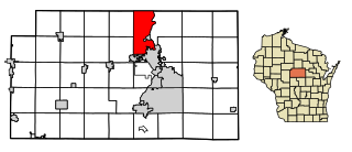
Maine is an incorporated village in Marathon County, Wisconsin, United States. It is part of the Wausau, Wisconsin Metropolitan Statistical Area. The population was 2,337 at the 2010 census. The unincorporated communities of Mount View and Taegesville are located partially in the town.

Oak Creek is a city in the U.S. state of Wisconsin. Located in Milwaukee County, it sits on the southwestern shore of Lake Michigan and is located immediately south of Milwaukee. The city is one of the fastest growing in Milwaukee County and all of Wisconsin. As of the 2020 census the population was 36,497.

Germantown is a village in Washington County, Wisconsin, United States. The population was 19,749 at the 2010 census. The village surrounds the Town of Germantown. In July 2007, Germantown was ranked the 30th most appealing place to live in the United States by Money Magazine.

Pewaukee is a city in Waukesha County, Wisconsin. The population was 13,195 at the 2010 census. The Village of Pewaukee, which was incorporated out of the town before it incorporated as a city, is surrounded by the city.
Sinsinawa is an unincorporated community in Grant County, Wisconsin, United States. The community is in the towns of Jamestown and Hazel Green, one mile north of the border with Illinois. The community is 7+1⁄2 miles (12.1 km) east of Dubuque, Iowa, and 6+1⁄2 miles (10.5 km) west of the village of Hazel Green, Wisconsin. The town is best known for being the mother house of the Sinsinawa Dominican Sisters.
The following is a set–index article, providing a list of lists, for the cities, towns and villages within the jurisdictional United States. It is divided, alphabetically, according to the state, territory, or district name in which they are located.

The following is an alphabetical list of articles related to the U.S. state of Wisconsin.

Albion is an unincorporated community located in the Town of Albion, Dane County, Wisconsin, United States.

Harrison is a village in Calumet and Outagamie Counties, Wisconsin, United States. The village was created on March 8, 2013, from unincorporated areas of the Town of Harrison and a portion of the Town of Buchanan: the right of way along County Trunk Highway KK in Outagamie County. The village is located in what was the northwestern part of the town of Harrison and borders Appleton and Menasha. It has a population of 11,532 and an area of 4.7 square miles (12 km2).


