Wausaukee, Wisconsin | |
---|---|
Coordinates: 45°24′N87°55′W / 45.400°N 87.917°W | |
Country | United States |
State | Wisconsin |
County | Marinette |
Area | |
• Total | 1.39 sq mi (3.60 km2) |
• Land | 1.38 sq mi (3.56 km2) |
• Water | 0.01 sq mi (0.03 km2) |
Elevation | 774 ft (236 m) |
Population | |
• Total | 575 |
• Estimate (2019) [4] | 554 |
• Density | 402.62/sq mi (155.41/km2) |
Time zone | UTC-6 (Central (CST)) |
• Summer (DST) | UTC-5 (CDT) |
Area code(s) | 715 & 534 |
FIPS code | 55-84550 [5] |
GNIS feature ID | 1576328 [2] |
Wausaukee is a village in Marinette County, Wisconsin, in the United States. The population was 575 at the 2010 census. The village is part of the Marinette, WI– MI Micropolitan Statistical Area.
Wausaukee is a Menominee word that means “river in the hills.” [6] The town was started in 1863 by John S. Monroe, who bought 160 acres of land from business tycoon Lars Kovala and built a mill to supply the railroads with lumber for bridges and culverts. [6] His first building was a log cabin home that was also used to board the mill workers. As the town grew and more settlers moved in, his log cabin grew into an inn that was the only public eating establishment north of Green Bay. [6]
On August 19, 2011 at 4:45pm, an EF1 tornado struck Wausaukee. One fatality was recorded. [7]
Wausaukee is located at 45°23′N87°57′W / 45.383°N 87.950°W (45.3767, -87.9561). [8]
According to the United States Census Bureau, the village has a total area of 1.41 square miles (3.65 km2), of which, 1.40 square miles (3.63 km2) of it is land and 0.01 square miles (0.03 km2) is water. [9]
The Wausaukee River flows through the village into the Menominee River. [10]
Census | Pop. | Note | %± |
---|---|---|---|
1930 | 663 | — | |
1940 | 655 | −1.2% | |
1950 | 612 | −6.6% | |
1960 | 608 | −0.7% | |
1970 | 557 | −8.4% | |
1980 | 648 | 16.3% | |
1990 | 656 | 1.2% | |
2000 | 572 | −12.8% | |
2010 | 575 | 0.5% | |
2020 | 559 | −2.8% | |
2019 (est.) | 554 | [4] | −3.7% |
U.S. Decennial Census [11] |
As of the census [3] of 2010, there were 575 people, 275 households, and 145 families living in the village. The population density was 410.7 inhabitants per square mile (158.6/km2). There were 325 housing units at an average density of 232.1 per square mile (89.6/km2). The racial makeup of the village was 95.7% White, 1.2% Native American, 0.2% Asian, 0.5% from other races, and 2.4% from two or more races. Hispanic or Latino of any race were 2.8% of the population.
There were 275 households, of which 25.8% had children under the age of 18 living with them, 33.5% were married couples living together, 12.7% had a female householder with no husband present, 6.5% had a male householder with no wife present, and 47.3% were non-families. 41.8% of all households were made up of individuals, and 24% had someone living alone who was 65 years of age or older. The average household size was 2.09 and the average family size was 2.78.
The median age in the village was 43.3 years. 22.8% of residents were under the age of 18; 7.8% were between the ages of 18 and 24; 21.6% were from 25 to 44; 25.2% were from 45 to 64, and 22.4% were 65 years of age or older. The gender makeup of the village was 48.7% male and 51.3% female.
As of the census [5] of 2000, there were 572 people, 251 households, and 150 families living in the village. The population density was 402.4 inhabitants per square mile (155.4/km2). There were 294 housing units at an average density of 206.8 per square mile (79.8/km2). The racial makeup of the village was 96.50% White, 0.87% Black or African American, 22.22% Native American, 0.17% from other races, and 1.22% from two or more races. 0.87% of the population were Hispanic or Latino of any race.
There were 251 households, out of which 28.7% had children under the age of 18 living with them, 43.0% were married couples living together, 13.5% had a female householder with no husband present, and 40.2% were non-families. 35.9% of all households were made up of individuals, and 20.3% had someone living alone who was 65 years of age or older. The average household size was 2.27 and the average family size was 2.97.
In the village, the population was spread out, with 26.2% under the age of 18, 7.2% from 18 to 24, 22.9% from 25 to 44, 21.9% from 45 to 64, and 21.9% who were 65 years of age or older. The median age was 40 years. For every 100 females, there were 84.5 males. For every 100 females age 18 and over, there were 75.8 males.
The median income for a household in the village was $25,313, and the median income for a family was $35,833. Males had a median income of $30,313 versus $20,417 for females. The per capita income for the village was $13,098. About 17.5% of families and 23.0% of the population were below the poverty line, including 36.8% of those under age 18 and 11.3% of those age 65 or over.
Ferryville is a village in Crawford County, Wisconsin, United States. The population was 176 at the 2010 census. It is located on Wisconsin Highway 35 along the Great River Road.
Cleveland is a village in Manitowoc County, Wisconsin, United States. The population was 1,485 at the 2010 census.
Maribel is a village in Manitowoc County, Wisconsin, United States. The population was 351 at the 2010 census.
Reedsville is a village in Manitowoc County, Wisconsin, United States. The population was 1,195 at the 2020 census.
Brokaw is a former village in Marathon County, Wisconsin, United States. It is part of the Wausau, Wisconsin Metropolitan Statistical Area. The population was 251 at the 2010 census. Brokaw merged with the village of Maine, Wisconsin on October 1, 2018.
West Milwaukee is a village in Milwaukee County, Wisconsin, United States, which is located in the center of the county approximately a mile south of American Family Field. The population was 4,114 at the 2020 census.
North Bay is a village in Racine County, Wisconsin, United States. The population was 209 at the 2020 census.
Exeland is a village in Sawyer County, Wisconsin, United States. The population was 229 at the 2020 census.
Adell is a village in Sheboygan County, Wisconsin, United States. The population was 516 at the 2010 census. It is included in the Sheboygan, Wisconsin Metropolitan Statistical Area.
Random Lake is a village in Sheboygan County, Wisconsin, United States. The population was 1,594 at the 2010 census. It is part of the Sheboygan, Wisconsin Metropolitan Statistical Area.
Chaseburg is a village in Vernon County, Wisconsin, United States. The population was 284 at the 2010 census.
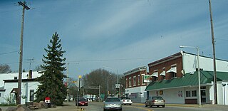
Redgranite is a village in Waushara County, Wisconsin, United States. The population was 2,149 at the 2010 census.
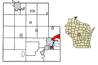
Biron is a village in Wood County, Wisconsin, United States. The population was 839 at the 2010 census. It is the site of ND Paper's Biron Mill.
Dorchester is a village in Clark and Marathon counties in the U.S. state of Wisconsin, along the 45th parallel. It is part of the Wausau, Wisconsin Metropolitan Statistical Area. The population was 876 at the 2010 census. Of this, 871 were in Clark County, and only 5 were in Marathon County.
Egg Harbor is a village in Door County, Wisconsin, United States. The population was 201 at the 2010 census. The village was incorporated in 1964, and is adjacent to the Town of Egg Harbor and the Town of Gibraltar.
Luxemburg is a village in Kewaunee County, Wisconsin, United States. The population was 2,515 at the 2010 census. It is part of the Green Bay Metropolitan Statistical Area. The village is located within the town of Luxemburg.
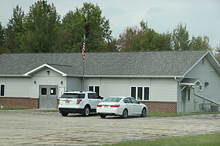
Pound is a town in Marinette County, Wisconsin, United States. The population was 1,367 at the 2000 census. The village of Pound is located within but politically independent of the town.
Wausaukee is a town in Marinette County, Wisconsin, United States. The estimated population was 573 in 2011. The Village of Wausaukee is located within the town. The unincorporated community of Cedarville is located partially in the town.
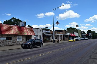
Oxford is a village in Marquette County, Wisconsin, United States. The population was 537 at the 2020 census. The village is located within the Town of Oxford. The Union Pacific Railroad runs through the town and over Neenah Lake to the northwest.
Prentice is a village in Price County, Wisconsin, United States. The population was 660 at the 2010 census. The village is located within the Town of Prentice.