Middle Inlet (community), Wisconsin

Last updated
Middle Inlet, Wisconsin
MiddleInletWisconsinDowntown141.jpg
Downtown Middle Inlet
WIMap-doton-Middle Inlet.png
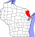
Location in Wisconsin
Coordinates: 45°17′30″N87°59′32″W / 45.29167°N 87.99222°W / 45.29167; -87.99222 Coordinates: 45°17′30″N87°59′32″W / 45.29167°N 87.99222°W / 45.29167; -87.99222
Country Flag of the United States.svg  United States
State Flag of Wisconsin.svg  Wisconsin
County Marinette
Elevation
[1]
220 m (722 ft)
Time zone UTC-6 (Central (CST))
  Summer (DST) UTC-5 (CDT)
Area code(s) 715 & 534
GNIS feature ID1569420 [1]

Middle Inlet is an unincorporated community in Marinette County, Wisconsin (USA), in the town of Middle Inlet.

Contents

Geography

Middle Inlet, 1912 map detail Middle Inlet Wisconsin 1912.jpg
Middle Inlet, 1912 map detail

Middle Inlet is located 6 miles (9.7 km) south of the village of Wausaukee, at the intersection of U.S. Highway 141 and County Highway X [2] [3] at an elevation of 722 feet (220 m). [1] It is located along the Escanaba and Lake Superior Railroad. [4] Middle Inlet is connected by road to Wausaukee to the north and Crivitz to the south (both via Highway 141), and Goll to the east (via Highway X). Middle Inlet Creek runs north of the settlement, and Lower Middle Inlet Creek flows to the south; a third stream, Upper Middle Inlet Creek, flows further north. [3] [5] All three streams feed Lake Noquebay, which lies to the southeast. [3]

History

A post office was established in Middle Inlet in 1890, and it operated until 1974. [6] Middle Inlet was formally established in 1910, when it was separated from the town of Wausaukee. It is named for Middle Inlet Creek, one of three streams flowing into Lake Noquebay. [7] On October 9, 1910, a log train wreck in Middle Inlet killed one man and injured two others. The accident partially destroyed the railroad depot at Middle Inlet. [8] The settlement formerly had a cheese factory [9] and a sawmill. [10] In the 1950s and 1960s a ski area called Fun Valley operated just west of Middle Inlet; [11] [12] [13] it was shut down around 1970. [5]

Images

Related Research Articles

<span class="mw-page-title-main">Marinette County, Wisconsin</span> County in Wisconsin, United States

Marinette County is a county in the U.S. state of Wisconsin. As of the 2020 census, the population was 41,872. Its county seat is Marinette. Marinette County is part of the Marinette, WI–MI Micropolitan Statistical Area.

<span class="mw-page-title-main">Crivitz, Wisconsin</span> Village in Wisconsin, United States

Crivitz is a village in Marinette County, Wisconsin, United States. The population was 984 at the 2010 census. It is part of the Marinette, WI–MI Micropolitan Statistical Area.

<span class="mw-page-title-main">Marinette, Wisconsin</span> City in Wisconsin, United States

Marinette is a city in and the county seat of Marinette County, Wisconsin, United States. It is located on the south bank of the Menominee River, at its mouth at Green Bay, part of Lake Michigan; to the north is Stephenson Island, part of the city preserved as park. During the lumbering boom of the late 19th century, Marinette became the tenth-largest city in Wisconsin in 1900, reaching a peak population of 16,195.

<span class="mw-page-title-main">U.S. Route 141</span> U.S. Highway in Michigan and Wisconsin

US Highway 141 (US 141) is a north–south United States Numbered Highway in the states of Wisconsin and Michigan. The highway runs north-northwesterly from an interchange with Interstate 43 (I-43) in Bellevue, Wisconsin, near Green Bay, to a junction with US 41/M-28 near Covington, Michigan. In between, it follows city streets in Green Bay and has a concurrent section with US 41 in Wisconsin. North of Green Bay, US 141 is either a freeway or an expressway into rural northern Wisconsin before downgrading to an undivided highway. In Michigan, US 141 is an undivided highway that runs through rural woodlands. The highway has two segments in each state; after running through Wisconsin for about 103 miles (166 km), it crosses into Michigan for approximately another eight miles (13 km). After that, it crosses back into Wisconsin for about 14+12 miles (23 km) before crossing the state line one last time. The northernmost Michigan section is about 43+12 miles (70 km), making the overall length about 169 miles (272 km).

<span class="mw-page-title-main">Wisconsin Highway 180</span>

State Trunk Highway 180 is a 30.42-mile (48.96 km), north–south state highway in southeastern Marinette County, Wisconsin, United States, that runs from Wisconsin Highway 64 (WIS 64) in Marinette to U.S. Route 141 (US 141) in Wausaukee.

<span class="mw-page-title-main">Lake Noquebay</span> Freshwater lake in Wisconsin, US

Lake Noquebay is a large freshwater lake in northeastern Wisconsin. It is the largest lake in Marinette county. It is located north of Green Bay, Wisconsin, approximately 4 miles (6.4 km) northeast of Crivitz, Wisconsin.

<span class="mw-page-title-main">Amberg (CDP), Wisconsin</span> Census-designated place in Wisconsin, United States

Amberg is an unincorporated census-designated place in Marinette County, Wisconsin, United States, in the town of Amberg. It is located on U.S. Highway 141. As of the 2010 census, its population was 180. The Amberg Historical Society operates the Amberg Historical Museum Complex which consists of the historic town hall that is on the National Register of Historic Places, the community's train depot, a 1900-era house, and the Amberg Museum.

<span class="mw-page-title-main">Marinette micropolitan area</span>

The Marinette Micropolitan Statistical Area, as defined by the United States Census Bureau, is an area consisting of two counties – one in Wisconsin and one in Michigan – anchored by the city of Marinette, Wisconsin. As of the 2000 census, the μSA had a population of 68,710.

Beaver is an unincorporated community located in the town of Beaver, Marinette County, Wisconsin, United States. Beaver is located along U.S. Route 141 3 miles (4.8 km) north-northeast of Pound.

<span class="mw-page-title-main">Porterfield (community), Wisconsin</span> Unincorporated community and Census-designated place in Wisconsin, United States

Porterfield is a census-designated place in the town of Porterfield, Marinette County, Wisconsin, United States.

<span class="mw-page-title-main">Rubys Corner, Wisconsin</span> Unincorporated community in Wisconsin, United States

Rubys Corner is an unincorporated community located in the town of Porterfield, Marinette County, Wisconsin, United States.

Loomis is an unincorporated community located in the town of Lake, Marinette County, Wisconsin, United States.

McAllister is an unincorporated community located in the town of Wagner, Marinette County, Wisconsin, United States.

<span class="mw-page-title-main">May Corner, Wisconsin</span> Unincorporated community in Wisconsin, United States

May Corner is an unincorporated community located in the town of Grover, Marinette County, Wisconsin, United States.

Harmony is an unincorporated community located in the town of Grover, Marinette County, Wisconsin, United States. Harmony is located 5 miles (8.0 km) northwest of Peshtigo.

<span class="mw-page-title-main">Miles, Wisconsin</span> Unincorporated community in Wisconsin, United States

Miles is an unincorporated community located in the town of Porterfield, Marinette County, Wisconsin, United States.

<span class="mw-page-title-main">Goll, Wisconsin</span> Unincorporated community in Wisconsin, United States

Goll is an unincorporated community located in the town of Wagner, Marinette County, Wisconsin, United States.

Cedarville is an unincorporated community located in the towns of Amberg and Wausaukee, Marinette County, Wisconsin, United States.

<span class="mw-page-title-main">Harlan P. Bird</span> American politician (1838–1912)

Harlan Page Bird was an American businessman and Republican politician. He served 8 years in the Wisconsin State Senate, representing northeast Wisconsin.

Koss is an unincorporated community in Menominee County, Michigan, United States. Koss is located in Lake Township, 4.9 miles (7.9 km) west-southwest of Stephenson.

References

  1. 1 2 3 "Middle Inlet". Geographic Names Information System . United States Geological Survey, United States Department of the Interior.
  2. "Middle Inlet Populated Place Profile / Marinette County, Wisconsin Data".
  3. 1 2 3 Wausaukeee Quadrangle Wisconsin–Marinette Co., 15 Minute Series (Topographic). 1963. Map, 1:62,500. Washington, DC: U. S. Geological Survey.
  4. "Wisconsin Railroad & Harbors 2020" (PDF). Wisconsin Department of Transportation. 2020. Retrieved January 14, 2020.
  5. 1 2 "Welcome to Middle Inlet". The Green Bay Press-Gazette. February 19, 1975. p. 5. Retrieved January 1, 2020 via Newspapers.com. Open Access logo PLoS transparent.svg
  6. "Wisconsin. Marinette County". Jim Forte Postal History. Retrieved August 2, 2019.
  7. Civil Townships and Localities
  8. "Log Train Wreck: One Dead". Oshkosh Daily Northwestern. October 10, 1910. p. 1. Retrieved September 7, 2014 via Newspapers.com. Open Access logo PLoS transparent.svg
  9. "Will Build Cheese Factory near Crivitz". The Green Bay Press-Gazette. April 10, 1925. p. 17. Retrieved January 4, 2020 via Newspapers.com. Open Access logo PLoS transparent.svg
  10. "Pound Notes". The Green Bay Press-Gazette. June 10, 1927. p. 4. Retrieved January 5, 2020 via Newspapers.com. Open Access logo PLoS transparent.svg
  11. "Skiing Season in Early Start". The Green Bay Press-Gazette. December 6, 1958. p. 17. Retrieved January 2, 2020 via Newspapers.com. Open Access logo PLoS transparent.svg
  12. "Middle Inlet, Hidden Valley Ski Areas Popular in FRV". The Post Crescent. February 13, 1960. p. 6. Retrieved January 2, 2020 via Newspapers.com. Open Access logo PLoS transparent.svg
  13. "Improvements Made at Moon Valley". The Green Bay Press-Gazette. December 9, 1962. p. 60. Retrieved January 2, 2020 via Newspapers.com. Open Access logo PLoS transparent.svg