Walsh, Wisconsin

Last updated
Walsh, Wisconsin
Walsh Wisconsin.jpg
USA Wisconsin location map.svg
Red pog.svg
Walsh, Wisconsin
Usa edcp location map.svg
Red pog.svg
Walsh, Wisconsin
Coordinates: 45°10′46″N87°45′45″W / 45.17944°N 87.76250°W / 45.17944; -87.76250
Country Flag of the United States.svg  United States
State Flag of Wisconsin.svg  Wisconsin
County Marinette
Elevation
[1]
206 m (676 ft)
Time zone UTC-6 (Central (CST))
  Summer (DST) UTC-5 (CDT)
Area code(s) 715 & 534
GNIS feature ID1576182 [1]

Walsh is an unincorporated community located in the town of Porterfield, in Marinette County, Wisconsin, United States. [1] [2]

Contents

Geography

Walsh Wisconsin 1912.jpg
Walsh, 1912 map detail
Porterfield Wisconsin - town hall 1.jpg
Porterfield town hall and fire station

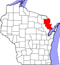
Walsh is located along County Trunk Highway G at the intersection with Bagley Road and Twin Creek Road, [3] at an elevation of 676 feet (206 m). [1] It is connected by road to Rubys Corner to the east, Loomis to the west, and Porterfield to the south (via County Trunk Highway E). The town of Porterfield's town hall and fire station are located in Walsh.

Name

The community was originally known as Rawnsville in the nineteenth century. [4] [5] [6] It was named for the family of Jacob Rawn (1819–1896; surname earlier spelled Rein, Raan, or Rhyne), [7] who settled in the area. The name was changed to Walsh on July 5, 1902. [4] The new name honored John R. Walsh (1837–1911) of Chicago. Walsh was the founder of the Chicago National Bank, and he purchased a controlling interest in the Wisconsin & Michigan Railway in October 1900. [8]

History

A post office was established in Rawnsville (later Walsh) in 1881 but discontinued in 1882. [9] [10] The post office was reestablished in 1902 and operated until 1928. [10] [11] Rawnsville was the first stop north of Bagley Junction on the Wisconsin & Michigan (W. & M.) Railway line to Iron Mountain. [8] The rail line was built in 1894 using surplus rail from the Chicago World's Fair, which had closed in 1893. The line was used to ship logs south to the mills in Marinette and Menominee, and it also offered passenger service. In the 1920s, the railroad owner John Marsch (1869–1954) operated a gravel pit with its own narrow-gauge railroad with a saddle tank locomotive next to the W. & M. line in Walsh. Gravel from the pit was delivered to Iron Mountain and then used to build the Ford Motor Company factory in nearby Kingsford. Gravel from Walsh was also used in the construction of U.S. Route 2 in Norway, Michigan. The rail line through Walsh was discontinued in 1938, when Marsch had the tracks torn out and the rolling stock sold off. [8] [12] [13]

Churches

Walsh has a Catholic church with a nearby cemetery, and there is a Lutheran church about 1 mile (1.6 km) to the west.

Related Research Articles

<span class="mw-page-title-main">Ozaukee County, Wisconsin</span> County in Wisconsin, United States

Ozaukee County is a county in the U.S. state of Wisconsin. As of the 2020 census, the population was 91,503. Its county seat is Port Washington, making it one of three Wisconsin counties on Lake Michigan not to have a county seat with the same name. Ozaukee County is included in the Milwaukee–Waukesha–West Allis, WI Metropolitan Statistical Area.

<span class="mw-page-title-main">Marinette County, Wisconsin</span> County in Wisconsin, United States

Marinette County is a county in the U.S. state of Wisconsin. As of the 2020 census, the population was 41,872. Its county seat is Marinette. Marinette County is part of the Marinette, WI–MI Micropolitan Statistical Area.

<span class="mw-page-title-main">Marinette, Wisconsin</span> City in Wisconsin, United States

Marinette is a city in and the county seat of Marinette County, Wisconsin, United States. It is located on the south bank of the Menominee River, at its mouth at Green Bay, part of Lake Michigan; to the north is Stephenson Island, part of the city preserved as park. During the lumbering boom of the late 19th century, Marinette became the tenth-largest city in Wisconsin in 1900, reaching a peak population of 16,195.

<span class="mw-page-title-main">Pembine, Wisconsin</span> Town in Wisconsin, United States

Pembine is a town in Marinette County, Wisconsin, United States. The population was 1,036 at the 2000 census. The unincorporated community of Kremlin is located in the town, The census-designated place of Pembine is also located in the town.

<span class="mw-page-title-main">Porterfield, Wisconsin</span> Town in Wisconsin, United States

Porterfield is a town in Marinette County, Wisconsin, United States. The population was 1,991 at the 2000 census. The unincorporated communities of Bagley Junction, Miles, Porterfield, Rubys Corner, and Walsh are located in the town.

<span class="mw-page-title-main">Thiensville, Wisconsin</span> Village in Ozaukee County, Wisconsin

Thiensville is a village in Ozaukee County, Wisconsin, United States. Located on the west bank of a bend in the Milwaukee River, the community is bordered on all sides by the City of Mequon and is a suburb in the Milwaukee metropolitan area. The population was 3,235 at the 2010 census.

<span class="mw-page-title-main">Port Washington, Wisconsin</span> City and county seat of Ozaukee County, Wisconsin

Port Washington is the county seat of Ozaukee County in the U.S. state of Wisconsin. Located on Lake Michigan's western shore east of Interstate 43, the community is a suburb in the Milwaukee metropolitan area 27 miles north of the City of Milwaukee. The city's artificial harbor at the mouth of Sauk Creek was dredged in the 1870s and was a commercial port until the early 2000s. The population was 11,250 at the 2010 census.

<span class="mw-page-title-main">Peshtigo, Wisconsin</span> City in Wisconsin, United States

Peshtigo is a city in Marinette County, Wisconsin, United States. The population was 3,420 at the 2020 census The city is surrounded by the Town of Peshtigo. It is part of the Marinette, WI–MI Micropolitan Statistical Area. Peshtigo is known for being the site of the Peshtigo fire of 1871, in which more than 1,200 people perished.

<span class="mw-page-title-main">Grand Trunk Western Railroad</span> American railroad

The Grand Trunk Western Railroad Company was an American subsidiary of the Canadian National Railway operating in Michigan, Illinois, Indiana, and Ohio. Since a corporate restructuring in 1971, the railroad has been under CN's subsidiary holding company, the Grand Trunk Corporation. Grand Trunk Western's routes are part of CN's Michigan Division. Its primary mainline between Chicago and Port Huron, Michigan serves as a connection between railroad interchanges in Chicago and rail lines in eastern Canada and the Northeastern United States. The railroad's extensive trackage in Detroit and across southern Michigan has made it an essential link for the automotive industry as a hauler of parts and automobiles from manufacturing plants.

<span class="mw-page-title-main">Wisconsin Highway 180</span>

State Trunk Highway 180 is a 30.42-mile (48.96 km), north–south state highway in southeastern Marinette County, Wisconsin, United States, that runs from Wisconsin Highway 64 (WIS 64) in Marinette to U.S. Route 141 (US 141) in Wausaukee.

<span class="mw-page-title-main">Rubys Corner, Wisconsin</span> Unincorporated community in Wisconsin, United States

Rubys Corner is an unincorporated community located in the town of Porterfield, Marinette County, Wisconsin, United States.

Packard is an unincorporated community located in the town of Wagner, Marinette County, Wisconsin, United States.

McAllister is an unincorporated community located in the town of Wagner, Marinette County, Wisconsin, United States.

<span class="mw-page-title-main">May Corner, Wisconsin</span> Unincorporated community in Wisconsin, United States

May Corner is an unincorporated community located in the town of Grover, Marinette County, Wisconsin, United States.

<span class="mw-page-title-main">Bagley Junction, Wisconsin</span> Unincorporated community in Wisconsin, United States

Bagley Junction is an unincorporated community located in the town of Porterfield, Marinette County, Wisconsin, United States.

<span class="mw-page-title-main">Miles, Wisconsin</span> Unincorporated community in Wisconsin, United States

Miles is an unincorporated community located in the town of Porterfield, Marinette County, Wisconsin, United States.

<span class="mw-page-title-main">Wagner (community), Wisconsin</span> Unincorporated community in Wisconsin, United States

Wagner is an unincorporated community located in the town of Wagner, Marinette County, Wisconsin, United States. Wagner is 11.5 miles (18.5 km) east-southeast of Wausaukee.

<span class="mw-page-title-main">Goll, Wisconsin</span> Unincorporated community in Wisconsin, United States

Goll is an unincorporated community located in the town of Wagner, Marinette County, Wisconsin, United States.

Koss is an unincorporated community in Menominee County, Michigan, United States. Koss is located in Lake Township, 4.9 miles (7.9 km) west-southwest of Stephenson.

The Wisconsin & Michigan Railway (W&M) was incorporated October 26, 1893, under the general laws of Wisconsin for the purpose of constructing, maintaining, and operating a railroad as described in its articles of incorporation.

References

  1. 1 2 3 4 "Walsh, Wisconsin". Geographic Names Information System . United States Geological Survey, United States Department of the Interior.
  2. "Walsh Populated Place Profile / Marinette County, Wisconsin Data".
  3. Porterfield Quadrangle Wisconsin–Marinette Co., 7.5 Minute Series (Topographic). 1982. Map, 1:24,000. Reston, VA: U. S. Geological Survey.
  4. 1 2 Wisconsin Place Names. Madison, WI: Wisconsin State Genealogical Society. 1985. pp. 71, 87.
  5. LeMay, Phyllis Jacques (2001). Pioneers of Porterfield: Charron & Jacques Families. Kaukauna, WI: P. J. LeMay. pp. 12, 41.
  6. "Peshtigo Fire Survivors". Wisconsin Historical Markers. Retrieved August 1, 2019.
  7. Rawn family genealogy
  8. 1 2 3 McLeod, Richard (1968). "History of the Wisconsin and Michigan Railway". The Railway and Locomotive Historical Society Bulletin. 118: 7–20.
  9. Post Office Department (1882). United States Official Postal Guide. Boston: Houghton, Mifflin and Company. p. 132.
  10. 1 2 Callary, Edward (2016). Place Names of Wisconsin. Madison, WI: University of Wisconsin Press. p. 284.
  11. "Wisconsin. Marinette County". Jim Forte Postal History. Retrieved August 2, 2019.
  12. "Seek Permission to Abandon Lines". The Oshkosh Northwestern. April 10, 1937. p. 17. Retrieved August 2, 2019 via Newspapers.com. Open Access logo PLoS transparent.svg
  13. "Approve Wisconsin and Michigan Ry. Line Abandonment". The Daily Tribune. January 20, 1938. p. 5. Retrieved August 2, 2019 via Newspapers.com. Open Access logo PLoS transparent.svg

Coordinates: 45°10′46″N87°45′45″W / 45.17944°N 87.76250°W / 45.17944; -87.76250