Grover, Marinette County, Wisconsin

Last updated

Grover, Wisconsin
WIMap-doton-Grover.png
Location of Grover, Wisconsin
Coordinates: 45°4′6″N87°52′22″W / 45.06833°N 87.87278°W / 45.06833; -87.87278
Country Flag of the United States.svg  United States
State Flag of Wisconsin.svg  Wisconsin
County Marinette
Area
  Total73.3 sq mi (189.9 km2)
  Land73.1 sq mi (189.4 km2)
  Water0.2 sq mi (0.5 km2)
Elevation
[1]
689 ft (210 m)
Population
 (2010)
  Total1,768
  Density23.6/sq mi (9.1/km2)
Time zone UTC-6 (Central (CST))
  Summer (DST) UTC-5 (CDT)
Area code 534 & 715
FIPS code 55-31725 [2]
GNIS feature ID1583327 [1]
Website http://townofgroverwi.com

Grover is a town in Marinette County, Wisconsin, United States. The population was 1,768 at the 2010 census.

Contents

Communities

Geography

According to the United States Census Bureau, the town has a total area of 73.3 square miles (189.9 km2), of which, 73.1 square miles (189.4 km2) of it is land and 0.2 square miles (0.5 km2) of it (0.27%) is water.

Demographics

As of the census [2] of 2000, there were 1,729 people, 633 households, and 496 families residing in the town. The population density was 23.6 people per square mile (9.1/km2). There were 676 housing units at an average density of 9.2 per square mile (3.6/km2). The racial makeup of the town was 99.13% White, 0.35% Native American, 0.06% Asian, 0.06% Pacific Islander, 0.12% from other races, and 0.29% from two or more races. Hispanic or Latino of any race were 0.35% of the population.

There were 633 households, out of which 34.0% had children under the age of 18 living with them, 70.8% were married couples living together, 5.1% had a female householder with no husband present, and 21.5% were non-families. 18.5% of all households were made up of individuals, and 8.8% had someone living alone who was 65 years of age or older. The average household size was 2.73 and the average family size was 3.12.

In the town, the population was spread out, with 26.8% under the age of 18, 8.2% from 18 to 24, 27.4% from 25 to 44, 23.5% from 45 to 64, and 14.1% who were 65 years of age or older. The median age was 38 years. For every 100 females, there were 106.6 males. For every 100 females age 18 and over, there were 104.5 males.

The median income for a household in the town was $40,536, and the median income for a family was $45,368. Males had a median income of $29,208 versus $21,553 for females. The per capita income for the town was $17,104. About 7.0% of families and 7.9% of the population were below the poverty line, including 11.2% of those under age 18 and 8.1% of those age 65 or over.

Related Research Articles

Seven Oaks is a census-designated place (CDP) in Lexington County, South Carolina, United States, 8 miles (13 km) northwest of downtown Columbia, the state capital. The population of the CDP was 15,144 at the 2010 census. It is part of the Columbia Metropolitan Statistical Area.

<span class="mw-page-title-main">Humboldt, Wisconsin</span> Town in Wisconsin, United States

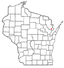
Humboldt is a town in Brown County in the U.S. state of Wisconsin. The population was 1,311 at the 2010 census. The community name was chosen by Henry Fontaine.

<span class="mw-page-title-main">Ledgeview, Wisconsin</span> Town in Wisconsin, United States

Ledgeview is a town in Brown County in the U.S. state of Wisconsin. The population was 6,555 as of the 2010 census, up from 3,363 at the 2000 census.

<span class="mw-page-title-main">Morrison, Wisconsin</span> Town in Wisconsin, United States

Morrison is a town in Brown County in the U.S. state of Wisconsin. The population was 1,599 at the 2010 census.

<span class="mw-page-title-main">Pittsfield, Wisconsin</span> Town in Wisconsin, United States

Pittsfield is a town in Brown County in the U.S. state of Wisconsin. The population was 2,608 at the 2010 census.

<span class="mw-page-title-main">Weston, Clark County, Wisconsin</span> Town in Wisconsin, United States

Weston is a town in Clark County in the U.S. state of Wisconsin. The population was 638 at the 2000 census. The unincorporated communities of Christie and Globe are located in the town.
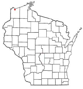
<span class="mw-page-title-main">Clay Banks, Wisconsin</span> Town in Wisconsin, United States

Clay Banks is a town in Door County, Wisconsin, United States. The population was 410 at the 2000 census. The unincorporated communities of Salona, and Vignes are located in the town.

<span class="mw-page-title-main">Cato, Wisconsin</span> Town in Wisconsin, United States

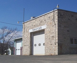
Cato is a town in Manitowoc County, Wisconsin, United States. The population was 1,616 at the 2000 census. A Manitowoc County park is located in the town which is called "Cato Falls" for a waterfall on the Manitowoc River.

<span class="mw-page-title-main">Franklin, Manitowoc County, Wisconsin</span> Town in Wisconsin, United States

Franklin is a town in Manitowoc County, Wisconsin, United States. The population was 1,293 at the 2000 census.

<span class="mw-page-title-main">Schleswig, Wisconsin</span> Town in Wisconsin, United States

Schleswig is a town in Manitowoc County, Wisconsin, United States. The population was 1,900 at the 2000 census.
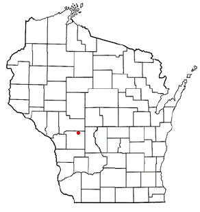
<span class="mw-page-title-main">Little River, Wisconsin</span> Town in Wisconsin, United States

Little River is a town in Oconto County, Wisconsin, United States. The population was 1,065 at the 2000 census. The unincorporated communities of County Line and Cullen are located in the town.

<span class="mw-page-title-main">Morgan, Wisconsin</span> Town in Wisconsin, United States

Morgan is a town in Oconto County, Wisconsin, United States. The population was 882 at the 2000 census.

<span class="mw-page-title-main">Underhill, Wisconsin</span> Town in Wisconsin, United States

Underhill is a town in Oconto County, Wisconsin, United States. The population was 846 at the 2000 census.

<span class="mw-page-title-main">Stella, Wisconsin</span> Town in Wisconsin, United States

Stella is a town in Oneida County, Wisconsin, United States. The population was 633 at the 2000 census. The unincorporated community of Starks is located within the town.

<span class="mw-page-title-main">Belle Plaine, Wisconsin</span> Town in Wisconsin, United States

Belle Plaine is a town in Shawano County, Wisconsin, United States. The population was 1,867 at the 2000 census. The unincorporated communities of Adams Beach and Belle Plaine are located in the town. The former unincorporated community of Hunting was located partially in the town.

<span class="mw-page-title-main">Hartland, Shawano County, Wisconsin</span> Town in Wisconsin, United States

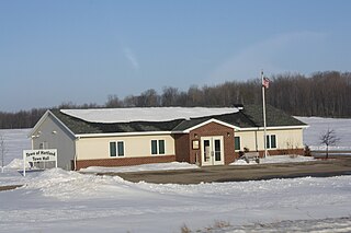
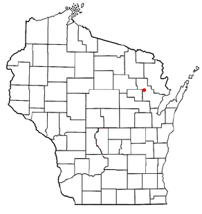
Hartland is a town in Shawano County, Wisconsin, United States. The population was 825 at the 2000 census. The unincorporated community of Slab City is located within the town. The unincorporated communities of Frazer Corners and Zachow are also located partially in the town. Hartland was established in 1859.

<span class="mw-page-title-main">Mosel, Wisconsin</span> Town in Wisconsin, United States

Mosel or Moselle is a town in Sheboygan County, Wisconsin, United States. The population was 839 at the 2000 census. The town is included in the Sheboygan, Wisconsin Metropolitan Statistical Area.

<span class="mw-page-title-main">Sugar Creek, Wisconsin</span> Town in Wisconsin, United States

Sugar Creek is a town in Walworth County, Wisconsin, United States. The population was 3,902 at the 2020 census. The unincorporated communities of Millard and Tibbets are located in the town. The unincorporated community of Abells Corners is also located partially in the town.

Oakfield is a town in Fond du Lac County, Wisconsin, United States. The population was 767 at the 2000 census. The Village of Oakfield is located within the town. The unincorporated community of Oak Center is also located in the town.

<span class="mw-page-title-main">Merton, Wisconsin</span> Town in Wisconsin, United States

Merton is a town in Waukesha County, Wisconsin, United States; before Wisconsin statehood, it was called Warren. The population was 8,277 at the 2020 census. The town surrounds the villages of Chenequa and Merton. The unincorporated communities of Camp Whitcomb, Monches, and North Lake are in the town and the unincorporated community of Stone Bank is partially in the town. The pioneer Swedish-American settlement of New Upsala was also at one time located within Merton.

References

  1. 1 2 "US Board on Geographic Names". United States Geological Survey. October 25, 2007. Retrieved January 31, 2008.
  2. 1 2 "U.S. Census website". United States Census Bureau . Retrieved January 31, 2008.
  3. Chicago and North Western Railway Company (1908). A History of the Origin of the Place Names Connected with the Chicago & North Western and Chicago, St. Paul, Minneapolis & Omaha Railways. p. 139.